
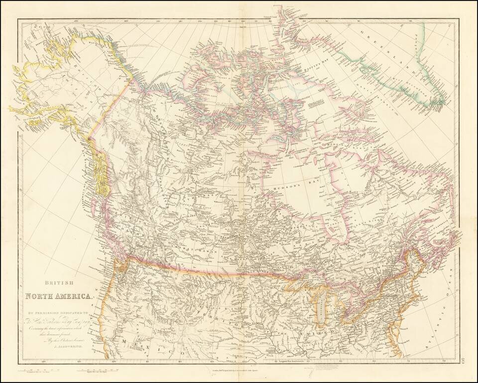
Detailed Map of British Possessions in North America—Rare Late Edition! Highly-detailed state of John Arrowsmith’s map of British possessions in North America, published in multiple editions between 1832 and 1859. This is a late edition, from the...
![[State of Lincoln!] British Columbia and the North West Territory](/map/small/60287.jpg)
Rare separately published map of Western Canada and part of the Northern United States, including the proposed State of Lincoln. The map provides a detailed treatment of the Western part of Canada, along with a very rare appearance of the proposed...
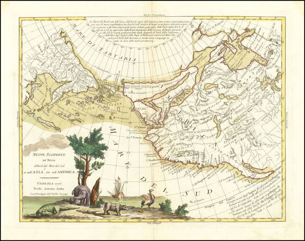
An Ostrich, An Elephant and the Northwest Passage! Striking example of Zatta's map of the northern Pacific Coastal regions and one of the best illustrations of a late rendition of the Northwest Passage, here illustrating two wide passages from the...
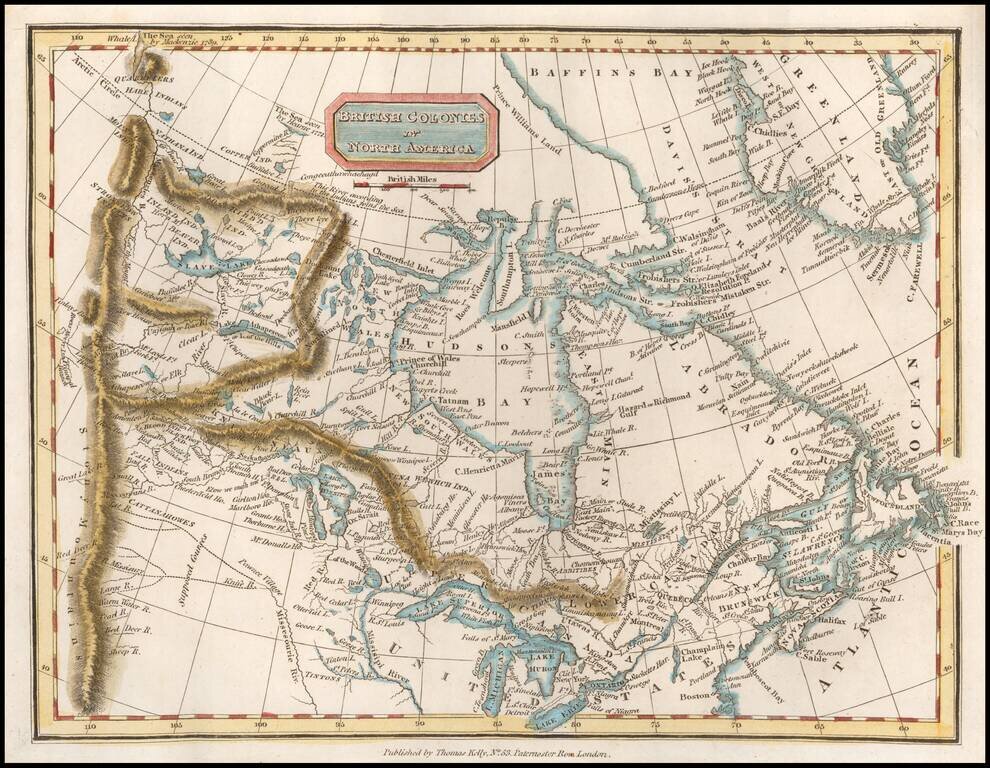
Scarce map of Canada, extending west to the Rocky Mountains and the MacKenzie River. Perhaps the most interesting feature is the depiction of the headwaters of the Missouri River. Here, the map incorporates the reports of Peter Fidler for the Hudson's...
![[Montana, Calgary, Edmonton, Saskatchewan] Amer. Sep. No. 32. Partie De La Nouvelle Bretagne](/map/small/54847.jpg)
Highly detailed map, extending from the area around Kalispell Lake and Flathead Lake, Montana in the southwest, to Calgary and Edmonton to the north and Prince Albert Saskatchewan in the northeast. The map includes a number of early factories of the...
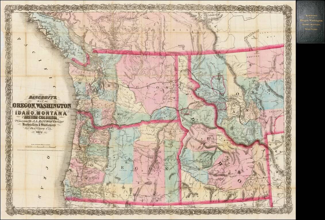
Rare separately issued map of the northwestern United States and British Columbia, issued in 1872 by A.L. Bancroft & Co. in San Francisco. Bancroft's map was first issued by HH Bancroft in 1868. The map was drawn from a section of Bancroft's...
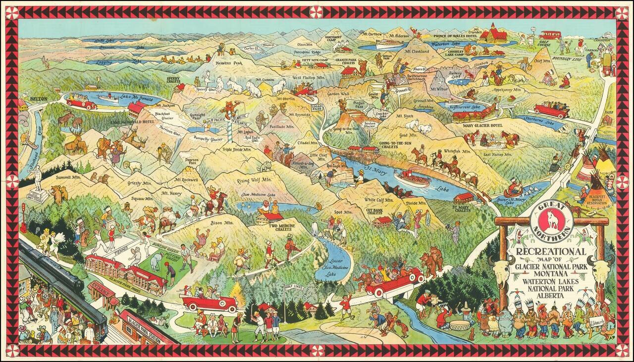
Fine early pictorial map promoting the Great Northern Railway. The map includes a lively offering of park scenes, including Grizzly Bears confronting tourists on a bridge, yacht rides in the major lakes, and another Grizzly Bear dumping Champagne (?)...
![(Nothern Half) [Bancroft's Map of the Pacific States]](/map/small/54924.jpg)
Previously Unkown 1863-64 Second State. "Bancroft's, in scope, was probably the most important map yet produced by a publisher of the Pacific coast." - Streeter (TMW 1061) Two northern sheets of an engraved proof of the previously-unknown 1863 second...
![(Notherneastern Sheet) [Bancroft's Map of the Pacific States]](/map/small/54925.jpg)
Engraved Proof Sheet. "Bancroft's, in scope, was probably the most important map yet produced by a publisher of the Pacific coast." - Streeter (TMW 1061) Engraved proof of the 1867 edition of H.H. Bancroft's Map of the Pacific States. The detail in...
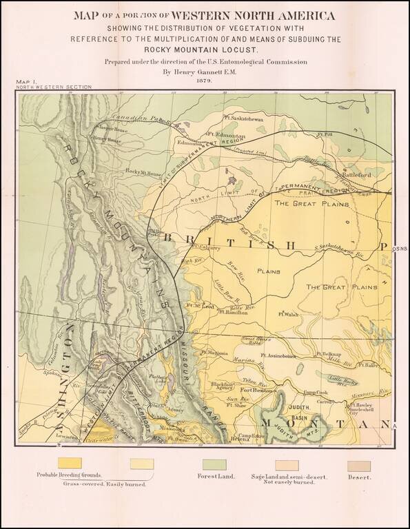
Detailed Vegetation Map of northern Montana, Idaho, Western Washington and contiguous parts of Alberta and British Columbia, from the Second Report of the United States Entomological Commission for the years 1878 and 1879. The map is relatedto the...
The Benevento Copy. The Earliest Printed Map of the Northwest Coast of North America Fine old color example of this rare, important map depicting the west coast of North America, derived from Plancius's world map of 1592. De Jode's map is one of the...
![Limes Occidentis Quivira et Anian. 1597 [Pacific Northwest & Northwest Passage]](/map/small/71207.jpg)
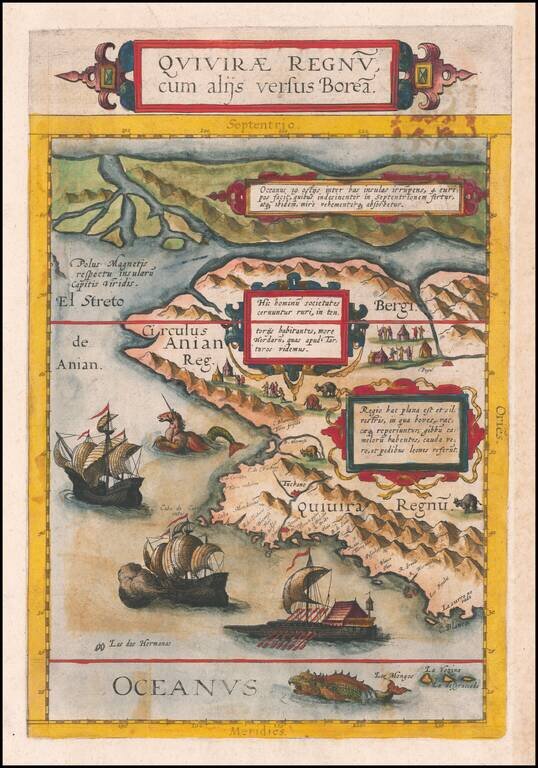
The Second Printed Map of the Northwest of North America, including the Northwest Passage. This is a fine example of Wytfliet's map of the Northwest Coast of North America, the second printed map to focus on the region which would become Alaska and...
![The Map of Maps -- Alaska and British Columbia Showing the Yukon, Cariboo Cassiar, with a Portion of the Kootenay Gold Fields . . . Feb. 1898 [with inset showing Lake Routes to Dawson]](/map/small/40495.jpg)
Scarce separately issued map of Alaska and British Columbia, showing the various routes to the Klondyke Gold Fields, including a separate large format map showing the Lake Routes to Dawson. Rare Gold Rush Guide Map. Eberstadt (163:20, 1964, priced at...
Excellent British Admiralty chart of the Strait of Juan de Fuca, focusing on the San Juan Islands, and also showing Victoria and Vancouver B.C. The chart was originally published in 1882 and was updated numerous times to 1924. Despite the fact that...
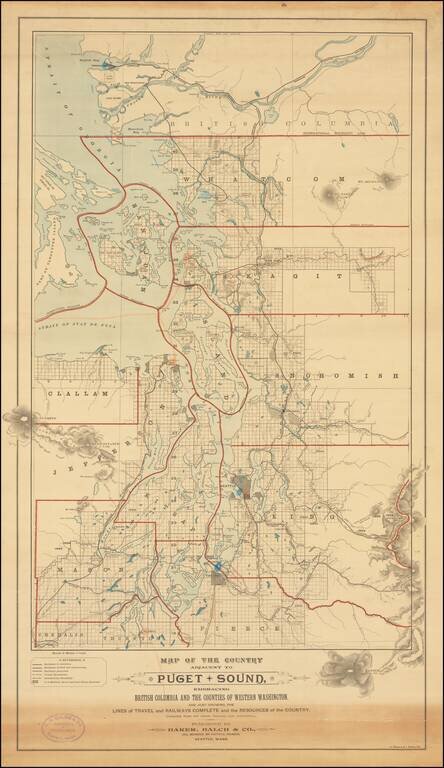
Rare separately published map of "the Puget Sound Country," published by Baker, Balch & Co. Civil, Mechanical and Electrical Engineers and lithographed by A. Zeese & Co. of Chicago. A remarkable advertising map issued to promote settlement,...

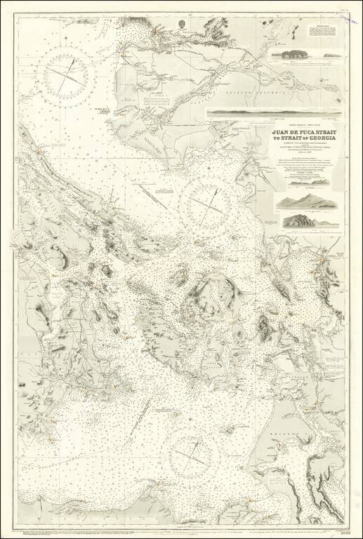
Scarce working sea chart of the Strait of Juan de Fuca and contiguous regions, published by the British Admiralty. The map extends from Flores Island and Sydney Inlet in the northwest to Cape Flattery and New Dungeness in the south. with Victoria, and...