Map size in jpg-format: 38.0754MiB
Click to open in high resolution (open in new tab).
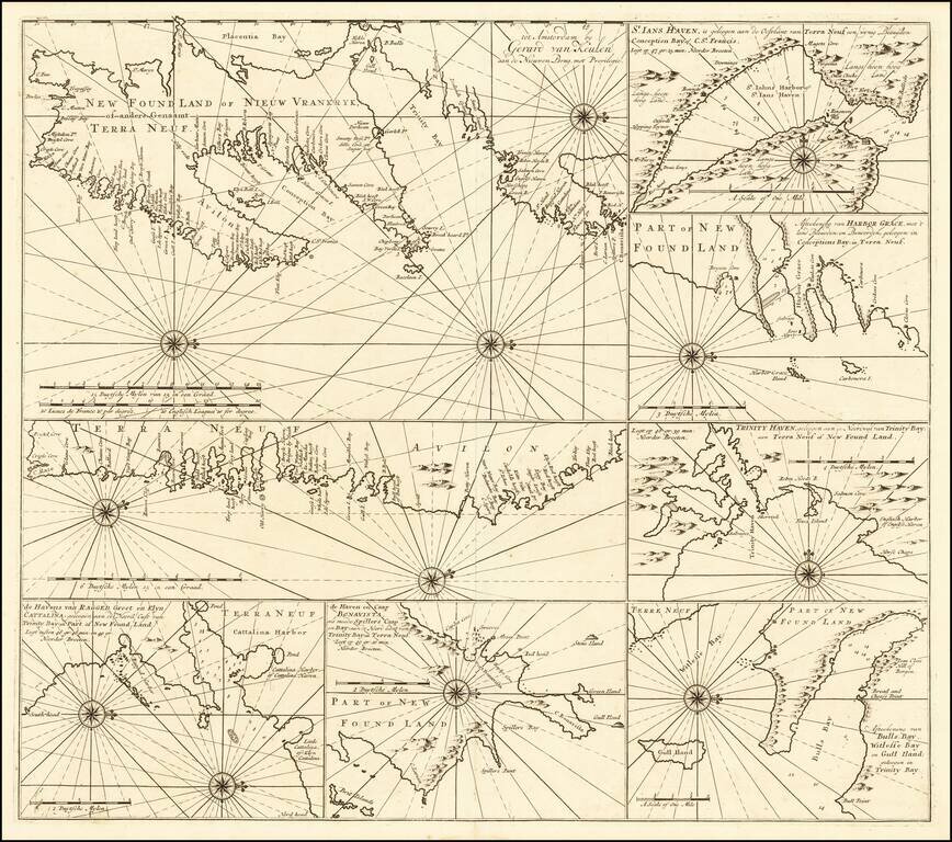
Rare sea chart of of the Coast of Newfoundland, published by Gerard Van Keulen.
The chart incorporates eight insets showing various portions of Canada's Newfoundland coast.
Include twelve compass roses with rhumb lines, with separate delineations of the Avalon Peninsula, St. John's Harbour, Harbour Grace, Trinity Haven, Catalina Harbour, Cape Bonavista and Bull's Bay.
If you are a student, write to us in telegram: @antiquemaps and indicate what material you need and for what work you need a map in high detail. We are ready to provide material on special terms. For students only!
![[The First Maps in a la poupée Printed Color] Cartes en Couleur des Lieux Sujets aux tremblements de Terre Dans toutes les parties du Monde Selon le Sisteme de l’impulsion Solaire](/map/small/52293op.jpg)

