Map size in jpg-format: 16.8589MiB
Click to open in high resolution (open in new tab).
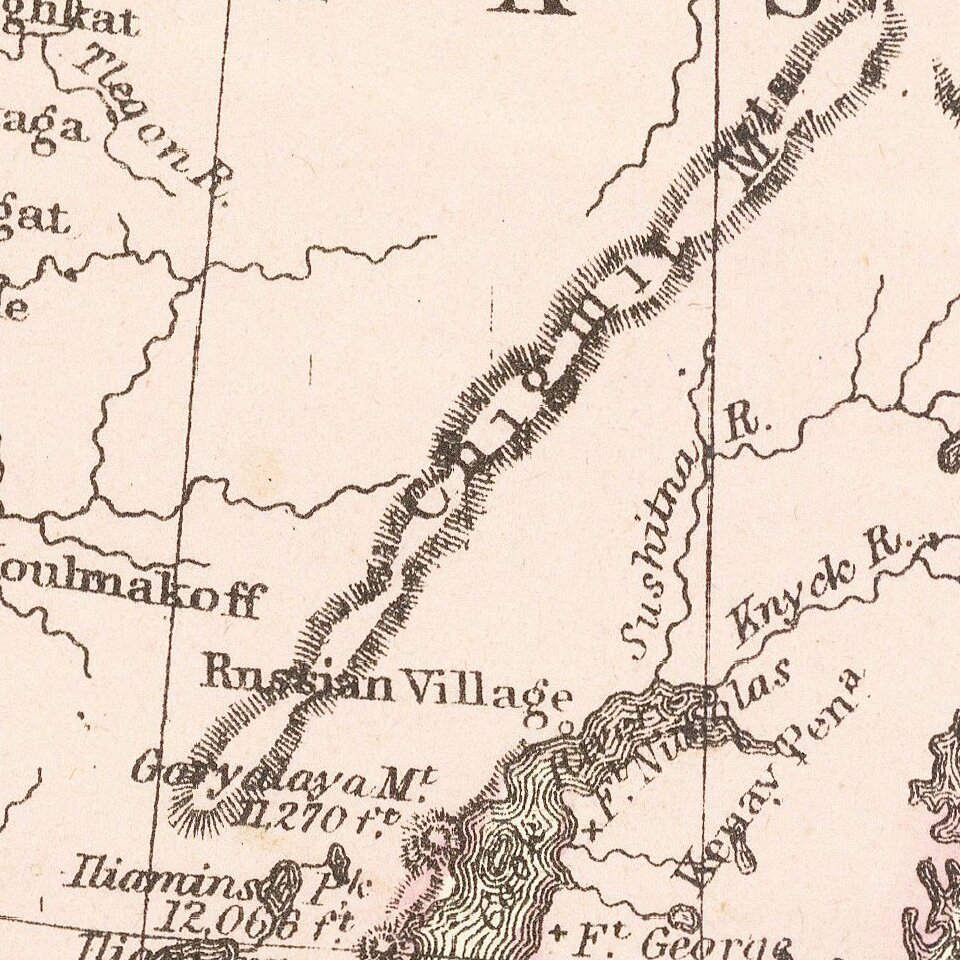
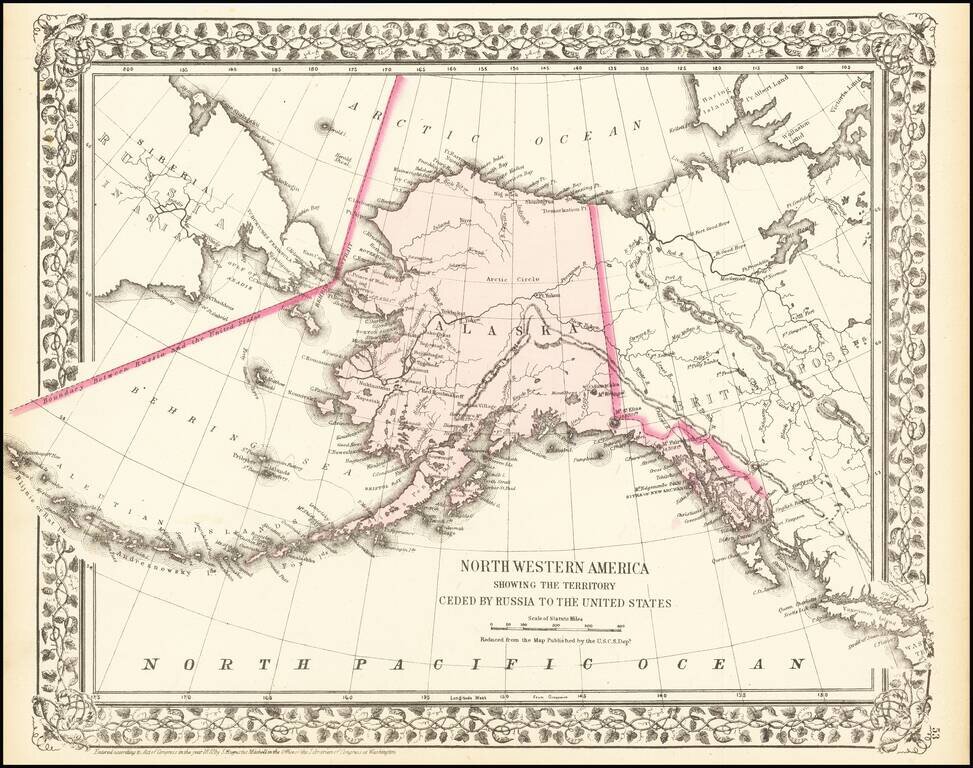
A detailed map of Alaska, showing the territory shortly after it was sold by Russia to America for $7.2 Million in 1867. The map locates towns, mountains (with elevations), rivers, bays, and other details. Cities named include Sitka and Sheshalik. The only indication of settlement in the Cook Inlet is a "Russian Village" near present-day Tyonek.
Detail extends into neighboring countries. Several mountain ranges are visible throughout Canada, which is labeled simply as a "British Possession." Many of the major features are well mapped, with the Yukon River traceable to its source. Central Alaska and the Brooks Range are little mapped, and these would not be fully explored or even named until the 1920s.
Alaska had been purchased by the US in 1867 in a move then-known as "Seward's Folly" after the Secretary of State who organized the transfer. Russia had been interested in selling the territory for some time prior, both needing an immediate income and realizing that the territory proved a liability in the event of a war with Britain. The deal would not be completed until after the Civil War, during the Johnson presidency. In the immediate aftermath of the purchase, both Russian and American settlers were unhappy. American settlers generally lacked the capital to exploit Alaskan resources, and were easily outcompeted by markets in Canada and the Pacific Northwest. Russian and indigenous inhabitants were unhappy at the erosion of the rule of law under the territorial government. The territory would not be seen as valued or adequately-governed until the Klondike gold strike, and debate continues even to this day about the profitability of the purchase.
Samuel Augustus Mitchell Jr. inherited the Mitchell Company from his father in 1860. For over thirty years, the company had specialized in the production of school atlases and wall maps of America. They were one of the pioneers on engraving on steel plates. In 1860, Samuel Jr. released the New General Atlas, which had been compiled in house and replaced a previous atlas by Tanner. The elder Mitchell died in 1868 and Samuel Jr. continued the business until the 1890s. At its height, the Mitchell Company employed 250 people and sold 400,000 publications annually.
If you are a student, write to us in telegram: @antiquemaps and indicate what material you need and for what work you need a map in high detail. We are ready to provide material on special terms. For students only!
![America [Manuscript Map Showing the Sea of the West!]](/map/small/41297dm.jpg)

![[Atlantis?] Ristretto Delle Carte presentate all' Academia delle Scienze di Parigi negli anni 1737 e 1752 dal Sig di Buache](/map/small/58667.jpg)