logo

1780. Carte Des Royaumes De Suede et Norwege divisee en ses differents Etats . . . 1780

  • Carte Des Royaumes De Suede et Norwege divisee en ses differents Etats . . . 1780

Carte Des Royaumes De Suede et Norwege divisee en ses differents Etats . . . 1780 information:

Year of creation: 
Resolution size (pixels): 
 5212x4302 px
Disk Size: 
 5.0514MiB
Number of pages: 
 1
Place: 
 Paris

Print information. Print size (Width x height in inches):
Printing at 72 dpi 
  72.39 х 59.75
Printing at 150 dpi 
 34.75 х 28.68
Printing at 300 dpi 
 17.37 х 14.34

An example of detailing the file of this map of in a printable high-resolution:

Click to open in high resolution (open in new tab).
Attention! this is just the central piece (central area 960x960 px) of the map file!
This is an example, so that you can see and study the level of detail of a given map. The entire Map will be fully available after payment!

Carte Des Royaumes De Suede et Norwege divisee en ses differents Etats . . . 1780

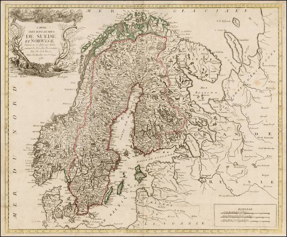
Rare map of Scandinavia by De La Fosse, one of the rarest of the late 18th Century French Mapmakers.

This is only the third De La Fosse map we have seen in 20 years.


Special conditions for students!

If you are a student, write to us in telegram: @antiquemaps and indicate what material you need and for what work you need a map in high detail. We are ready to provide material on special terms. For students only!

Item information:

Year of creation:
Size:
5212x4302 px
Disk:
5.0514MiB
Number of pages:
1
Place:
Paris
Author:
Louis Joseph Mondhare. J. B. De La Fosse.
$14.99

Related item