
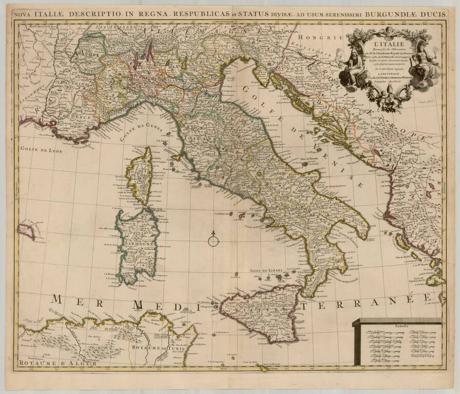
Fine dark impression of Covens & Mortier's map of Italy, Sardinia, Corsica and Sicily, based upon the work of De L'Isle. Highly detailed throughout, showing towns, rivers, mountains, lakes, islands, roads, boundaries, etc.
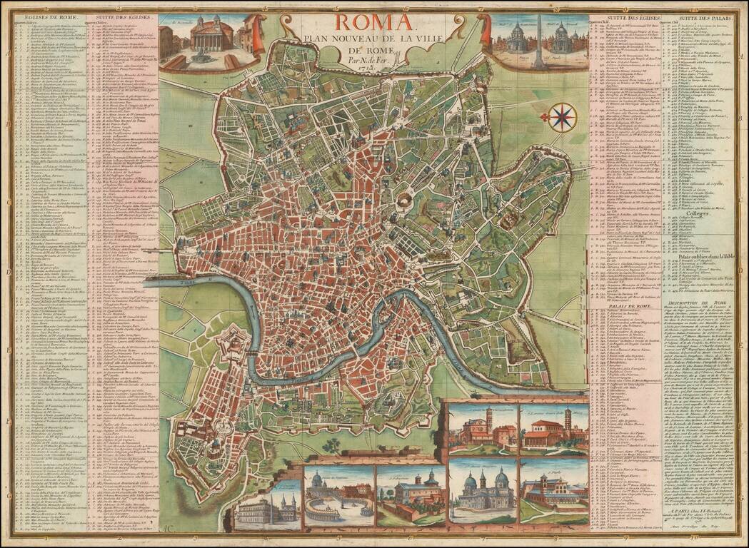
Rare 18th Century Plan of Rome, with 10 inset views and a key identifying over 450 places of interest within the map. The plan includes a number of profiles views of major monuments within the city, as well as bridges, gates and fortified walls. The...
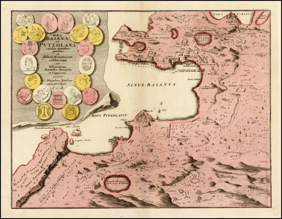
Detailed map the Bay of Naples, with large inset of the city of Puteoli, graphically depicted. In the first century, Puteoli was a mercantile outpost of Rome and one of the major trading ports of the Mediterranean. The map is beautifully engraved to...
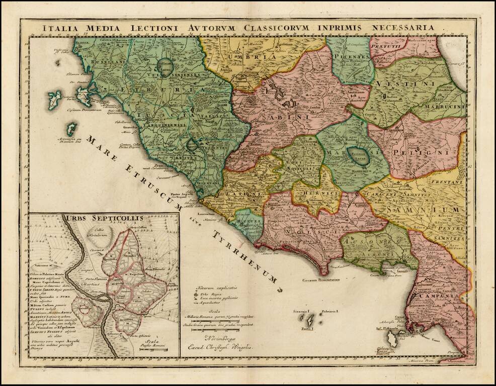
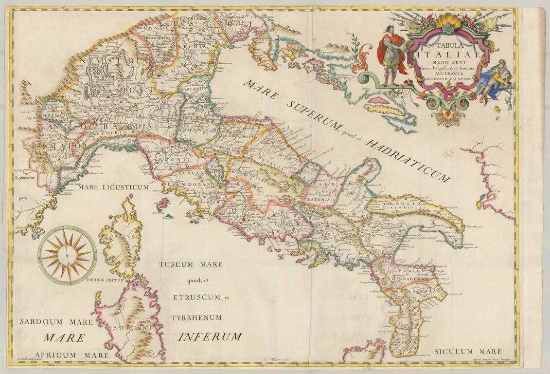
Detailed map of Central Italy in the Etruscan era. The map is divided into early regions, with Rome referred to as "Septicollis." Many early roads are illustrated.
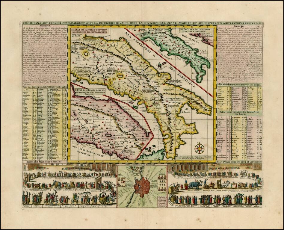
Wonderful map of Italy, comprising maps of Italy during modern (1720) times, at the time of Cesear and at the time of the commencement of the Roman Republic. Large inset of the environs of Rome with two large vignettes showing a Parade of the Ancient...
![[Venice] Carte Du Gouvernement Militarire De La Republique Du Venise . . .](/map/small/30732.jpg)
Decorative set of views of Venice. The inner views are of the Piazza San Marco, a scene of the Gondoliers and a second scene on the Lagoon and a view of the Ponte de la Rialto on the Grand Canal. A striking and decorative map from Chatelain's Atlas...
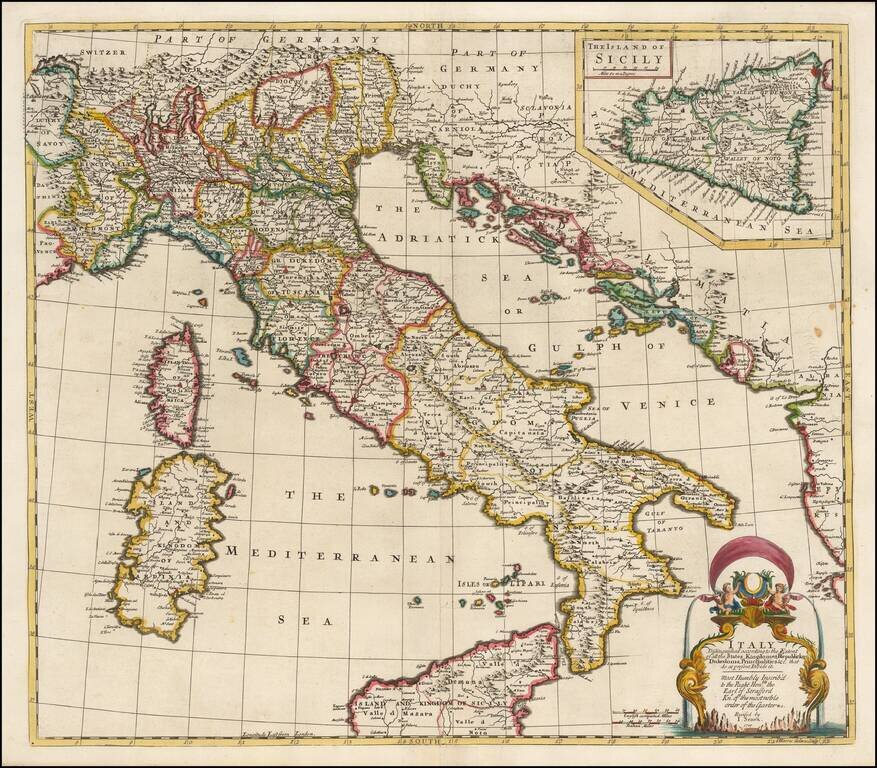
Striking and highly detailed map of Italy, divided into its various regions, from Senex's General Atlas. Includes decorative cartouche and a large inset of Sicily, with dedication to the Earl of Stafford, Knight of the Order of the Garter.
Rare map of Italy, pubished in Venice by Giovanni Giacomo Spinelli, engraved by Angela Varoni. A very rare and decorative map, this being the first example we have ever seen.
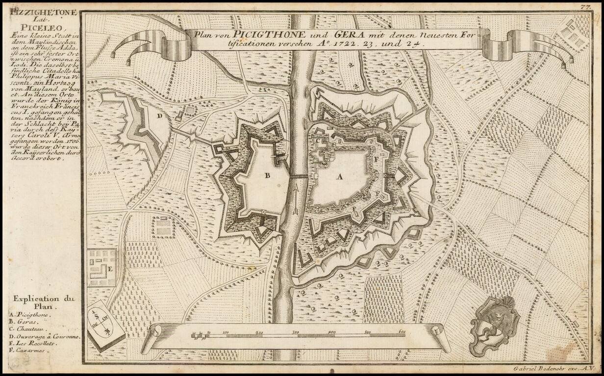
Detailed plan showing two towns in the Duchy of Milan on the River Add, published by Gabriel Bodenehr.
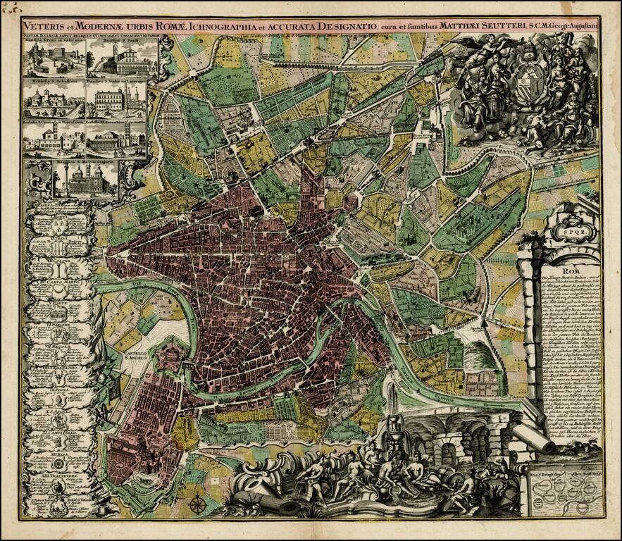
Decorative plan of Rome by Seutter, one of the most prolific printers of town plans in Germany during the 18th Century. The plan includes ichnographic representations of a number of the major buildings and structures of ancient and modern Rome, along...
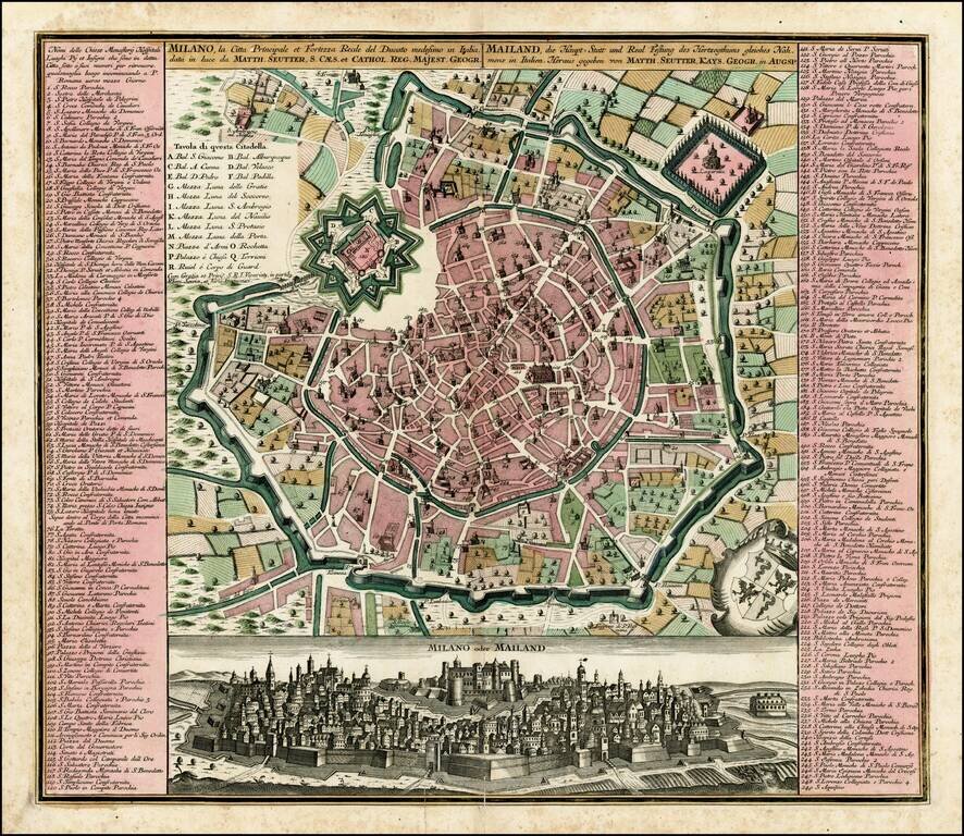
Fine old color example of Seutter's decorative and highly detailed plan of Milan, with a striking view of the City below. The view below the map shows the city atop a hill, with the fortifications in the foreground.
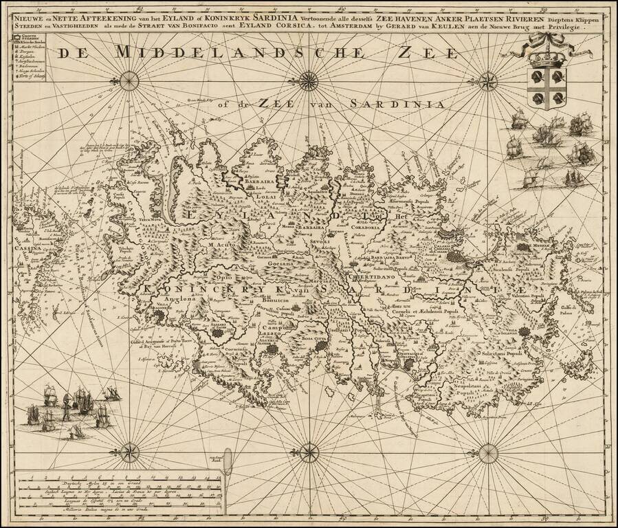
Highly detailed large format sea chart of Sardinia, including multiple sailing ships, compass roses, decorative cartouche, coat of arms, etc. Rare and decorative sea chart of Sardinia oriented to the East, which rarely appears on the market and even...
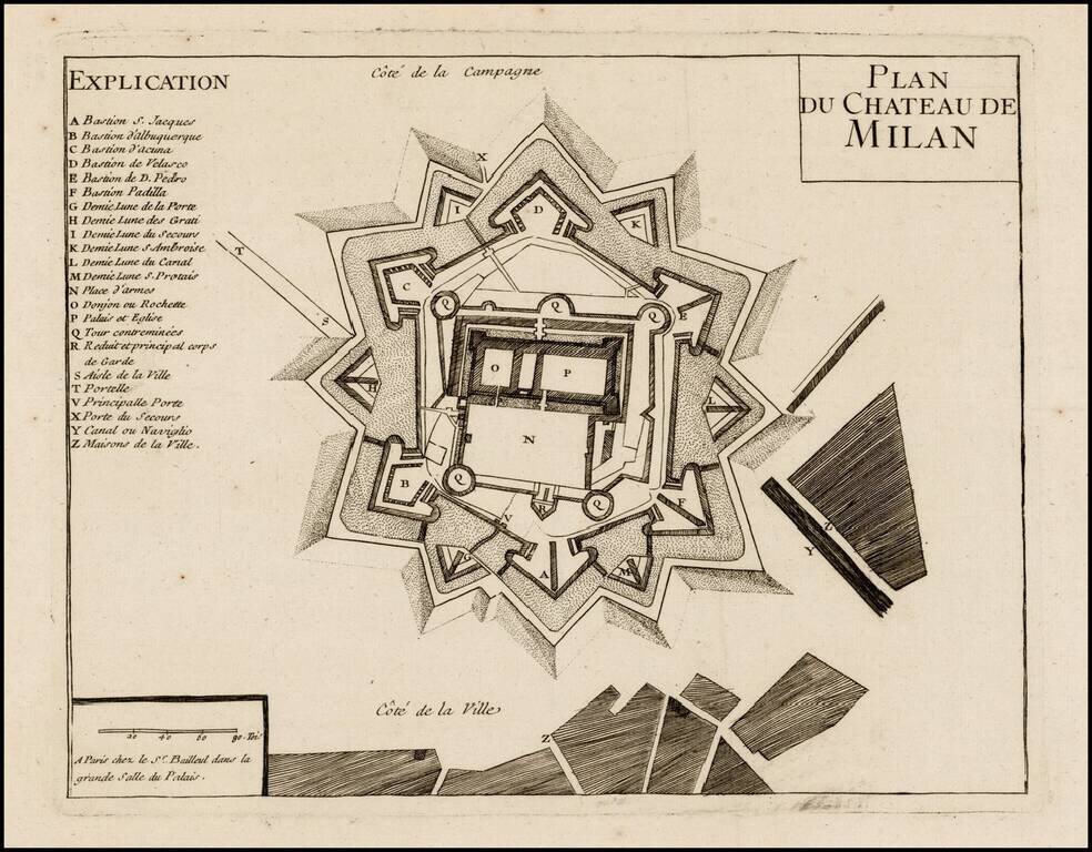
Rare plan of the fortifications at Chateau de Milan, published by Gaspar Bailleul in Paris. Very rare plan showing the fortifications of the Sforza Castle in Milan, in about 1735.
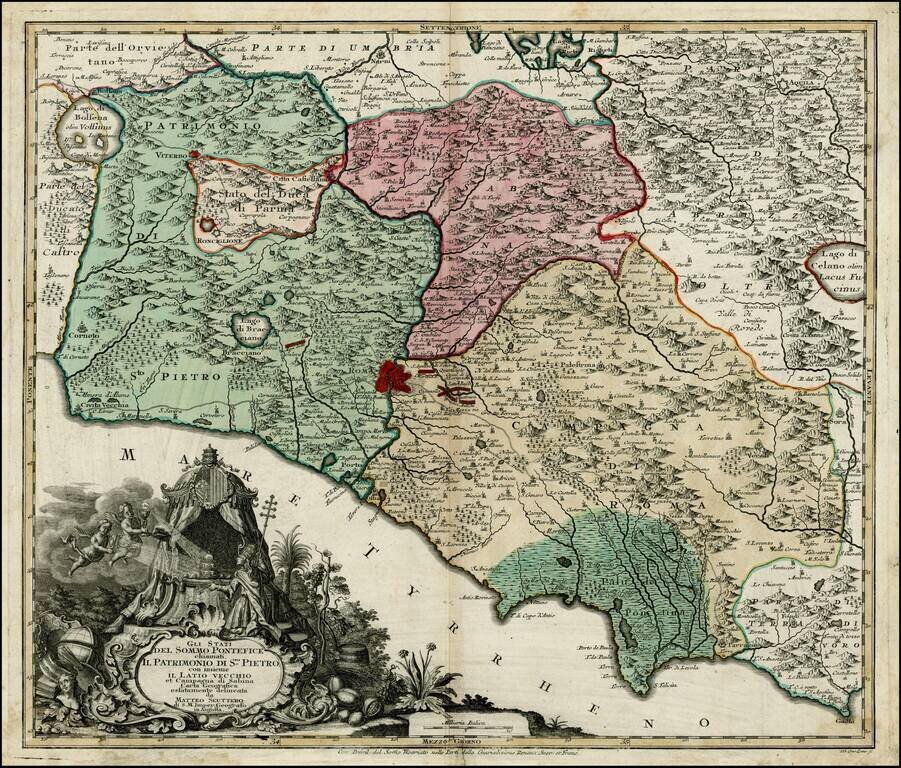
Scarce map of the "Stati del Sommo Pontefice," showing the area centered on Rome, controlled by the Pope. Fine decorative cartouche. The first time we have ever seen this map.
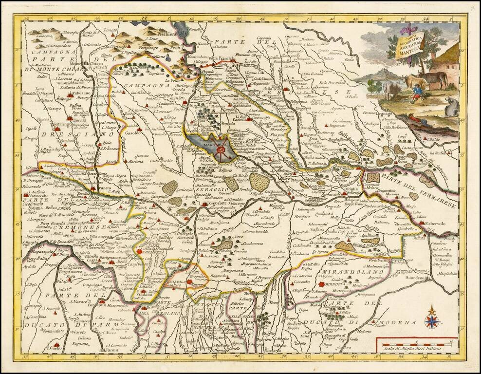
Striking map of the Duchy of Mantova, based upon De L'Ise's map. Includes a decorative cartouche and excellent geographical detail. Albrizzi's maps are scarce and beautifully engraved.
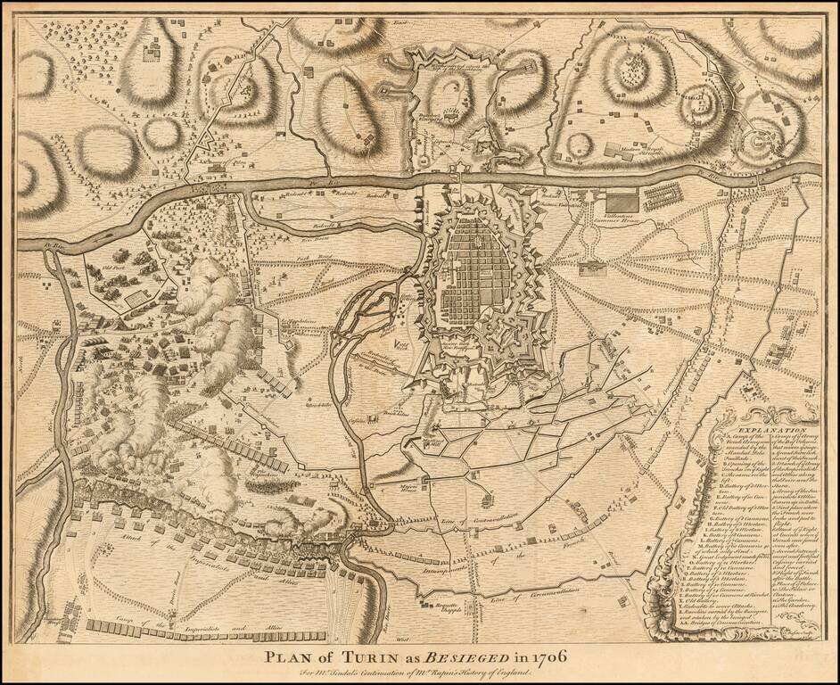
Detailed map of the Siege of Turin in 1706. Shows the fortified town, countryside, local bridges and the troop positions and fortifications associated with the Siege, along with an extensive key. The siege of Turin occurred during the War of Spanish...