
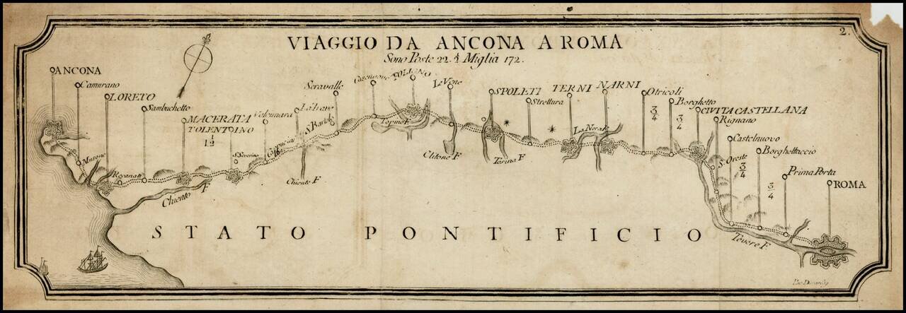
Rare postal roads map, showing the post roads from Rome to Narni, Terni, Spoleti, Foligno, Macerata, Loreto and Ancona. Includes distances, rivers and some topographical features.
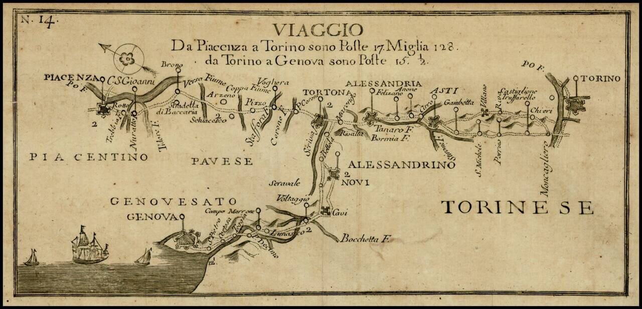
Rare postal roads map, showing the post roads from Torino to Genoa and Torino to Piacenza. Includes distances, rivers and some topographical features.
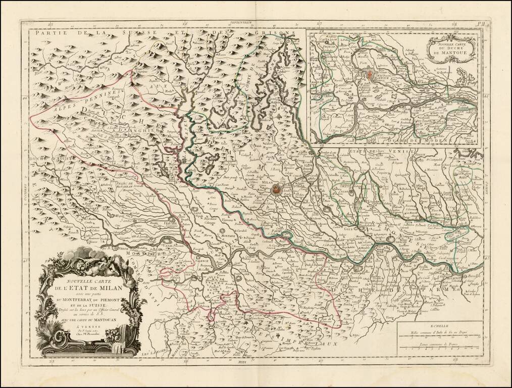
Scarce regional map of the State of Milan and environs, published in Venice by Francois Santini. Unlike many of the maps in Santini's atlas, this regional map of Italy is not drawn from De Vaugondy and is based upon Italian sources. Includes a large...
![L'Italie divisee en ses differens Etats… [2 sheet map]](/map/small/66173.jpg)
Attractive pair of maps Italy, Corsica, Sardinia, Sicily and Malta, showing extraordinary details. Large decorative title carouche.
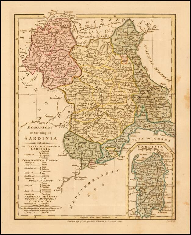
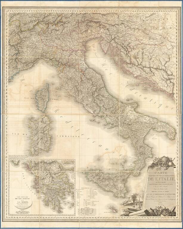
Detailed map of the Kingdom of Sardinia, with a large inset of the Island of Sardinia. Includes Savoy, Aosa, Novarese, Canavese, the Province of Turin, Province of Pignerol, Marquesat of Susa, Province of Alba, Province of Coni, States of Genoa,...
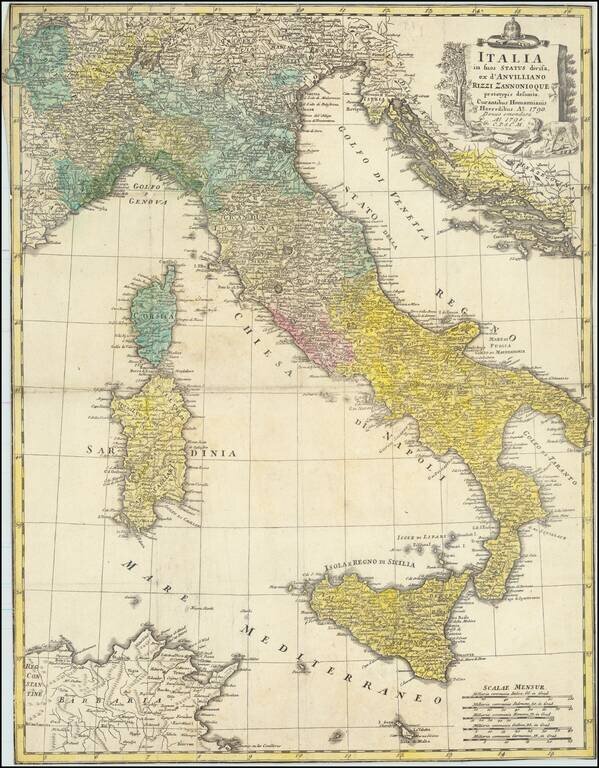
Rare separately issued map of Italy, Sicily, Corsica, Sardinia, etc., extending south to Malta and showing the Gulf of Venice and the contiguous Balkans.
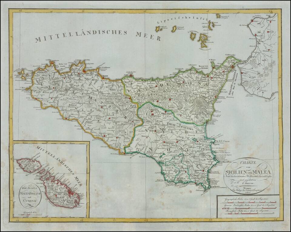
Rare early 19th Century map of Sicily and large inset map of Malta. Shows excellent detail in the interior of the Islands, including political subdivisions, topography and the location of Volcanoes on Sicily. This is the first time we have ever seen...
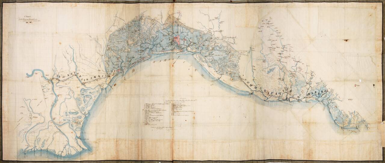
Napoleon's Survey of Venice After The Fall of the Venetian Republic Extraordinary manuscript reconnaissance map of the area around Venice, extending from San Canzian d'Isonzo and the mouth of the Isonzo River to Isola di Polensine and the mouth of the...
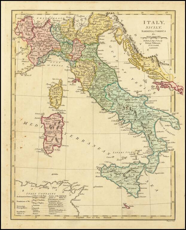
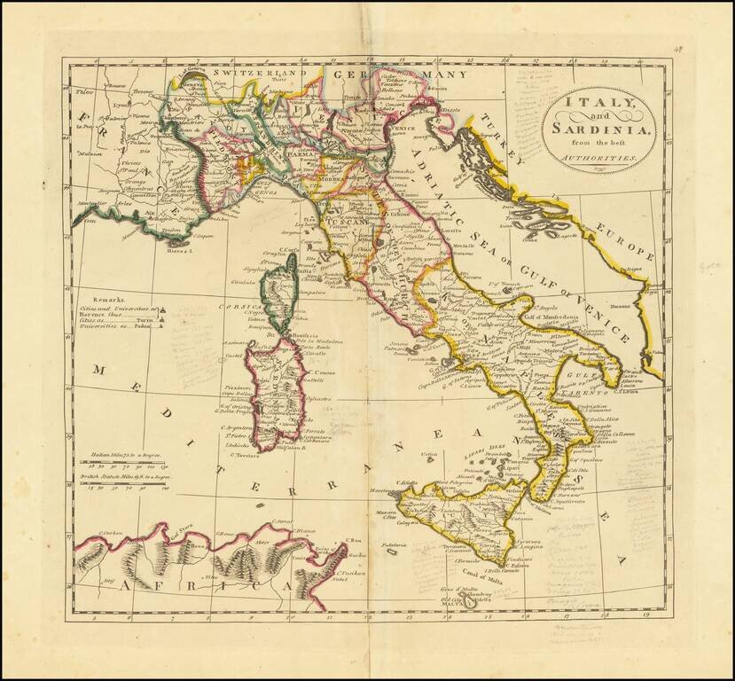
Attractive English language map of Italy, hand colored by regions. The map key shows the allegiances of the various regions (to the Pope, King of Sardinia, King of Naples, Austria, Spain, Italy, etc.) Shows towns, rivers, mountains, lakes, etc....
Interesting map of Italy, Sicily, Corsica and Sardinia, from the 1814 edition of Matthew Carey's General Atlas.
Fine example of this decorative wall map of Italy, published by Orgiazzi in Paris. The map extends from Monaco to Otranto and from The Alps to Malta, with an inset map of Greece. Decorative cartouche illustrates Rome's classical history.
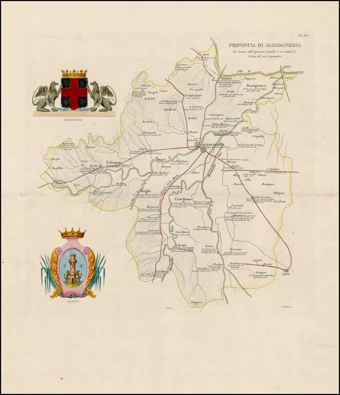
Rare regional map the Province of Allesandria. Includes the coats of arms of Allesandria and Valenza.
![Italy [shows Corsica, Sardinia, Sicily and Malta]](/map/small/67057.jpg)
Detailed map of Italy, Corsica, Sardinia, Sicily and Malta, colored by Kingdoms. The map appeared in an early edition of Finley's New General Atlas.
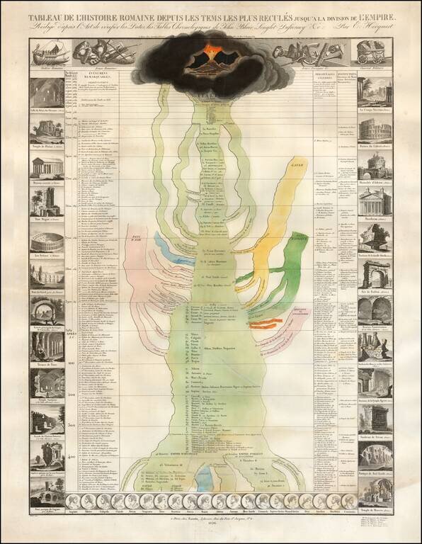
Striking engraved "time map" showing the history of Rome from the time of the year 1984 BC to 500 AD. The sides of the image are adorned with vignettes of various Roman ruins spread across Europe. Portraits of Roman emperors line the bottom of the...
![Kindgom of Sardinia [with inset of Sardinia]](/map/small/48738.jpg)
Scarce regional map of Italy, centered on the Gulf of Genoa, Alessandria and the Duchy of Milan. The map includes Genoa, the Duchy of Milan, Piedmont, and Savoy, along with neighboring regions. Includes a large inset of the island of Sardinia.
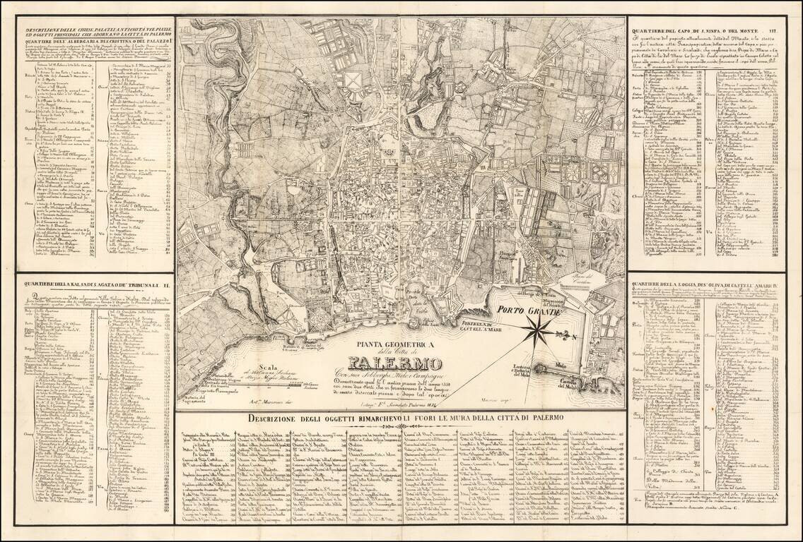
Detailed Map of Palermo, published in Palermo Large map of the city of Palermo and its surroundings, designed by A. Musucemi, lithographed by F. Sconduto in Palermo in 1838 and printed by Mercurio. The map is accompanied by a table of references of...