
![[Map of Italy] Карта Италіи](/map/small/66941.jpg)
Detailed and very rare Russian-language map of Italy, Sicily, Corsica and Sardinia, published in Saint Petersburg in 1836. Rarity The map is very scarce. We have been unable to find any other examples in sales databases, libraries and archives, nor...
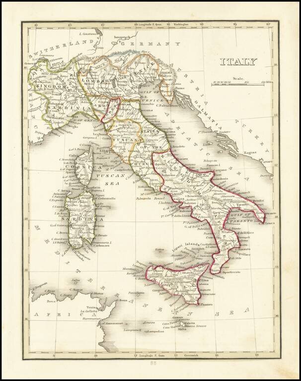
Striking full hand-color engraved map of Italy (with Sicily, Sardinia, Malta and Part of Corsica), which appeared in David Burr's Universal Atlas, in 1836. Burr's Atlas was perhaps the most elegant American commercially published atlas of its time,...
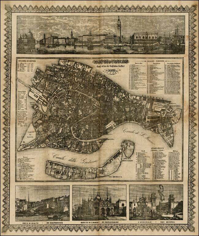
Decorative map of Venice, printed on linen by Willem Seiffert. The map was probably printed for the German tourist market. Fine view of the Grande Canale with the Venetian state barge in the foreground. The lower views show the 'Ponte di Rialto',...
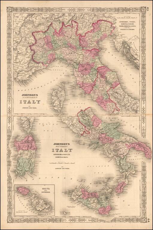
Interesting map of Italy, which appeared in the later editions of Johnson's New Family Atlas of the World. Shows early railroads, among other details.
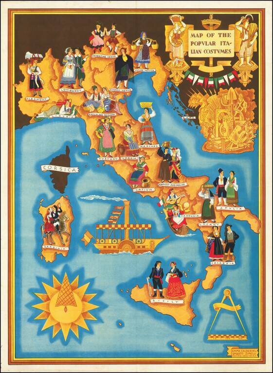
Rare Separately Published Broadside Promoting Italian Culture in Fascist Italy Striking pictorial map of Italy published in the 12th year of the Fascist Era (E.F. XII), extolling the virtues of the Fascism and Italian Culture. The present example has...
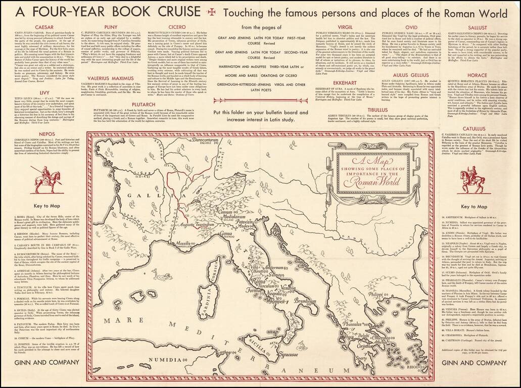
Fascinating "map of the Roman World", illustrating a Ginn & Company promotional advertising brochure promoting its Latin and other educational text books.
![[World War II -- The Italian Campaign] The Battle For Rome](/map/small/68200.jpg)
This Map Is Not For The Orderly Room. It Is To Be Displayed Where The Largest Number of People in the Unit Can Study it. This is a fine large map of the area around Rome, published in February 1944 by the British Army Bureau of Current Affairs...
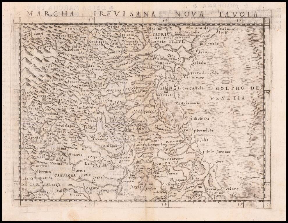
Nice example of Gastaldi's modern map of the Trevisana region, with the Gulf of Venice in the east and Lago de Garda in the west, one of the earliest obtainable modern maps of the region, from Gastaldi's Geografia di Claudio Ptolemeo Alexandrino . . ....
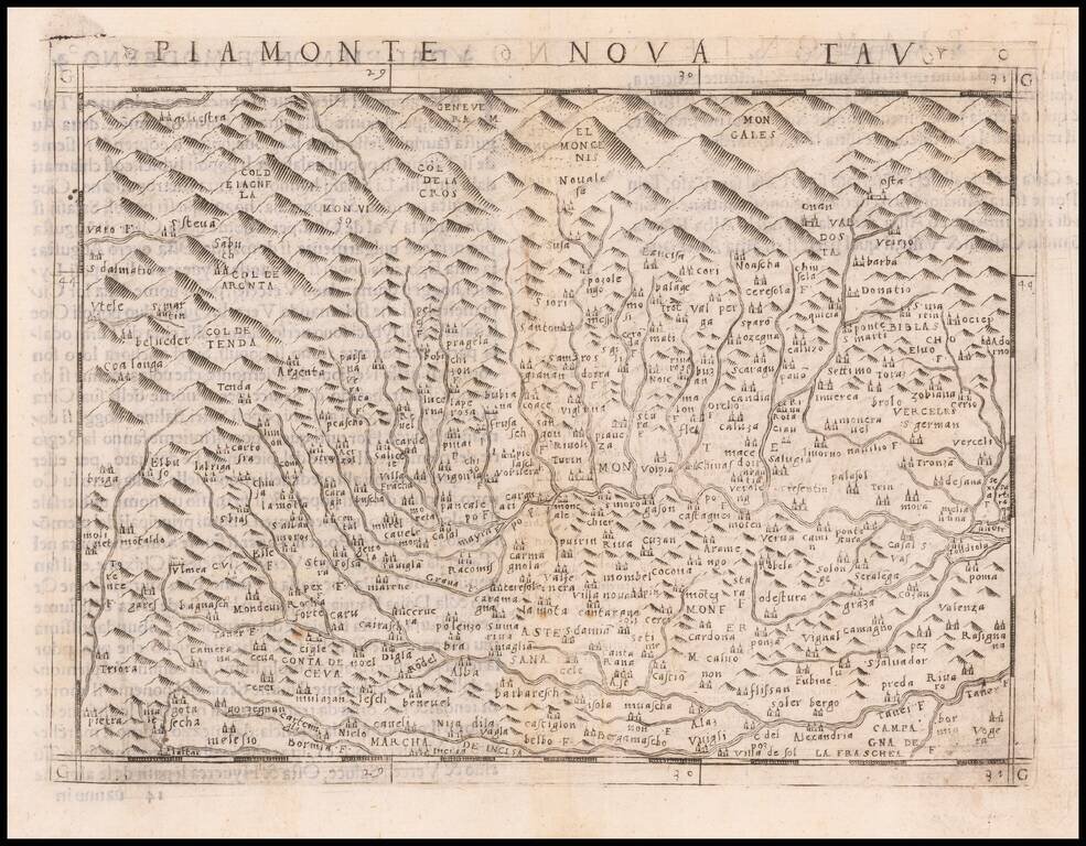
Nice example of Giacomo Gastaldi's modern of the Piedmont region of Italy, published in Gastaldi's Geografia di Claudio Ptolemeo Alexandrino. Italian text on the verso. Nice dark impression.
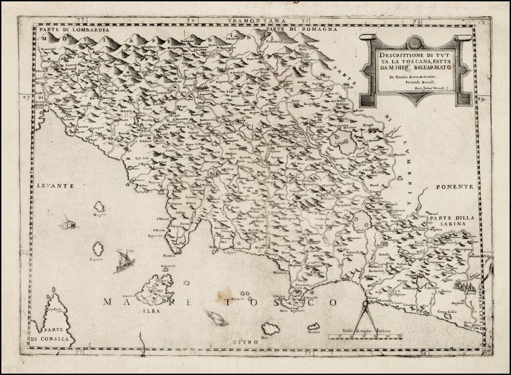
Fine example of Girolamo Bell'Armato's important early map of Tuscany, published in Venice by Bertelli and Forlani. Bell'Armato's map, first published in 1536, is the earliest printed map of Tuscany. Born in Siena in 1493, Bell'Armato's 4 sheet map of...
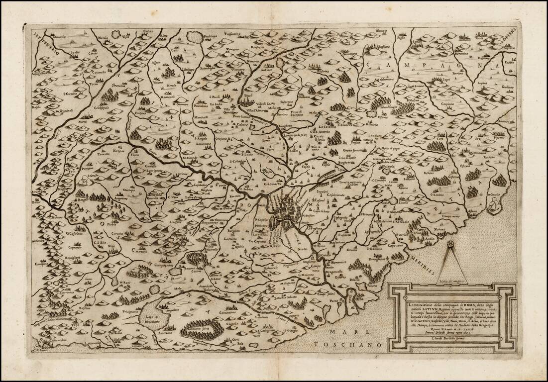
Rare Johannes Orlandi edition of Claudio Duchetti's map of the area around Rome. Duchetti's map of the area around Rome is based upon the map of Euphrosynus Ulpius. Duchetti's first edition was issued in 1564, with later edition issued by Henrik Van...
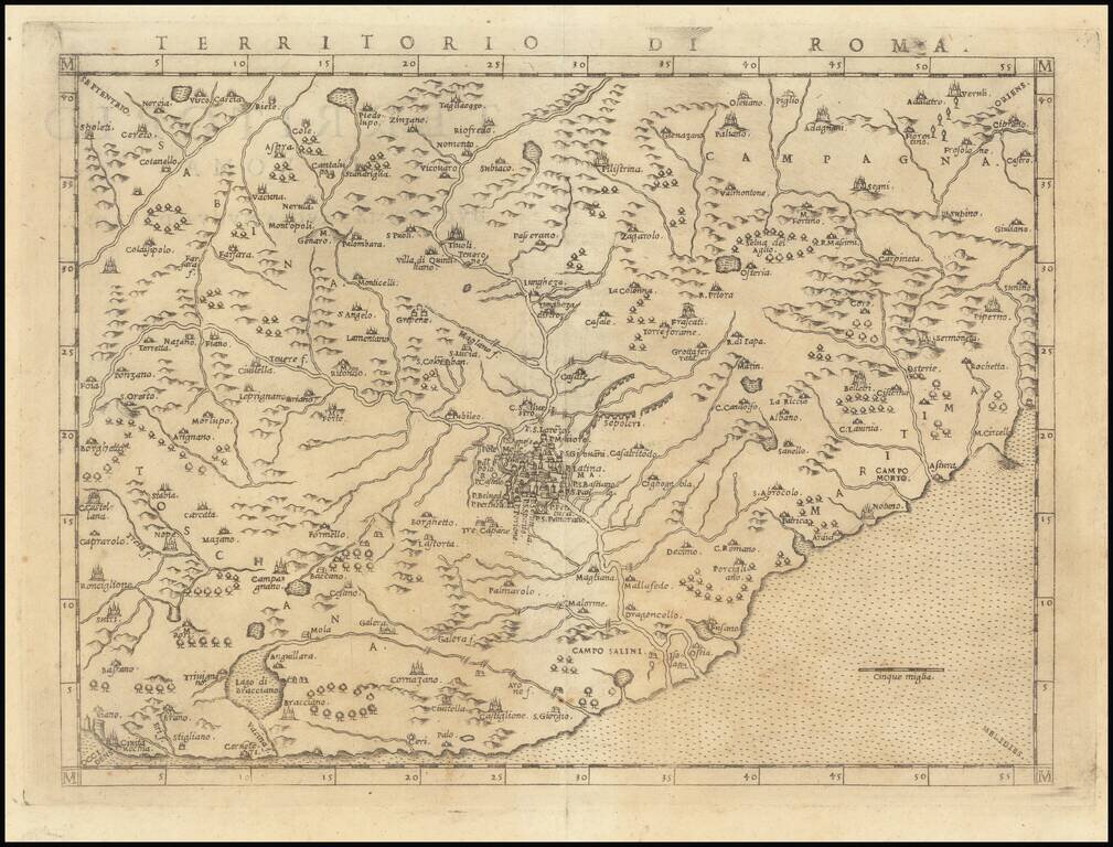
Scarce modern map of the region around Rome, published by Giralomo Ruscelli in 1574. While Ruscelli's atlas was first published in 1561, this is one of the few maps that did not appear in the first edition of the atlas, making it much scarcer on the...
![[Padua & Puglia] Patavini Territorii Corographia Iac. Castaldo Auct. [and] Apuliae Quae Olim Iapygia Nova Corographia](/map/small/70702mp2.jpg)
Nice full color example of Ortelius' maps of the region centered on Venice, Padua and Vicenza, in one map and Puglia and Calabria in the other, from his Theatrum Orbis Terrarum, the first modern atlas of the world. Sailing ship and sea monster.
![(Siena, Corsica, etc.) Senensis Ditionis Accurata Descrip [and] Corsica [and] Marcha Anconae Olim Picenum. 1572](/map/small/44502.jpg)
Fine old color example of Ortelius' maps of Corsica, part of Tuscany and the Tuscan Sea (Siena, etc.) and the Ancona region, Ortelius' Theatrum Orbis Terrarum, the first modern atlas of the world.
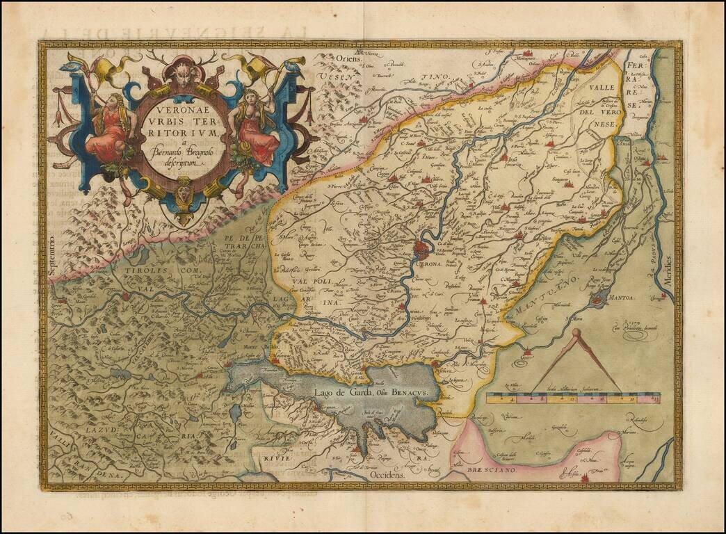
Decorative example of the Ortelius' map of Verona, based upon Brugnoli's map, which was issued by Forlani in Venice in 1574. The map appeared in Ortelius' Theatrum Orbis Terrarum, the first modern atlas of the world. Striking massive cartouche and...