
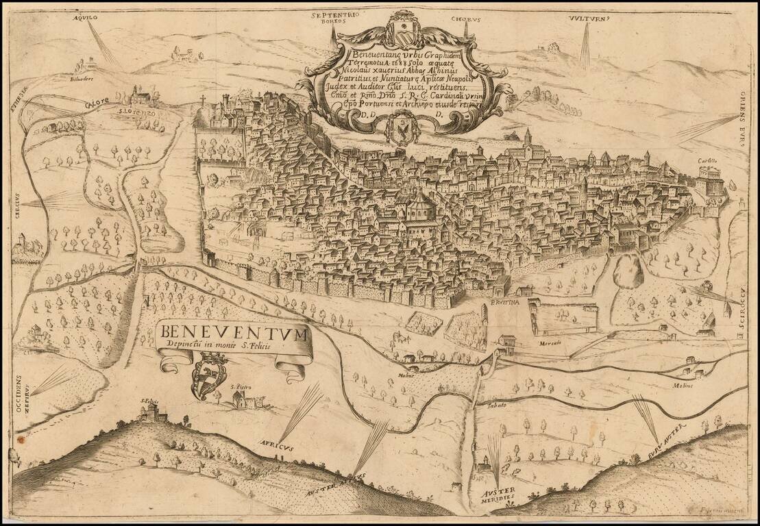
The First Printed Map of Benevento Rare view of Benevento, Italy, published in Benevento and engraved by XXXX.
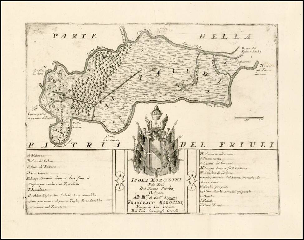
Fine example of this very rare map of the Isola Morosini, formed by the area between the Lisonzo River and Sdoba River. The map is dedicated to Francesco Morosini and includes the family coat of arms and a key locating approximately 20 places on the...
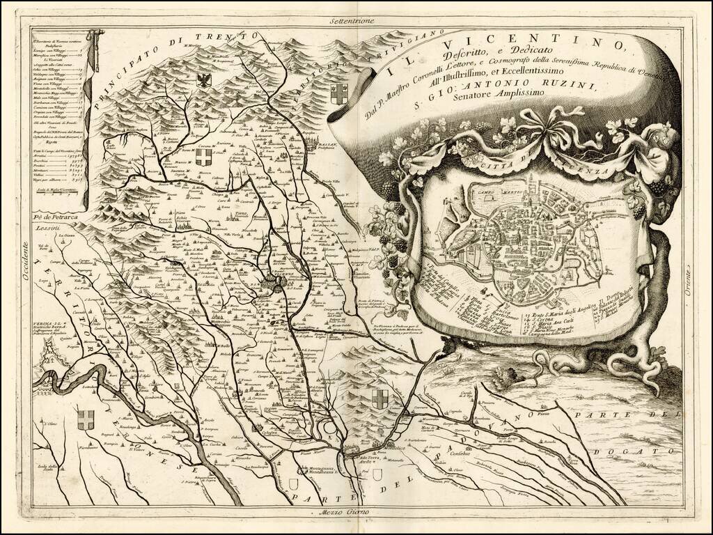
Fine depiction of part of The territory of Vicenza, published in Venice by Coronelli. The map provides a remarkable depiction of the rivers, mountains and valleys, in the region, extending from the Alpine regions to the rivers draining toward the Gulf...
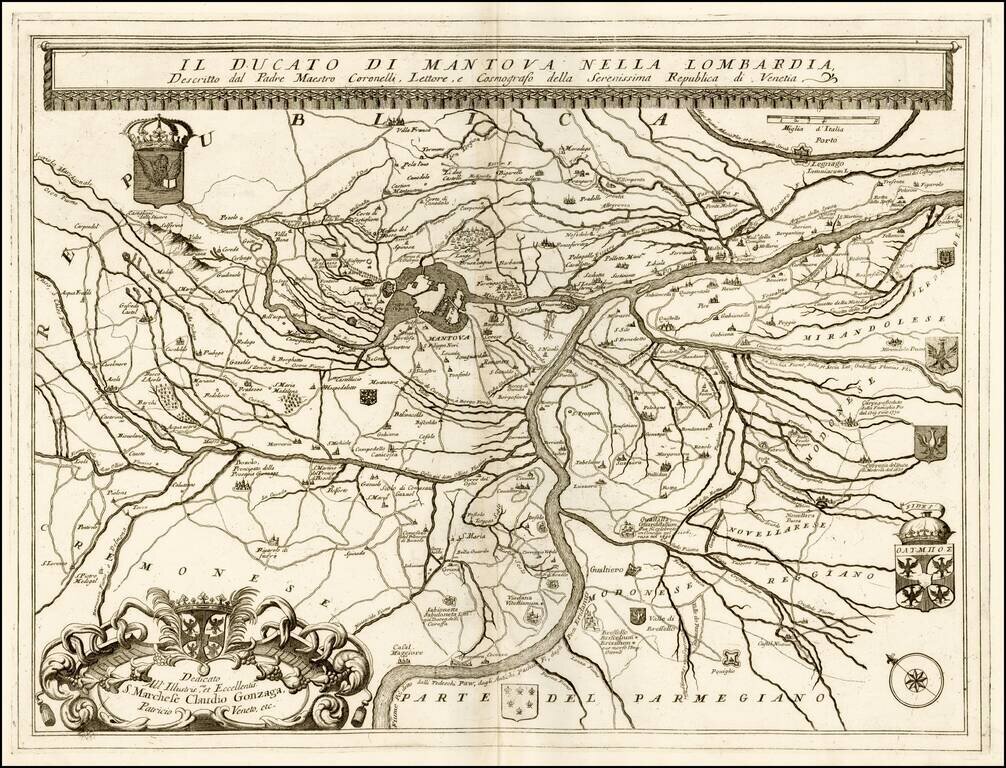
Fine example of this scarce map of the Duchy of Mantova and environs, published by Coronelli in his C orso Geogrpaphico. The map shows the section of the Po River and Tributaries in the Duchy of Mantova, including 8 coats of arms. Vincenzo Coronelli...
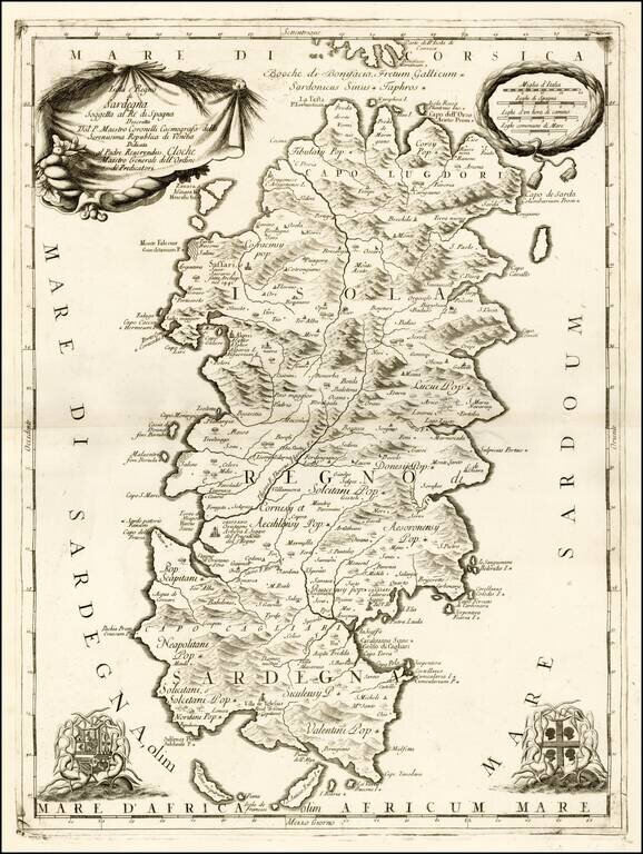
Fine example of this scarce map of the island of Sardigna, published by Coronelli in his C orso Geogrpaphico. Vincenzo Coronelli apprenticed as a Xylographer, before joining the Convental Franciscans in 1665. In about 1678, after studying Astronomy...
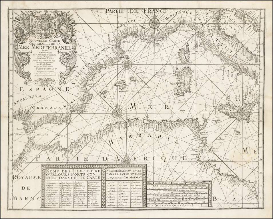
A rare separately issued map of the Western Mediterranean, published in Marseille by François Berthelot. This important early chart of the Western Mediterranean is one of a series of 4 charts published by Berthelot covering the Mediterranean and...
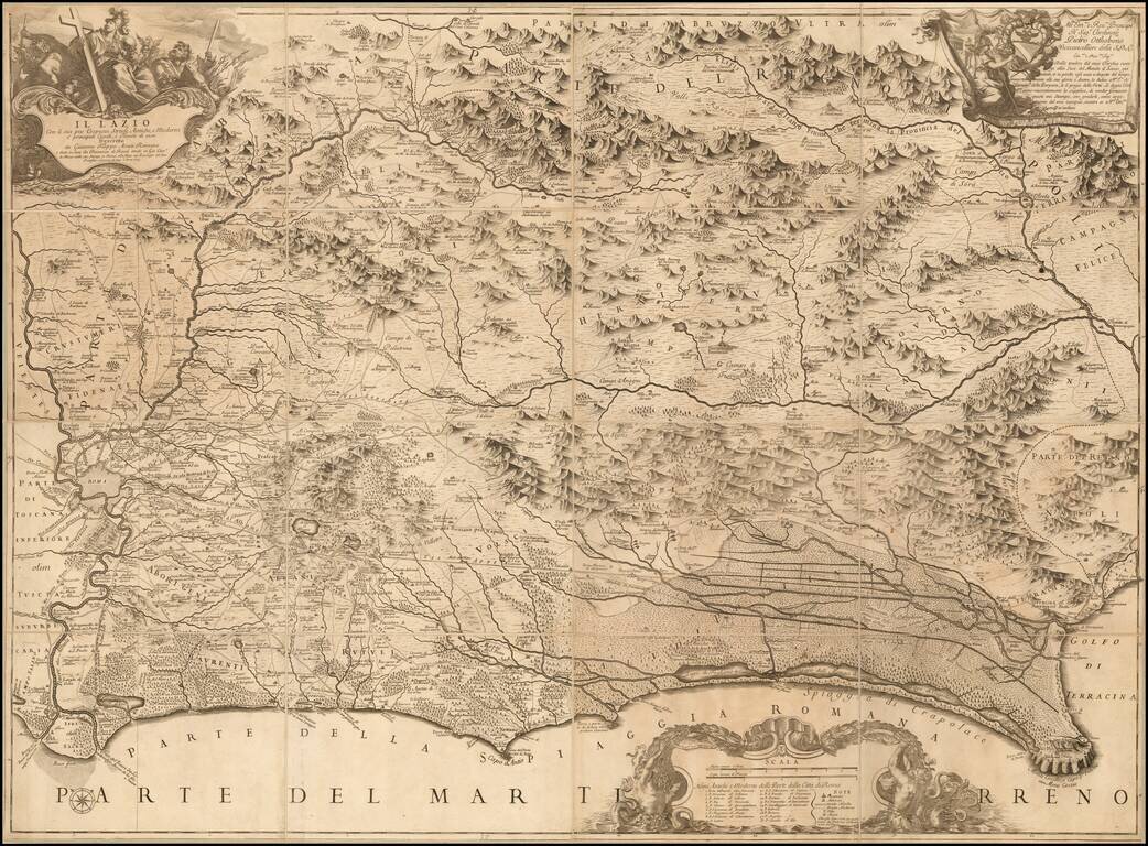
Nice example of Rossi's 4 sheet map of the Lazio region, including Rome, first published in 1693. The map shows the Lazio territory from Rome to Circeo, with incredible detail. Drawn and engraved by Giacomo Filippo Ameti. The cartouche in the upper...
![Stato Di Milano Parte Occidentale [and] Stato Di Milano Parte Orientale](/map/small/33886.jpg)
Fine example of this detailed 2 sheet map of the Stato Di Milano, from Vincenzo Maria Coronelli's Corso Geographico, published in Venice. The map provides a fantastic image of the topography of the region, naming mountains, rivers, lakes, towns,...
![Il Monferrato . . . [and] Parte Settentrionale Del Monferrato](/map/small/33919.jpg)
Fine example of this detailed 2 sheet map of Monferrato, from Vincenzo Maria Coronelli's Corso Geographico, published in Venice. The map provides a fantastic image of the topography of the region, naming mountains, rivers, lakes, towns, castles, etc....
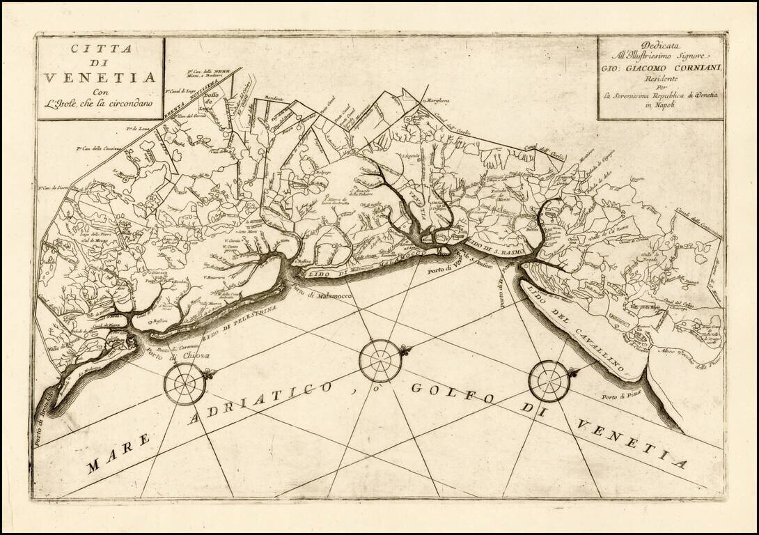
Finely engraved map of the area around Venice, focusing on the rivers and Canals, published by Coronelli. Vincenzo Maria Coronelli was among the most important and influential map makers of the late 17th Century. After starting his career in Venice,...
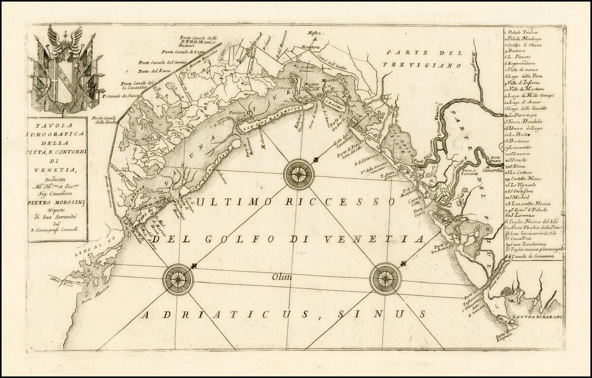
Finely engraved map of the area around Venice, focusing on the rivers and canals, published by Coronelli. Includes a decorative coat of arms and table locating 35 places in the area. Vincenzo Maria Coronelli was among the most important and...
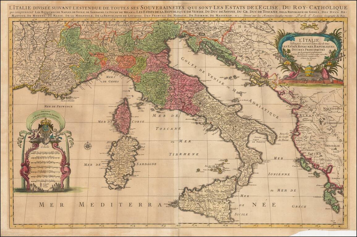
Striking large and highly detailed map of Italy, the Adriatic, Mediterranean and contiguous islands, including Corsica, Sardinia and Sicily. Two highly decorative large cartouches. One of the best large format maps of Italy to appear in a commercial...
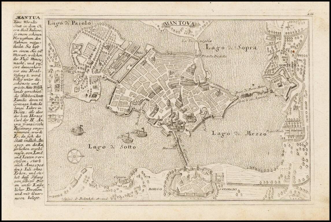
Detailed view and plan of the fortifications of the town of Mantova, published by Gabriel Bodenehr.
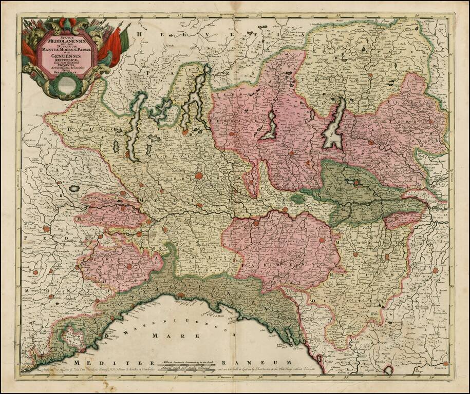
Striking old color example of Valk's scarce map of Northern Italy. The map is in fine old color and printed on double thick paper, from a composite atlas of the period.
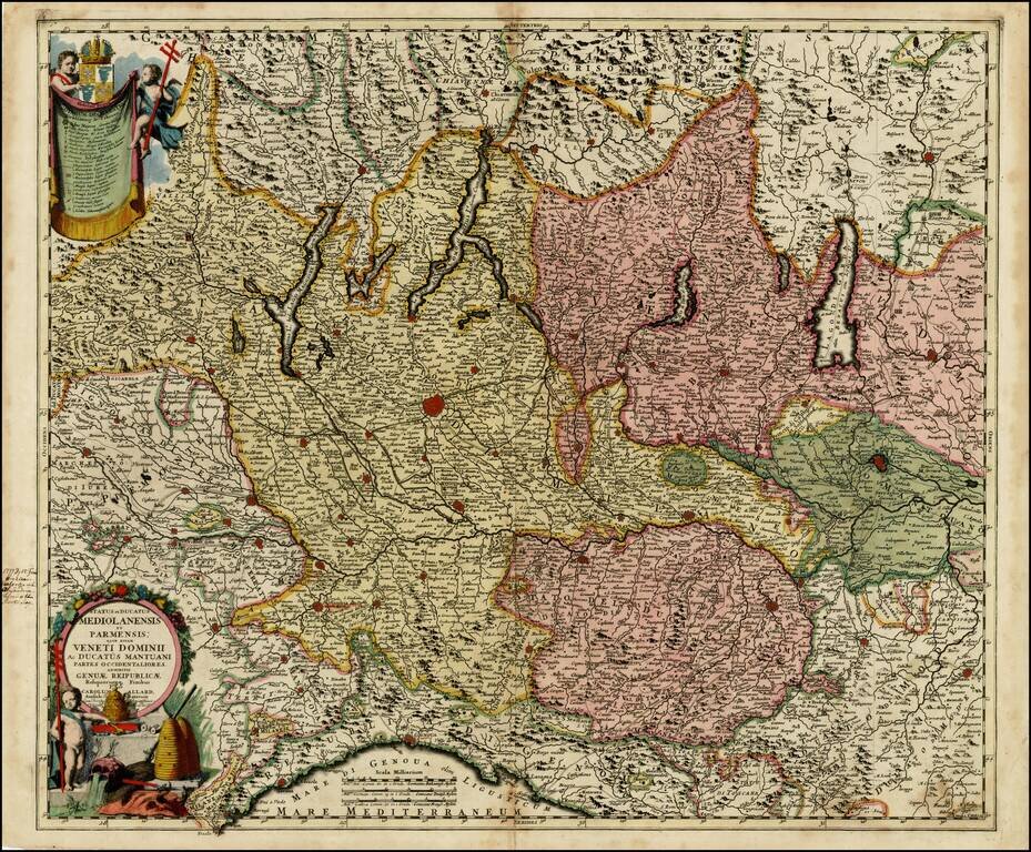
Striking regional map of Northwestern Italy, from the Lake Districts and the Coast of Liguria to Mantua and Modean, centered on Milan and Lago di Como. Includes 2 striking cartouches. Shows roads, rivers, mountains, lakes and many other details.
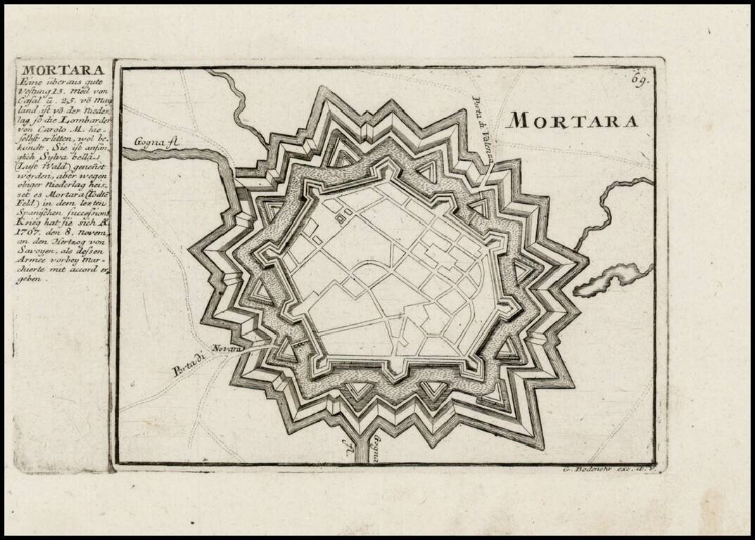
Detailed view and plan of the fortifications of the town of Mortara (southwest of Milan), published by Gabriel Bodenehr.