Map size in jpg-format: 3.06442MiB
Click to open in high resolution (open in new tab).
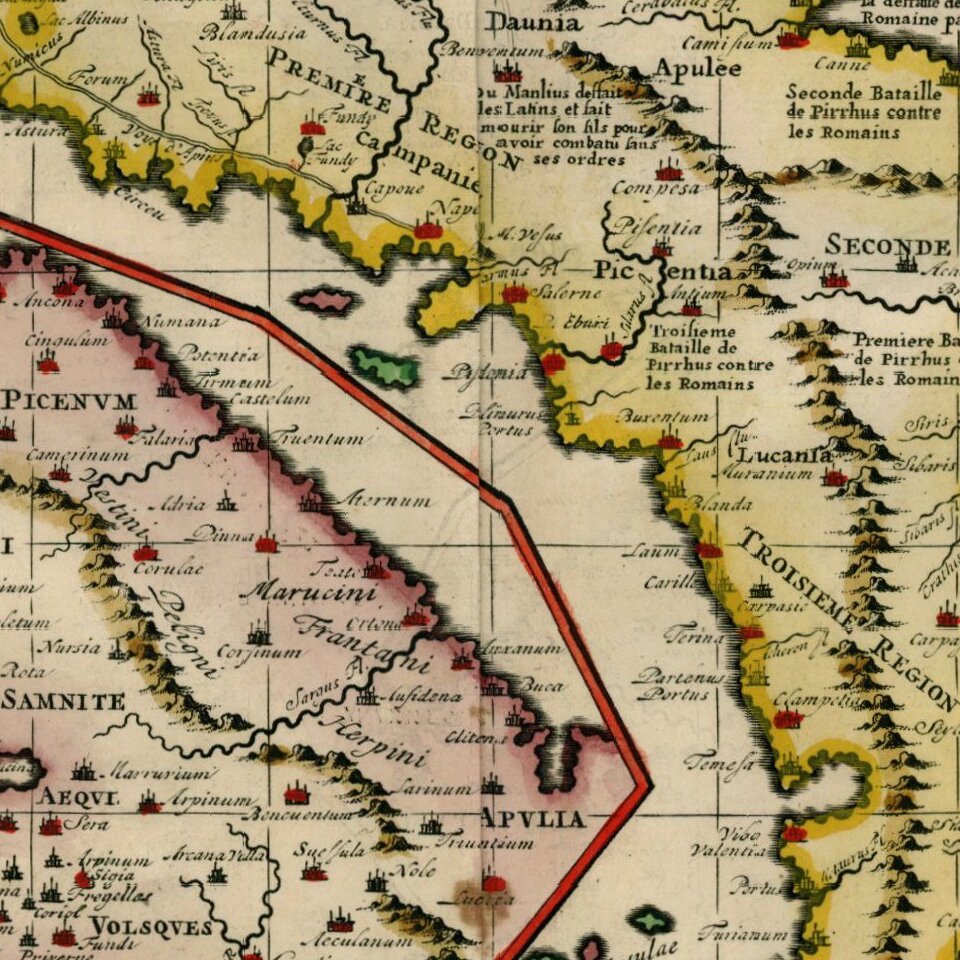
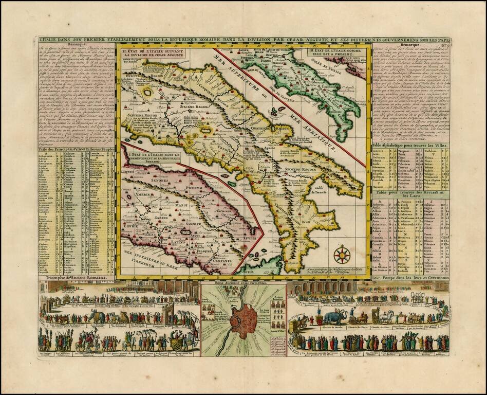
Wonderful map of Italy, comprising maps of Italy during modern (1720) times, at the time of Cesear and at the time of the commencement of the Roman Republic.
Large inset of the environs of Rome with two large vignettes showing a Parade of the Ancient Romans and a Papal Ceremony. A striking and decorative map from Chatelain's Atlas Historique.
Henri Abraham Chatelain (1684-1743) was a Huguenot pastor of Parisian origins. Chatelain proved a successful businessman, creating lucrative networks in London, The Hague, and then Amsterdam. He is most well known for the Atlas Historique, published in seven volumes between 1705 and 1720. This encyclopedic work was devoted to the history and genealogy of the continents, discussing such topics as geography, cosmography, topography, heraldry, and ethnography. Published thanks to a partnership between Henri, his father, Zacharie, and his younger brother, also Zacharie, the text was contributed to by Nicolas Gueudeville, a French geographer. The maps were by Henri, largely after the work of Guillaume Delisle, and they offered the general reader a window into the emerging world of the eighteenth century.
If you are a student, write to us in telegram: @antiquemaps and indicate what material you need and for what work you need a map in high detail. We are ready to provide material on special terms. For students only!


