Map size in jpg-format: 1.75184MiB
Click to open in high resolution (open in new tab).

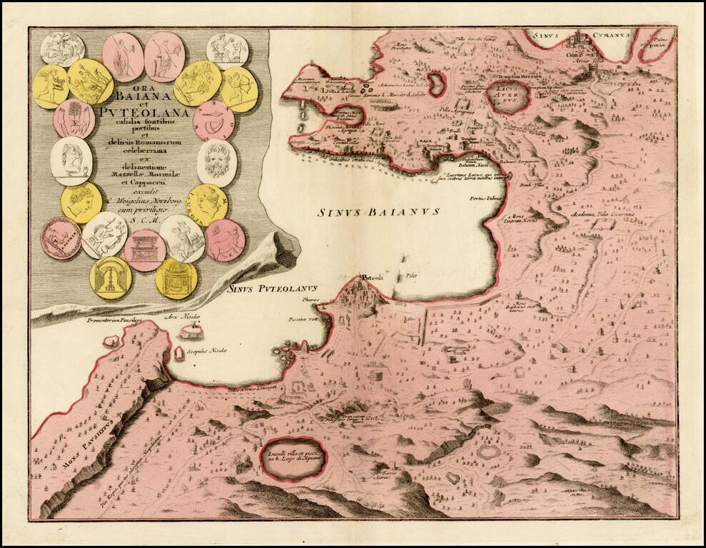
Detailed map the Bay of Naples, with large inset of the city of Puteoli, graphically depicted.
In the first century, Puteoli was a mercantile outpost of Rome and one of the major trading ports of the Mediterranean. The map is beautifully engraved to show all the major Roman sites in the region including fortresses, villas, coliseums and roads.
The large title cartouche incorporates various types of Roman coins.
If you are a student, write to us in telegram: @antiquemaps and indicate what material you need and for what work you need a map in high detail. We are ready to provide material on special terms. For students only!


