
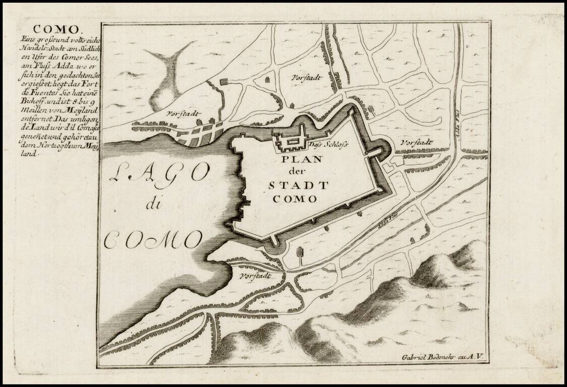
Detailed view and plan of the fortifications of the town of Como on the edge of Lago di Como, published by Gabriel Bodenehr.
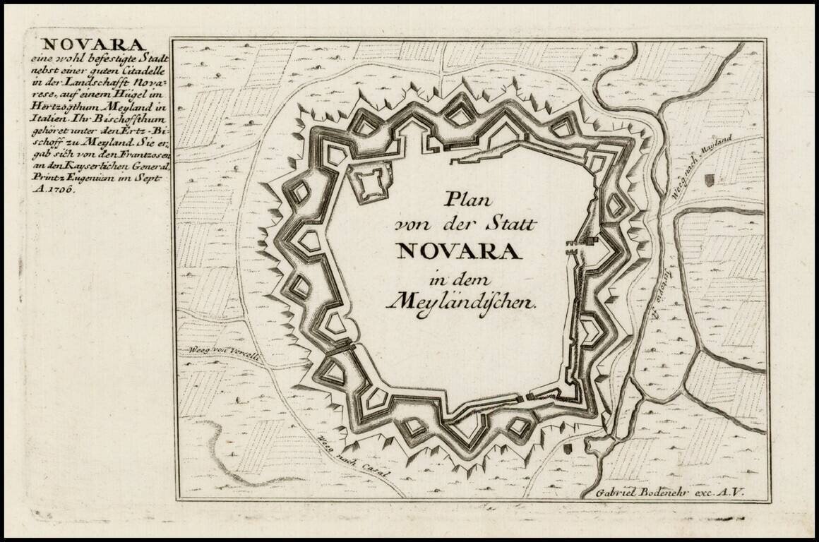
Detailed view and plan of the fortifications of the City of Novara, published by Gabriel Bodenehr.
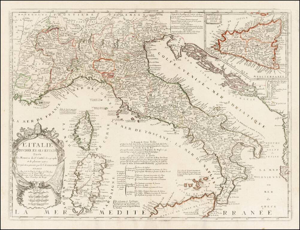
Rare variant edition of Nolin's map of Italy, with a large inset of Sicily. This edition has Nolin's address as "le Quay de l'Horloge du Palais vers le Pont Neuf ". An earlier edition of the map shows the address at "le Quay de l'Horloge du Palais...
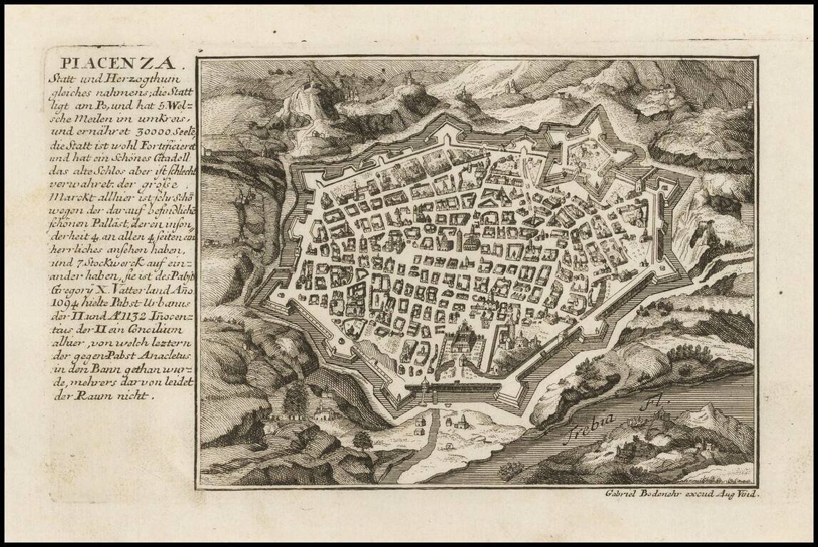
Detailed plan of the fortifications of the town of Piacenza, published by Gabriel Bodenehr.
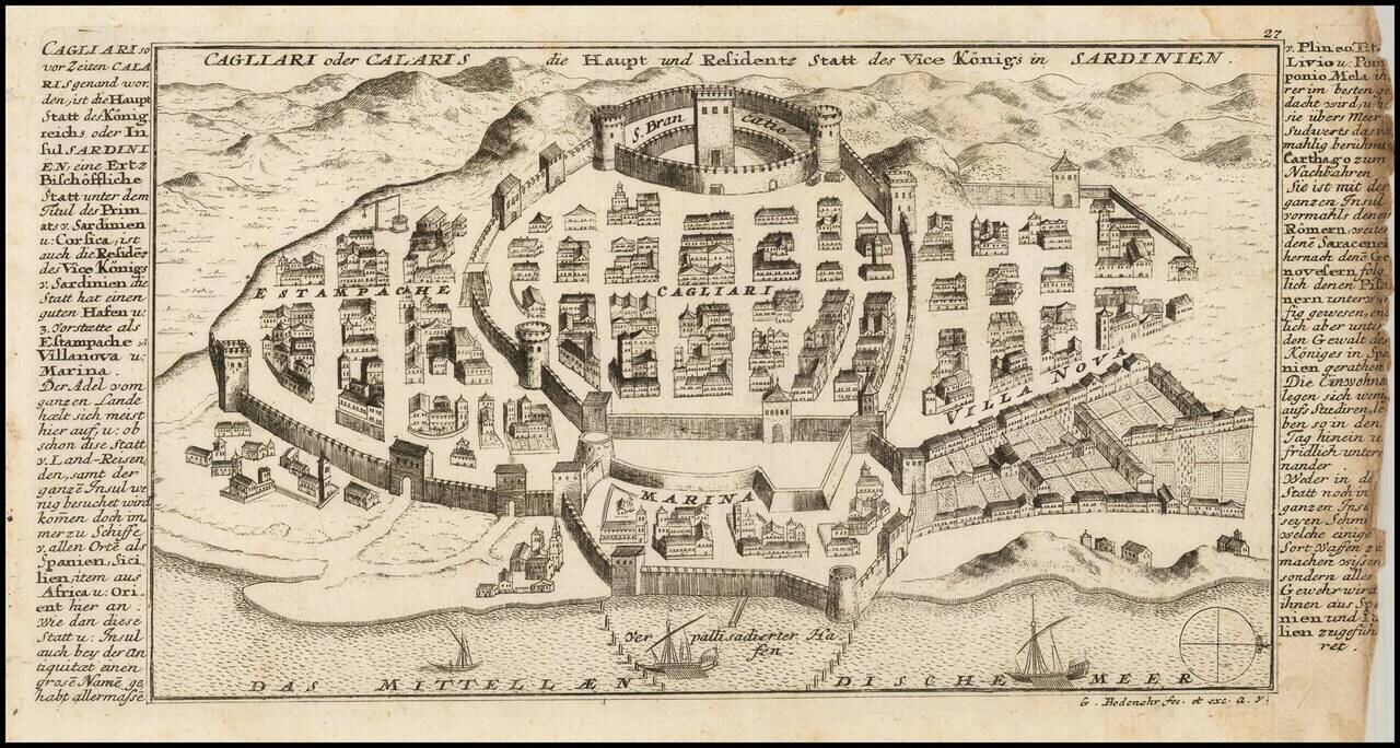
Detailed view and plan the town, harbor and fortifications of Cagliari, one of the capital cities of Sardinia, published by Gabriel Bodenehr.
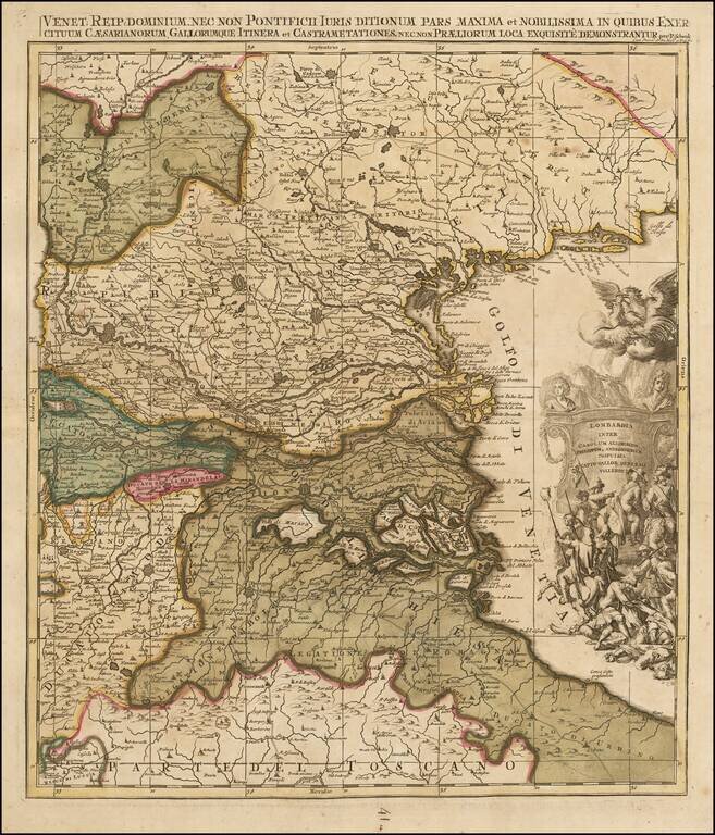
Scarce map of Northeatern Italy, published in Amsterdam by Peter Schenk. The map extends from the Venice area in the east to Belluno and Trento in the north, Reggio and Verona in the west and the northern part of Tuscany.
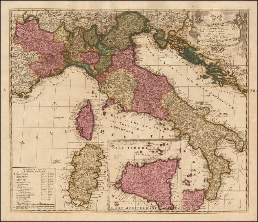
Scare map of Italy, with a large inset map of Sicily, published in Amsterdam by Schenk. Includes a table showing symbols and abbreviations.
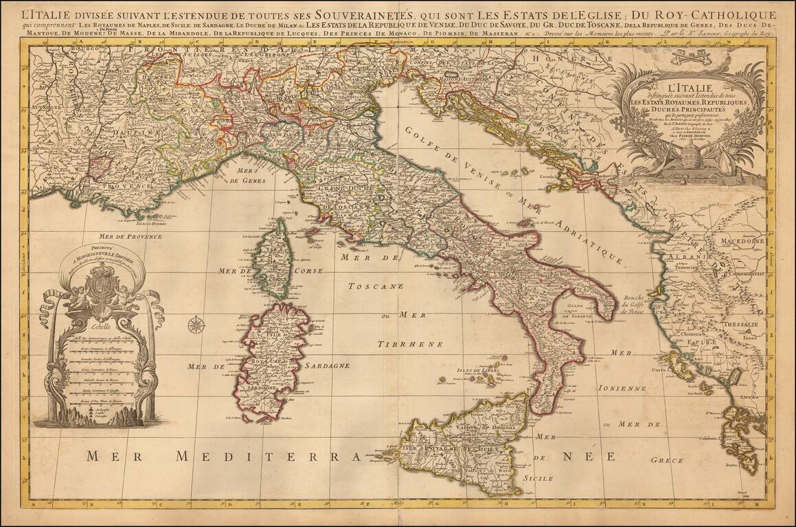
Striking large and highly detailed map of Italy and the Adriatic, published in Amsterdam by Mortier. Includes two decorative cartouches.
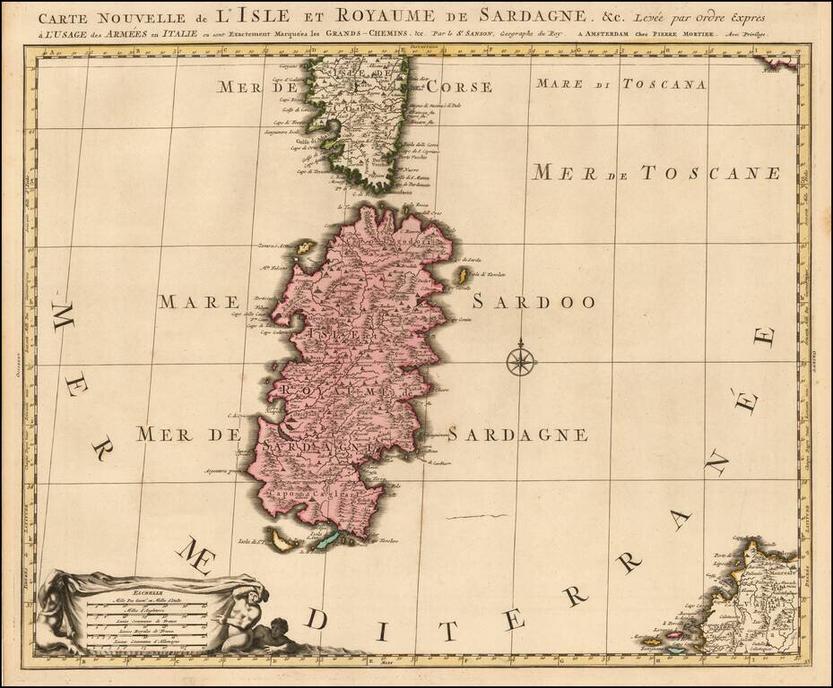
Early state of the Mortier map of Sardinia. The map would later be re-issued by Coven & Mortier, with a number of ships and battle scenes.
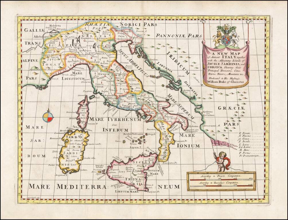
Decorative anicent map of Italy at the beginning of the 18th Century. This map was part of an atlas dedicated to the Duke of Glocester, who was then and 11 year old student attending school in Oxford.
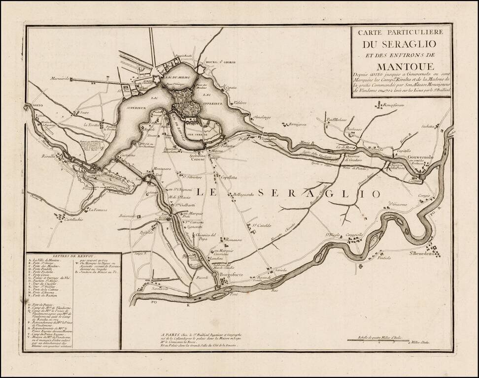
Rare map of the area around Mantua, published by Gaspar Bailleul in Paris. The map would seem to relate to the Battle of Luzzara, a battle of the War of the Spanish Succession, which was fought on August 15, 1702 near Luzzara, Italy. In the summer of...
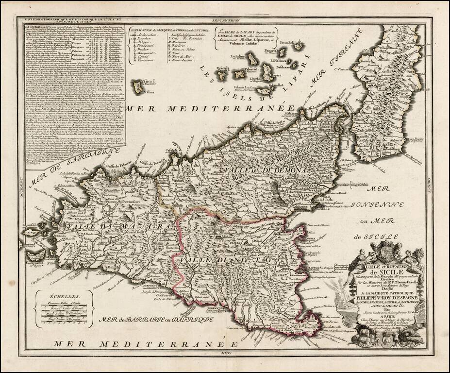
Early edition of Nolin's rare large format map of Sicily. Nolin's map is dedicated to Filipo V. The basic configuration and place names follow the map of Giacomo Cantelli. A later edition, with lengthy text annotation in the upper left corner,...
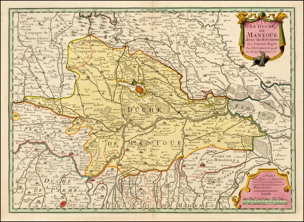
Extremely rare separately issued map of the Duche of Mantua, published in Paris by Liebaux. Includes exceptional detail and fine full original wash coloring.
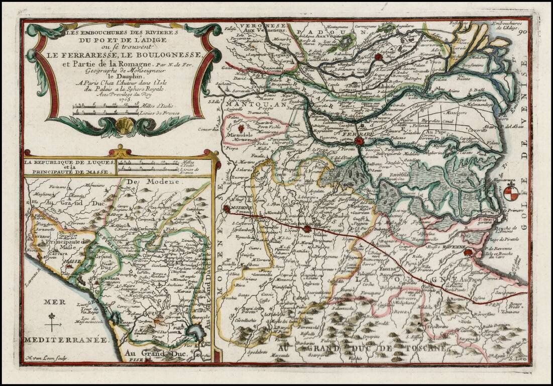
Scarce regional map of Italy, showing the mouths of the Po and Adige Rivers flowing into the Gulf of Venice. Shows towns, roads, rivers, lakes, mountains, etc. Excellent detail. Inset map shows the Republic of Luca and Principality of Masse on the...
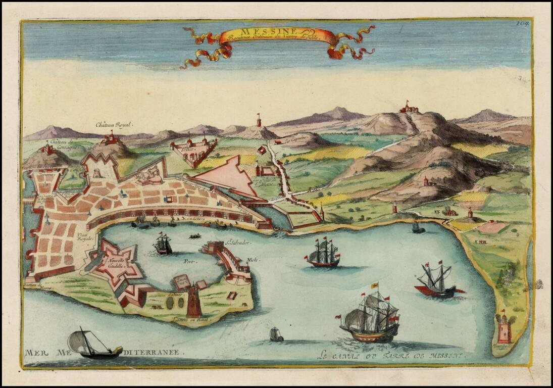
Detailed view of Messina, the residence of the Viceroy of Sicily. From De Fer's Atlas Curieux.
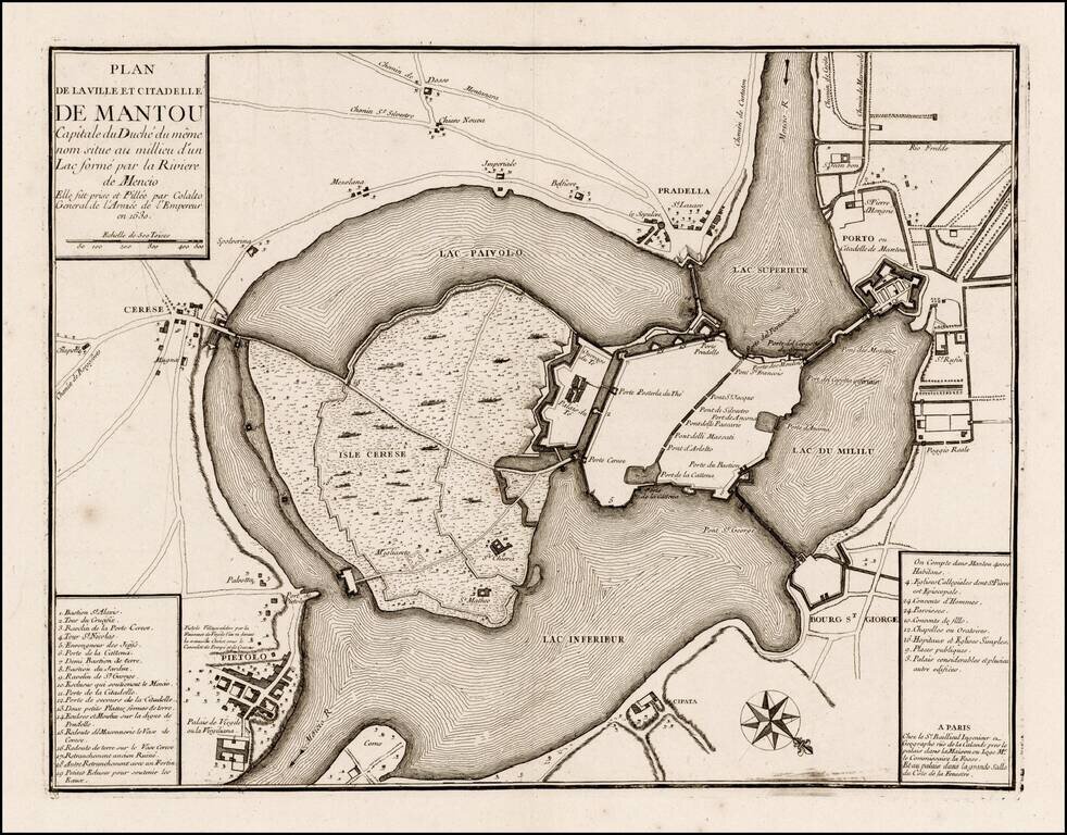
Rare plan of Mantua, published by Gaspar Bailleul in Paris. The map shows the internal fortifications of the island city of Mantua, with bridges, roads, etc. The map is quite scarce, with no appearance on the market in the past 25 years.