
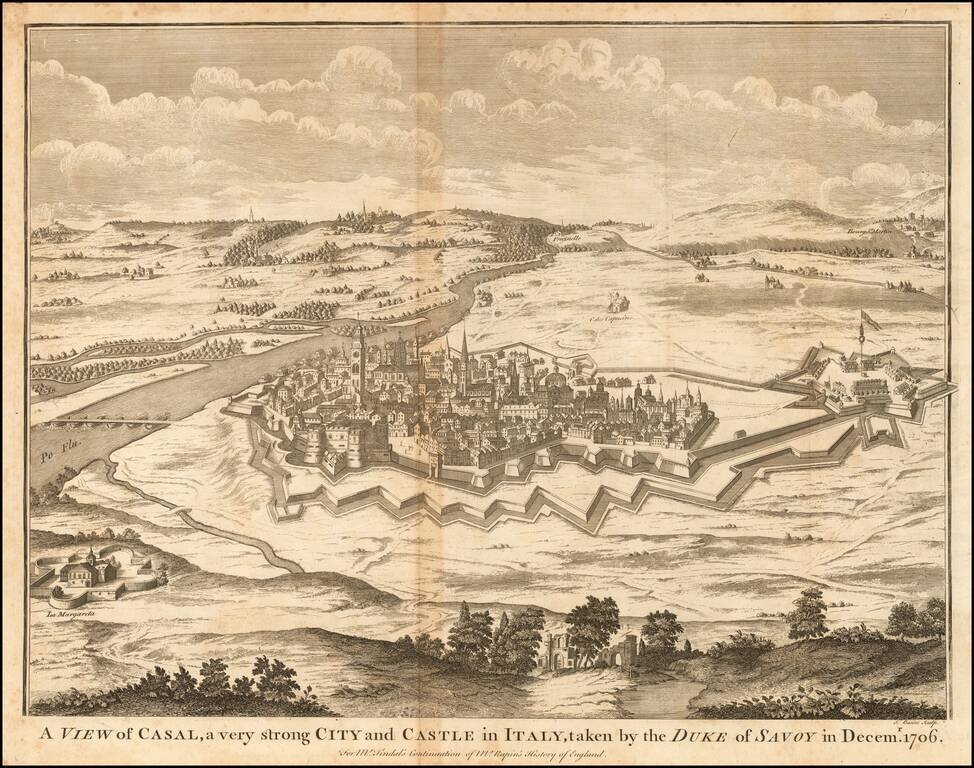
Fine contemporary engraved plan of Casal in Italy, during the War of the Spanish Succession, from Rapin & Tindall's History of England.
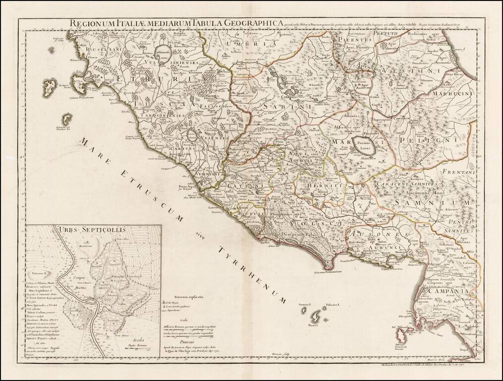
Detailed map of a portion of Italy, showing the regions in ancient times, including Etruscan Tuscany, Sabini, Vestini, Marruncini, Peligni, Latini, Henrici, Samnium, Volsci, Ausones and part of Ubria and Picentes. Many early towns, roads, rivers,...
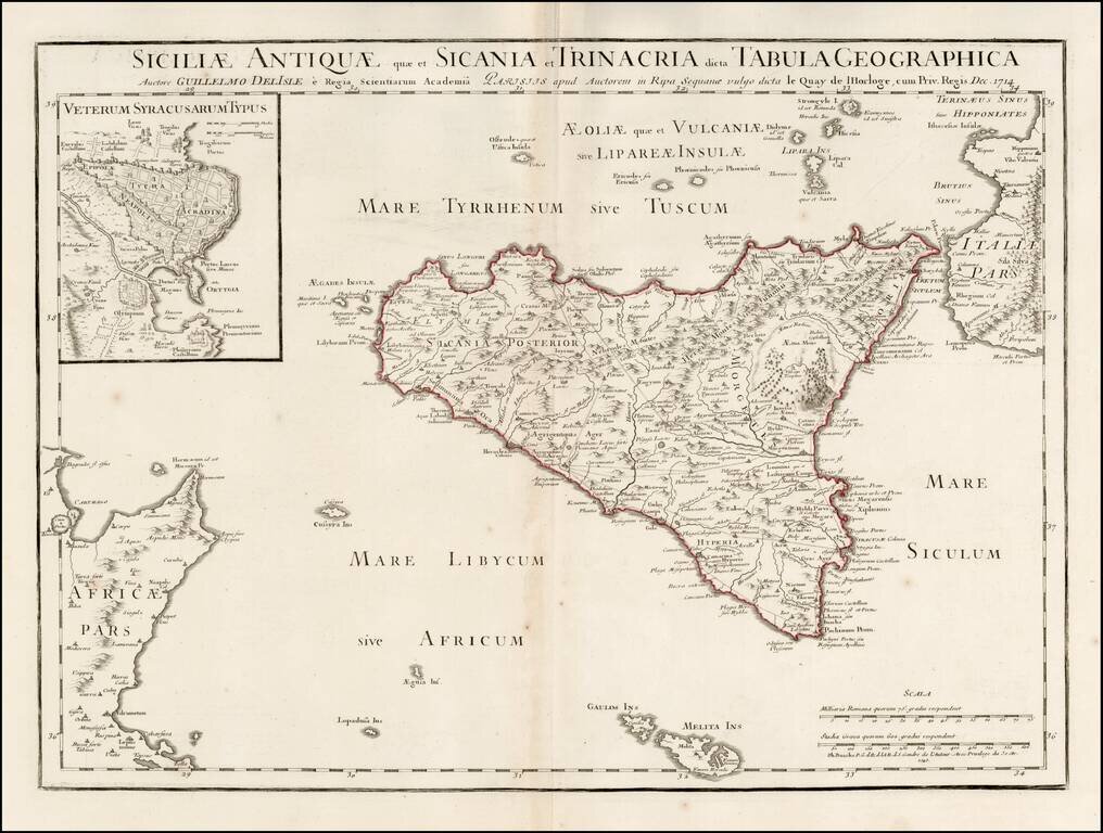
Scarce map of Ancient Sicily, with a large inset of Syracuse, originally published by Guillaume De L'Isle in 1714. Detailed map of ancient Sicily, showing roads, mountains, rivers, towns, harbors, smaller islands, etc. Extends south to Malta. Shows...
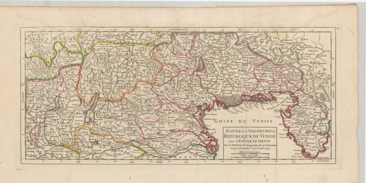
Striking example of De Vaugondy's map of the northeast part of Italy and neighboring Balkan regions, from his Atlas Portatif, Universel et Militaire. . . , first published in Paris in 1748. The map extends from Bergamo and Milan in the west to...
![Plan Des [Ersten?] und Lezten Theil Der Affeire Des Feldmarschal Konigseg in Tyrol](/map/small/51959.jpg)
Attractive 18th-century manuscript map in ink and watercolor. The map proclaims to show the first and last parts of the action of "Fieldmarschal Konigseg" in Tyrol. That being said, the map seems largely imaginary. The Brenta River is certainly real,...
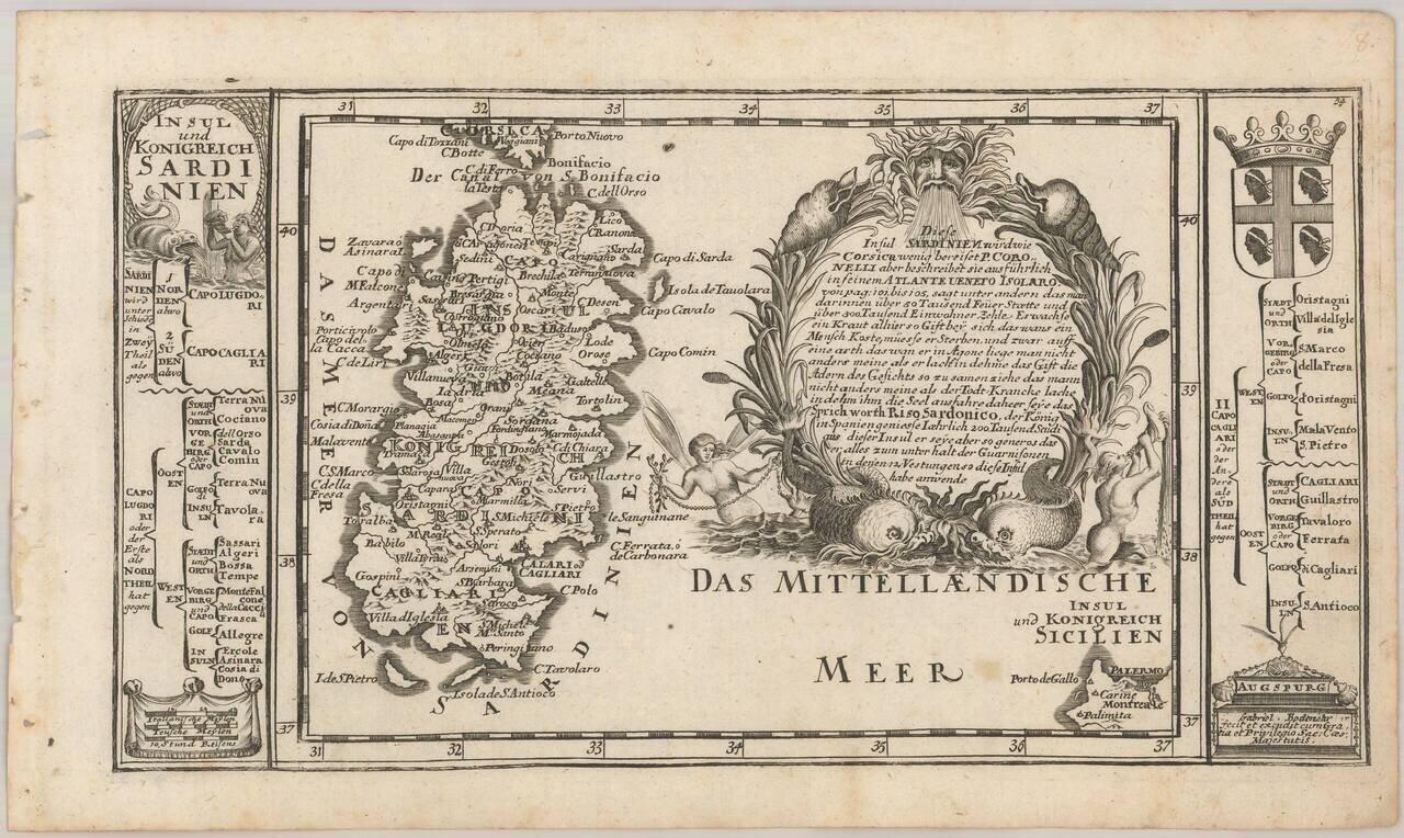
Detailed map of Sardinia, with an elaborate cartouche and coats of arms. The Bodenehr family of engravers and publishers of Augsburg began with Johannes Georg Bodenehr (1631 - 1704), a publisher of atlases and geographical books. His son Gabriel...
![Italia in suos Status divisa et ex prototypo del Isliano desumta . . . [shows Sicily]](/map/small/69246.jpg)
Detailed map of Italy, Sicily, Corsica, Sardinia, etc., extending south to Malta and showing the Gulf of Venice and the contiguous Balkans. Includes a decorative cartouche.
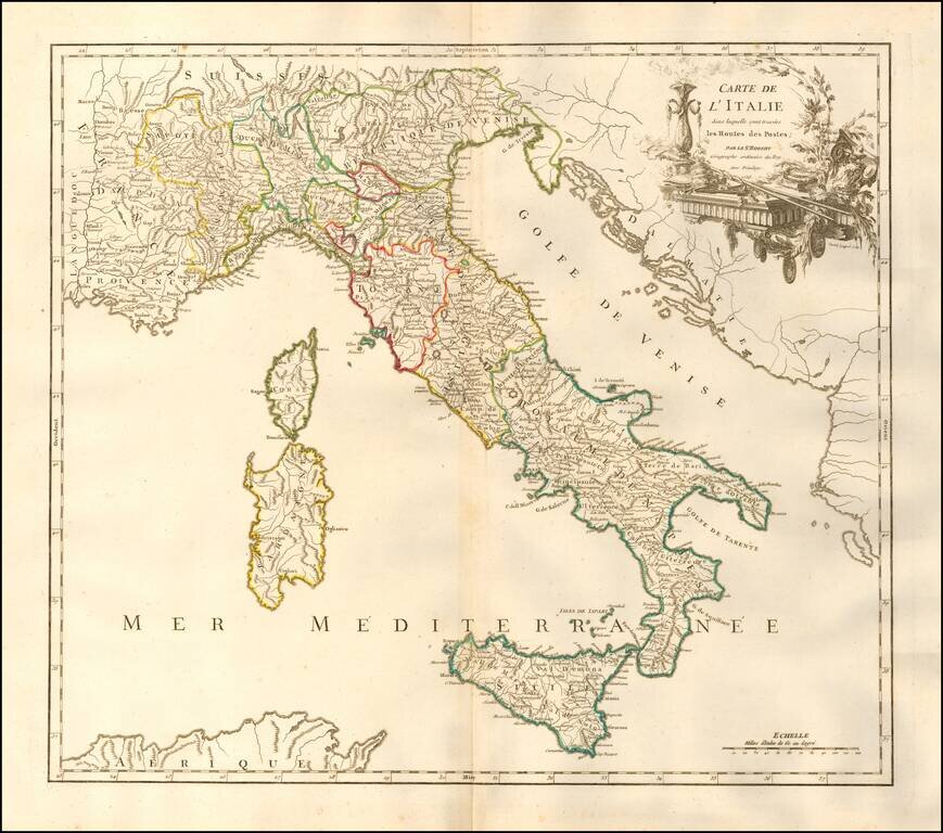
Interesting postal route map of Italy, Sicily, Sardinia & Corsica, from an early edition of DeVaugondy's Atlas Universel. Shows the various postal routes in Italy and Sicily, with the various stops also noted. Includes towns, mountains, rivers,...
Detailed map of Italy, Sicily, Sardinia & Corsica, from an early edition of DeVaugondy's Atlas Universel. Includes a decorative cartouche. De Vaugondy's atlas was one of the most successful and enduring works of the 2nd half of the 19th Century.
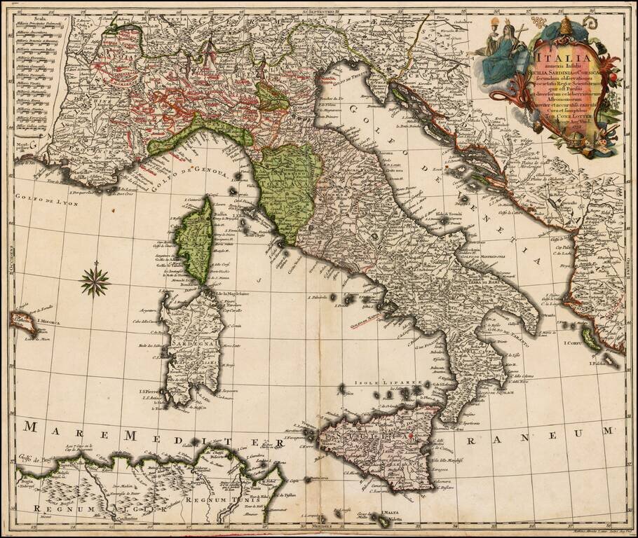
Scarce map of Italy, published by TC Lotter. Includes Sicily (Mt. Aetna erupting), Corsica and Sardinia. Fine dark impression.
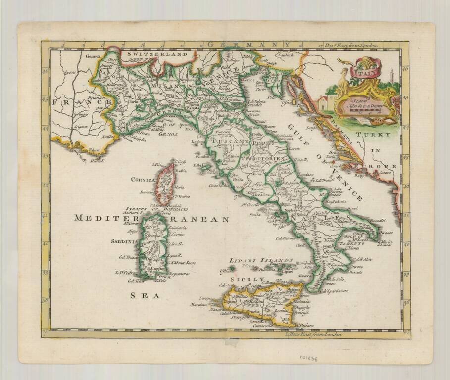
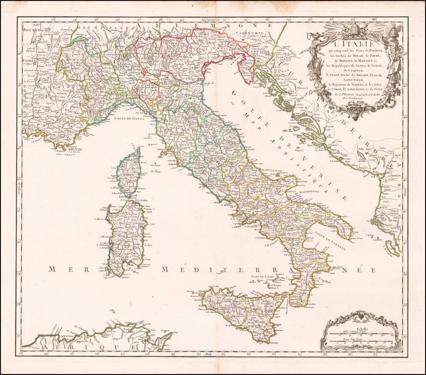
Detailed map of Italy, Sicily, Corsica and Sardinia, and the Gulf of Venice, showing the many kingdoms which then comprised the country. Shows, towns, mountains, rivers, lakes, islands, etc. A charming mid 18th Century English map with decorative...
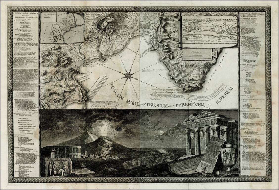
Rare map of the Gulf of Naples, which includes a spectacular view of the eruption of Mt. Vesuvius, but Filippo Morghen, Antonio Cardon & Giuseppe Bracci. Extremely rare and highly detailed map of the Gulf of Naples, by Filippo Morghen. The map...
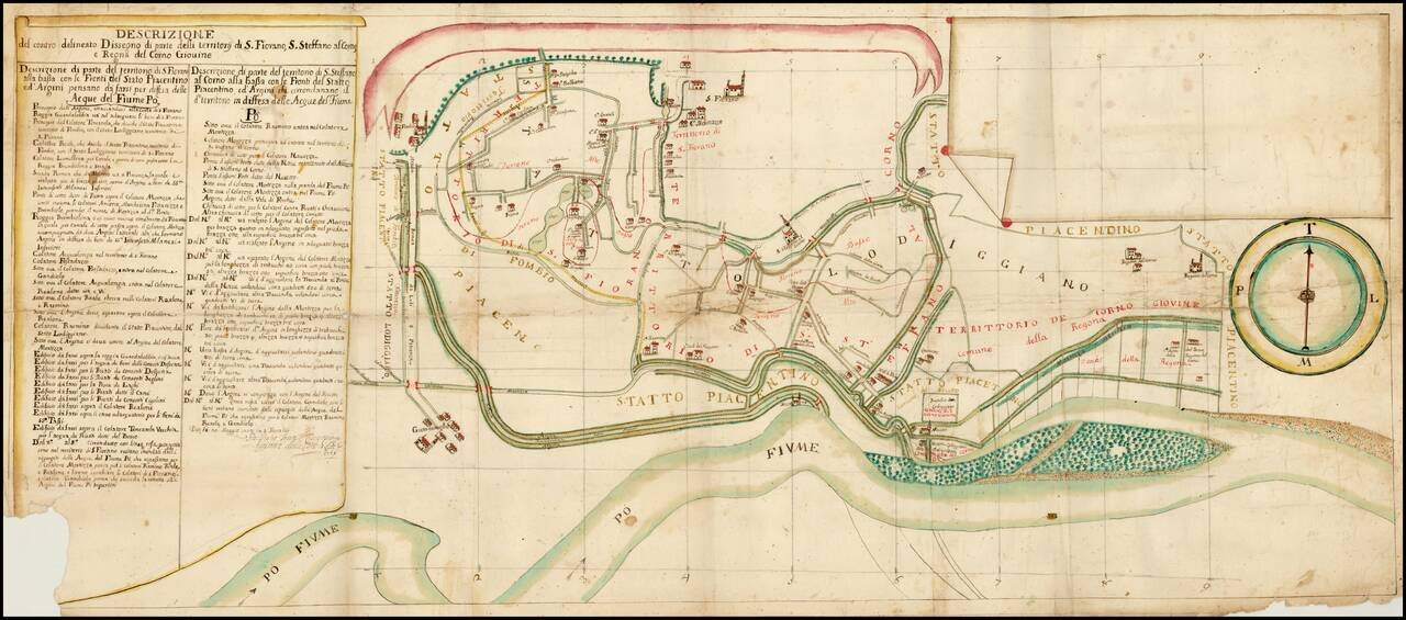
Fascinating map showing Piacenza on the Po River, with a number of canals, roads, public buildings, churches and other places of interest. The map is apparently oriented with south at the top. We have not learned much about the map--it is probably...
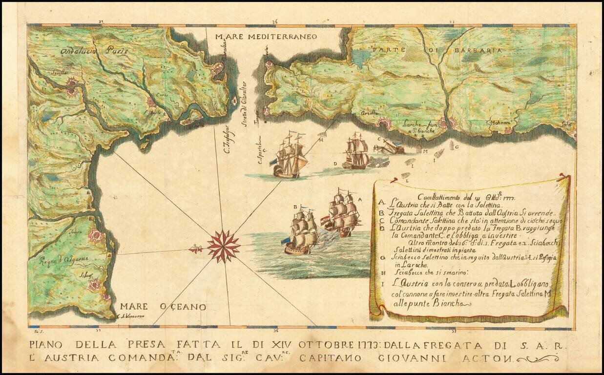
Map illustrating a battle between the Tuscan Navy and the Barbary pirates. The Tuscans, aboard the S.A.R. Austria, were led by Captain Giovanni (John) Acton. The key at the right provides details of the battle. Sir John Francis Edward Acton VI,...
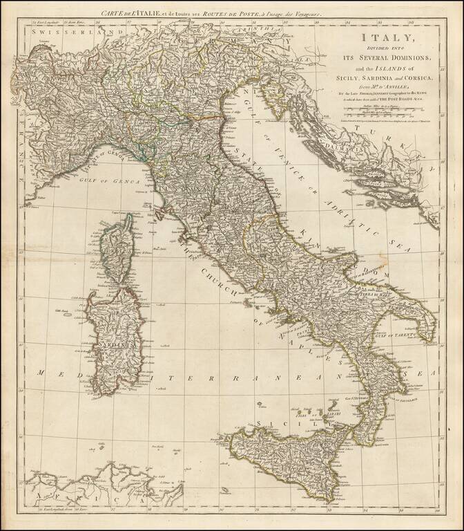
Detailed late 18th Century Postal map of Italy, Sicily, Corsica and Sardinia, with contiguous regions. Title also given in French.
![Partie Meridionale du Royaume De Naples ou se trouvent La Calabre et L'Isle et Royaume de Sicile . . . 1779 [with] Supplement pur L'Isle De Malte](/map/small/35618.jpg)
Striking map of Sicily, Naples and contiguous islands, with a large inset of Malta, published in Venice. Includes towns, mountains, rivers, lakes and a host of other details. Decorative cartouche. Santini's maps are largely based upon De Vaugondy's...