Map size in jpg-format: 62.2449MiB
Click to open in high resolution (open in new tab).
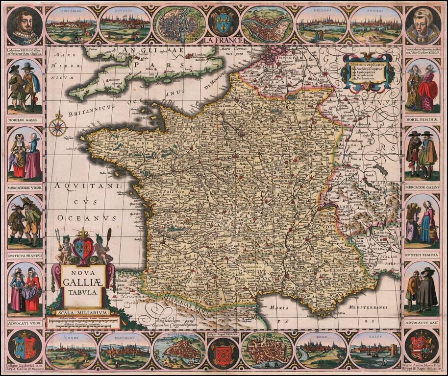
Rare separately published map of France, surrounded by views of French Cities, portraits and local costumes.
Rare carte-à-figures map in its 2nd state (of 4) with Cloppenburgh's imprint;.
This is the second state of the map of France first published "by Jodocus Hondius Jr. (before 1629)" (Sch./St. p. 351).
The geographical content is based mainly on Blaeu 1607.
Includes a fine decorative borders largely based upon on C. J. Visscher: portraits of Louis XIII. (as an adult with moustache; see preceding catalogue entry) and Anne of Austria, 4 armorial shields, 4 pairs of costumed figures at either side, and 12 views along top and bottom: Poitiers, Bourges, Paris, Lyon, Orleans, Angers, Calais, Rouen, Bordeaux, Marseille, Beaumont and Tours.
If you are a student, write to us in telegram: @antiquemaps and indicate what material you need and for what work you need a map in high detail. We are ready to provide material on special terms. For students only!
![Carte d'Etude [Study Map]](/map/small/66795.jpg)
![Orange [Vauban Style Fortress]](/map/small/62043.jpg)
