Map size in jpg-format: 35.1912MiB
Click to open in high resolution (open in new tab).
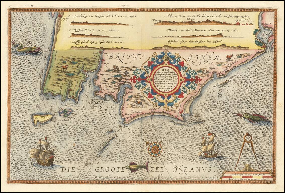
Striking full color example of Wagenhaer's map the French Bretagne Coastline, showing the western most part of Bretagne, centered on the area around Brest and Crozon.
Wagenhaer was a Dutch pilot who produced the first set of effective navigational charts, under the title Spiegel der Zeevaerdt.
These gorgeous charts, engraved by Baptist and Jan van Doetecum, embody the latest contemporary knowledge of navigation and position finding and set the standard which was followed for more than a century. Waghenaer's charts are magnificent works of art, which are highly sought after by collectors.
If you are a student, write to us in telegram: @antiquemaps and indicate what material you need and for what work you need a map in high detail. We are ready to provide material on special terms. For students only!
![Carte d'Etude [Study Map]](/map/small/66795.jpg)
![Orange [Vauban Style Fortress]](/map/small/62043.jpg)
