logo

1581. Burgundiae Comitatus Recentis Descriptio. 1579

  • Burgundiae Comitatus Recentis Descriptio. 1579

Burgundiae Comitatus Recentis Descriptio. 1579 information:

Year of creation: 
Resolution size (pixels): 
 12727x9497 px
Disk Size: 
 38.7245MiB
Number of pages: 
 1
Place: 
 Antwerp
Author: 

Print information. Print size (Width x height in inches):
Printing at 72 dpi 
  176.76 х 131.9
Printing at 150 dpi 
 84.85 х 63.31
Printing at 300 dpi 
 42.42 х 31.66

An example of detailing the file of this map of in a printable high-resolution:

Click to open in high resolution (open in new tab).
Attention! this is just the central piece (central area 960x960 px) of the map file!
This is an example, so that you can see and study the level of detail of a given map. The entire Map will be fully available after payment!

Burgundiae Comitatus Recentis Descriptio. 1579

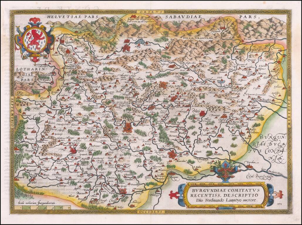
Beautifully hand-colored, decorative regional map of Burgundy in France, centered on Besancon, Poligny, Quingey and St Anne. Includes a number of famous wine regions, from Ortelius's Theatrum Orbis Terrarum, the first modern atlas of the world.

The map is embellished with a number of striking strapwork cartouches.

This is the first of Ortelius's four maps of Burgundy. It was based on Ferdinand de Lannoy's map of Burgundy from 1563.

Van Den Broecke 51

Special conditions for students!

If you are a student, write to us in telegram: @antiquemaps and indicate what material you need and for what work you need a map in high detail. We are ready to provide material on special terms. For students only!

Item information:

Year of creation:
Size:
12727x9497 px
Disk:
38.7245MiB
Number of pages:
1
Place:
Antwerp
Author:
Abraham Ortelius.
$14.99

Related item