logo

1801. Brest Harbour

  • Brest Harbour

Map size in jpg-format: 3.90511MiB

Download "Brest Harbour", in high resolution.

Brest Harbour information:

Year of creation: 
Resolution size (pixels): 
 4527x3926 px
Disk Size: 
 3.90511MiB
Number of pages: 
 1
Place: 
 London
Author: 

Print information. Print size (Width x height in inches):
Printing at 72 dpi 
  62.88 х 54.53
Printing at 150 dpi 
 30.18 х 26.17
Printing at 300 dpi 
 15.09 х 13.09

An example of detailing the file of this map of in a printable high-resolution:

Click to open in high resolution (open in new tab).
Attention! this is just the central piece (central area 960x960 px) of the map file!
This is an example, so that you can see and study the level of detail of a given map. The entire Map will be fully available after payment!

Brest Harbour

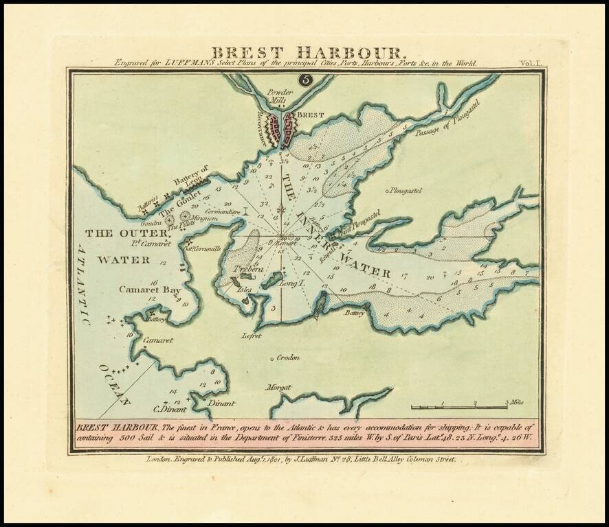
Rare harbor chart of Cadiz, published in London by John Luffman.

The text at the bottom notes:

Brest Harbour, The Finest in France, opens to the Atlantic & has every accommodation for shipping: It is capable of containing 500 Sail & is situated in the Department of Finisterre 325 miles W. by S. of Paris Late 48. 23 No. Longe 4. 26W.


Special conditions for students!

If you are a student, write to us in telegram: @antiquemaps and indicate what material you need and for what work you need a map in high detail. We are ready to provide material on special terms. For students only!

Item information:

Year of creation:
Size:
4527x3926 px
Disk:
3.90511MiB
Number of pages:
1
Place:
London
Author:
John Luffman.
$14.99

Related item