logo

1759. A Plan of Havre de Grace, and the Face of the adjacent Country

  • A Plan of Havre de Grace, and the Face of the adjacent Country

A Plan of Havre de Grace, and the Face of the adjacent Country information:

Year of creation: 
Resolution size (pixels): 
 7188x4454 px
Disk Size: 
 11.1198MiB
Number of pages: 
 1
Place: 
 London
Author: 

Print information. Print size (Width x height in inches):
Printing at 72 dpi 
  99.83 х 61.86
Printing at 150 dpi 
 47.92 х 29.69
Printing at 300 dpi 
 23.96 х 14.85

An example of detailing the file of this map of in a printable high-resolution:

Click to open in high resolution (open in new tab).
Attention! this is just the central piece (central area 960x960 px) of the map file!
This is an example, so that you can see and study the level of detail of a given map. The entire Map will be fully available after payment!

A Plan of Havre de Grace, and the Face of the adjacent Country

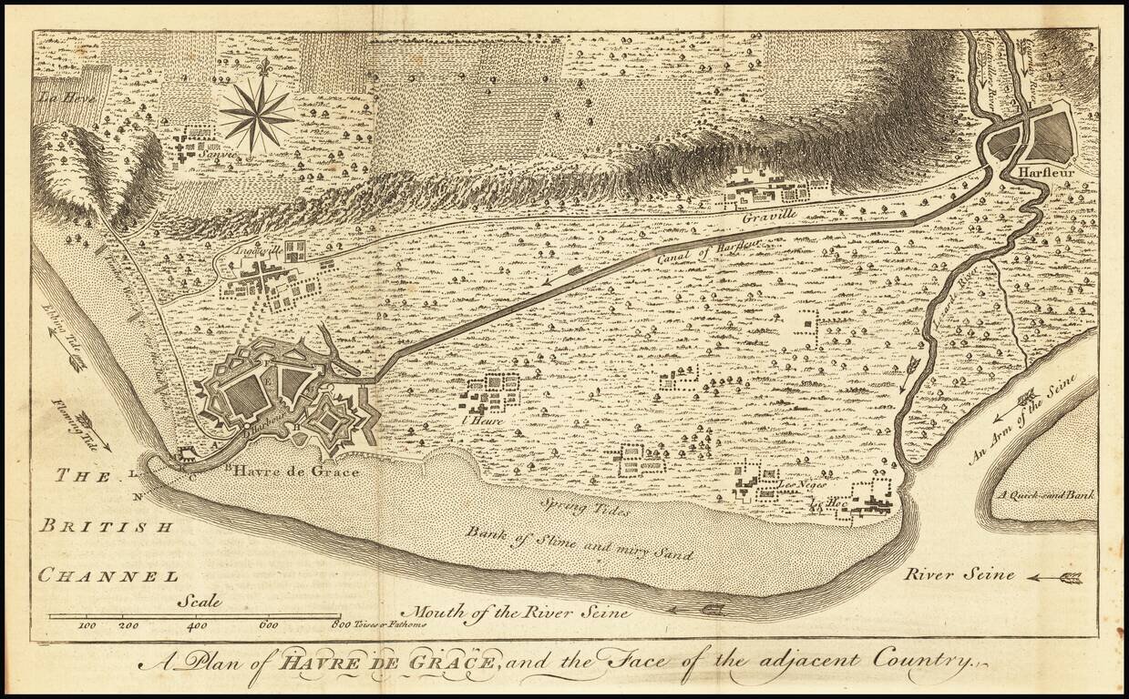
Detailed map of the area around Havre de Grace on the Seine River, along with the Canal of Harfleur and surrounding roads, rivers and town.


Special conditions for students!

If you are a student, write to us in telegram: @antiquemaps and indicate what material you need and for what work you need a map in high detail. We are ready to provide material on special terms. For students only!

Item information:

Year of creation:
Size:
7188x4454 px
Disk:
11.1198MiB
Number of pages:
1
Place:
London
Author:
Universal Magazine.
$14.99

Related item