logo

1759. Plan of Dunkirk, with the Canal of Mardick, as they were in 1757

  • Plan of Dunkirk, with the Canal of Mardick, as they were in 1757

Plan of Dunkirk, with the Canal of Mardick, as they were in 1757 information:

Year of creation: 
Resolution size (pixels): 
 6081x4539 px
Disk Size: 
 8.82566MiB
Number of pages: 
 1
Place: 
 London
Author: 

Print information. Print size (Width x height in inches):
Printing at 72 dpi 
  84.46 х 63.04
Printing at 150 dpi 
 40.54 х 30.26
Printing at 300 dpi 
 20.27 х 15.13

An example of detailing the file of this map of in a printable high-resolution:

Click to open in high resolution (open in new tab).
Attention! this is just the central piece (central area 960x960 px) of the map file!
This is an example, so that you can see and study the level of detail of a given map. The entire Map will be fully available after payment!

Plan of Dunkirk, with the Canal of Mardick, as they were in 1757

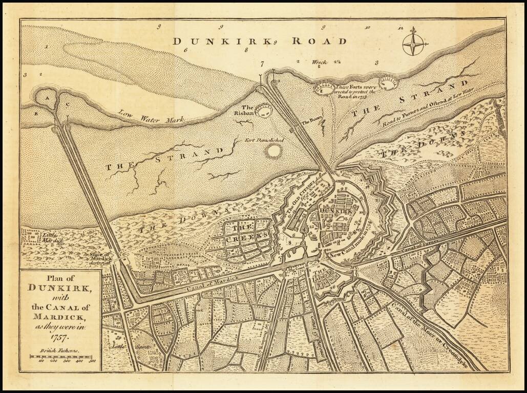
Detailed plan of the city of Dunkirk, including fortifications, town plan, roads, farms, rivers and canals.

The map appeared in the Universal Magazine.


Special conditions for students!

If you are a student, write to us in telegram: @antiquemaps and indicate what material you need and for what work you need a map in high detail. We are ready to provide material on special terms. For students only!

Item information:

Year of creation:
Size:
6081x4539 px
Disk:
8.82566MiB
Number of pages:
1
Place:
London
Author:
Universal Magazine.
$14.99

Related item