Map size in jpg-format: 27.1392MiB
Click to open in high resolution (open in new tab).
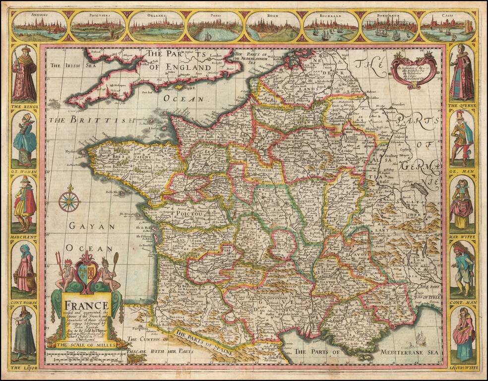
Decorative map of France, published in London by John Speed.
Side panels depict costumed figures, while above are vignettes of notable places including Orleans, Paris, Calais, Bordeaux, and Poitiers. The map was engraved by Dirck Gryp in 1626, but this later example shows evidence of retouching of the plate which was almost certainly done much later.
Includes four town view vignettes across the top and 4 sets of costumes. The text on the verso provides a colorful Anglo-centric view of life in France at the beginning of the 17th Century.
John Speed (1551 or '52 - 28 July 1629) was the best known English mapmaker of the Stuart period. Speed came to mapmaking late in life, producing his first maps in the 1590s and entering the trade in earnest when he was almost 60 years old.
John Speed's fame, which continues to this day, lies with two atlases, The Theatre of the Empire of Great Britaine (first published 1612), and the Prospect of the Most Famous Parts of the World (1627). While The Theatre ... started as solely a county atlas, it grew into an impressive world atlas with the inclusion of the Prospect in 1627. The plates for the atlas passed through many hands in the 17th century, and the book finally reached its apotheosis in 1676 when it was published by Thomas Bassett and Richard Chiswell, with a number of important maps added for the first time.
If you are a student, write to us in telegram: @antiquemaps and indicate what material you need and for what work you need a map in high detail. We are ready to provide material on special terms. For students only!
![Carte d'Etude [Study Map]](/map/small/66795.jpg)
![Orange [Vauban Style Fortress]](/map/small/62043.jpg)
