logo

1669. Nouvelle Generale et tres-Exacte Descriptio du Duche D'Aniou 1669

  • Nouvelle Generale et tres-Exacte Descriptio du Duche D'Aniou 1669

Nouvelle Generale et tres-Exacte Descriptio du Duche D'Aniou 1669 information:

Year of creation: 
Resolution size (pixels): 
 2072x1562 px
Disk Size: 
 1.18581MiB
Number of pages: 
 1
Place: 
 Paris
Author: 

Print information. Print size (Width x height in inches):
Printing at 72 dpi 
  28.78 х 21.69
Printing at 150 dpi 
 13.81 х 10.41
Printing at 300 dpi 
 6.91 х 5.21

An example of detailing the file of this map of in a printable high-resolution:

Click to open in high resolution (open in new tab).
Attention! this is just the central piece (central area 960x960 px) of the map file!
This is an example, so that you can see and study the level of detail of a given map. The entire Map will be fully available after payment!

Nouvelle Generale et tres-Exacte Descriptio du Duche D'Aniou 1669

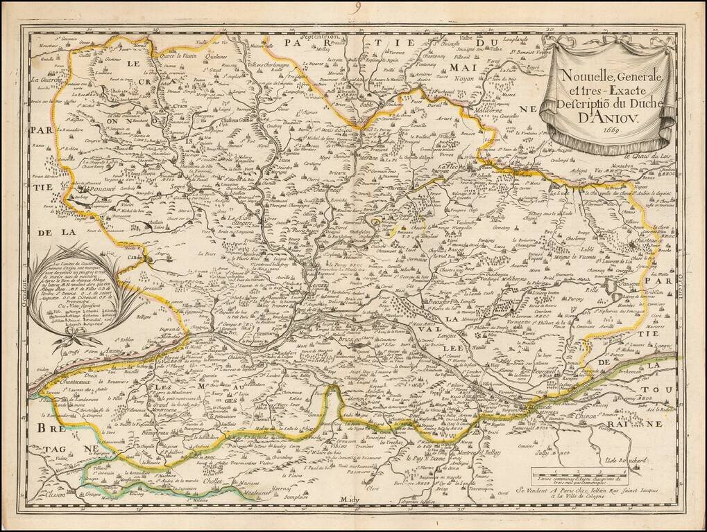
Scarce early map of the Anjou region of France, published by Gerard Jollain.

The map is centered on the Loire River, extending from Champtoceaux in the west to Langeais in the east, and from Sablé-sur-Sarthe in the north to Cholet and Clisson in the South.


Special conditions for students!

If you are a student, write to us in telegram: @antiquemaps and indicate what material you need and for what work you need a map in high detail. We are ready to provide material on special terms. For students only!

Item information:

Year of creation:
Size:
2072x1562 px
Disk:
1.18581MiB
Number of pages:
1
Place:
Paris
Author:
Gerard Jollain.
$9.99

Related item