Map size in jpg-format: 127.21MiB
Click to open in high resolution (open in new tab).
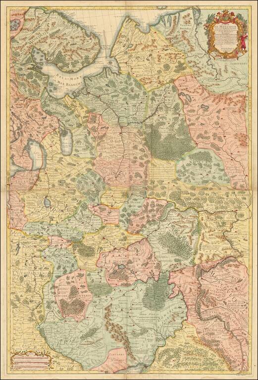
Important early map of Russia and the Ukraine, drawn by Guillaume De L'Isle, the leading French mapmaker at the beginning of the 18th Century.
If you are a student, write to us in telegram: @antiquemaps and indicate what material you need and for what work you need a map in high detail. We are ready to provide material on special terms. For students only!
![[Signed Political Satire Artwork] Vietnam ... Vietnam ... Vietnam ...](/map/small/68726.jpg)

