

Original artwork for political cartoon drawn by Dorman H. Smith, a political cartoonist who worked in Cleveland and Chicago for over 30 years. Among Smith's more noteworthy milestones, in 1924 he accompanied Ernest Hemingway to Pamplona, Spain. For a...

Flying visit of Truth to Berlin Rare satirical cartoon map of illustrating the British Royal Air Force propaganda raid on Berlin in September 1939, published by Rex Whistler. The image shows a winged goddess Britannia, with a trident and shield,...

World War II Civilian War Services Organizational Chart Unusual organizational chart showing the means for organizing civilians during World War II. As the chart notes, this is the Civilian War Services chart, NOT the chart for Civilian Protection....
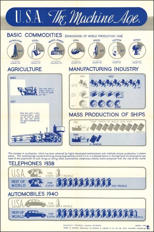
An interesting info-graphic, illustrating America's move toward industrialization in the 20th Century. The top line focuses in on the United States's increasing share of the productoin of Petroleum, Steel and Agricultural products. The next graphic...
![[Northwest Airlines -- Original Advertising Artwork] Transportation Down The Years Northwest Airlines](/map/small/70081.jpg)
Original Northwest Airlines advertising artwork, featuring a Boeing 377 Stratocruiser, which launched service in 1949. Striking image of a Boeing 377 Stratocruiser, introduced by Northwest Airlines on June 22, 1949. Beginning in the 1950s, the...
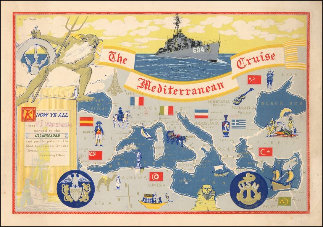
Decorative placemat map, given away aboard the USS Ingraham.
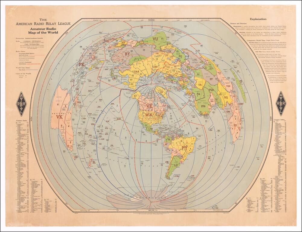
Finely executed map of the world, centered on the polar areas on a modified equidistant Azimuthal projection. Shows capital cities and major cities of the world, government radio districts and prefix areas, I.A.R.U. continental sub-divisions, I.T.U....
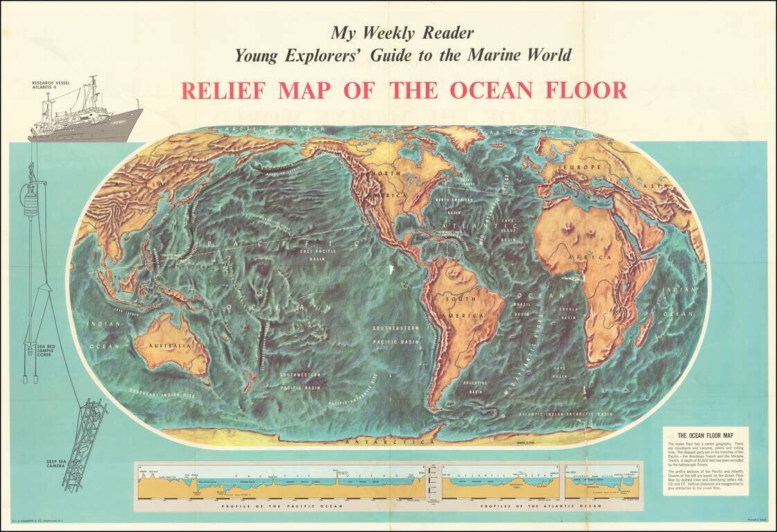
Fascinating map of the ocean floor, illustrating the topography of the seabeds for "Young Explorers". The map was issued as a supplement to My Weekly Reader, issued shortly after the expedition of the Bathyscaph Trieste to survey to survey the ocean...
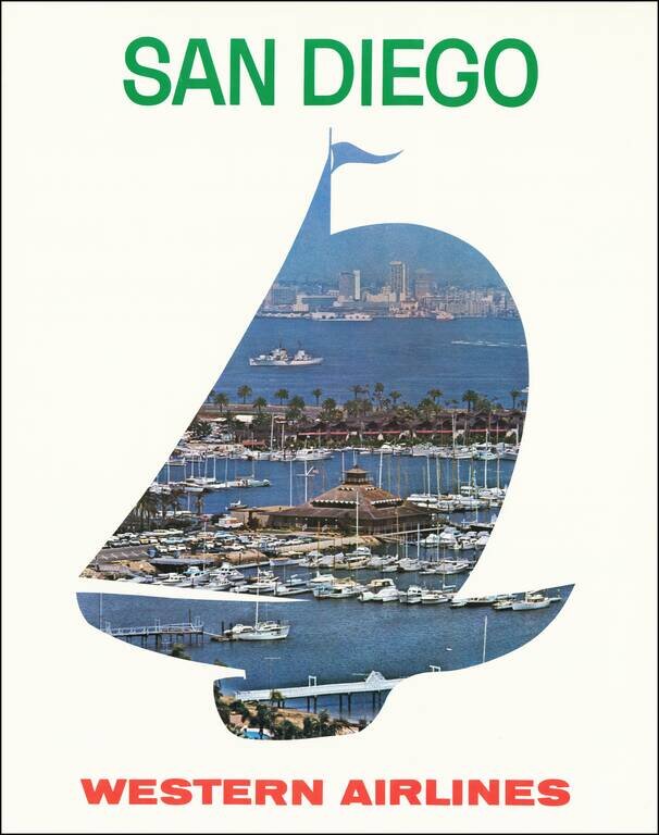
Scarce Western Airlines travel poster for San Diego. We estimated the date based upon the San Diego skyline and the cars in the parking lot of the marina.
![[Soviet Russian Ecology Propaganda Poster] Основы Водного Законодательства Союза ССР](/map/small/68343.jpg)
Original vintage Soviet Russian propaganda poster. The title translates as follows: The blue expanse is dear to us everywhere and it is not without reason that we are talking about it. - It's time to protect the wealth of our rivers and lakes in...
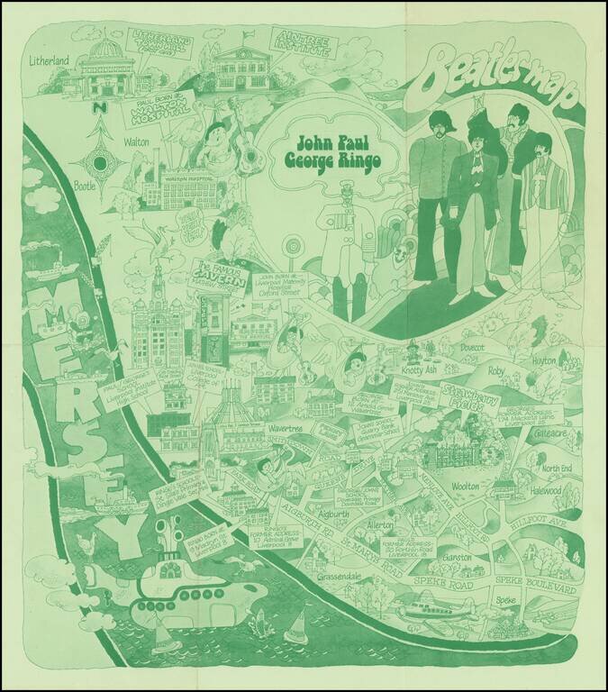
The Beatles Map of Liverpool was published in 1974 to commemorate the buildings and places where the Beatles started their career. As noted on the Liverpool Museums website: Featured here is one of the first Beatles maps of Liverpool that was ever...
![[Counterculture - Drug Culture] A Field Guide to American Wild Highs](/map/small/59955.jpg)
Map of the United States, surrounded by illustrations of mushrooms with psychotropic compounds, along with illustrations of Cannabis sativa (marijuana) and Lophophora williamsii (Peyote). The map includes numbers scattered around the US identifying...
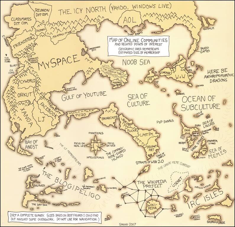
First Edition of Randall Munroe's Online Communities Map Fine example of Randall's first map of Online Communities, issued the year after Facebook became open to all users on September 26, 2006. As noted below the title "Geographic Area Represents...
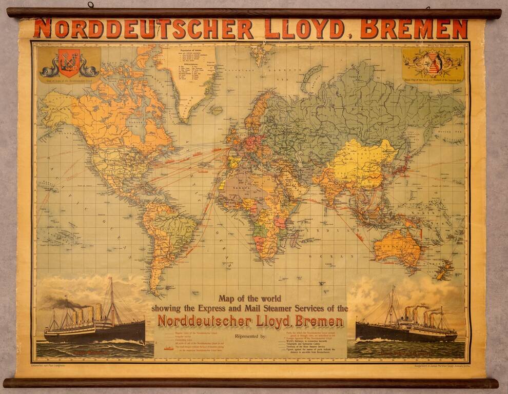
Fine promotional wall map of the world, promoting the Norddeutscher Lloyd line of Bremen. The map focuses on the routes of the Norddeutchser Lloyd Line, an important global steamship line in the 19th and 20th centuries. The routes of the line are...
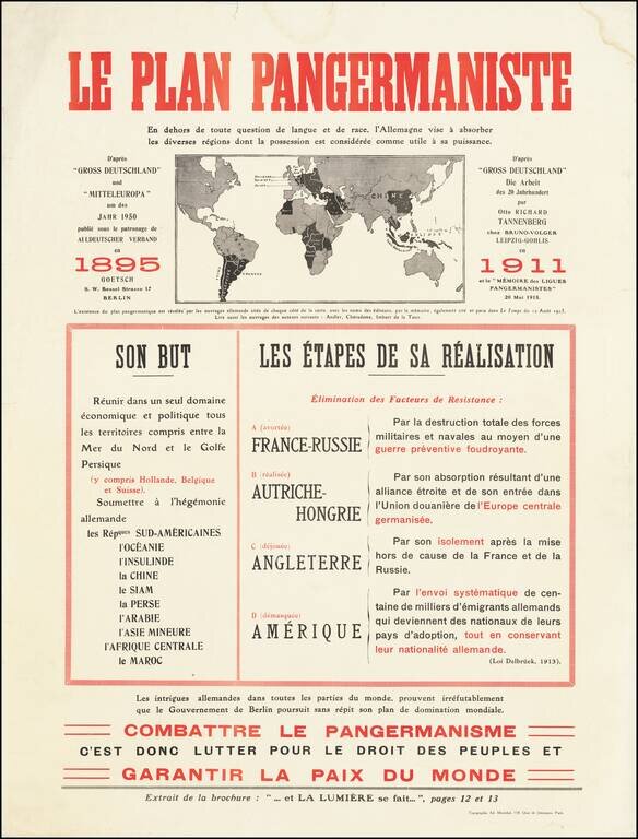
Fantastic anti-German polemic broadside map, issued in France during World War I, published by Adrien Maréchal. The map focuses on the so-called "Pan-Germanic Plan" of world domination. It rallies the French against the ever-expanding influence of...
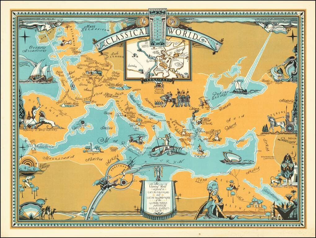
Rare pictorial map centered on the Mediterranean Sea, showing the world at the time of the Roman Empire, with place names in Latin. The map was produced for educational purposes to accompany a series of Latin textbooks published by Silver Burdett...