Map size in jpg-format: 74.2025MiB
Click to open in high resolution (open in new tab).

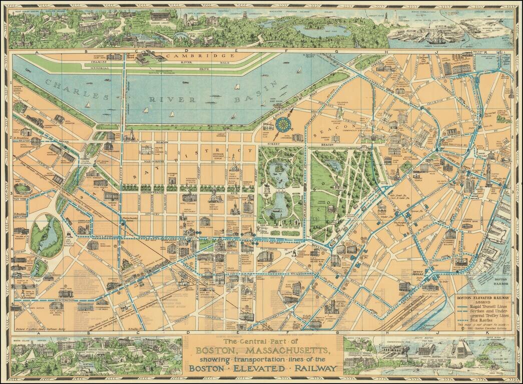
Decorative pictorial map of Boston, with 3 large inset views of various parts of the City.
The map shows streets, parks, city blocks, Rapid Transit Lines, surface and underground trolley lines and bus routes, city landmarks, including hotels, Fenway Park, Tufts Medical and Dental School, government buildings, etc.
Colorful border at upper and lower edge is a series of vignette bird's eye view of Boston: top left features several of the buildings of the Harvard campus, at lower right is Pleasure Bay, Commonwealth and Fish Pier.
Extensive index on verso, including listing some 38 theaters (which are numbered on the map).
If you are a student, write to us in telegram: @antiquemaps and indicate what material you need and for what work you need a map in high detail. We are ready to provide material on special terms. For students only!
![[Signed Political Satire Artwork] Vietnam ... Vietnam ... Vietnam ...](/map/small/68726.jpg)

