Map size in jpg-format: 49.5089MiB
Click to open in high resolution (open in new tab).

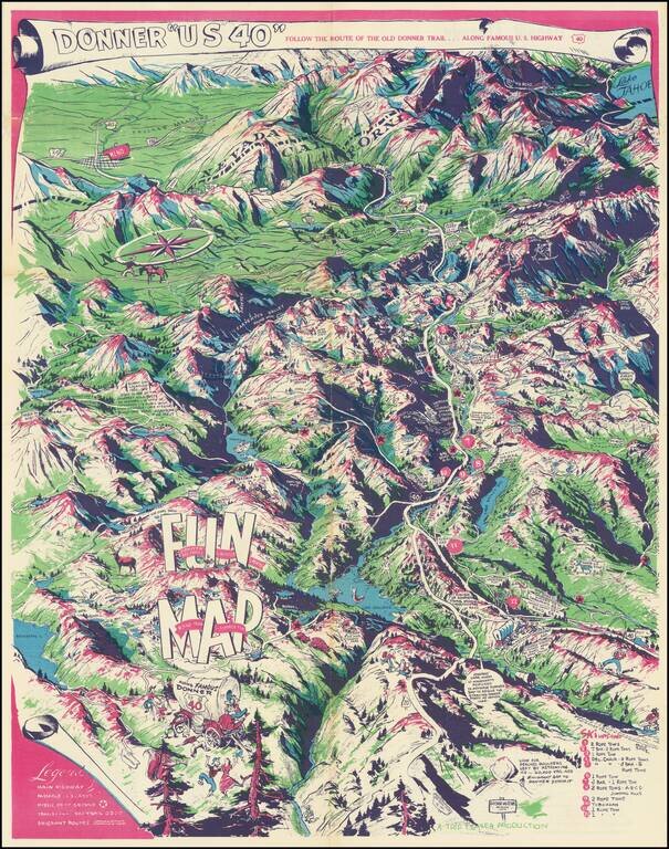
Humorous vintage pictorial map of U.S. Highway 40, the so-called Donner Trail Highway, through the Sierras near the California-Nevada border.
The map is mostly focused on the Sierras west of the Nevada border, with Reno in the upper-left corner and Lake Tahoe in the upper-right. Lakes Bowman, Spaulding, Fordyce, and others are illustrated. Ski lifts are noted in the lower-right corner.
The map features happy and carefree settlers in a covered wagon kissing, dancing, and enjoying themselves. One of the settlers is cooking what appears to be a... pig over a campfire.
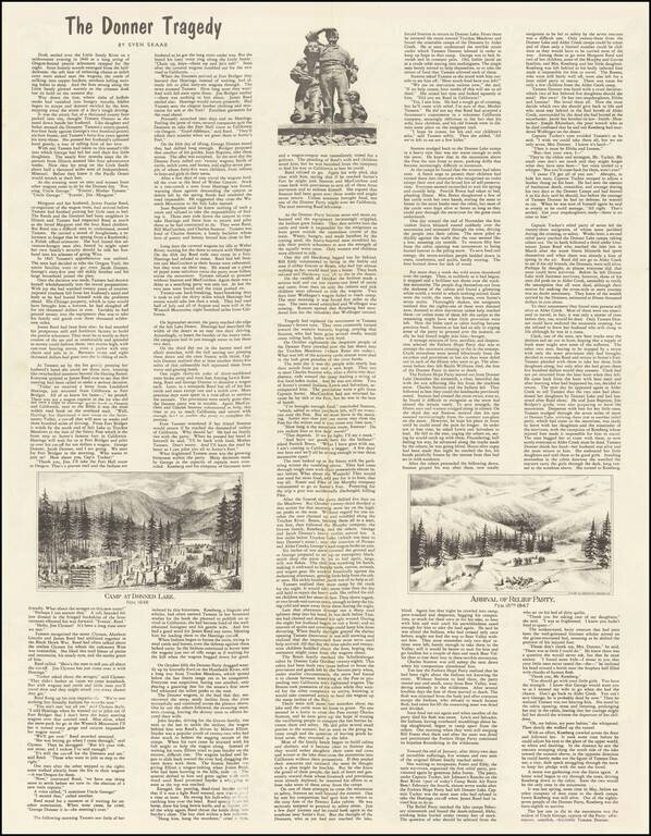
The back of the map is less lighthearted, with an extensive essay on "The Donner Tragedy" by Sven Skaar.
Mathis also made a map of Siskiyou County in the same style.
Estimated date comes from Rumsey (8579).
Rumsey notes:
Date estimated. Birdseye view looking east showing topography, sights, lakes, emigrant routes, roads, etc. with accompanying vignettes. Illustrator George Mathis (1909-1977) was a west coast artist who was nationally renown for his work on the Old West and Space. After living in the Bay Area from 1931-1948 he and his family moved to Nevada City, California, where he made this map. They moved on to Coloma, also in the Mother Lode, in 1960. Between 1960 and 1970 George Mathis' artistic vision took on a new dimension. During this time he worked in Sacramento for Aerojet Corporation, America's largest producer of rocket engines. Here his versatility, imagination, and eye for detail were once again challenged, and he became one of the better known space artists of the time. His illustrations include Gemini and Apollo space missions. His work is housed at Washington State University Library.
If you are a student, write to us in telegram: @antiquemaps and indicate what material you need and for what work you need a map in high detail. We are ready to provide material on special terms. For students only!

![Mexique par Th. Duvotenay…1843 [Republic of Texas]](/map/small/67925.jpg)
