

Extremely rare separately published pictorial map published by the British Israel World Federation (BIWF) on the 30th anniversary of its founding. The BIWF espouses the following tenants: that the descendants of the Lost Ten Tribes of Israel migrated...
![[World]](/map/small/47309.jpg)
Decorative map of world, published by Jacques Lizou. Lizou published a number of maps in this style in 1951, including maps of the French provinces, etc.
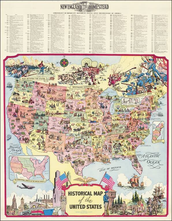
Fine pictorial map of the United States, drawn by R.L. McCollister and published for the New England Homestead Journal. The map presents and exceptionally dense historical montage of events and vignettes illustrating the history of the United States,...
![[Rare Complete Example with Game Pieces] Grand Circuit Des Capitales. Collection Concours Du Chocolat Menier](/map/small/70922rd.jpg)
Fine promotional map for Menier Chocolat. This example is quite unusual, in that it includes the 120 game pieces at the bottom of the map, still attached. Most examples come w/o the game pieces. The Menier Chocolate company was a chocolate...
![[Coffee, Tea, Vanilla & Spices / Pictorial Map of the World -- McCormick & Company]](/map/small/63197.jpg)
Decorative advertising and promotional map for McCormick & Company, promoting its world wide trade in coffee, tea, spices and flavorings. The map is a fascinating blend of pictorial map, historical map (showing the routes of many early explorers),...
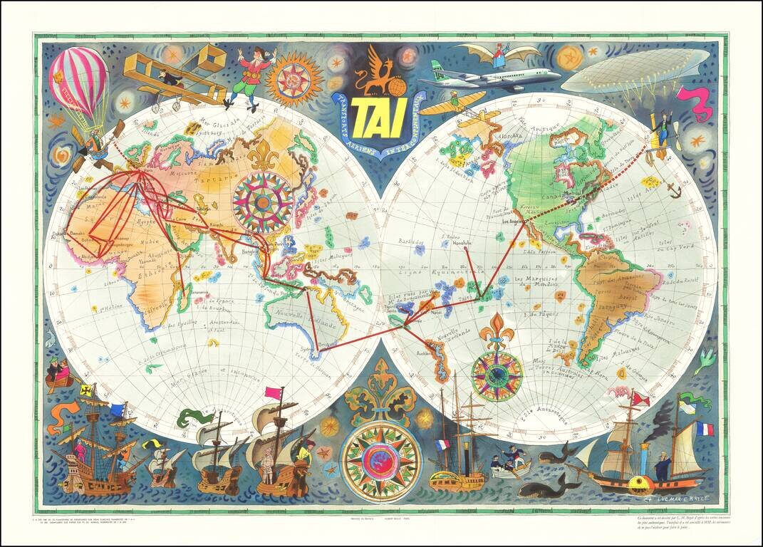
TAI Advertising Map of the World By Noted French Artist Luc-Marie Bayle Rare decorative world map, promoting the French Airline Transports Aeriens Intercontinentaux (TAI). Designed by Luc-Marie Bayle and printed in a limited print run of 500, this...
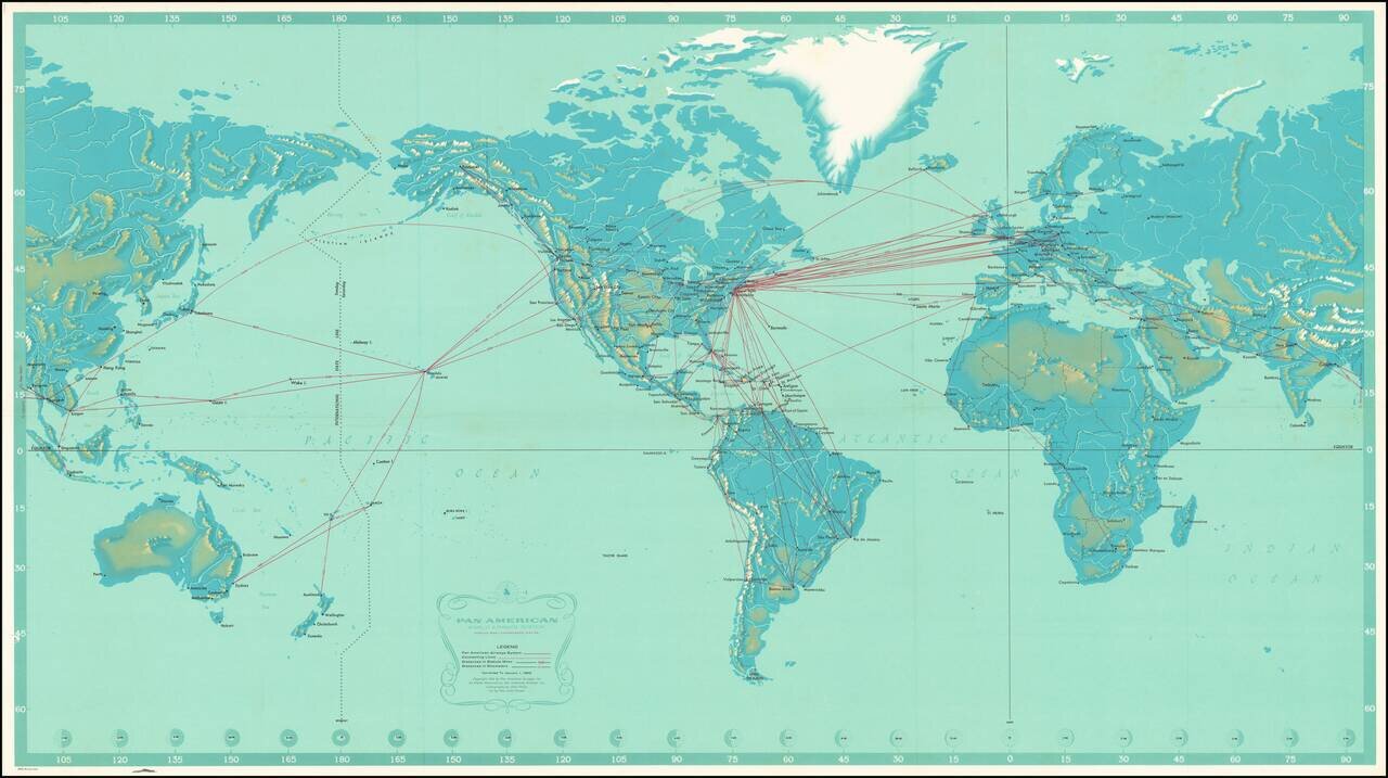
Striking large map of the World, published by Pan American Airlines, as a promotional item. Shows all the routes around the world to which Pan Am flew in 1963, including connecting lines and Pan Am's own lines. Cartography by John Philip. Art by Paul...
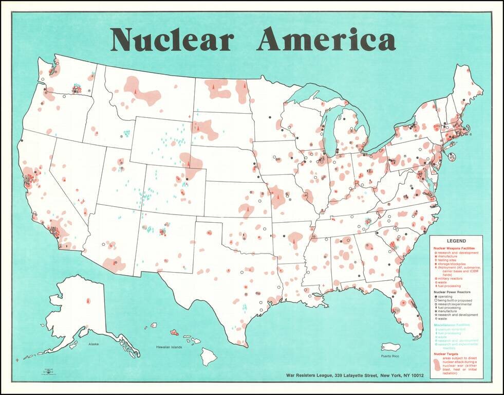
Anti-Nuclear Poster Published Two Months After the Three Mile Island Accident This map details the locations of areas of the United States which contribute to, and which are at risk from nuclear technologies. Nuclear weapon facilities, nuclear power...
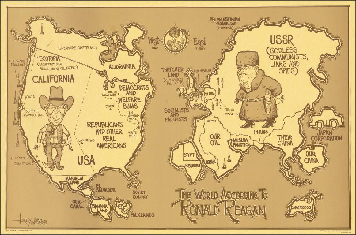
Lively political satire map, depicting the World According to Ronald Reagan. This is the first of two Reagan's World maps, the second published in 1987, showing different political humor. A classic look at satirical political humor from the 1980s....
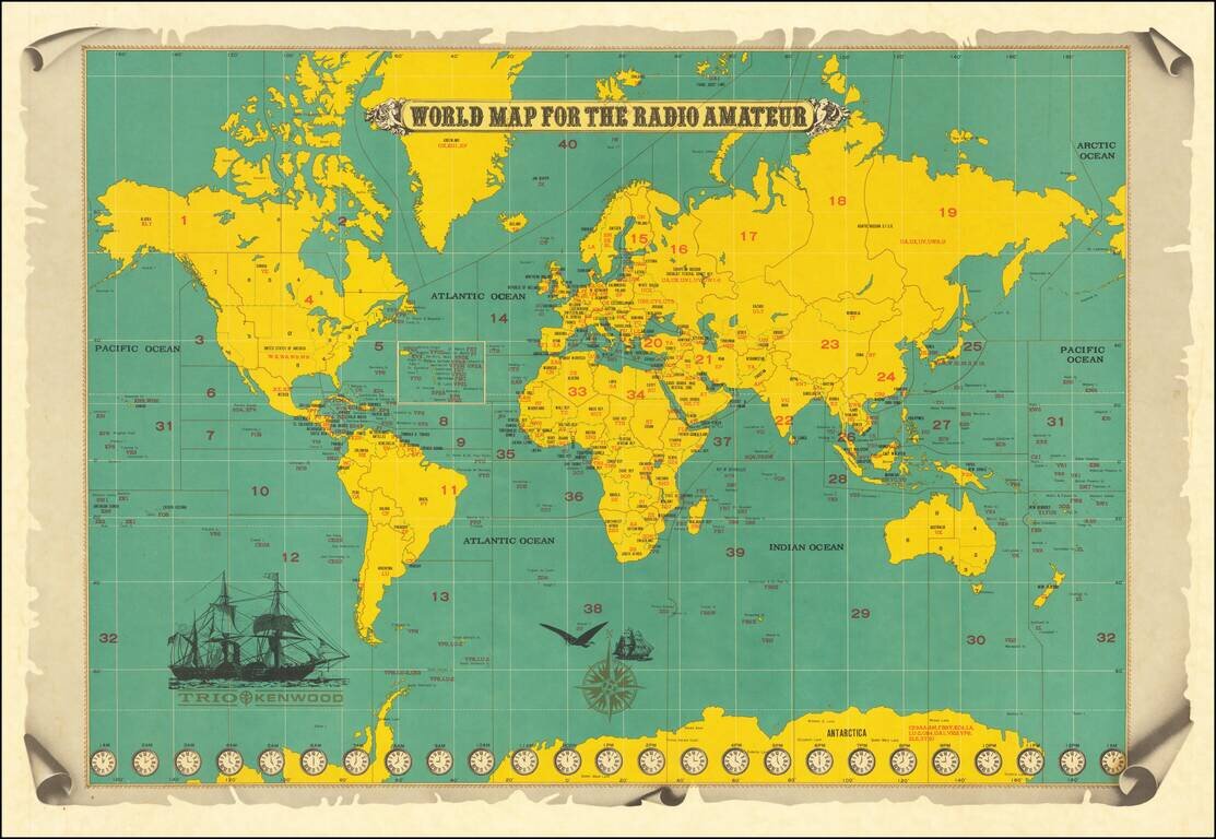
This is a map of the world produced for amateur radio operators, made by the Japanese Trio Kenwood (now Kenwood) Corporation. The map shows political boundaries, time zones, intriguing transportation devices, and, of course, useful information for...
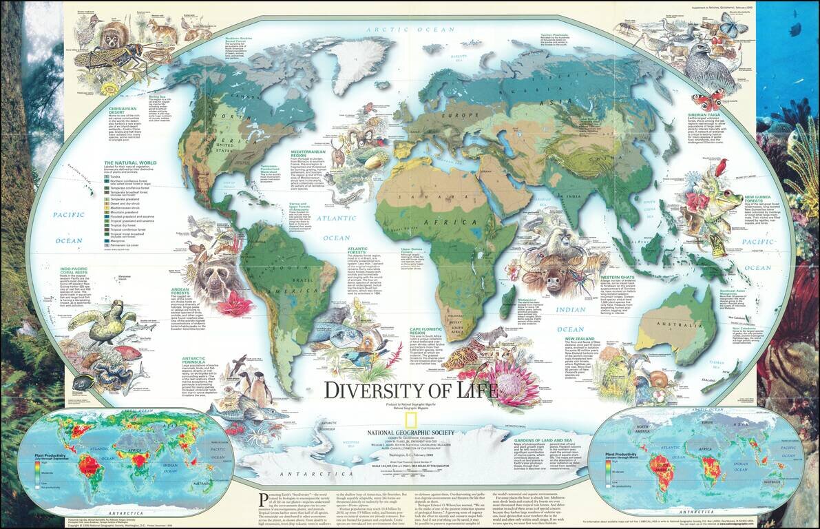
Fascinating pictorial map that portrays the many unique aspects of life on earth. Map itself portrays the world divided into biomes. Insets detail the differences in summer and winter primary productivity between the hemispheres. Includes drawings of...

Excellent "NavWar" pictorial map of the North Atlantic and Western European Theaters during World War II. The map is a very effective persuasive piece, which sweeping arcs depicting Allied naval power in the Atlantic combined with its air power over...
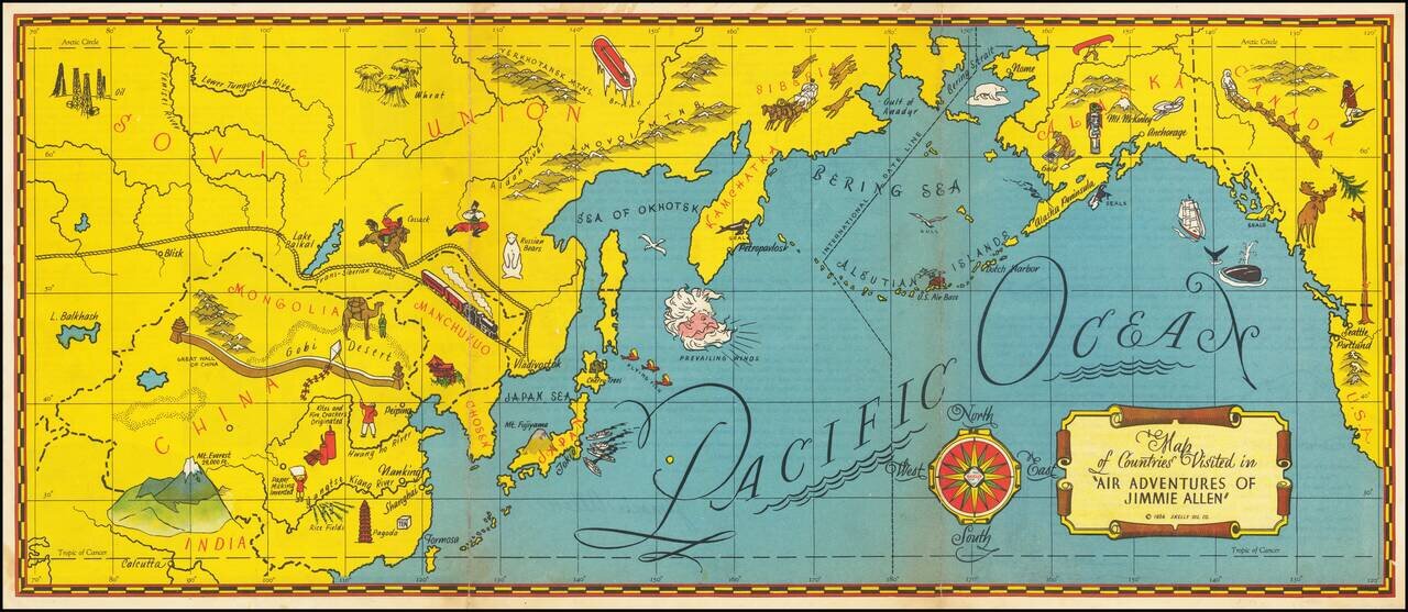
The Gold Age of Radio Theater -- The Air Adventures of 16 Year Old Crime Solving Pilot Jimmie Allen Rare pictorial map of the Pacific printed as a promotional premium for the Air Adventures of Jimmie Allen, theatrical radio production that aired from...
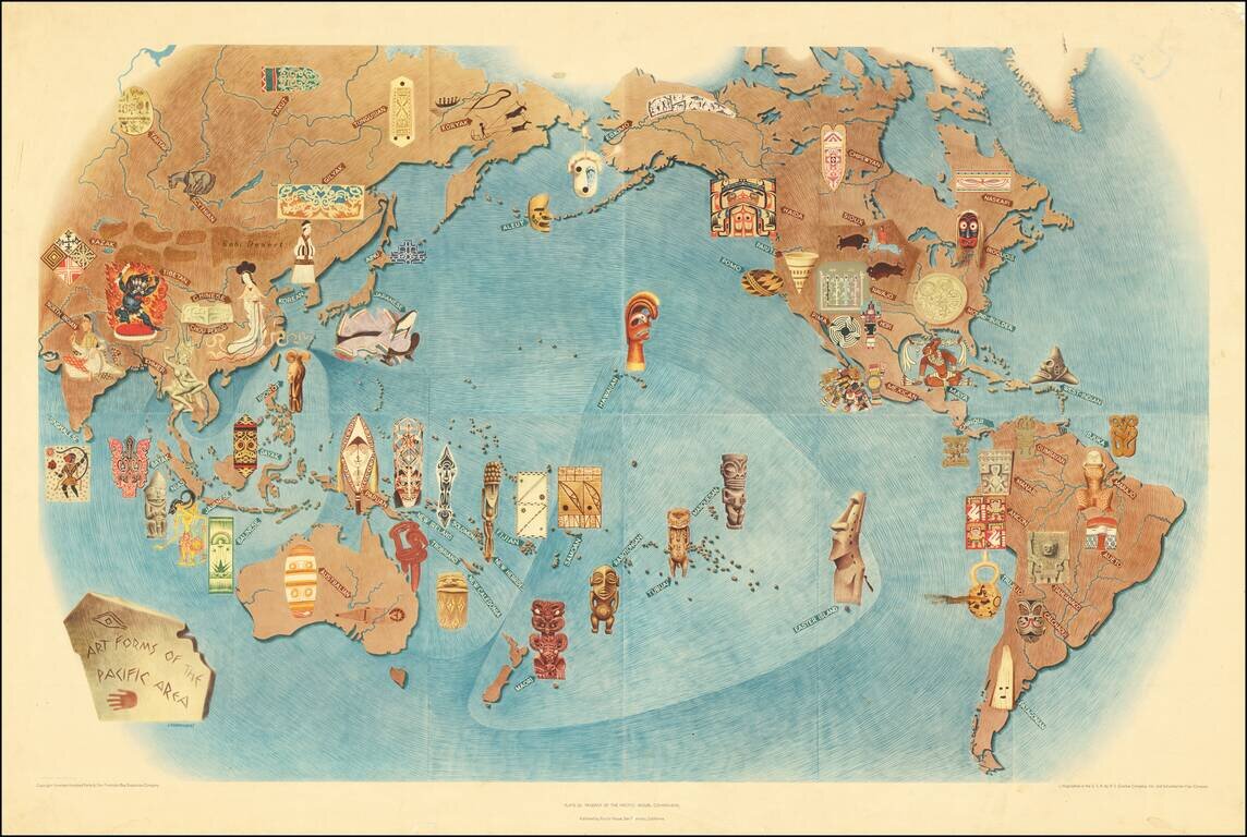
An attractive lithograph showing the art forms of the Pacific, after the eponymous mural by the talented Mexican intellectual Miguel Covarrubias. Many examples of traditional art forms are shown overlaid on a map that includes all of the Americas,...
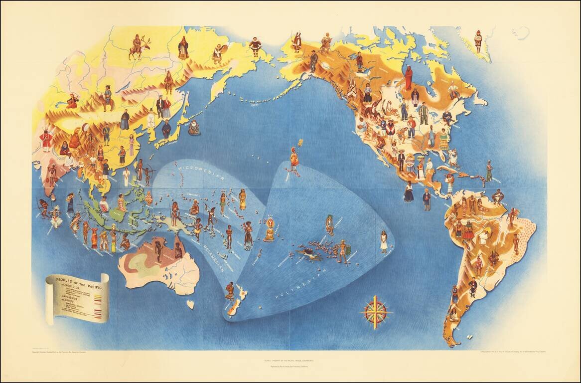
An attractive lithograph from 1940 showing the peoples of the Pacific, after the eponymous mural by the talented Mexican intellectual Miguel Covarrubias. The map shows the Pacific in its entirety and extends to all of the Americas, Oceania, and most of...
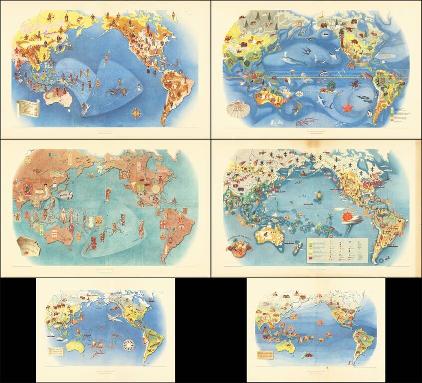
This is a series of six works, lithographed after Covarrubias's mural the Pageant of the Pacific, which was first displayed at the 1939 San Francisco Golden Gate International Exposition. Covarrubias was commissioned to create this mural that would be...