Map size in jpg-format: 32.7096MiB
Click to open in high resolution (open in new tab).
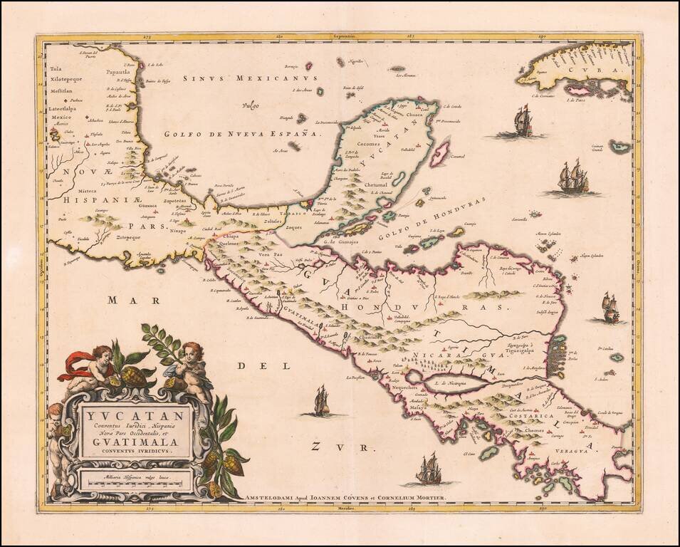
Rare example of Covens & Mortier's map of the Yucatan Peninsula.
First issued by Joannes Blaeu, this edition is very rare on the market.
This is one of the earliest Dutch maps to focus on the region centered on the Yucatan Peninsula.
Includes decorative cartouche and compass rose.
Rarity
This is the first example of the map we have offered in more than 20 years.
Pierre, or Pieter, Mortier (1661-1711) was a Dutch engraver, son of a French refugee. He was born in Leiden. In 1690 he was granted a privilege to publish French maps in Dutch lands. In 1693 he released the first and accompanying volume of the Neptune Francois. The third followed in 1700. His son, Cornelis (1699-1783), would partner with Johannes Covens I, creating one of the most important map publishing companies of the eighteenth century.
If you are a student, write to us in telegram: @antiquemaps and indicate what material you need and for what work you need a map in high detail. We are ready to provide material on special terms. For students only!


![Map of Mexico, Central America, and the West Indies [Insets of Bermuda, Sandwich Islands, Jamaica and Panama Railroad]](/map/small/69133.jpg)