Map size in jpg-format: 3.89526MiB
Click to open in high resolution (open in new tab).

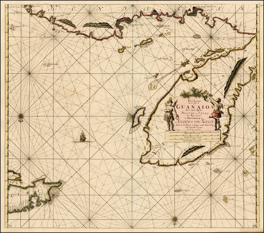
Fine old color example of Van Keulen's sea chart of the Yucatan and Vicinity, including Cozumel, and parts of the Coast of Belize, Nicaragua, Honduras and the western part of Cuba, from De Nieuwe Groote Lichtende Zee-Fakkel . . . .
A very attractive Dutch sea chart, which focuses on Coastal details and of shore hazards. The vast majority of the place names shown are of Spanish and Portuguese origin. This sea chart was used as evidence in the boundary dispute between Honduras and Guatemala in 1918-1919, with the text of the report of the mediation referencing the fact that this sea chart showed the name Honduras extending across the full expanse of the relevant coastline, noting:
The word " Honduras" is printed across the entire coast in such a manner as to include within the Province of Honduras all of the territory to the south of the Gulf of Honduras and to the east of Yucatan. Supports extreme claim of Honduras.The Van Keulen family dominated the chart making business in Holland from the 1680s until the middle of the 19th Century.
If you are a student, write to us in telegram: @antiquemaps and indicate what material you need and for what work you need a map in high detail. We are ready to provide material on special terms. For students only!


![Map of Mexico, Central America, and the West Indies [Insets of Bermuda, Sandwich Islands, Jamaica and Panama Railroad]](/map/small/69133.jpg)