
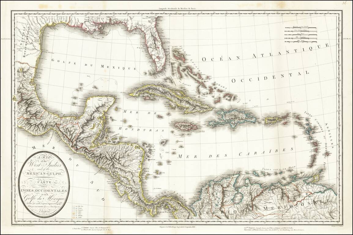
This is a rare separately issued map of the Gulf Coast and the Caribbean by Tardieu. The map was issued shortly after the Louisiana Purchase (1803) and the creation of the Mississippi Territory (1804). The map demonstrates the remarkably fine engraving...
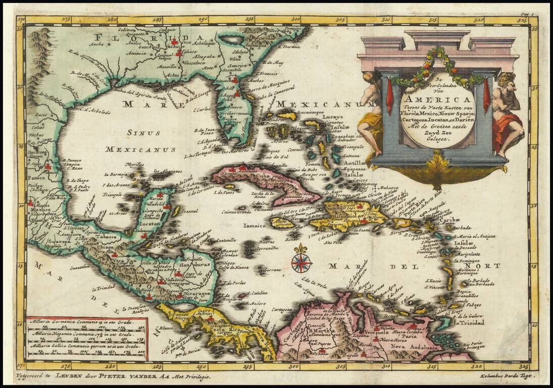
Detailed regional map of Florida and the Caribbean, used by Vander Aa to illustrate a Dutch translation of the narrative of one of Columbus' Voyages to the New World. Shows Central America and the Caribbean in full, with small parts of South America...
Interesting and detailed map of Florida, the Gulf Coast, Central America, and the Caribbean. The map shows the route of Ponce de Leon when he discovered Florida, Cortez's route in 1519, and that of De Cordova in 1517. The map features a decorative...
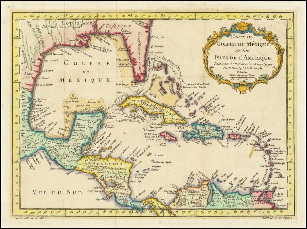
Antique Map of Texas, Mexico and the American Southwest, Florida and the Caribbean Scarce map of the Southwest, Caribbean and Gulf Coast, from De Vaugondy's Nouvel Atlas Portatif. Includes a marvelous contemporary cartographic representation of the...
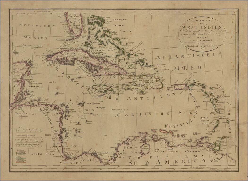
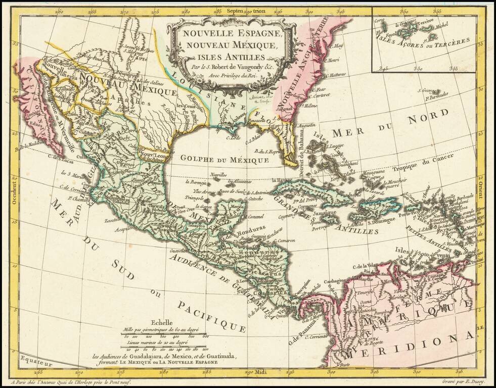
Rare edition of Gussefeld's map of South Florida, the Caribbean and coastlines of Central America. The map would be updated and re-issued for at least the next 20 years, with corrections. A comparison of this edition to the 1816 edition which we...
![Map of Mexico, Central America, and the West Indies [Insets of Bermuda, Cuba, Jamaica and Panama Railroad]](/map/small/51948.jpg)
Attractive map of Mexico, the Caribbean and the Gulf Coast, published by SA Mitchell Jr. Includes large insets of Cuba, Bermuda, Jamaica, and the Isthmus of Panama and a small inset of Jamaica. Shows shipping routes from New Orleans to points...
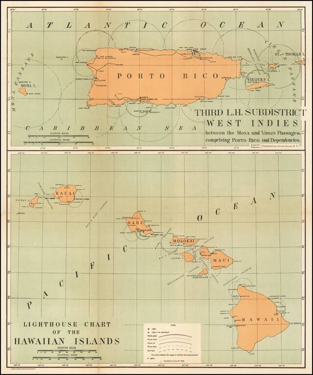
Rare pair of maps showing the lighthouses in Hawaii and the Puerto Rico areas, including proposed light houses, fog lights, light vessels, lighted buoys and a host of other navigational details within the state. This is the first time we have ever...
![The Coast of Newfoundland From Plancentia to Cape Bonavista [and] A Draught of the River Plata in South America [and] Havana, Harbour [and] the Bay of Honda](/map/small/38599.jpg)
Rare Sea Charts of North and South American Ports from an Influential Atlas This composite sea chart shows Newfoundland, Havana Harbor and the Bay of Honda, both in Cuba, and the River Plata in South America. The chart shows the coastlines and...
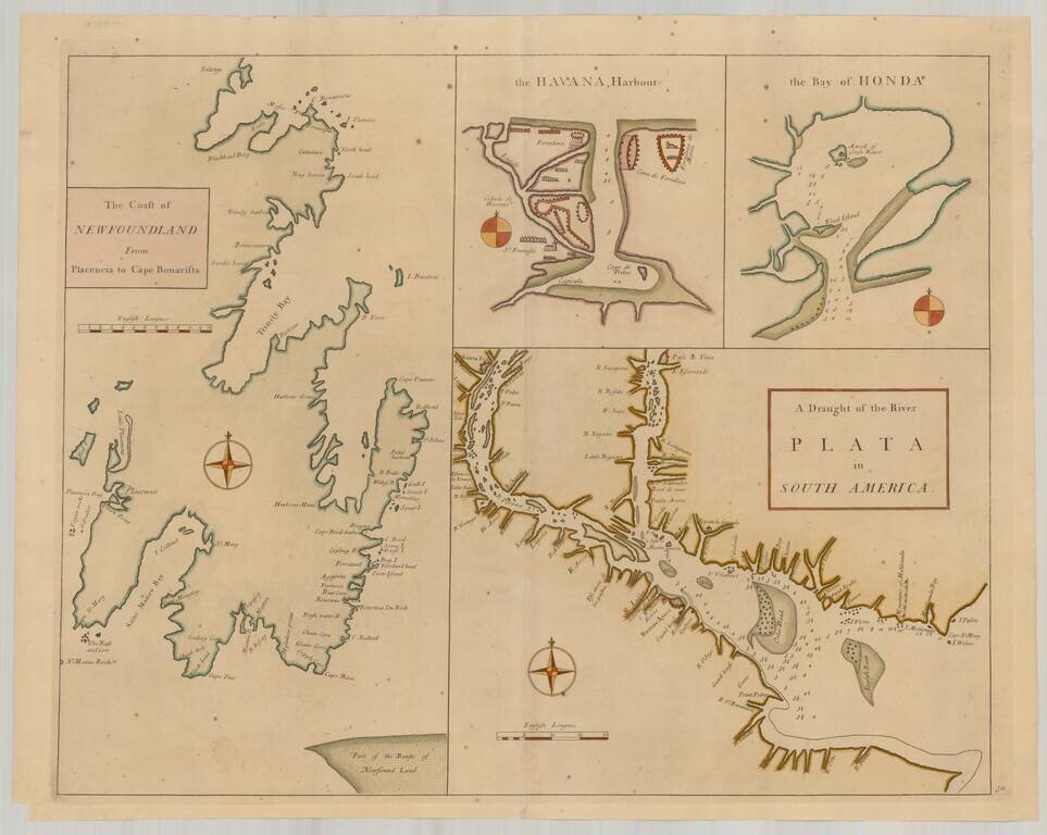
Rare Sea Charts of North and South American Ports from an Influential Atlas This composite sea chart shows Newfoundland, Havana Harbor and the Bay of Honda, both in Cuba, and the River Plata in South America. The chart shows the coastlines and...
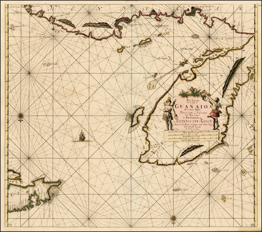
Fine old color example of Van Keulen's sea chart of the Yucatan and Vicinity, including Cozumel, and parts of the Coast of Belize, Nicaragua, Honduras and the western part of Cuba, from De Nieuwe Groote Lichtende Zee-Fakkel . . . . A very attractive...
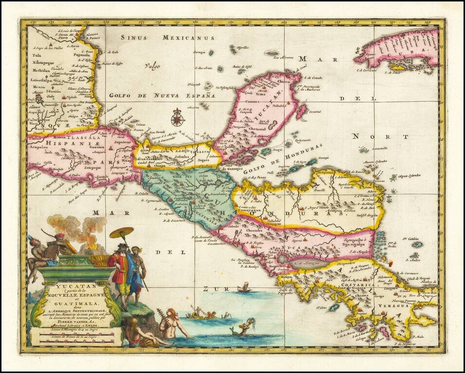
Rare early map of Central America and the Caribbean, published by Vander Aa in Amsterdam. Decorative map of the region from Mexico City to Panama City, extending to include part of Cuba, and is based on Blaeu's map of the Yucatan peninsula. Cozumel...
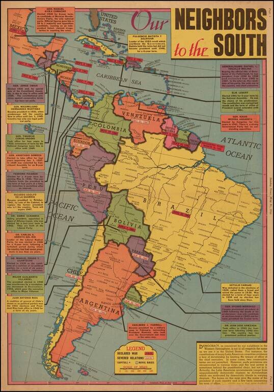
Latin American Democracy --"The Real Power Is Sometimes Behind The Presidential Chair, But Not In it." Scarce New York Sunday News map of the Pacific Theater, drawn by Edwin L. Sundberg. A graphic look at the various presidents and other leaders of...
![Cuba Insula [with] Hispaniola Insula [with] Insula Jamaica [with] Ins. S. Ioannis [with] I.S. Margareta Cum Confiniis](/map/small/70194.jpg)
Nice old color example of the Mercator-Hondius maps of Cuba, Puerto Rico, Hispaniola and Jamaica, with inset of Havana. A highly decorative map of the islands, embellished with sea monsters and sailing ships.
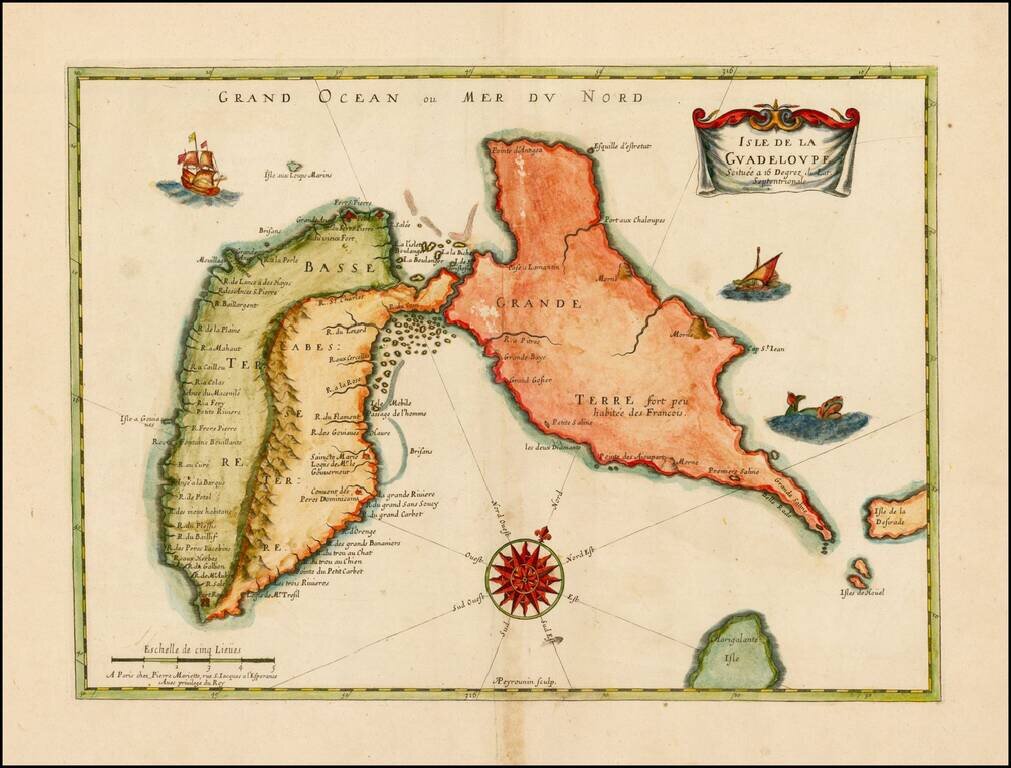
Nice full color example of the first printed map of the Island of Guadaloupe, shortly after its earliest settlement in 1635. Guadalupe was first visited by Columbus on his second journey to the Americas. He named it for an image in a Spanish monastery...
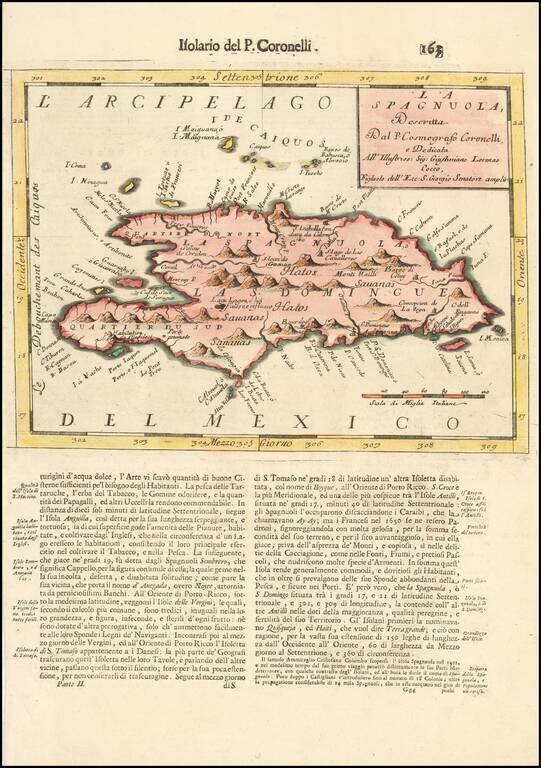
Detailed map of Hispaniola and neighboring Islands, from Coronelli's Isolario. Includes fine topographical details. The Turks and Caicos Islands are also shown, among others.
![Pas kaart Vande Zuyd kust van Cuba en Van Geheel Yamaica en andre bygeleegen plaatsen Door Vooght Geometra . . . [includes Cayman Islands]](/map/small/52393.jpg)
Decorative full color example of Van Keulen's map centered on Jamaica and the Cayman Islands and showing most of Cuba, along with parts of Hispaniola and Honduras. One of the most detailed treatments of the Cayman Islands to appear on a 17th Century...