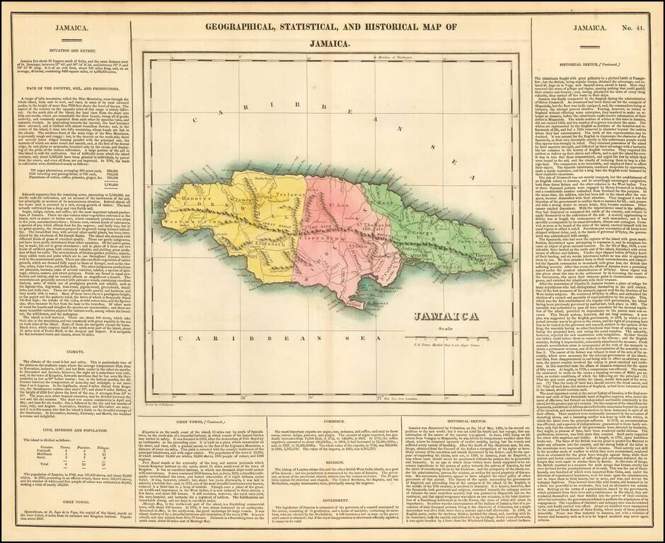
Nice detailed map of Jamaica from the second edition of Carey & Lea's Atlas. One of the most detailed maps of the Bahama Islands to appear in a commercial atlas. Lengthy narrative text below includes details about the islands, climates, towns,...
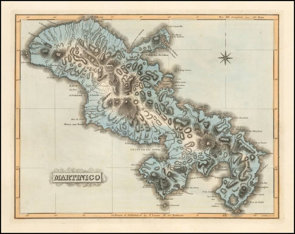
Scarce map of Martinico by Fielding Lucas Jr., which appeared in his General Atlas, as well as his A New General Atlas of the West India Islands. Lucas's map is the first detailed commercial map of Martinico published in America. The map depicts the...
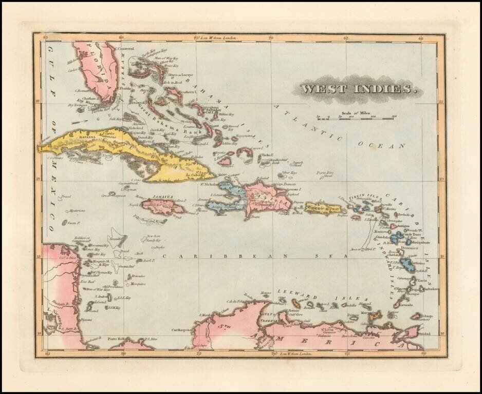
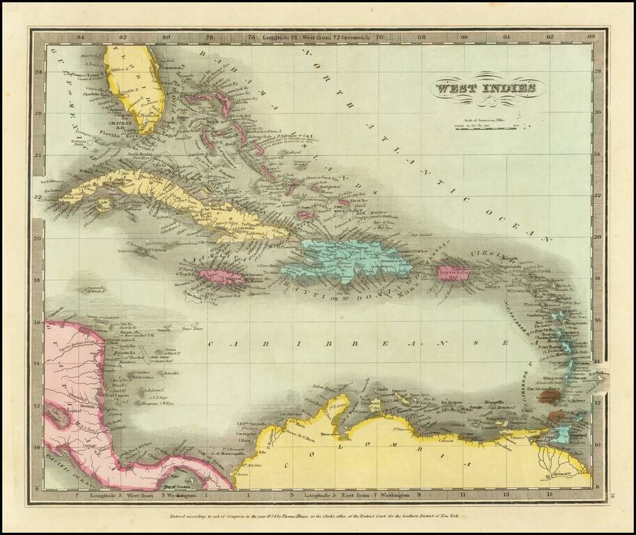
Fielding Lucas Jr.'s 1823 engraved map of the Caribbean. Nice detail in Florida, with the Keys named and the Florida Reef and Carysfort Reef illustrated. Tampa Bay is called "Hillsboro B[ay]". Attractively hand-colored by country.
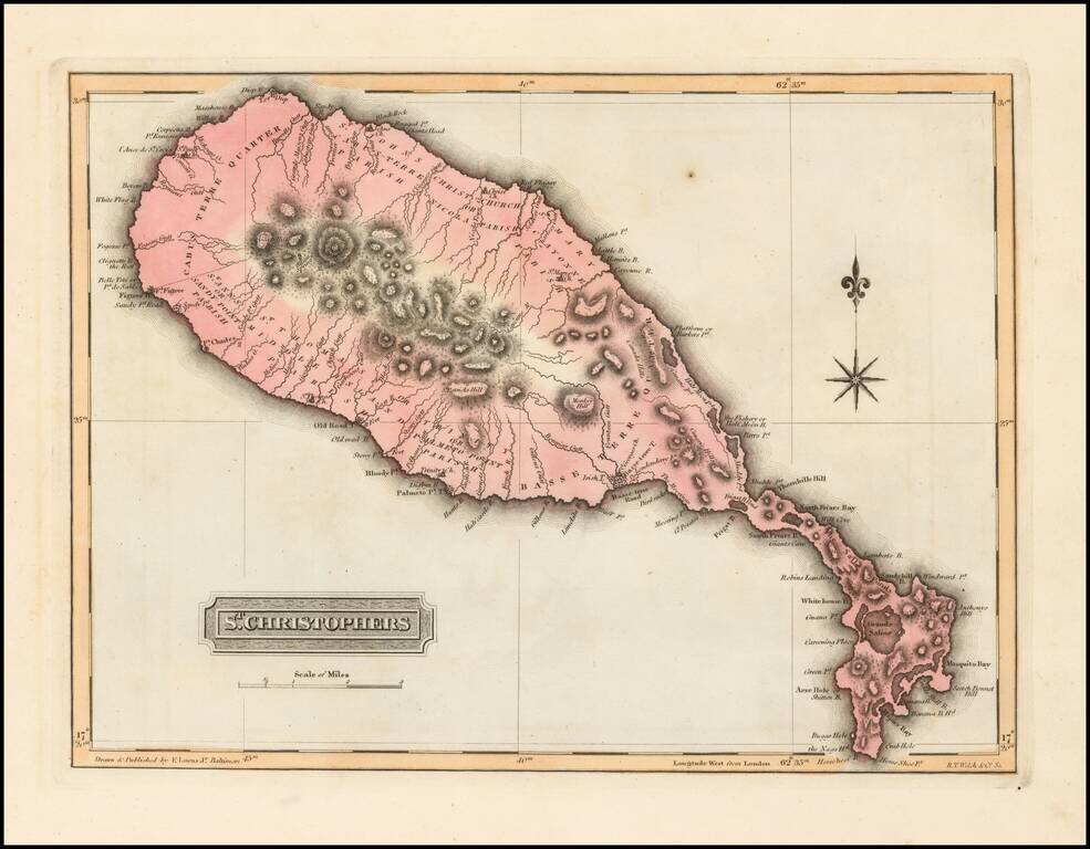
Scarce map of St. Christophers (St. Kits) by Fielding Lucas Jr., which appeared in his General Atlas, as well as his A New General Atlas of the West India Islands. Lucas's map is the first detailed commercial map of St. Kits published in America. The...
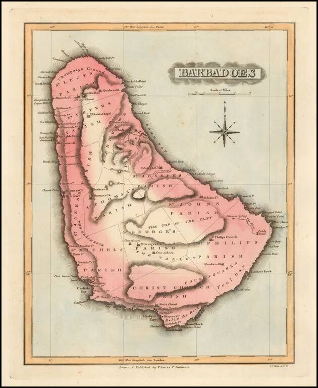
Scarce map of Barbadoes by Fielding Lucas Junior, which appeared in his General Atlas, as well as his A New General Atlas of the West India Islands. Lucas's map is the first detailed commercial map of Barbadoes published in America. The map depicts...
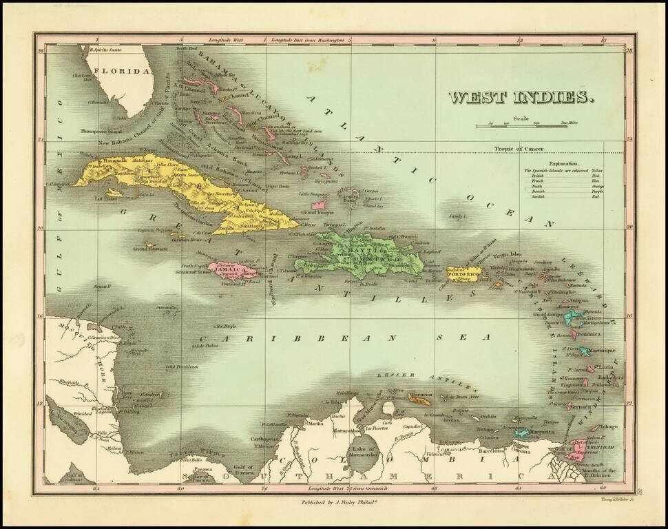
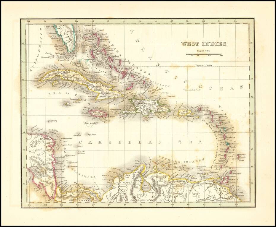
First edition of this early American map of the West Indies, from Finley's New General Atlas. Includes table of Colonial possessions.
![Amer. Sep. No. 69. Porto-Rico [and the Virgin Islands]](/map/small/42102.jpg)
Interesting regional map, showing Puerto Rico, the Virgin Islands, St. Martins and Anguille. The coverage of the Virgin Islands includes St. Thomas, St. John, Virgin Gorda, Tortola, Anegadia and the other primary islands, other than St. Croix. Nice...
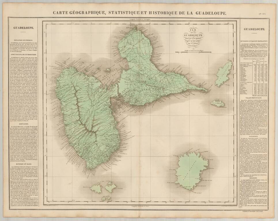
Detailed map of Guadeloupe, published in Paris. The map locates roads, towns, rivers and topographical features. The map appeared in the French edition of Carey & Lea's Atlas and is highly prized not only for its cartographic information but the...
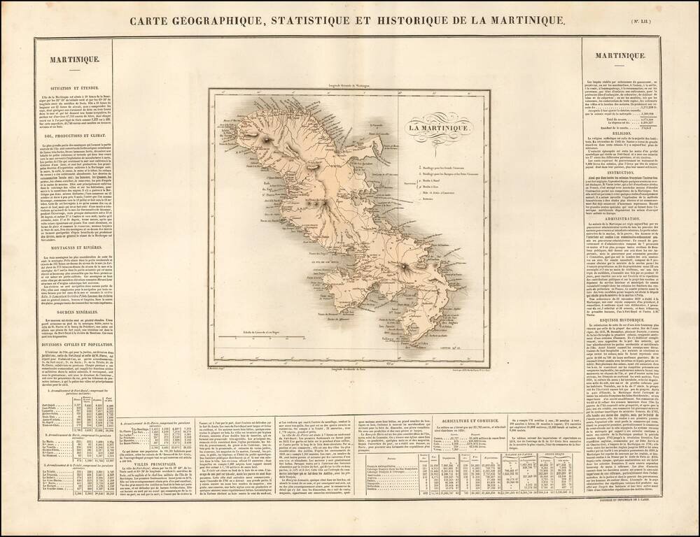
Detailed map of Martinique, published in Paris. The map appeared in the French edition of Carey & Lea's Atlas is highly prized not only for its cartographic information but the marvelous information about each of the states and territories...
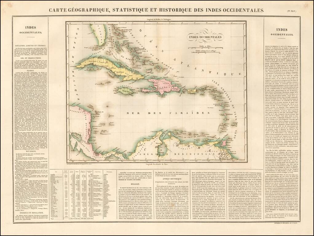
Detailed general map of the Caribbean, published in Paris. The map appeared in the earliest comprehensive atlas of the Americas published in Europe after the American Revolution.
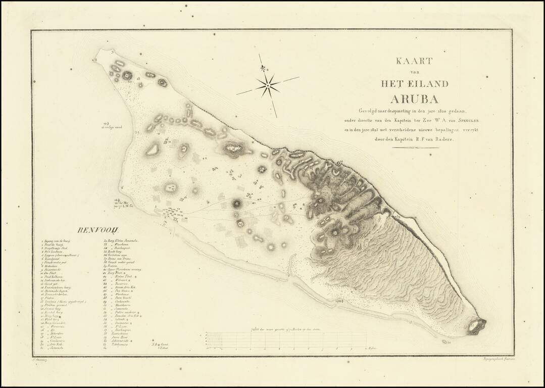
The Earliest Detailed Map of Aruba This is the first detailed map of Aruba. Made in the year 1825, it was based on information from Captain W. A. von Spengler's 1820 survey and enriched with several new provisions particularly focused on the discovery...
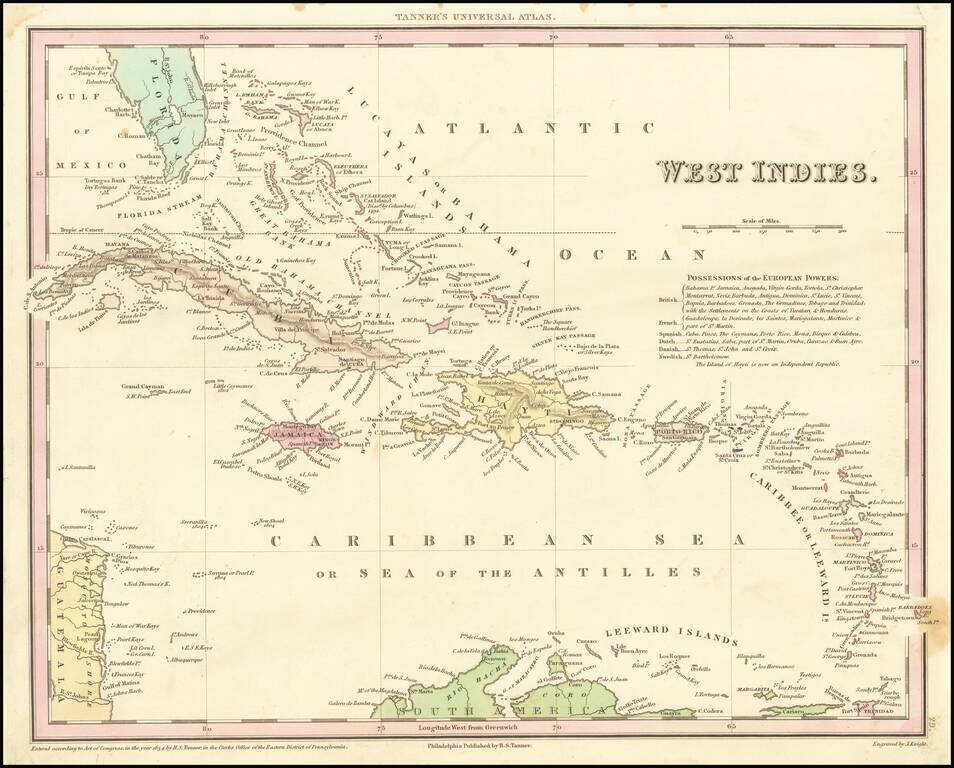
Detailed and attractive map of the southern portion of Florida and the Caribbean from the first edition of Tanner's Universal Atlas. The map shows the various European Powers possessions, including Spanish, British, French, Dutch, Danish and Swedish,...
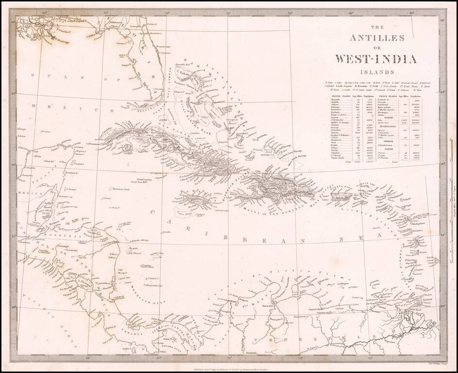
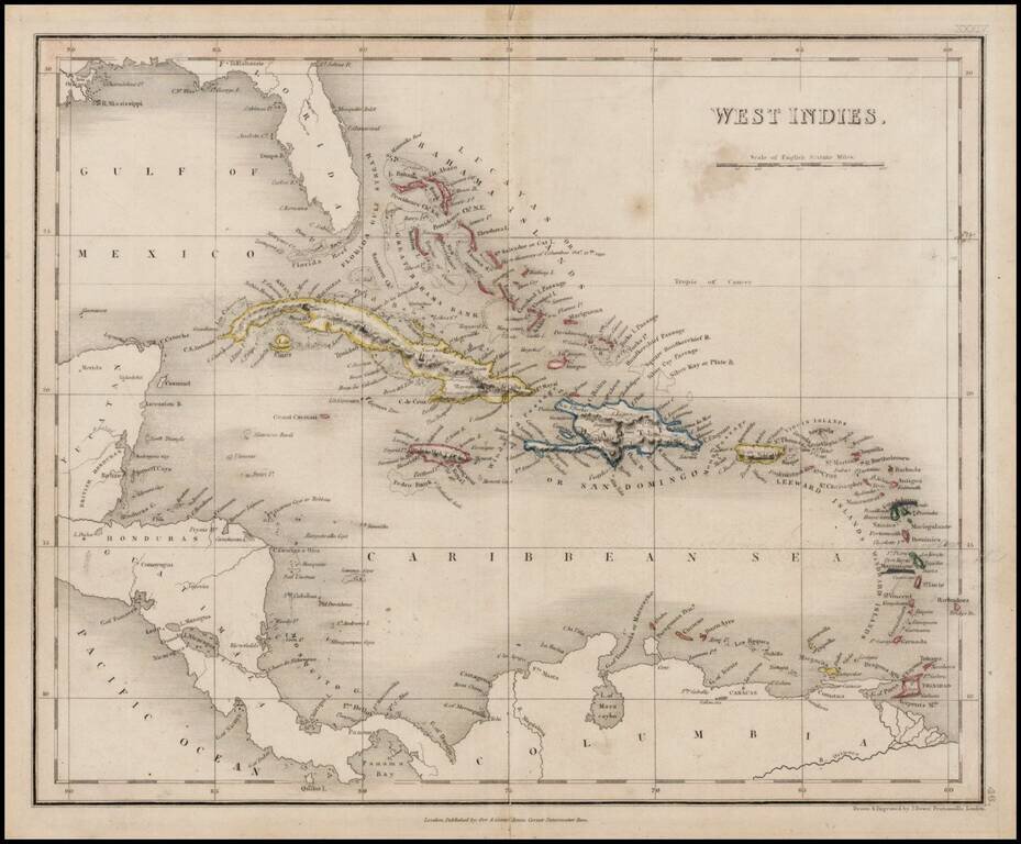
Detailed map of the whole of the West Indies, colored by territorial possession, with a table showing sizes and populations of the various islands. The Society for the Diffusion of Useful Knowledge was active from the 1830s through the 1860s and...
Detailed map of the Caribbean, Southern Florida, and a portion of Central America. Excellent details for a map of this size. Bradford's Comprehensive Atlas launched him as one of the prominent cartographic publishers of the period. This and his...
The map is quite detailed for its size and includes a fine wash color. Burr's Atlas was perhaps the most elegant American commercially published atlas of its time, utilizing wonderful wash colors and elegant engraving style. Burr studied under Simeon...