

Scarce chart of the Caribbean, Florida, Gulf Coast and Southeastern part of North America, with inset of the north coast of Cuba. Goos based his general chart of the West Indies, Gulf Coast and Southeast on the manuscript maps of Hessel Gerritsz,...
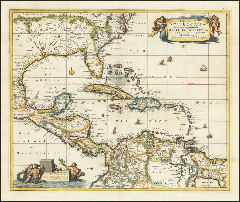
Nice example of Nicholas Visscher's map of the Caribbean, Florida, Southern US, Central America and part of South America. A number of cartographic myths appear on the map, including the large lake which appears in Georgia, a non-existent mountain...
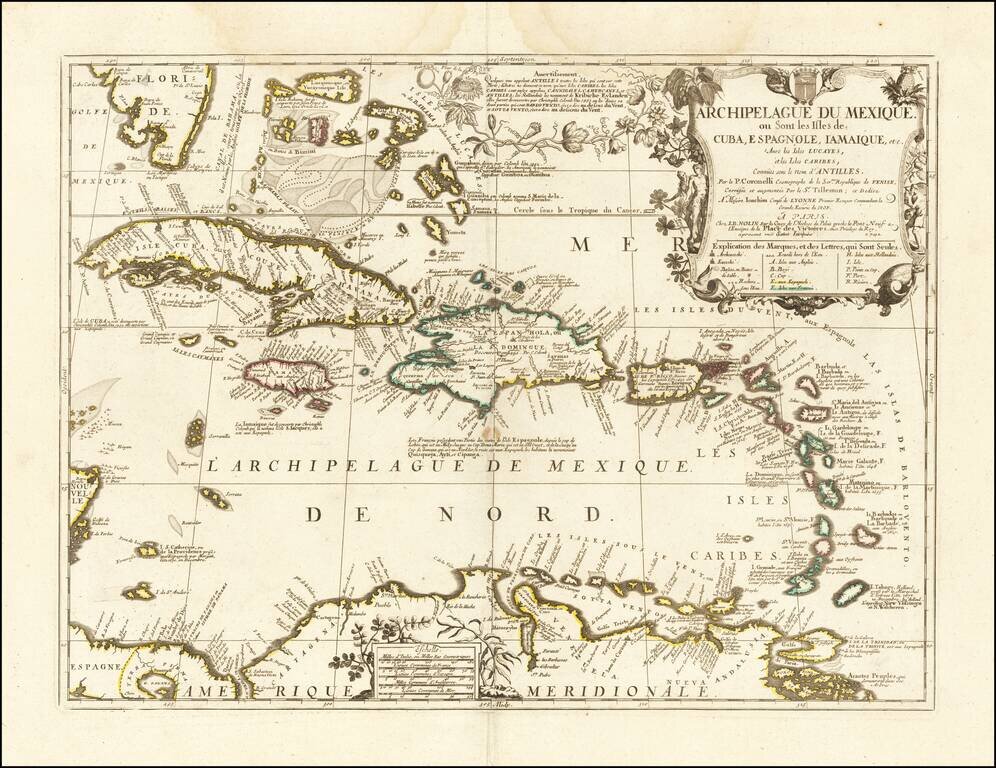
Nice example of the final edition of the Nolin-Coronelli map of the Caribbean. The map presents a marvelous large format look at the region, as it was known to Coronelli and Nolin at the end of the 17th century. Florida's southern coastline is...
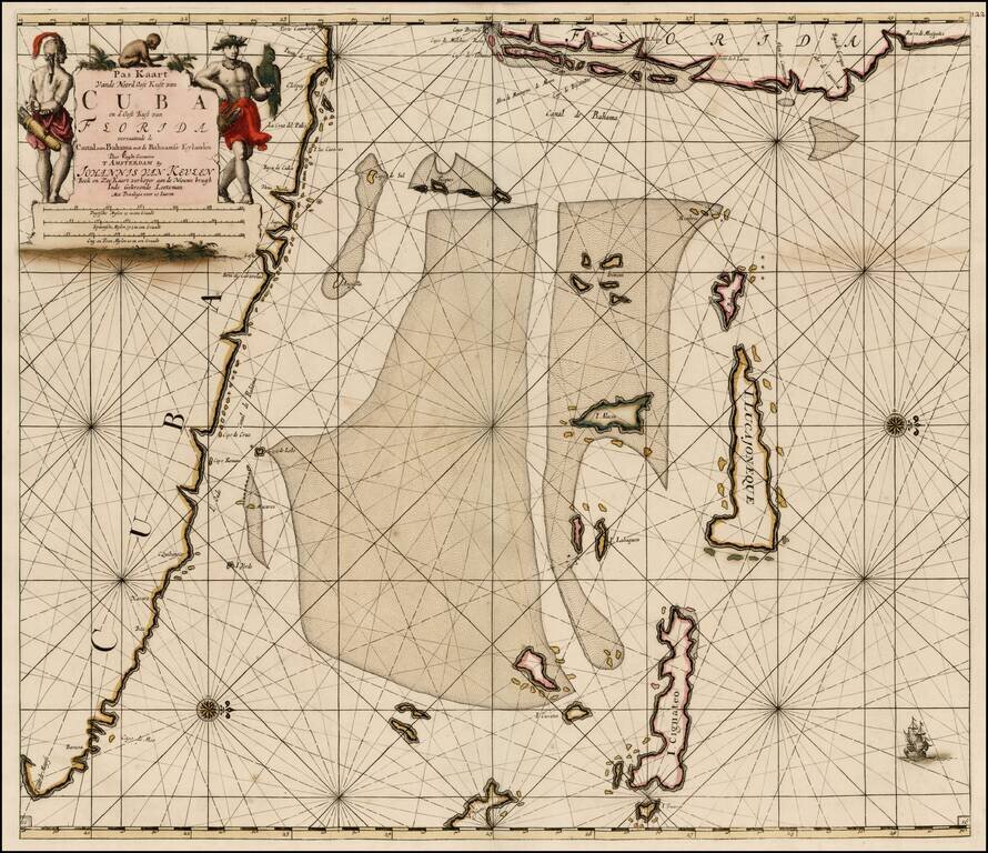
Southeastern Florida, Cuba and the Bahama Channel Fine old color example of Van Keulen's sea chart of Southeastern Florida, the Bahamas and Northeastern Cuba, first issued in the fourth part of the 1684 edition of his Zee-Fakkel, published in...
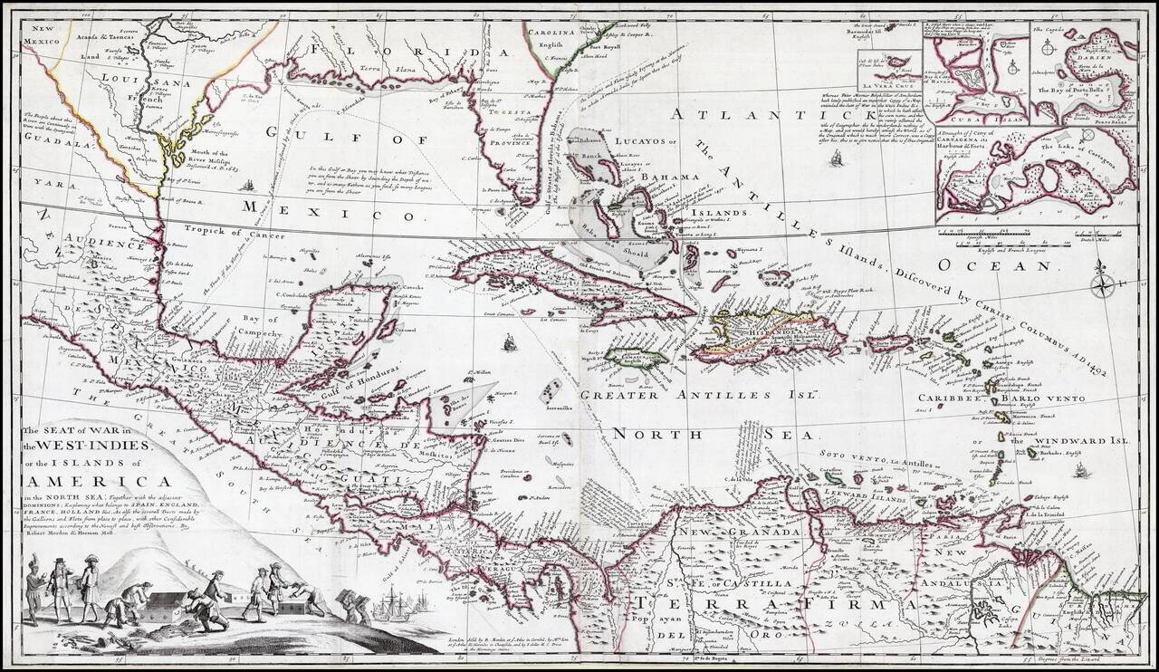
Striking old color example of this rare separately issued map of the Theater of War during the War of Jenkins Ear, published in London circa 1702, by Robert Morden & Herman Moll. A separately published and very rare English produced map of the War...
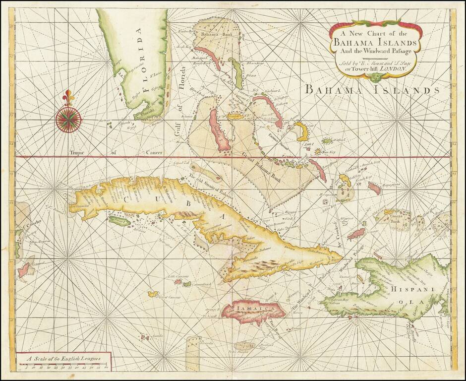
Scarce Early English Chart of the Bahamas from the Influential English Pilot, Fourth Book This chart by Mount and Page includes the tip of Florida, the Cayman Islands, Cuba, Jamaica, the western part of Hispaniola and Cozumel to the far west. The...
Detailed map of the Caribbean and Southeastern US, extending to Texas, Mexico, Central America and South America. Numerous annotations throughout.
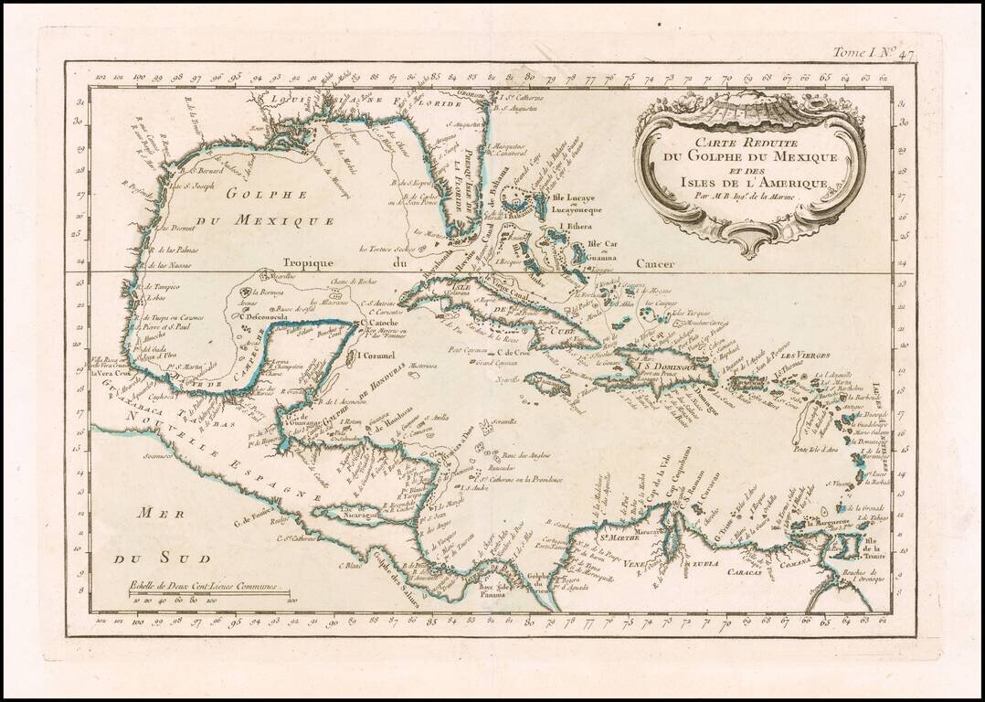
Detailed map of the Caribbean, published in Nicholas Bellin's Petit Atlas Maritime. The map covers The Gulf Coast, Florida, the Caribbean, Mexico, Yucatan and Central America.
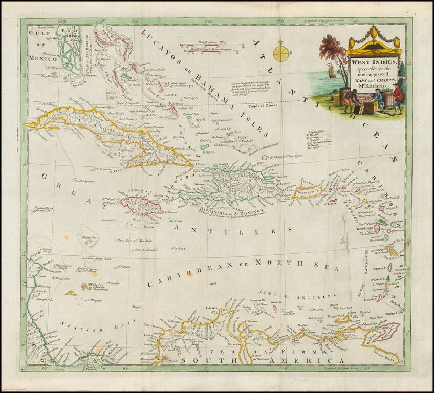
Decorative map of the Caribbean, extending from South Florida to the Northern edge of South America and the Windward and Leeward Islands. Nice detail in the Bahamas. Great Cayman and Little Caymans are shown. Decorative title vignette.
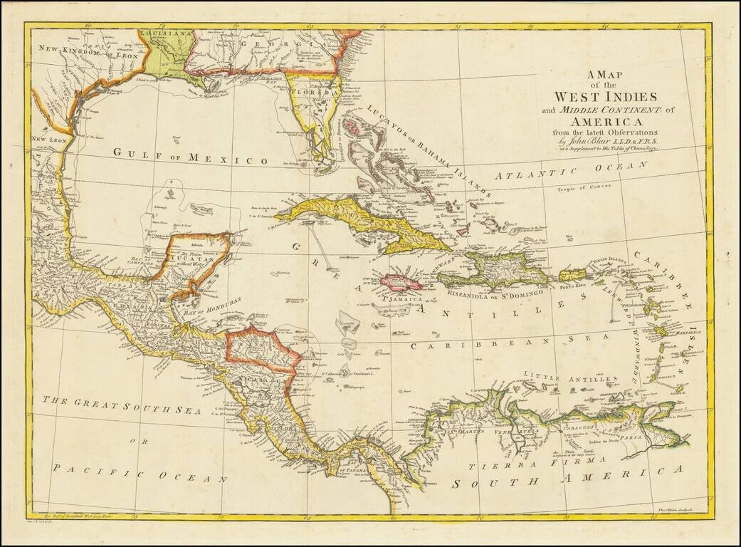
Detailed map of Florida, the Gulf Coast and Caribbean, centered on Cuba colored by regions. Florida is shown as an Archipelago. Georgia extends to the Mississippi River. Massive Kingdom of Leon (Texas). Nice detail in the Bahamas.
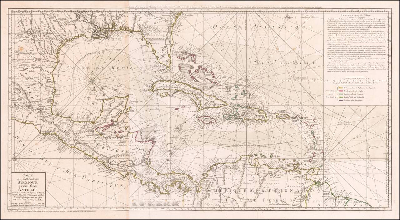
Striking, Intricate Map of the Caribbean Region Scarce and highly-detailed map of the Gulf Coast, Florida, Central America and the Caribbean from J.A. Dezauche, successor to Philippe Buache and Guillaume De L'Isle. The map is incredibly detailed, not...
John Cary's First Printed Map Nice example of John Cary's map of the Southeastern United States, Florida and the Caribbean, published on August 1, 1783. Published in August, 1783, the map was issued one month prior to the signing of the Treaty of...
Striking wide margined example of this scarce map of Cuba, the Bahamas and the Southern tip of Florida. The map provides a fine depiction of the Western Caribbean. The dating of this map runs the gamut from 1784 to 1806, but it can be reliably traced...
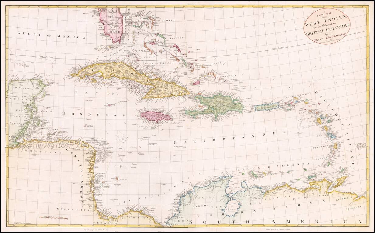
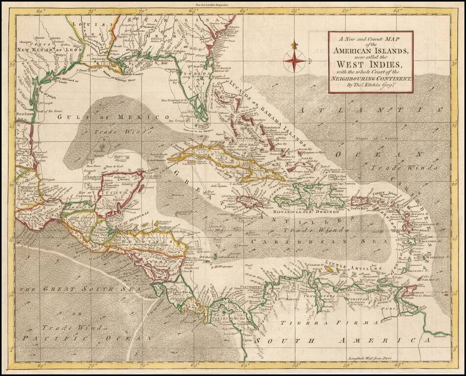
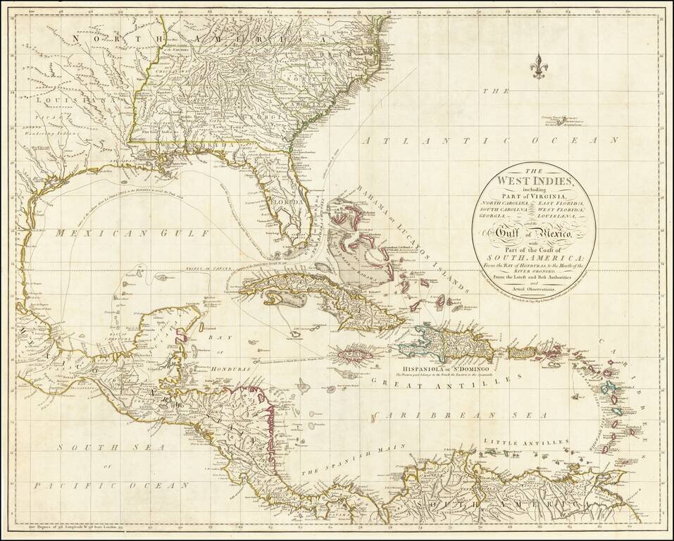
Fine large map of the South Florida and the Caribbean, published shortly after the American Revolution. The map extends from South Florida and the Florida (Gulf) Stream and the Bahamas in the north to the Yucatan, Mosquito Coast, Windward Islands and...
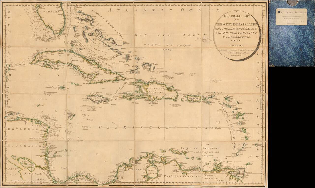
Rare Separately Issued Faden Map of the Caribbean &c. Detailed large format chart of the West Indies, Florida, Honduras, Nicaragua, Coast Rica, Panama and the Bahamas drawn by Louis Stanislas Delarochette, and published by William Faden in 1796....
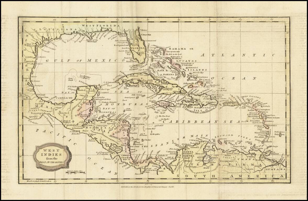
Interesting map of the West Indies and Gulf Coast region, showing Florida, the Yucatan, coast of Central America and South America. Fort Louis and Lake St. Joseph are shown along with St. Louis Bay and Bernard's Bay, near modern Galveston. Nice detail...