
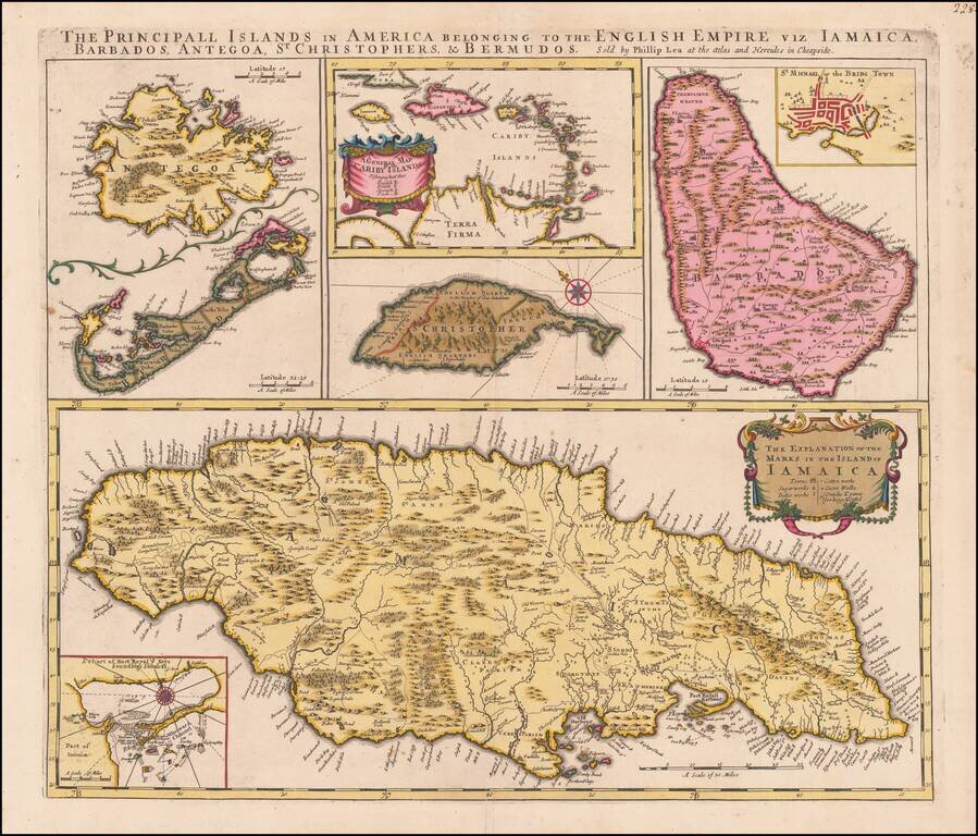
A Caribbean Rarity in Brilliant Original Color Fine original color example of Phillip Lea's rare antique map of the British Possessions in the Caribbean, published in London in 1689. The map includes detailed treatments of Bermuda, Antigua, St....

Very rare double-sided map sheet featuring a trio of plans of important Spanish American ports: Havana (Cuba), Portobello (Panama) and Cartagena (Colombia), published by Pierre Mortier in 1702, during the War of Spanish Succession. This rare map...
![The Island of St. Christopher [and Antigua] [and] Part of ye Islands of America &c.](/map/small/61547.jpg)
Excellent English map of St. Christophers (St. Kitts), Antigua and a regional map of the Islands by Herman Moll, one of the leading English mapmakers of the early 18th Century.
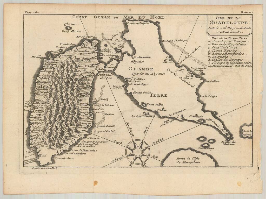
Rare map of the Island of Guadalupe. Includes a fine topographical treatment of the island, with a key locating 10 places of interest. The attribution to De Fer is based upon style--we were not able to locate another example of the map.
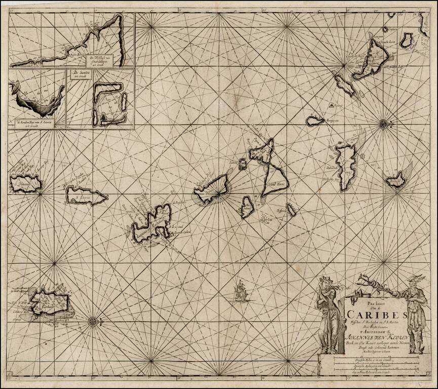
Nice example of Van Keulen's sea chart of the Lesser Antilles, from De Nieuwe Groote Lichtende Zee-Fakkel, Part IV. A very attractive Dutch sea chart, with north at the top, extending from the southern part of St. Martin in the north to St. Vincent in...
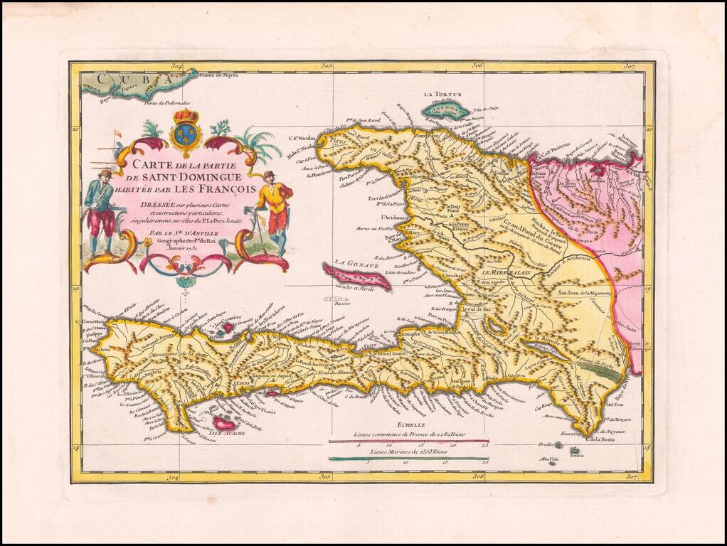
Exceptional Original Color Example of this Separately-Issued Map of Saint Domingue Based on Jesuit Manuscript Sources Finely detailed map of Saint Domingue by the renowned French mapmaker Jean-Baptiste Bourguignon d’Anville. This is a...
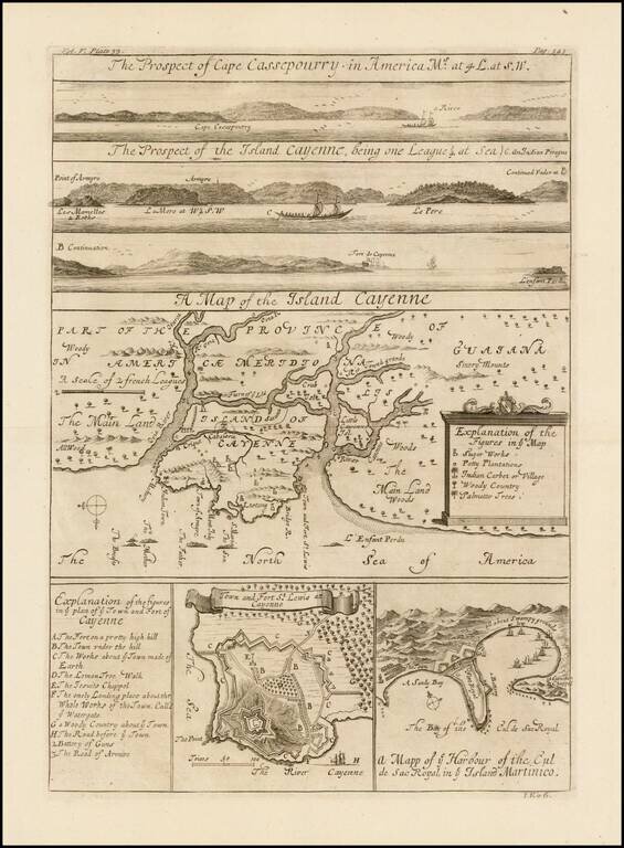
Dynamic Maps of Cayenne and Martinique From a Celebrated Voyage Collection Fine set of striking copper engravings of Cayenne and Cassepouri, French Guinea, in South America, and of Martinique in the West Indies. They were included in the Churchills’...
![Isle St. Christophle une antilles aux anglois [and]La Barbade une des antilles anglois divisee par Paroisses](/map/small/24310.jpg)
Detailed maps of St. Christopher and Barbardos, the latter showing Parishes.
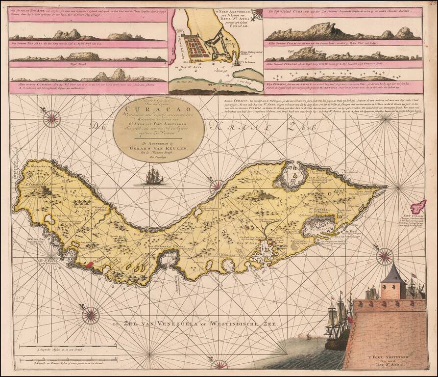
Fine Original Color Example Rare Dutch sea chart of Curaçao, published by the Van Keulen family in the middle of the 18th Century. The chart includes several coastal insets and an inset of Fort Amsterdam and the Bay of St. Anna. Van Keulen's chart...
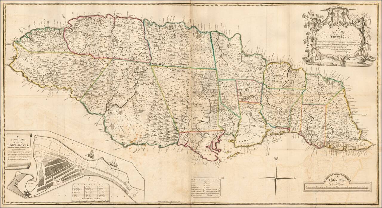
The true first state of the first large format Map of Jamaica. Fine 2-sheet map of Jamaica, published in London in 1755, engraved by J. Bayly. The present example is the first state of the "The first large-scale map of Jamaica." This large, dramatic...
![Carte Reduite des Isles Antilles Dressee au Depost des Cartes et Plans de la Marine… [Large Inset of Virgin Islands]](/map/small/68206.jpg)
Large engraved sea chart of the Lesser Antilles, with a detailed inset of the Virgin Islands, published by Jacques Nicolas Bellin in 1758. The Virgin Islands inset at the left is titled "Carte Particuliere des Isles des Vierges". Bellin credits the...
One of the Rarest Jamaican Maps of the 18th Century Rare map of Jamaica, which appeared in Thomas Jefferys', A general topography of North America and the West Indies. Being a collection of all the maps, charts, plans, and particular surveys, that...
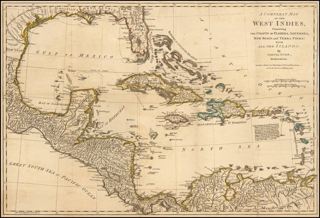
Detailed map of the West Indies, Florida, the Gulf Coast, Central America and part of Meixco.
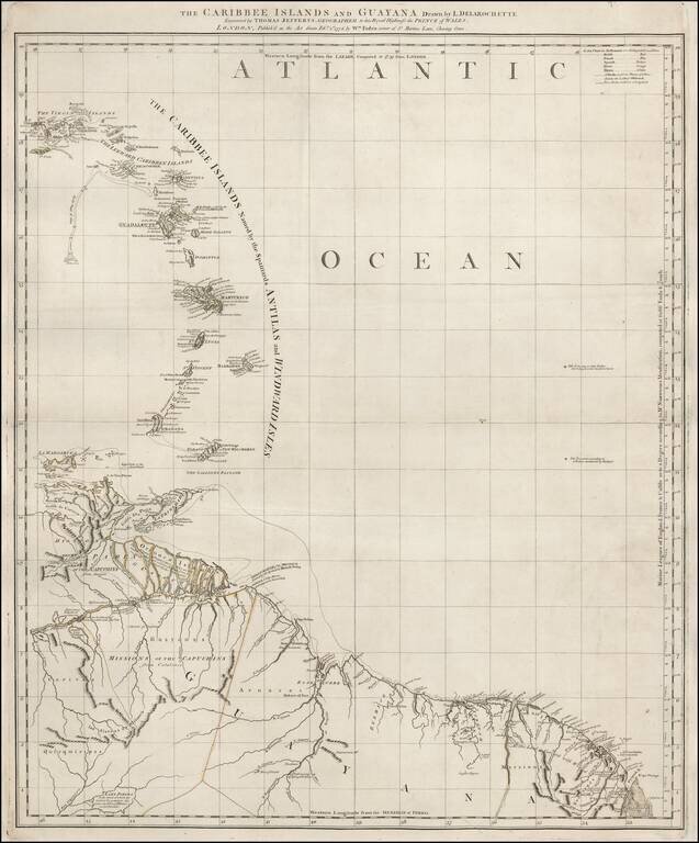
Scarce map of the Eastern Caribbean and Northeastern Coast of South America, published by Thomas Jefferys. The map extending from the Virgin Islands to Margarita and Trinidad Islands to Cayenne and Lake Parima, including a nice treatment of the...
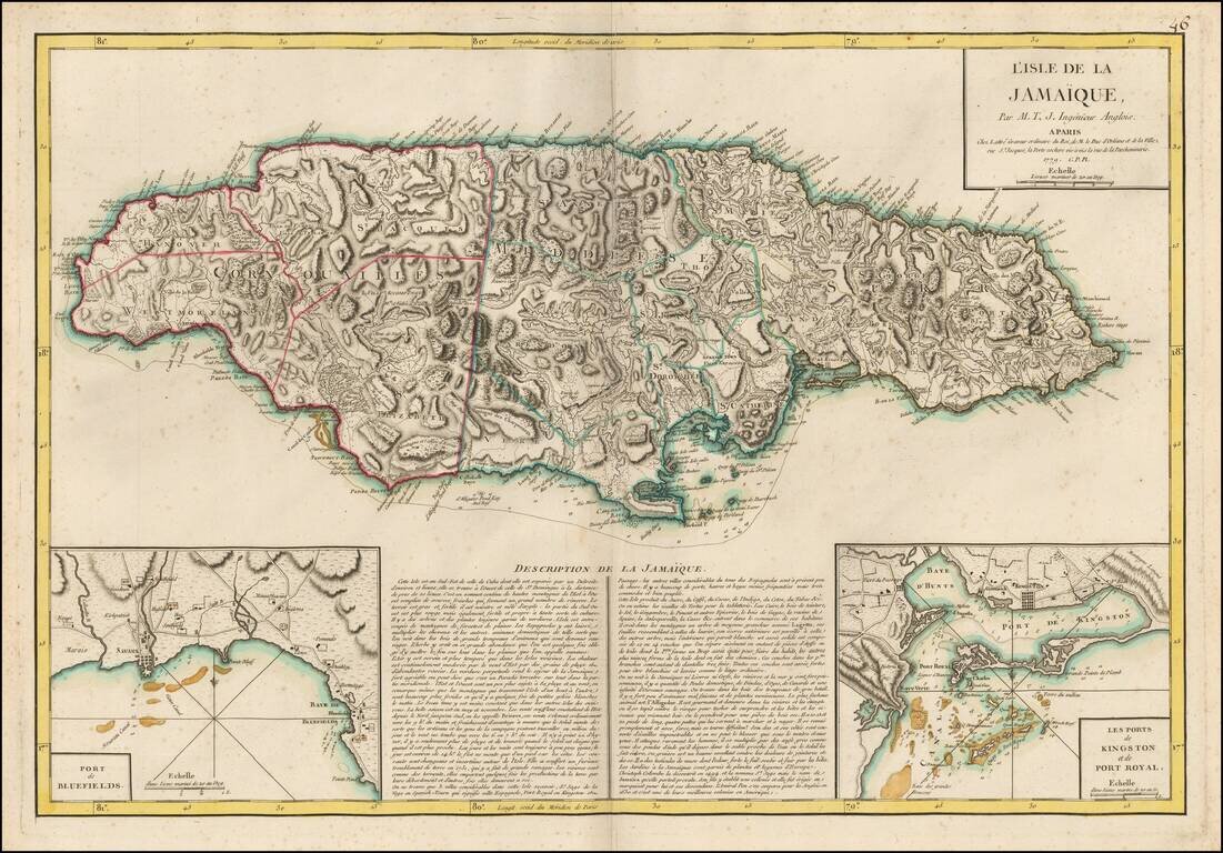
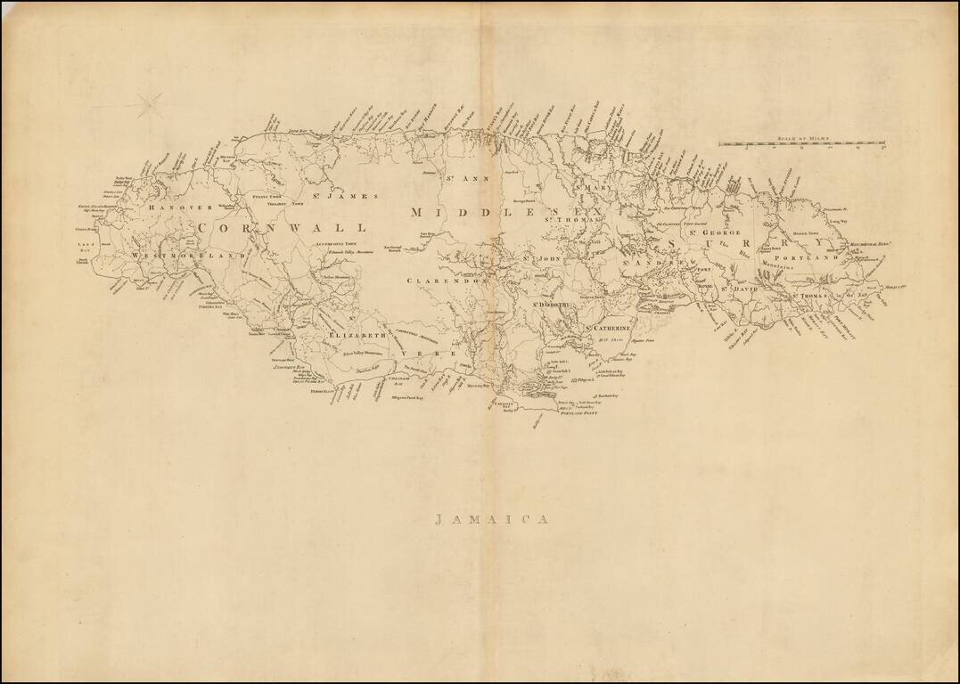
Rare French Map of Jamaica, published by Jean Lattre in Paris. The map provides remarkable topographical details, including mountains, rivers, islands, and other coastal features. Towns, Roads, Plantations, Churches and other features are also shown....
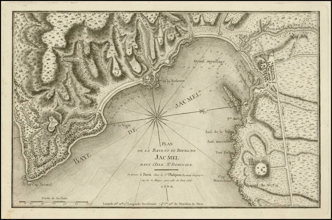
Fine example of this scarce chart of the bay and town of Jacmel, on the south coast of Haiti's southwestern peninsula, with multiple depth soundings and the topography of the surrounding countryside rendered in great detail. The map appeared in the...