
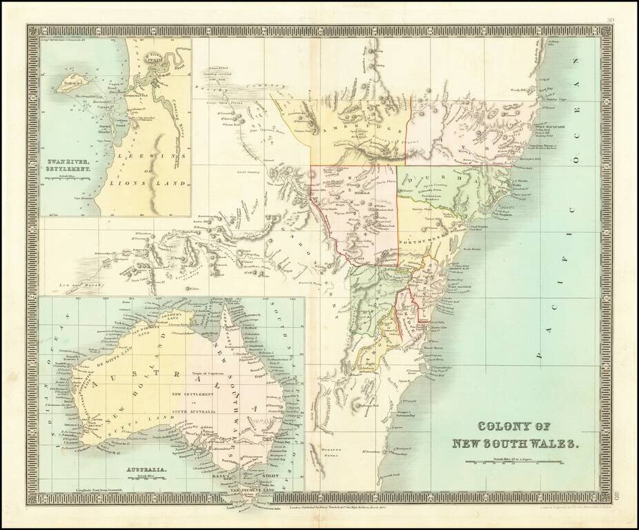
Detailed engraved map New South Wales, issued by Henry Teesdale in London in 1834. The map includes a number of early counties. Includes a large inset of the Swan River Settlement and a map of Australia.
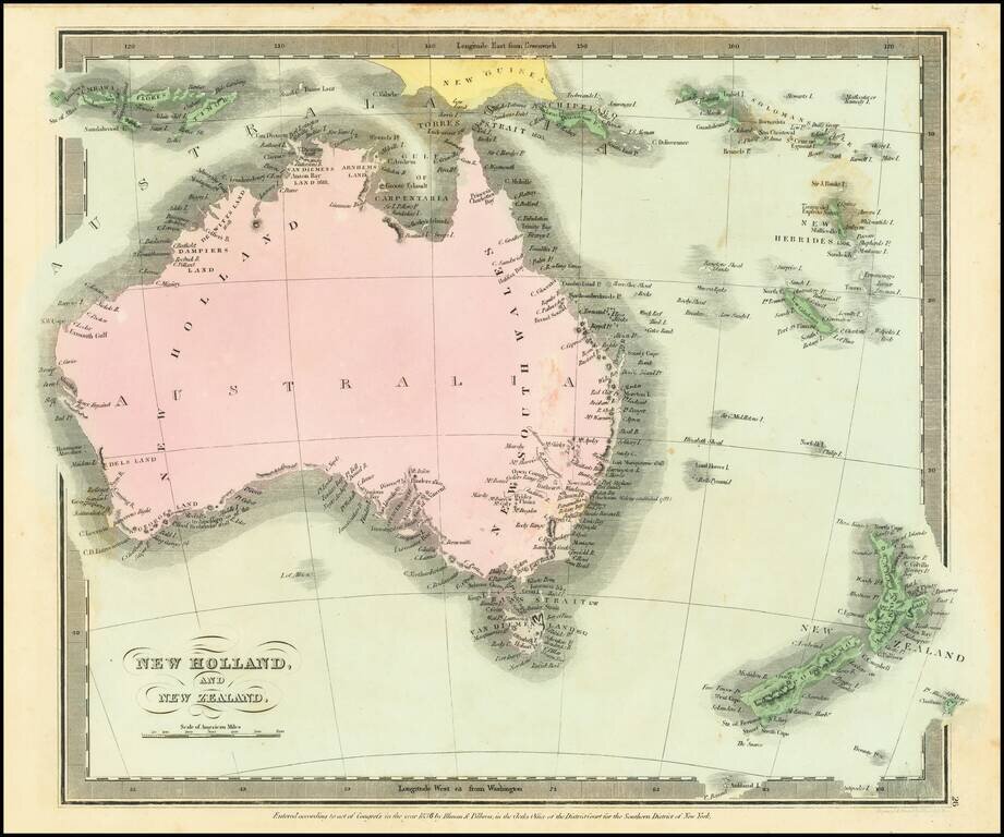
Scarce map of Australia and New Zealand, first published in David Burr's Universal Atlas. Includes a very early and primitive look at the interior of Australia. While the map bears the copyright date of 1834, Rumsey indicates that the atlas was not...
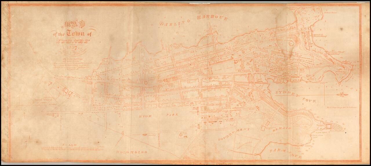
An Unusual Variant of An Important Early Sydney Plan Rare and highly detailed map of Sydney, oriented with west at the top, printed in Sepia and dated 1837. This map illustrates the settlement of Sydney as of 1837; detailing public buildings,...
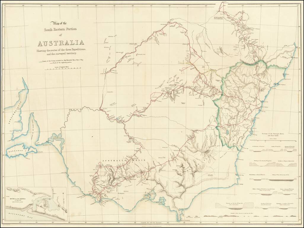
Striking Map of Australia Showing Mitchell’s First Three Important Exploratory Expeditions Fine map of southeast Australia highlighting the routes of Thomas Livingstone Mitchell in his early expeditions to better survey inland Australia. His three...
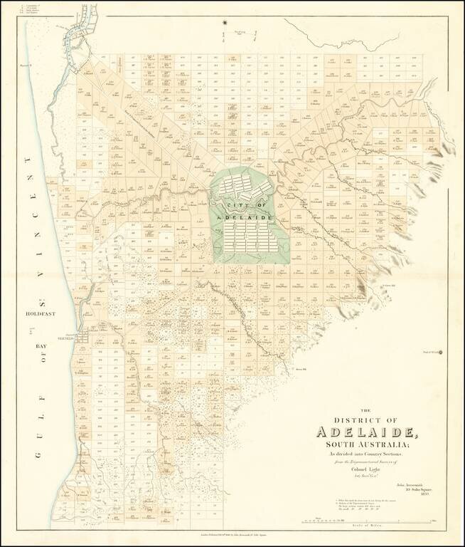
The First Map of Adelaide Rare cadastral map of the area around Adelaide, published by John Arrowsmith. The map illustrates Adelaide and the region surrounding, centered on the 'City of Adelaide', covering an area from Port Adelaide in the north...
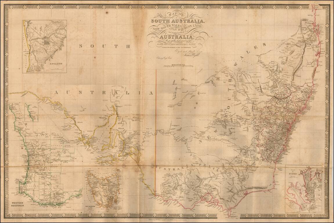
A fascinating early map of the settled parts of Australia, featuring discoveries from recent expeditions into the interior. Wyld's map depicts all of the settled areas of Australia as they appeared around 1840. The main map embraces the area of the...
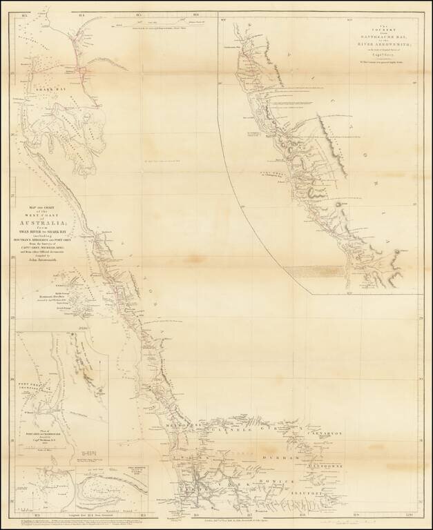
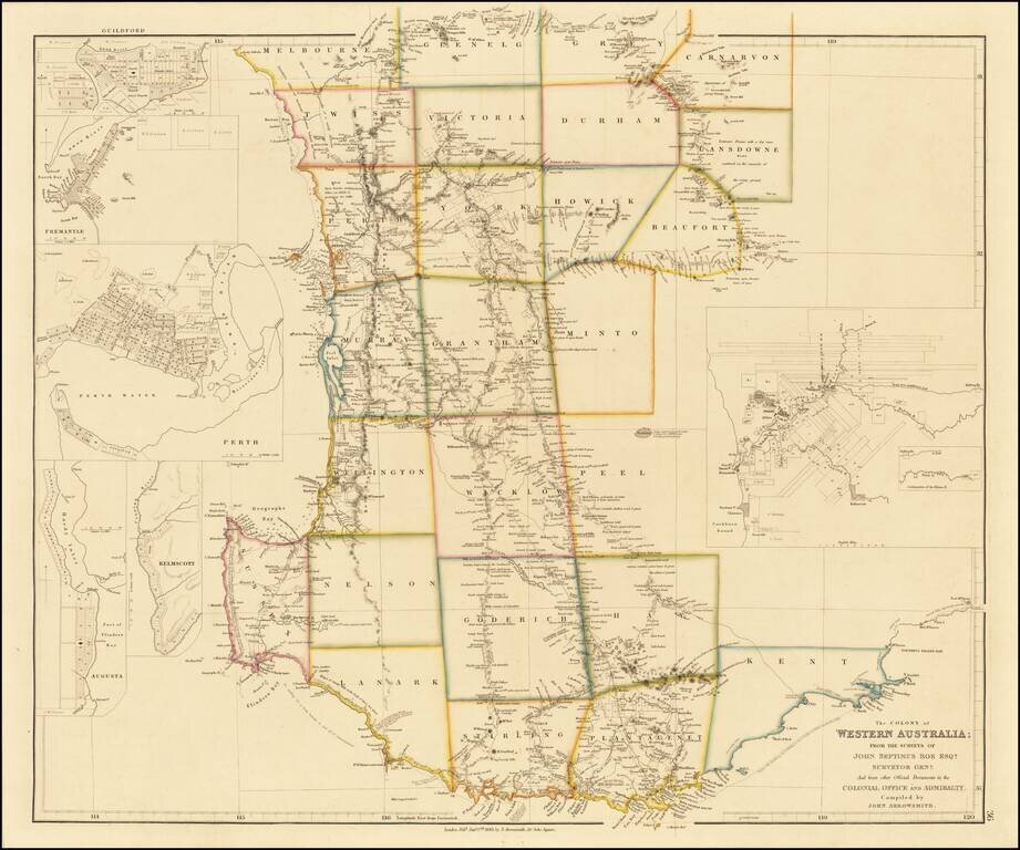
Striking, Intricate Arrowsmith Map of Western Australia with Details from Recent Explorations By The Future Prime Minister of New Zealand Finely-detailed map of Western Australia by London’s premier cartographer of exploration, John Arrowsmith. The...
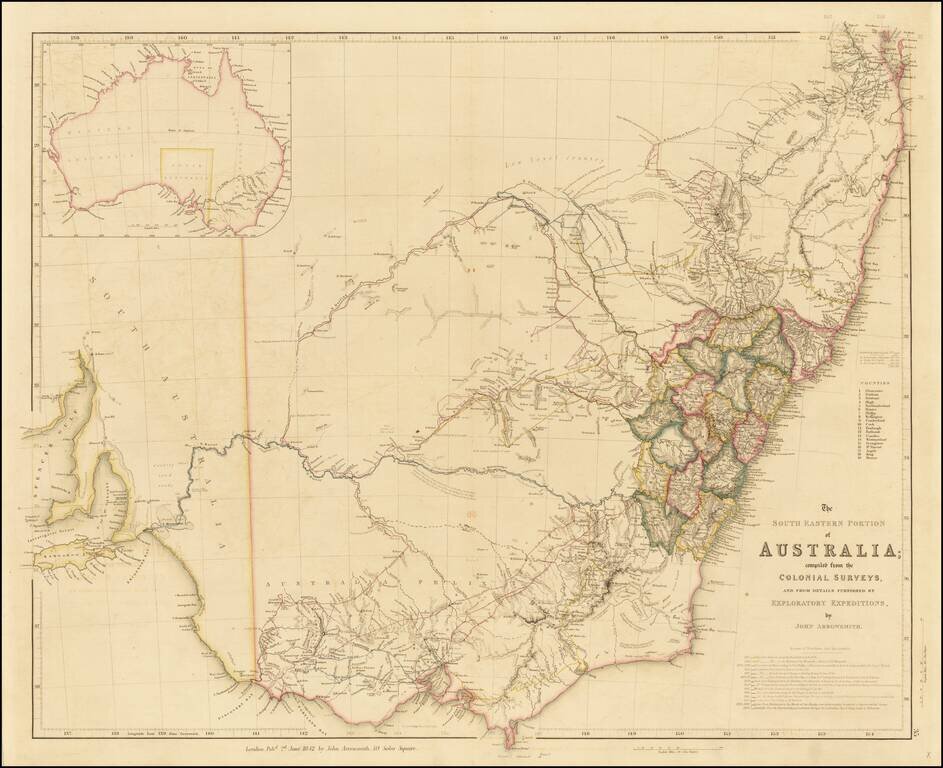
Finely detailed map of the Southeastern part of Australia, by John Arrowsmith. This is the second of the two maps which would be utilized to illustrate the extraordinary growth of this part of Australia during the early period of the Australian Gold...
Fine example of Arrowsmith's map of Tasmania, and one of the earliest separate maps of the island. Abel Tasman (1609? - 1659), a Dutch navigator, discovered the island in 1642 and named it Van Diemen's Land. At the time, Van Diemen's Land was still a...
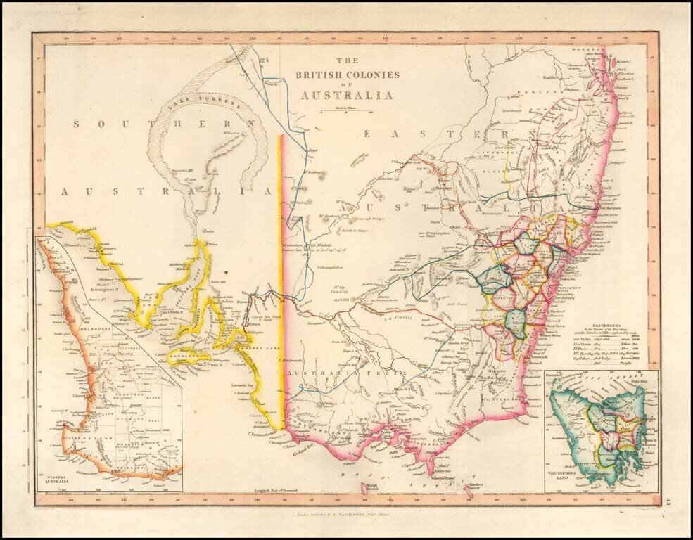
With a Massive Inland Lake Torrens Fine map of Southeastern Australia, illustrrating the British Colonies on the Continent. The map shows the region shortly before the discovey of gold would create a massive rush of fortunate seekers into the...
Early state of John Arrowsmith's map of Western Australia. The map shows the Colony of Western Australia, along inset maps of Perth, Guildford, Freemantle, Augusta and Kelmscott. The map was printed from 1839 until 1863 in eight states, tracking the...
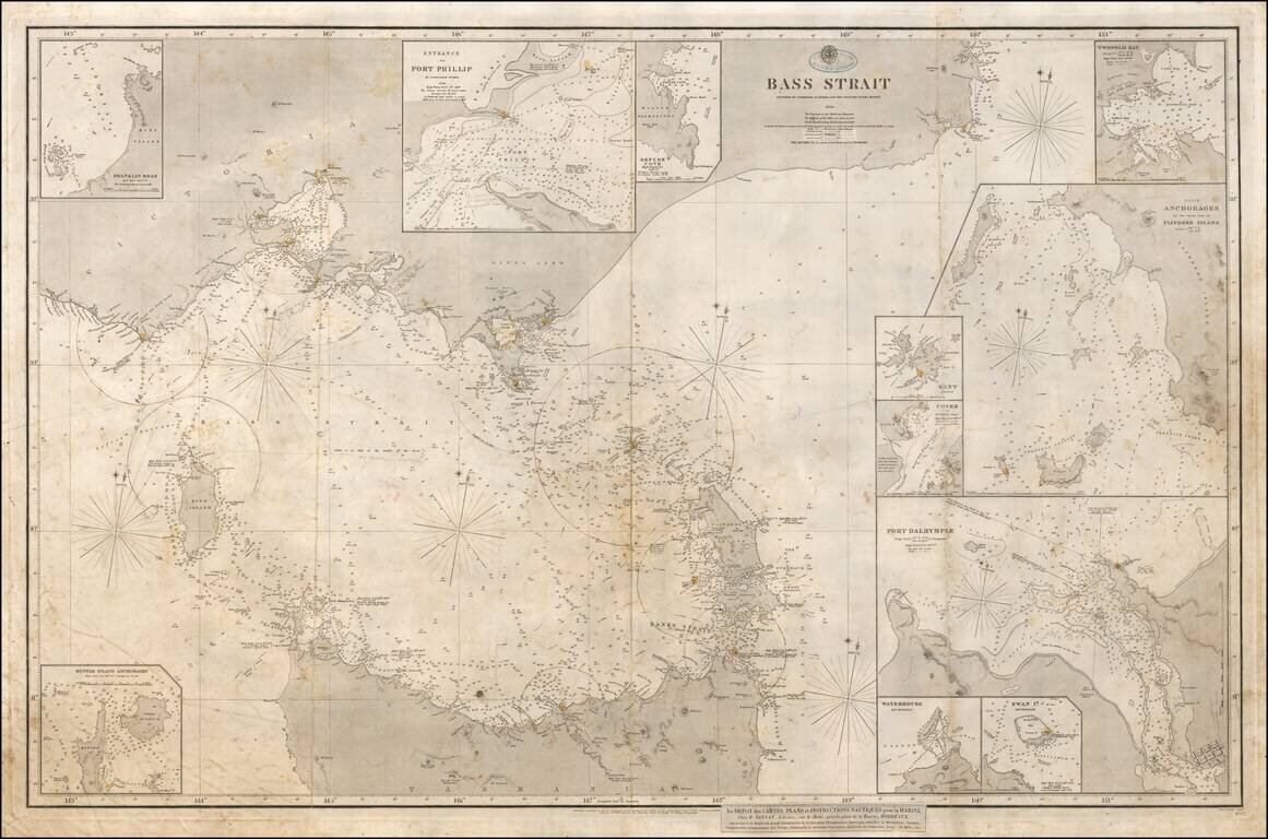
With Hand Drawn Annotations Showing Contemporary Use At Sea Annotated example of the 1843 edition of the British Admiralty Chart of the strait between Melbourne and Tasmania, revised and improved to 1844 and 1858. The map is based upon the...
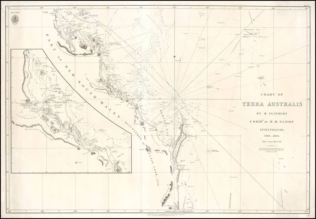
Fine example of the 1848 edition of the British Admiralty Chart of a large section of the East Coast of Australia, revised and improved to 1848. The chart is based upon the surveys of Matthew Flinders, between 1799 and 1803, including the tracks of his...
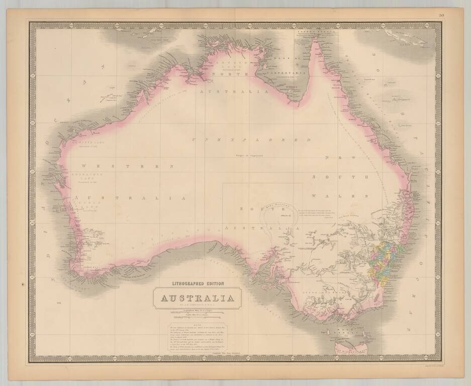
Highly detailed map of Australia. A few early counties shown in NSW and Western Australia. Laken Torens is shown, with other details in South Australia and New South Wales added from prior editions of the map. Includes a key with historical notes on...
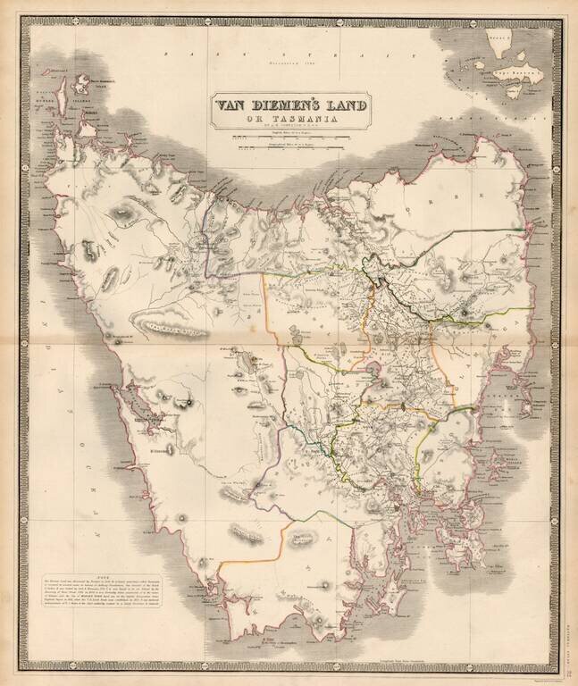
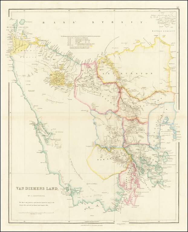
Highly detailed map of Tasmania, including provinces and land owners. Historical notes discuss the discovery of the island in 1642 by Abel Tasman, the remaining of the island to honor Anthony Vandiemen, Cook's visit, the discovery of Bass Strait in...
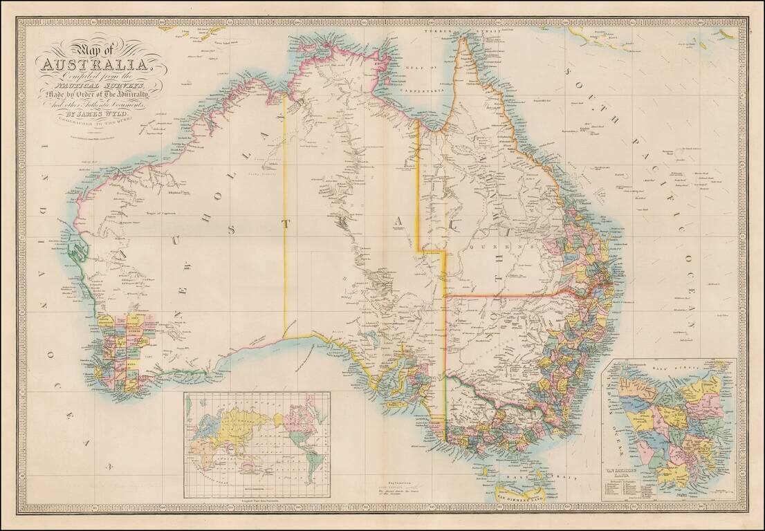
Important Map of Australia, Updated To Include The Gold Discoveries in the Newly Created Colony of Victoria. Wyld's map captures Australia in 1851, shortly after the creation of Victoria Colony and the discovery of Gold. The coastlines of the...