
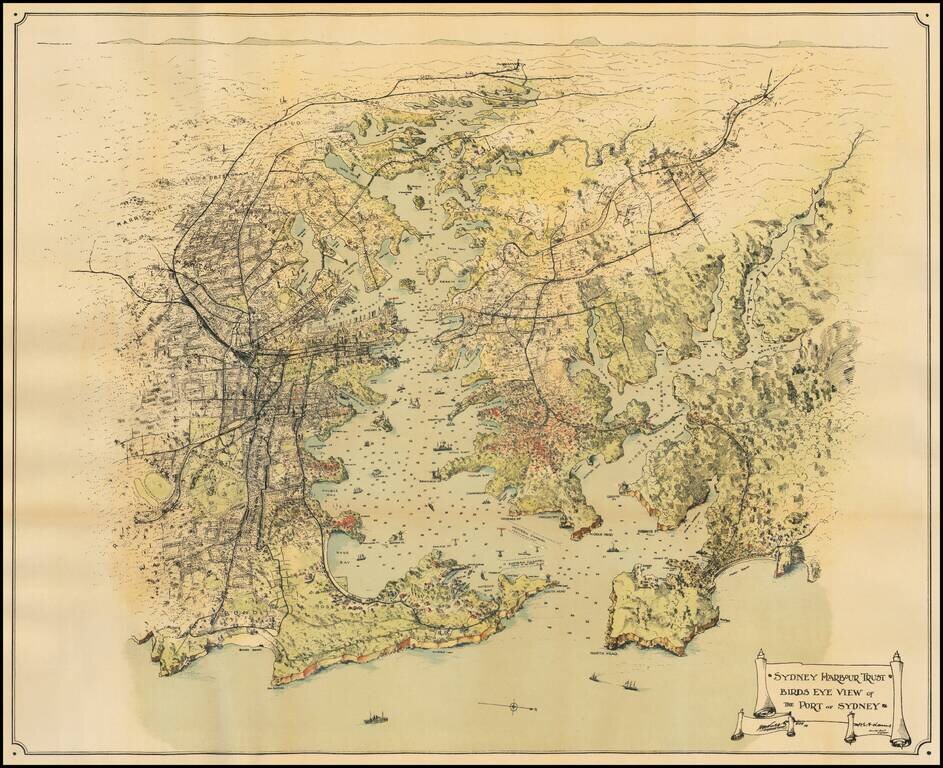
Fine overview of Sydney Harbor and environs, published for the Sydney Harbour Trust. An exceptional caricature style overview of the Harbor, illustrating existing and proposed changes to improve the harbor. Sydney Harbour Trust The Sydney Harbour...
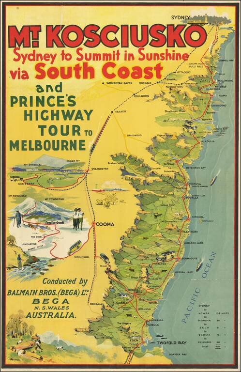
Rare travel poster of the area between Sydney and Twofold Bay, promoting the Balmain Bros. (Bega) Ltd., with the publication mark of J.H. Enemark Ltd., Litho. Sydney at the bottom left. The map illustrates a coastal motor route between Sydney and...
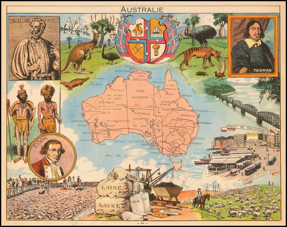
Decorative pictorial map of Australia, published by Children's book artist JP Pinchon.
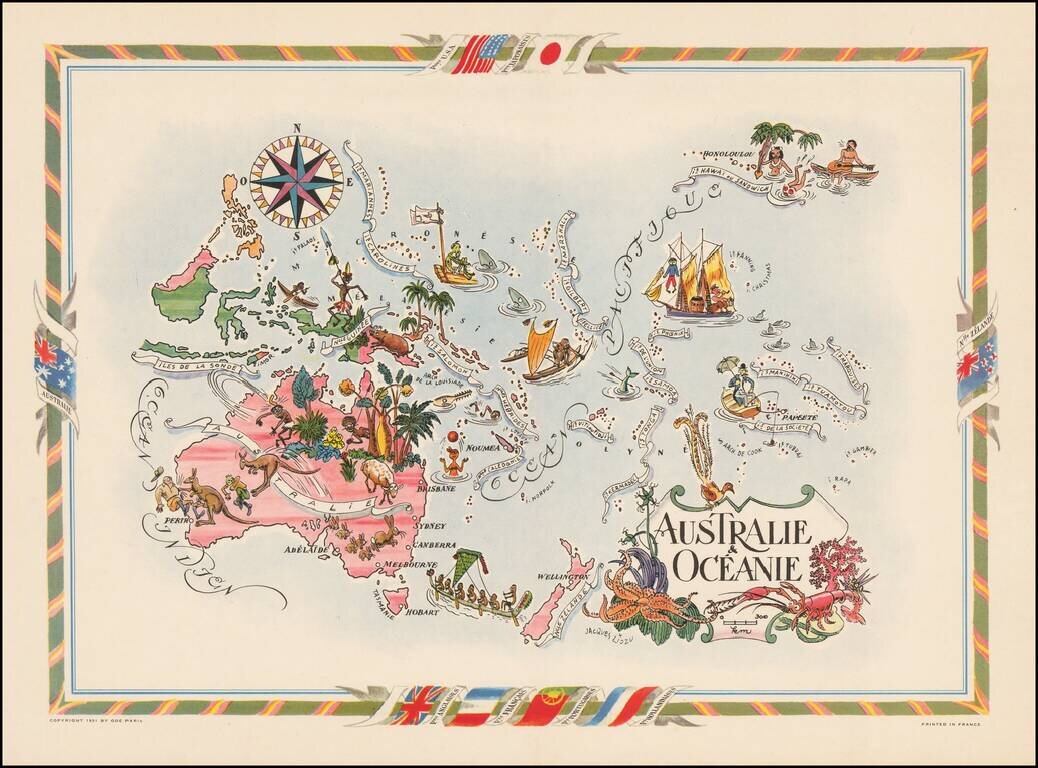
Decorative map of Australia, the Philippines, New Guinea, New Zealand and the South Pacific, published by Jacques Lizou. Lizou published a number of maps in this style in 1951, including maps of the French provinces, etc.
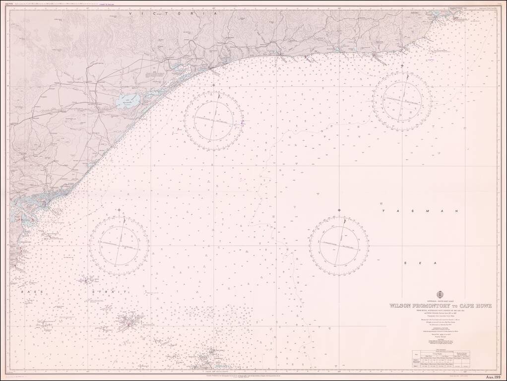
Fine sea chart extending from Cape Howe Marine National Park to Wilson Promontory, prepared for the Royal Australian Navy.
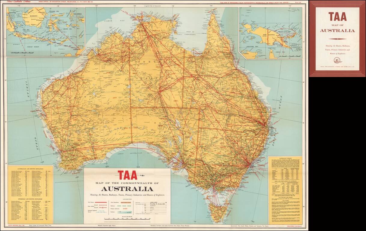
Scarce Trans Australia Airlines map of the continent of Australia, highlighting the air routes of TAA wihtin and beyond Australia. A key at the bottom left shows approximatetly 50 domestic and approximately 30 overseas air routes (including...