
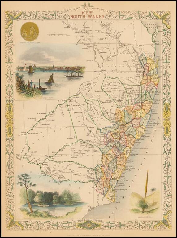
Striking full color example of this marvelous map. Includes vignettes of Sydney, The Murray and Xanthorrhea, plus a seal. Engraved for R. Montgomery Martin's Illustrated Atlas. Tallis was one of the last great decorative map makers. His maps are...
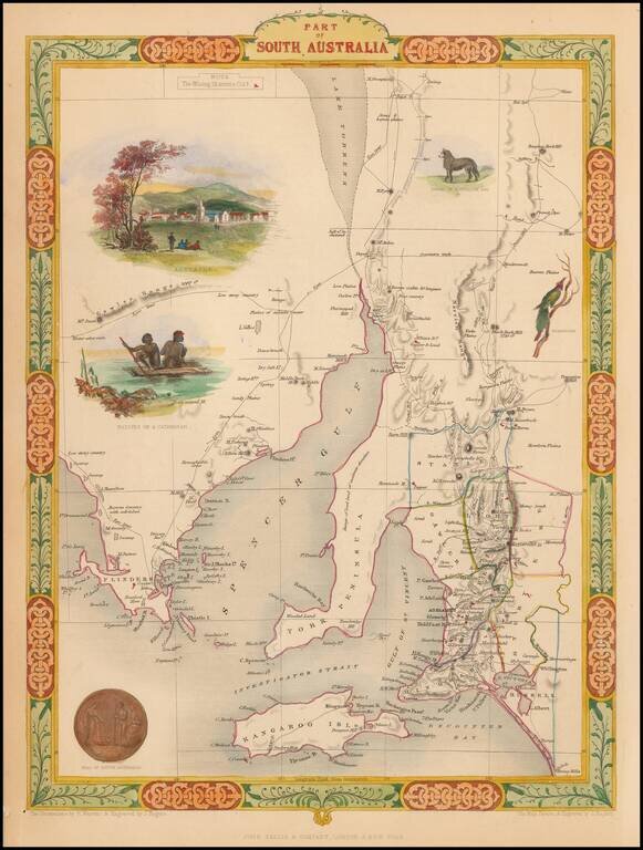
Interesting and detailed map of South Australia, centered on Spencer Gulf and York Peninsula and extending to Encounter Bay and Port Drummond. Vignettes show Adelaide, Aborigines on a raft, a Dingo, a Nymphicus and the seal of South Australia. Colored...
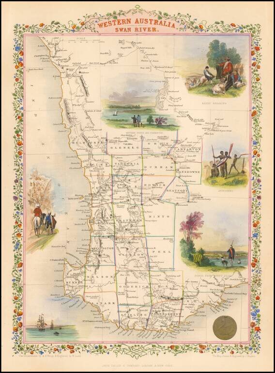
Gorgeous full color example of this decorative map, extending from Champion Bay to Doubtful Island Bay and colored by counties. Shows vignettes of Sheep Shearing, Aborigines, Perth From Mount Eliza and three other vignettes. Engraved for R. Montgomery...
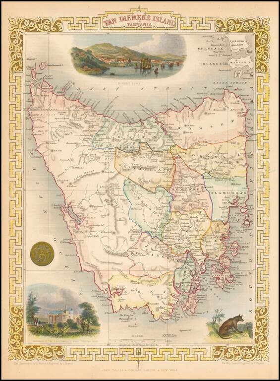
Stunning full color example of this marvelous map. Decorative Vignettes of Hobart Town, the Residence of the V.D.L Company's agent, Circular Head and two other vignettes. Engraved for R. Montgomery Martin's Illustrated Atlas. Tallis was one of the...
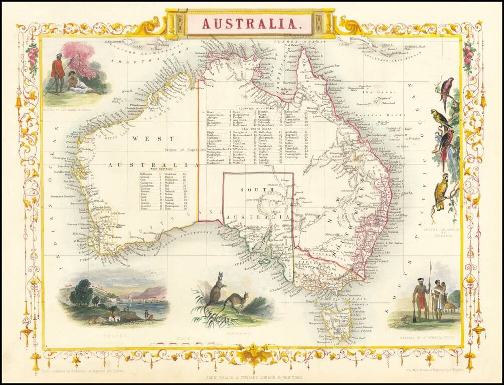
Gorgeous full color example of this wonderful map of Australia, with vignettes of Parrots, two sets of Aborigines, Kangaroos, and Sydney. Two sets of tables of counties in Victoria and NSW. Engraved for R. Montgomery Martin's Illustrated Atlas. Tallis...
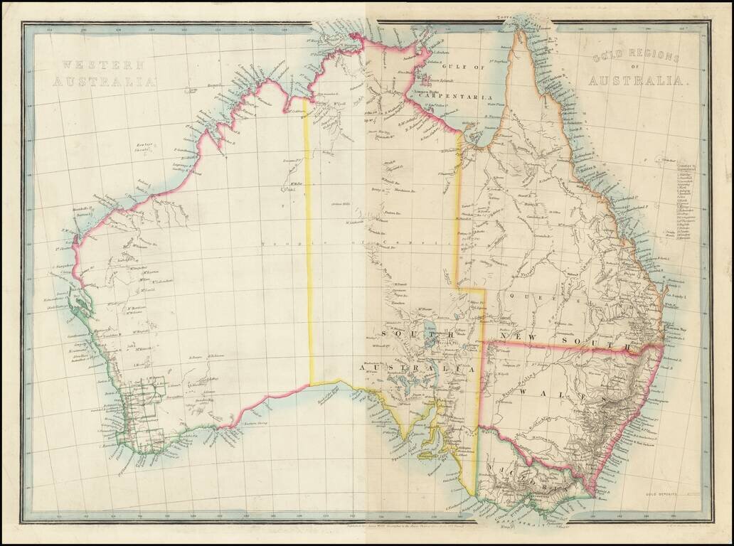
Rare early 2 sheet map of Australia, published by James Wyld (unjoined). The map shows only a few of the earliest gold rush related place names. However, the list of counties in Queensland suggests a later date -- as late as the early 1870s. The map...
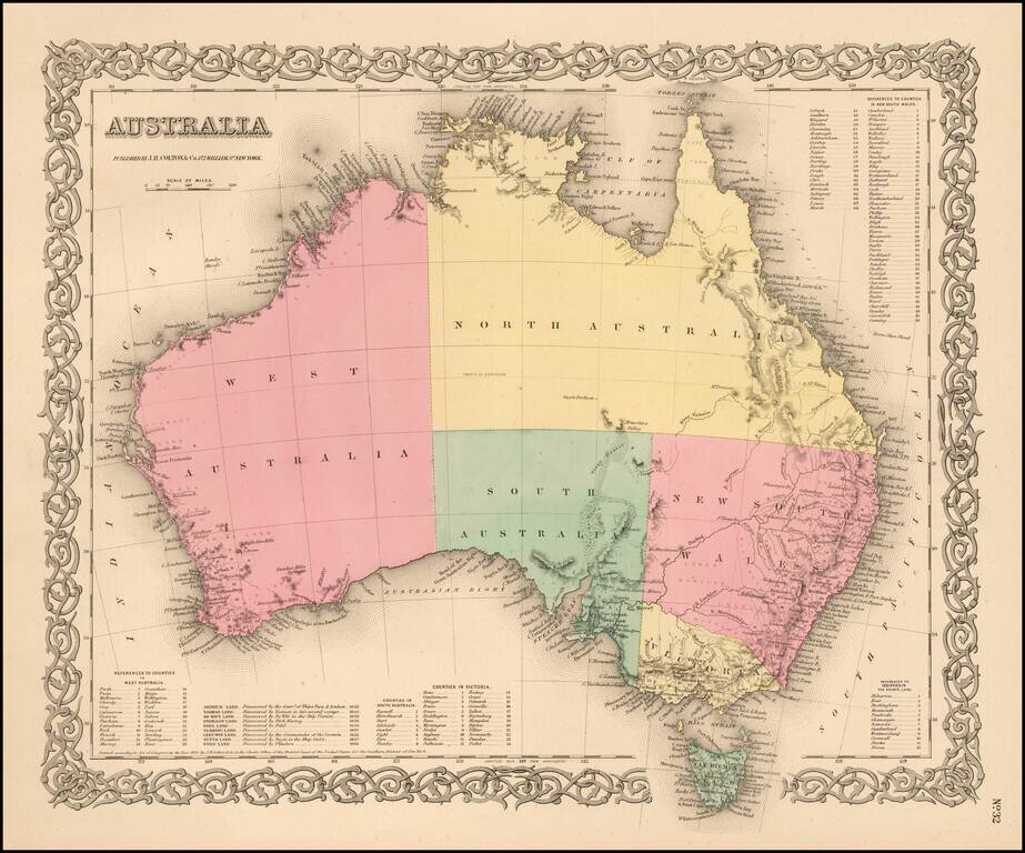
Highly detailed map of Australia, colored by provinces. Includes a key showing the various counties in each of the provinces. Shows towns, rivers, lakes, mountains, islands, etc. The interior is still highly primitive and unknown. Decorative border. A...
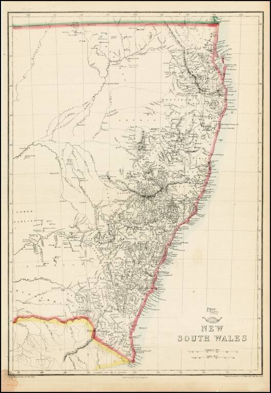
Highly detailed map of New South Wales, from the Weekly Dispatch Atlas. Includes nice early detail in the interior of NSW and fine detail along the coas. 'The Weekly Dispatch' newspaper between the years 1856 and 1862 included in each edition a map...
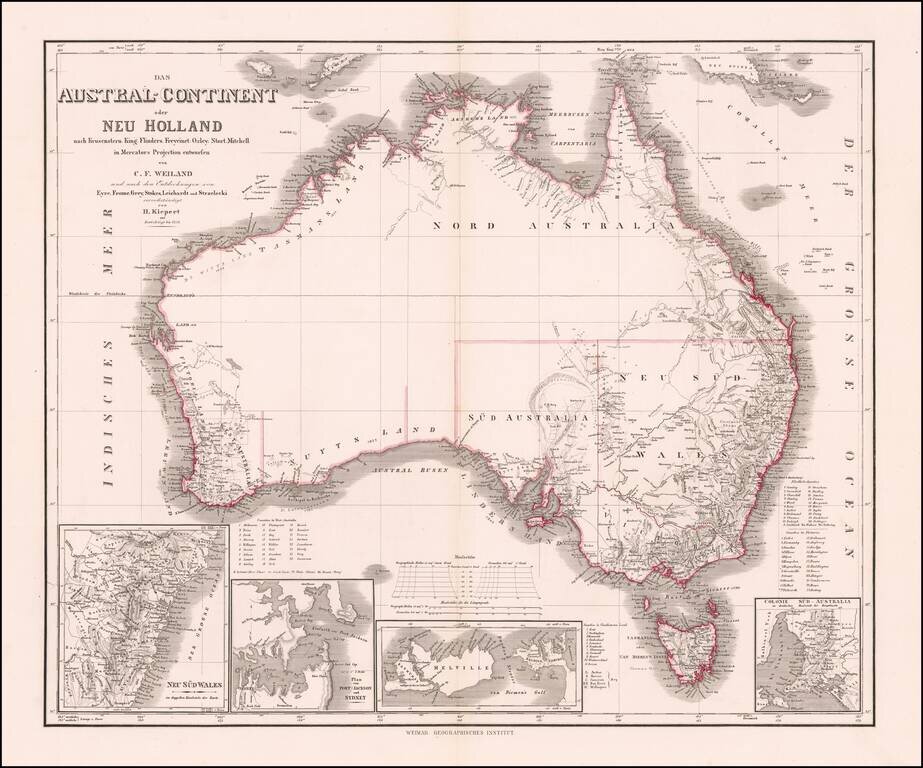
Nice example of Kiepert's fine early map of Australia, incorporating the recent explorations of Eyre, Frome, Grey, Stokes, Leichardt, und Strzeliecki.
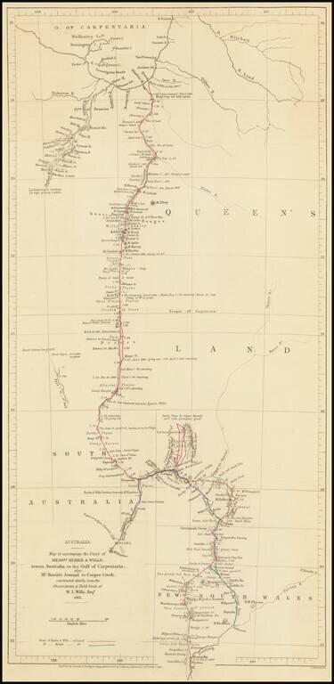
Route Map of the Burke and Wills Expedition Across Australia Detailed map showcasing the route of the Burke and Wills Expedition, which appeared in the Journal of the Royal Geographical Society to accompany an account of the expedition. The map shows...
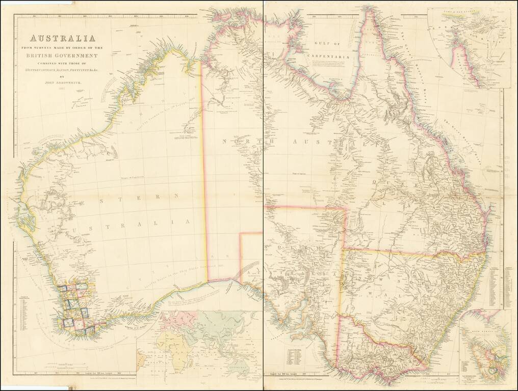
A Comprehensive Compilation of Australian Exploration Routes Into The Interior Parts of the Continent. Fine 2 sheet map of Australia, published by John Arrowsmith in London, shown in the midst of the decade of Australia's gold rushes and rapid...
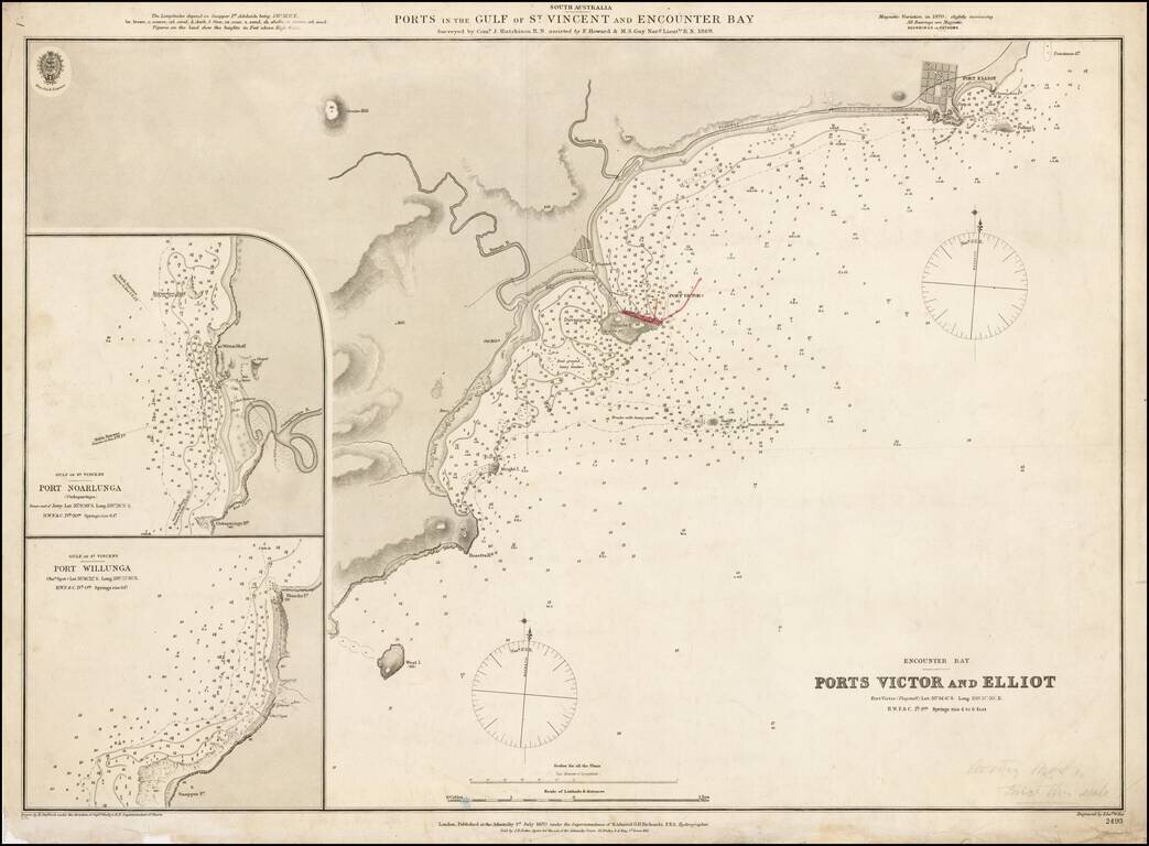
Fine example of the first edition of this early Admiralty Chart showing the ports in the Gulf of St. Vincent and Encounter Bay, published by the Admiralty in 1870. Detailed chart of the coastal region just south of Adelaide and east of Kangaroo...
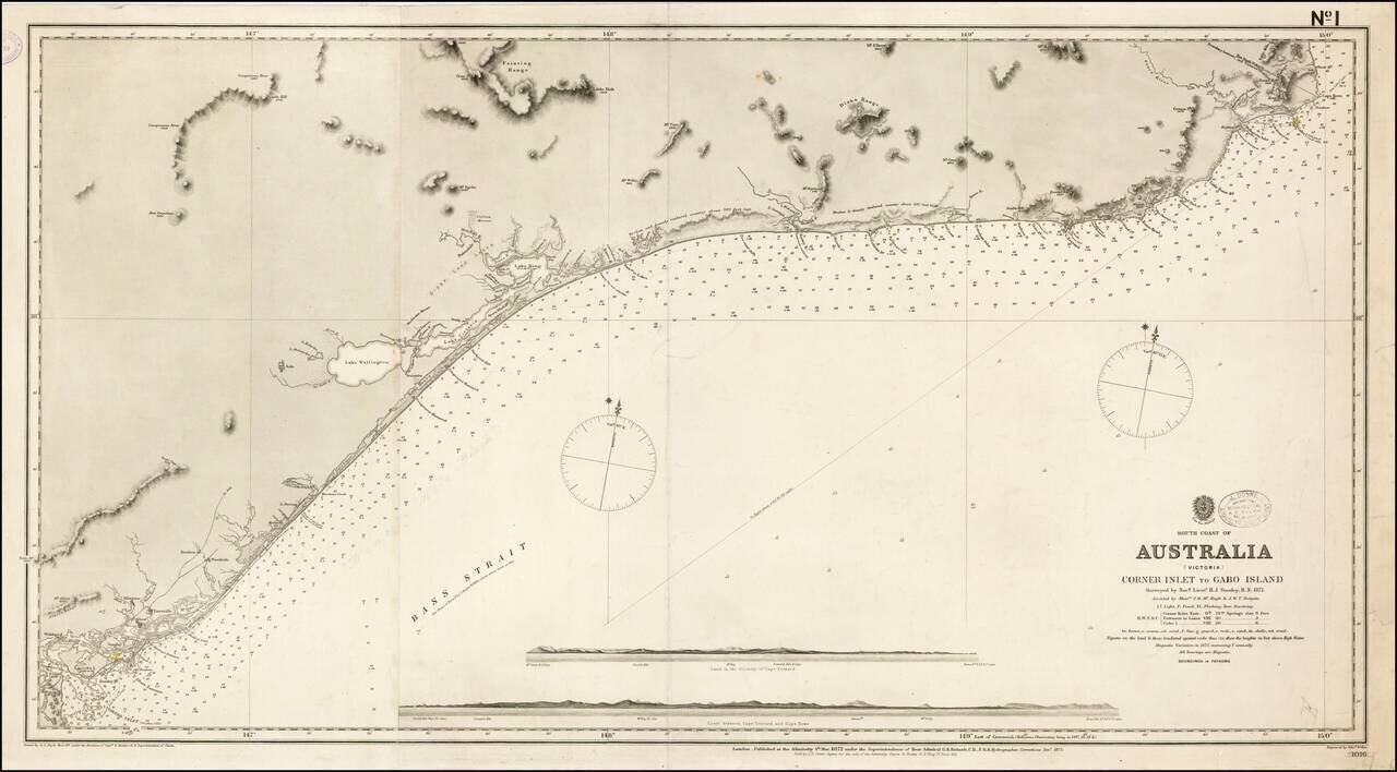
First State of this scarce working sea chart of the Victoria Coastline, to the northeast of Melbourne, published by the British Admiralty. The chart starts at the border between New South Wales and Victoria, near Cape Howe and Gabo Island, and extends...
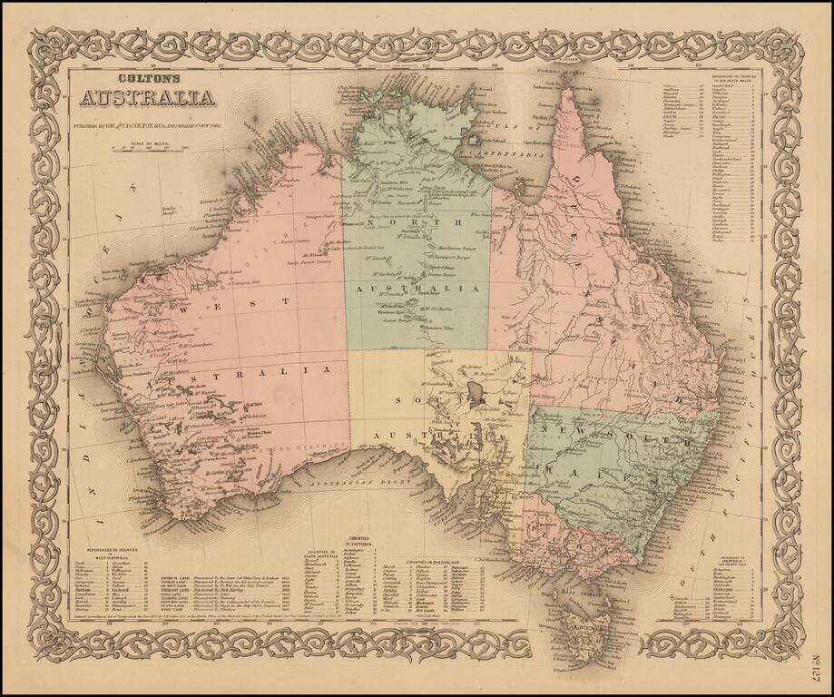
Highly detailed map of Australia, colored by provinces. Includes a key showing the various counties in each of the provinces. Shows towns, rivers, lakes, mountains, islands, etc. The interior is still highly primitive and unknown. Decorative border....
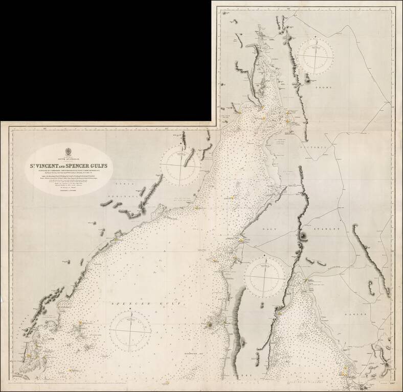
Northern sheet of this scarce working sea chart of St. Vincent and Spencer Gulfs on South Australia, published by the British Admiralty. The chart starts near Port Augusta and extends southeast to Adelaide and southwest to Port Lincoln. It includes...
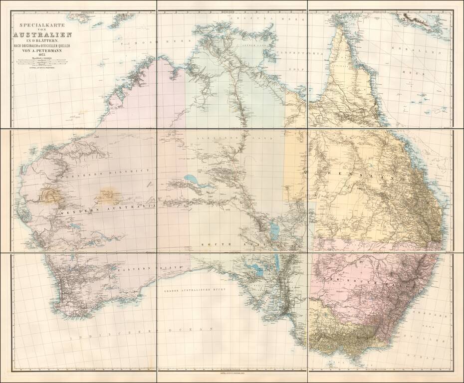
Scarce 9 sheet map of Australia, published by Augustus Petermann. Large map of Australia showing towns, river system, railways and telegraph lines and county boundaries. The map features the routes taken by a number of important overland explorers,...