Map size in jpg-format: 24.4079MiB
Click to open in high resolution (open in new tab).
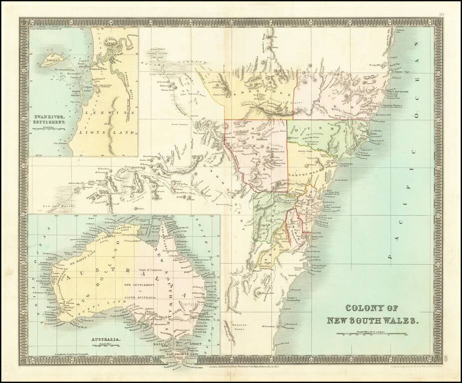
Detailed engraved map New South Wales, issued by Henry Teesdale in London in 1834.
The map includes a number of early counties. Includes a large inset of the Swan River Settlement and a map of Australia.
If you are a student, write to us in telegram: @antiquemaps and indicate what material you need and for what work you need a map in high detail. We are ready to provide material on special terms. For students only!

![[English Edition!] Maris Pacifici quod vulgo Mar del Zud](/map/small/71000.jpg)
