
Fine map of Oceana, issued shortly after Krusenstern's voyage to the region. Includes a reference to Australia as Ulimaroa and many other early annotations and place names. Australia is shown as divided between New South Wales and New Holland. The...
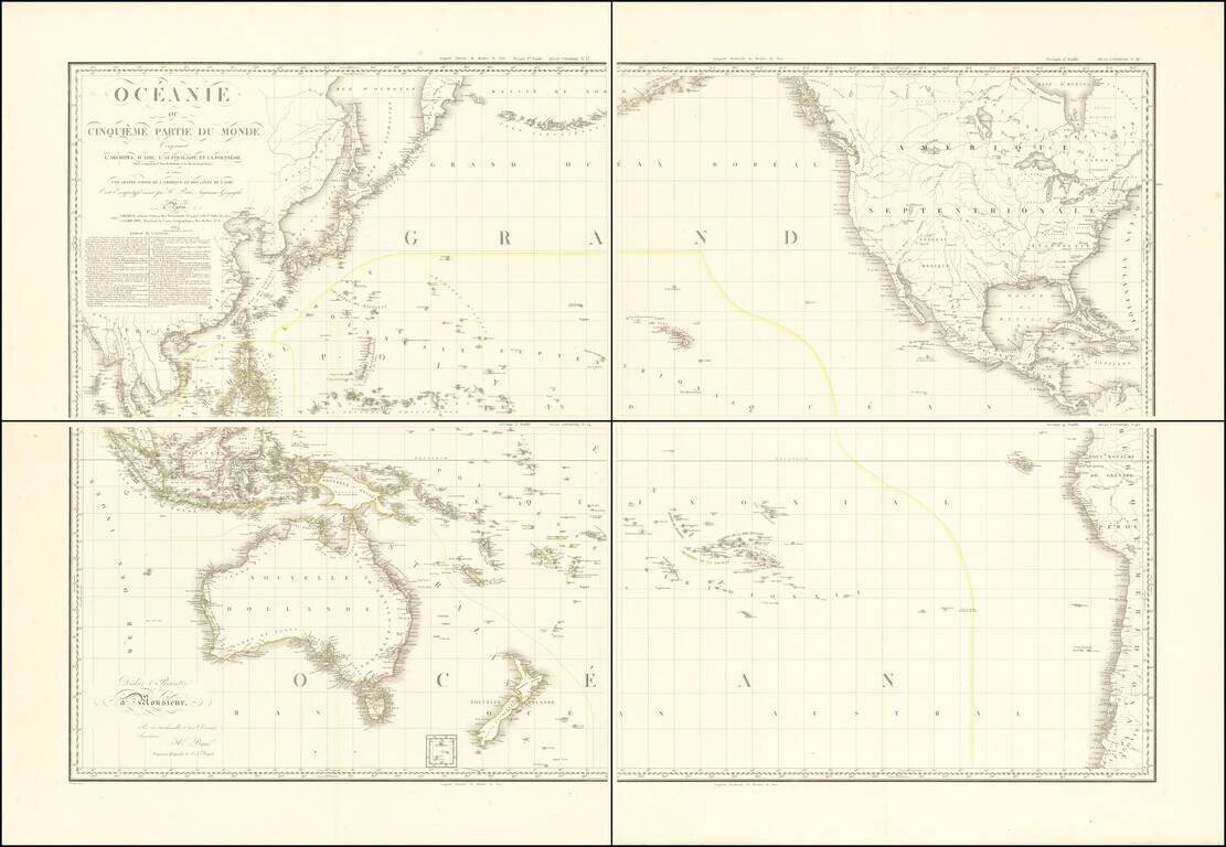
Stunning, Large-Format Map of the Pacific, the Origin of the Toponym Oceania Fine example of A.H. Brué's four-sheet map of the Pacific Ocean, first published in Paris in 1814 and here updated to 1817. The title in the upper left corner indicates...
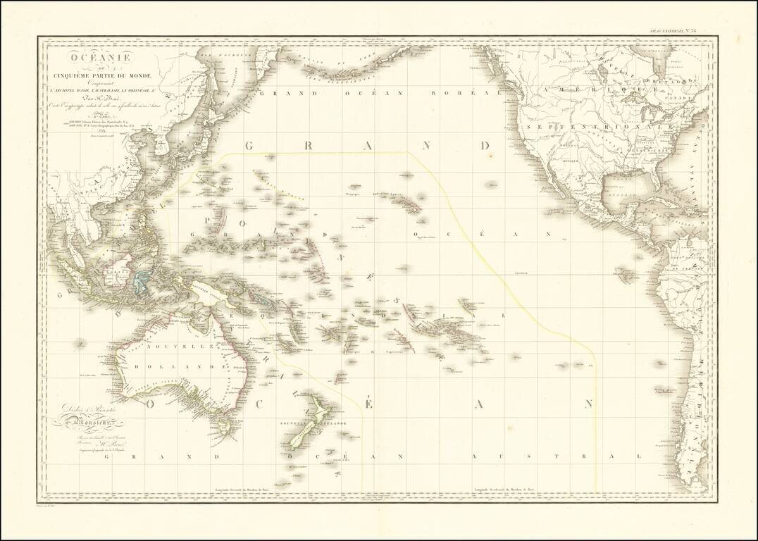
Striking Map of the Pacific, the Origin of the Toponym Oceania Fine example of A.H. Brué's distinctive map of the Pacific Ocean, first published in Paris in 1814 and here updated to 1816. The title in the upper left corner indicates that this map...
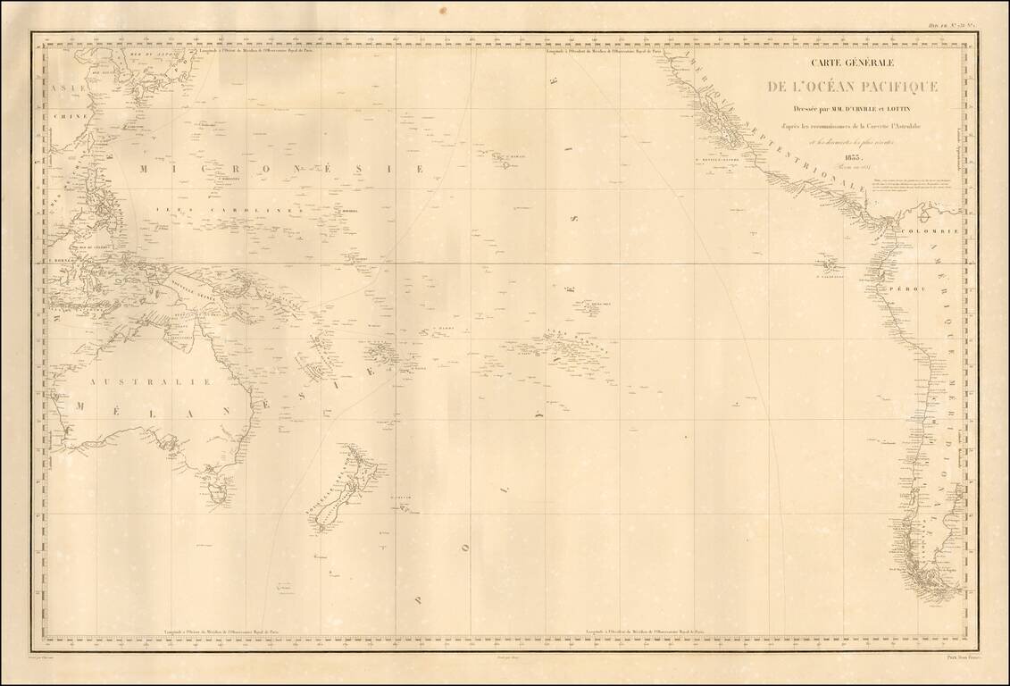
Fine separately published example of Dumont D'Urville's fine map of the Pacific, based upon his explorations. The map details the regions explored by the Astrolabe, under Dumont D'Urville's command. Rear Admiral Jules Sébastien César Dumont...
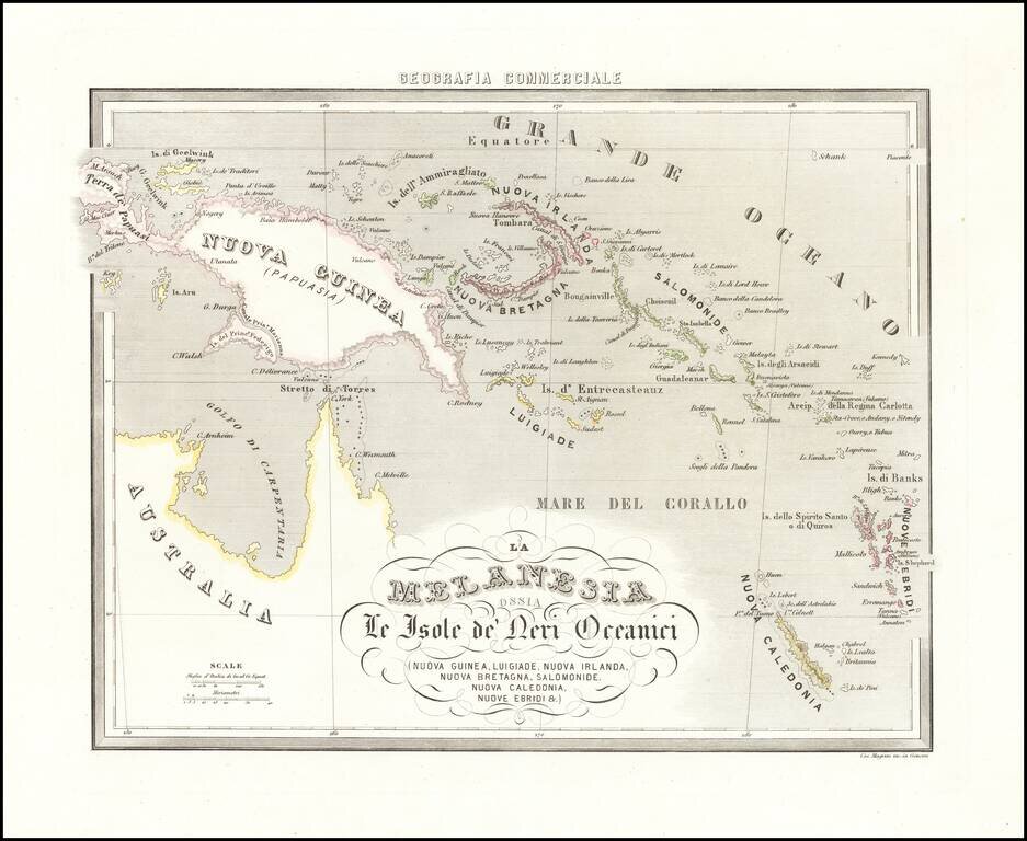
Rare map of New Guinea, the Solomon Islands, New Caledonia, the New Hebrides and the Gulf of Carpentaria, from Marmocchi's rare Geografia Commerciale.
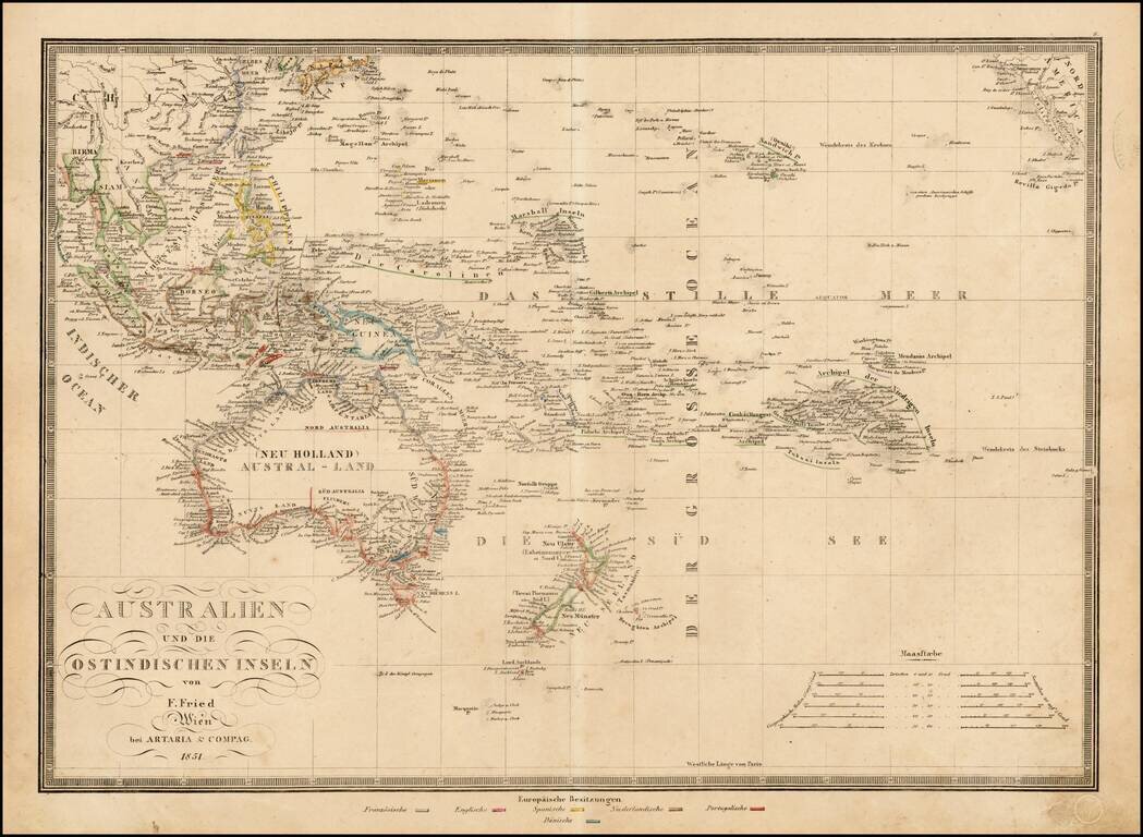
Rare regional map of Oceana, published in Vienna. The map identifies the various colonial possessions of the French, English, Spanish, Dutch, Portugese and Danish in Southeast Asia and the Pacific.
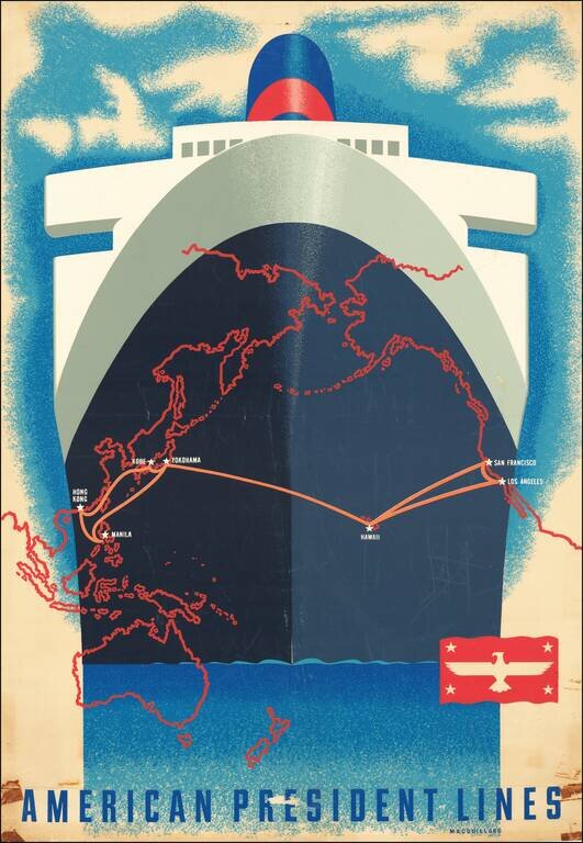
A San Francisco native, Macouillard was an accomplished artist, having studied at the California College of Arts and Crafts and the Art Students League of New York. He became Art Director of the Velvetone Poster Company in San Francisco and designed...
![[Australia and Houyhnhnms Land from Gulliver's Travels]](/map/small/54999.jpg)
Houyhnhnms Land and the Coast of Australia -- From Gulliver's Travels The Houyhnhnms are a race of intelligent horses described in the last part of Jonathan Swift's satirical Gulliver's Travels. The map shows Houyhnhnms Land to be south of...

Interesting map of the Eastern Hemisphere showing explorers' routes with dates, an early projection of Australia, with Van Diemen's Land attached and speculative coastlines along most of the Southern and Eastern Coasts. A fine map from Brion De La...
A detailed map of the Eastern Hemisphere, including a detailed depiction of the known coastlines of Australia. Four continents are shown in elegant color. Regions, cities, rivers, and more are all named and many more mountain ranges and features are...
![Representation du Cours ordinaire des Vents de Traverse qui regnent les Cotes dans la grande Mer Du Sud [California as an Island]](/map/small/54744.jpg)
Interesting map charging the course of the trade winds in the Pacific Ocean, published by Bellin in the Histoire Generale de Voyages, based upon the obseravations of Dampier. California is shown as an island. An odd piece of the southern hemisphere...

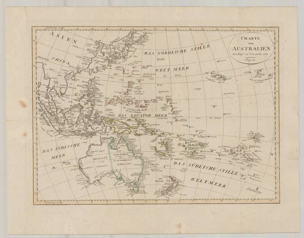
Nice example of Reinecke's map of the Western Pacific Ocean, Australia, Southeast Asia, etc. Neu Holland vormals Ulimaroa is named, along with an New South Wales. The coastline of Australia is incomplete. New Zealand is shown as two islands. Hawaii...
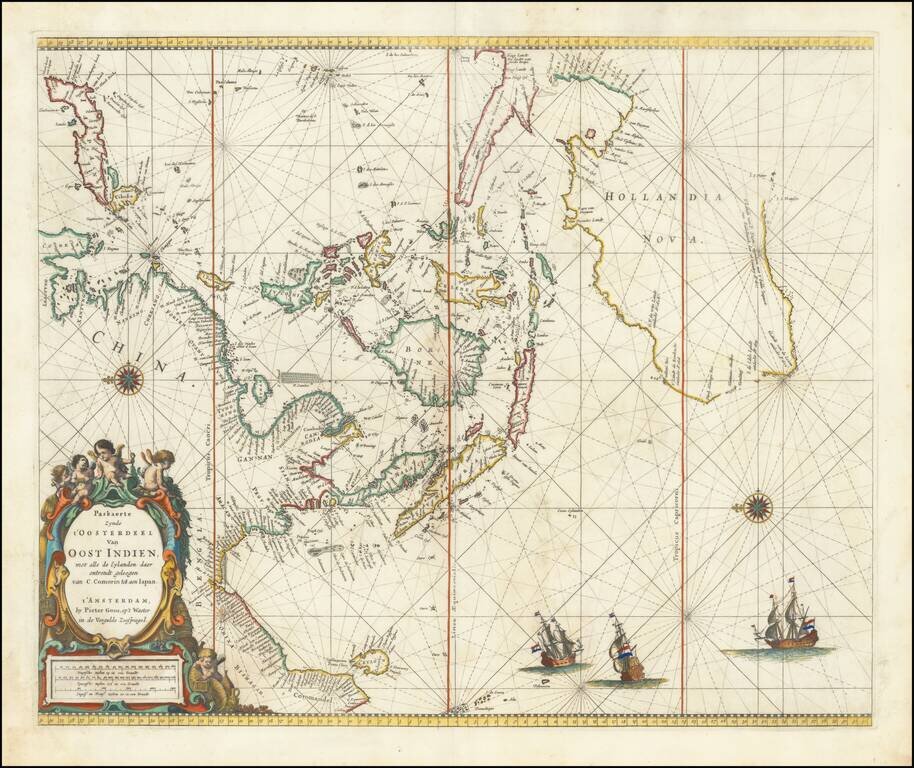
Nice old color example of Pieter Goos' sea chart of Australia, Southeast Asia, China, Japan, Korea and India. First published in Goos' Zee Atlas. The chart is the second of two charts encompassing the sea routes from Southern Africa to the Far East,...
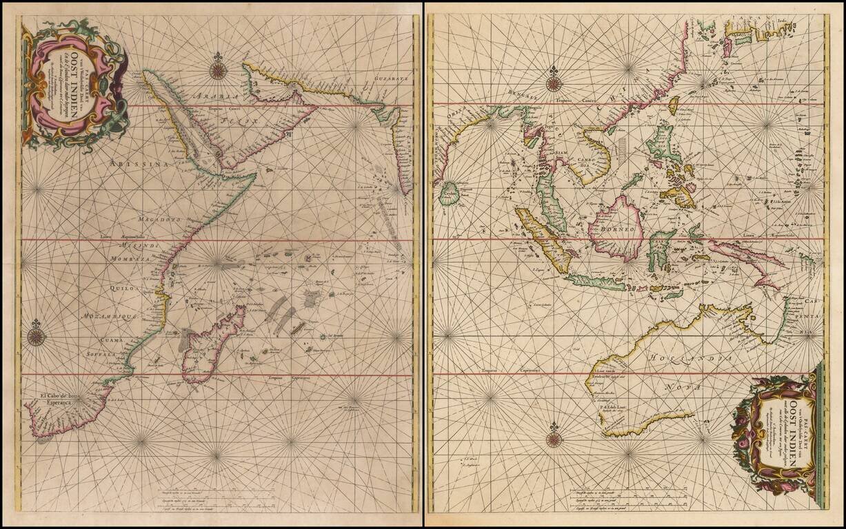
Rare Sea Chart of Australia, Southeast Asia, and the Indian Ocean from the Dutch Golden Age of Cartography Early pair of sea charts of the Indian Ocean and contiguous regions. Australia is remarkably delineated for this early date and reflects recent...
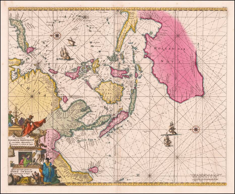
An Important Early Dutch Sea-Chart of Australia, the East Indies and Eastern Part of the Indian Ocean. Stunning original color example of De Wit's map of Australia, Southeast Asia, the Philippines, etc., first issued in 1675. The chart is...
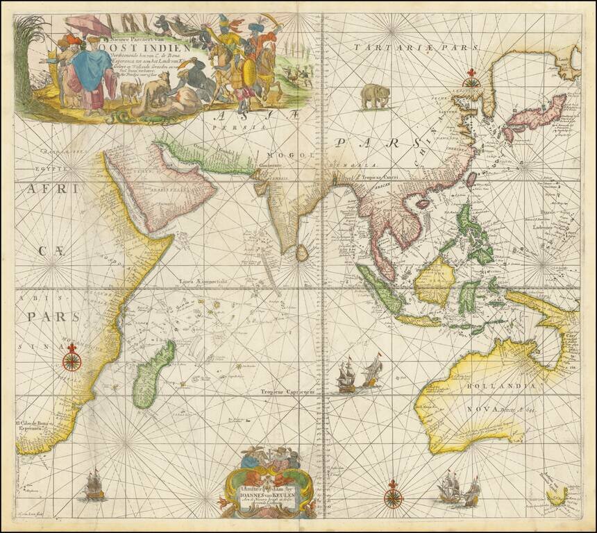
A Rare Dutch Chart of Southeast Asia, Australia, and the Indian Ocean A beautiful example of this rare sea chart of the Indian Ocean, Australia, etc., published in Amsterdam by Johannes Van Keulen. The chart appeared in Van Keulen's rare Maritime...