
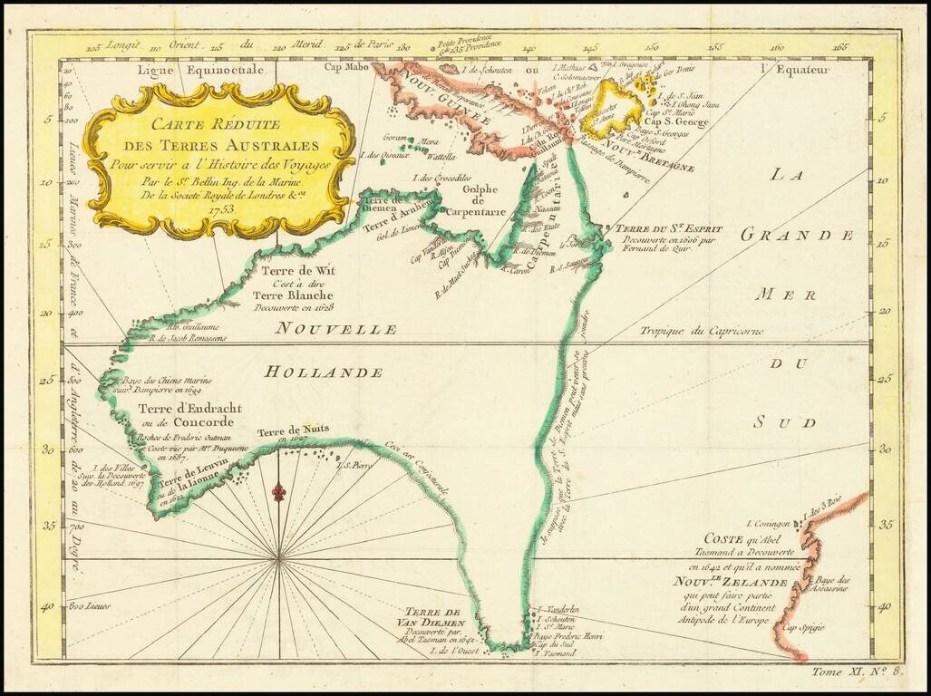
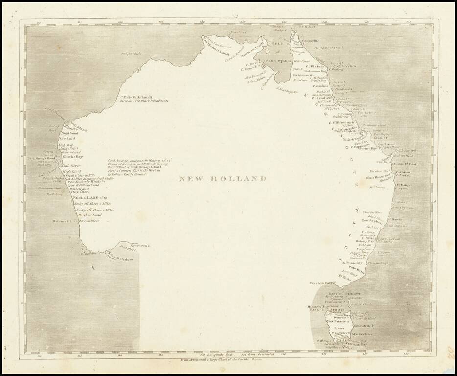
Fine Early Map of Australia with Dutch Discoveries and Innovative Geographic Theories Nice example of Bellin's map of Australia, which featured in the Abbe Prevost’s massive voyage collection, Histoire générale des voyages, published from 1746 to...

Cook’s Map of the Southern Hemisphere, Highlighting Historic Exploration toward Antarctica--French Edition French edition of Cook’s highly-detailed, large-format map of the Southern Hemisphere, showing the tracks of major voyages of exploration in...
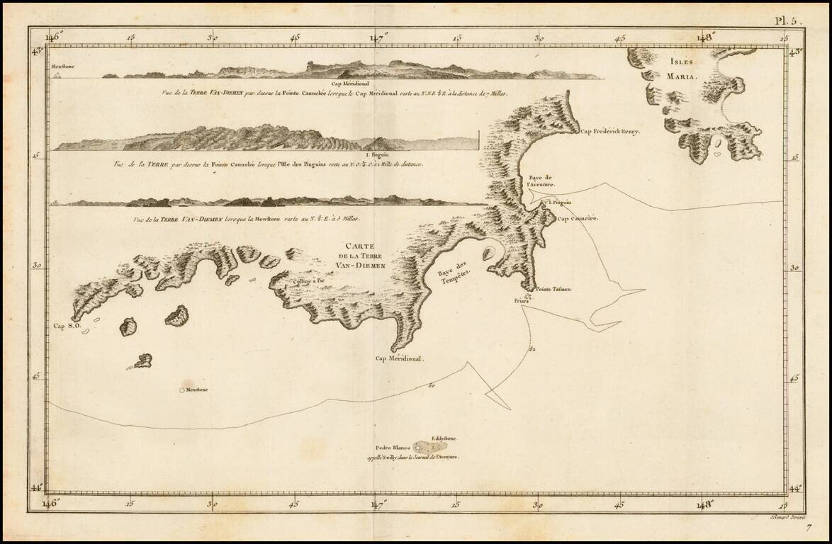
Detailed map of the Coast of Van-Diemen (Tasmania), from the French edition of the official account of Cook's voyage. Includes several profile views.
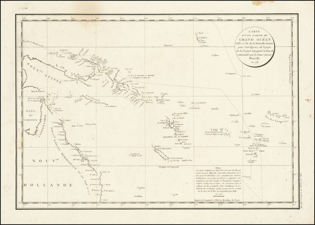
Interesting chart of Eastern Australia and part of the south-western Pacific, showing the routes taken by the Spanish explorer Don Francisco Antonio Maurelle in 1781 along the northern coast of New Guinea and across the Pacific to Fiji and Tonga,...
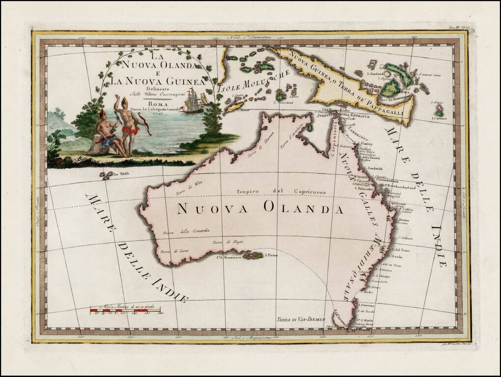
Striking early map of Australia, with large decorative title cartouche. Cassini's map of Australia is by far the most decorative map of Australia to appear in a commercially published atlas. Following Cook's landmark discovery of Australia's east...
Engraved map of Australia featuring a curious interpretation of the southern coastline. This simple map shows Van Diemen's Land as an Island, reflecting the knowledge after Flinders, but is completely devoid of coastal features in the south and...
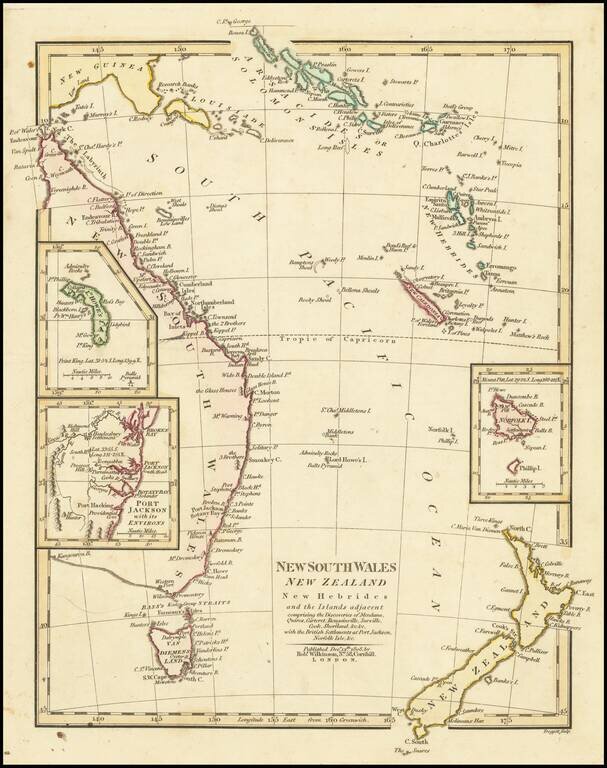
Interesting regional map of Eastern Australia and New Zealand, published by Robert Wilkinson. The map extends from the Solomon and Queen Charlotte Island in the North to New South Wales and New Zealand. Includes large insets of L. Howes and Norfolk...
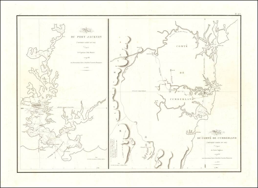
One of the Earliest Maps of Port Jackson - From the Expedition of Nicholas Baudin The two maps reflect one of the earliest scientific surveys of Port Jackson and the area around Sydney Harbor, undertaken by the French in 1802. During Nicolas Baudin's...
![[Western Australia] Carte de la Terre D'Edels et d'une partie De Celle D'Endracht (a la Nouvelle Hollande) Dressee Par M. L. Freycinet, Commandans la Goelette le Casuarina. (1801 & 1803) (Rare Separately Published Example)](/map/small/53267.jpg)
Rare Separately-Issued Chart of Western Australia from Freycinet's Surveys as Part of the Baudin Expedition Intricately detailed chart of the coastline of Western Australia, which until this time had only been sporadically encountered by Dutch ships...
![[Hunter Island / Tasmania] Carte des Iles Hunter dressee Par L. Freycinet, Commandant la Goelette le Casuarina, d'apres ses observations et celles de Mr. Boullanger Ingenieur Hydrographe -- December 1802. (Rare separately published example)](/map/small/53891.jpg)
Rare Separately Published Example of Freycinet's Rare and Separately Issued Chart of Hunter Island Striking separately published example of the Freycinet chart of Hunter Island, in the waters off Tasmania, or Van Diemen's Land. The chart is drawn...
![[]Hunter Island / Tasmania] Carte Trigonometrique des Iles Hunter dressee Par L. Freycinet, Commandant le Casuarina -- December 1802 (Rare Separately Published Example)](/map/small/53937.jpg)
Rare Separately-Issued Example of Freycinet's Trigonometric Survey of Hunter Island, off the Coast of Tasmania, the Earliest Detailed Charting of the Area Rare separately published example of this fine intricately detailed chart of the waters off...
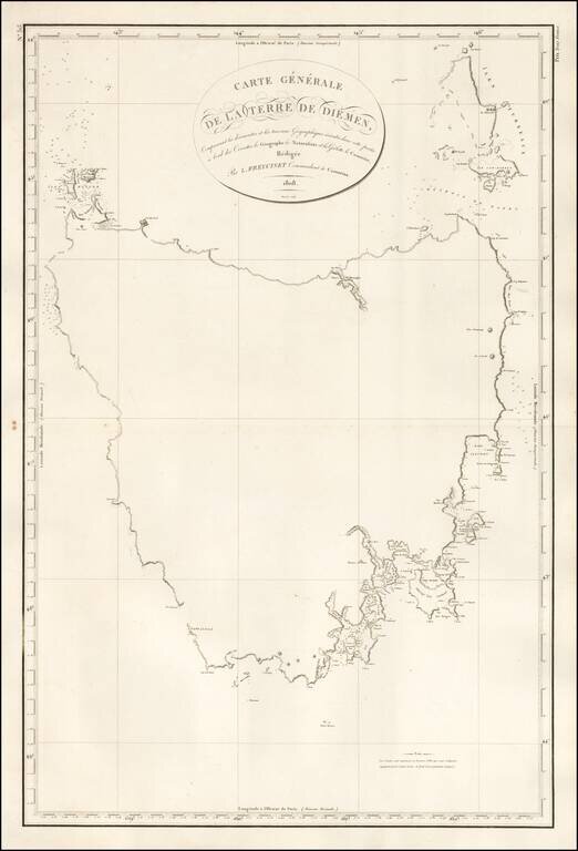
First Map of the Entire Island of Van Diemen's Land-Striking, Rare, Separately-Issued Chart of Tasmania from the Baudin Expedition Detailed chart of the island of Tasmania as surveyed during the Baudin expedition and published by expedition member...
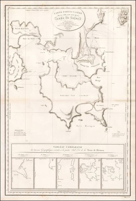
Rare, Detailed, Separately-Issued Chart of Southeast Van Diemen's Land from the Baudin Expedition Comprehensive chart of the southeast portion of the island of Tasmania as surveyed during the Baudin expedition and published by expedition member Louis...
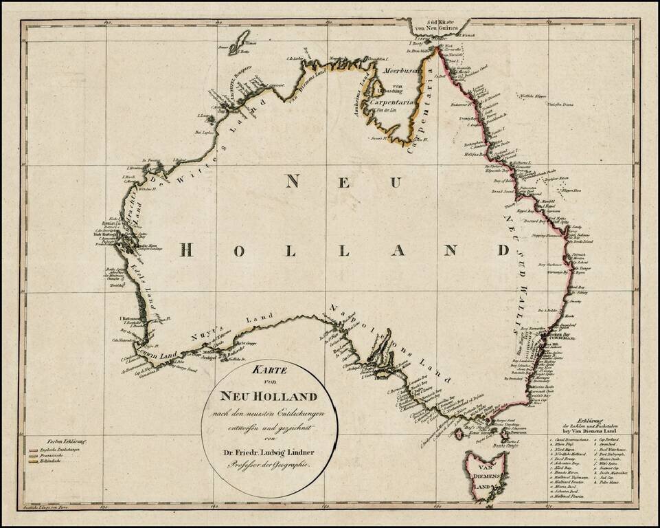
An early map of Australia showing a completed coastline, Bass Strait and the discoveries of both Baudin and Flinders. The coloring on the coasts is coded to denote the discoveries made by the English, French and Dutch. The map identifies most of...
![[Sydney, Australia] Panorama du Port Jackson et de la ville de Sidney [i.e. Sydney], pris du'une colline pres de la riviere de Parramatta](/map/small/39898sb.jpg)
Rare single sheet French edition of this highly important panoramic aquatint view of Sydney, based upon Major James Taylor's 3 sheet panorama published in London, in 1823. This remarkable panorama is perhaps the earliest single sheet version of...
![Western Australia containing the Settlements of Swan River and King George's Sound… [with ] Van Diemen Island](/map/small/48838.jpg)
Two highly detailed maps of the regions, colored by counties. Shows towns, rivers, mountains, lakes, roads, islands, etc. Highly detailed maps of two newly settled regions of Australia. The Society for the Diffusion of Useful Knowledge was active from...