Map size in jpg-format: 28.2467MiB
Click to open in high resolution (open in new tab).
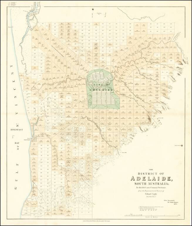
The First Map of Adelaide
Rare cadastral map of the area around Adelaide, published by John Arrowsmith.
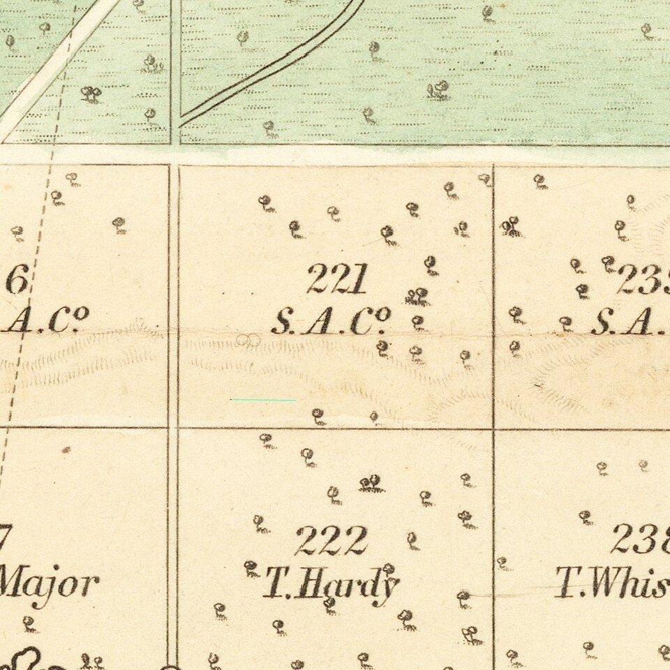
The map illustrates Adelaide and the region surrounding, centered on the 'City of Adelaide', covering an area from Port Adelaide in the north down to present day Brighton in the south The outlying area is divided into 443 blocks of land, the smaller lots at 80 acres each with the larger lots at 134 acres each. Lots sold are shown in color, with the names of the owners shown. Trigonometrical survey stations are marked with dots enclosed in open circles.
The first state of the map includes Arrowsmith's address at 35 Essex Street.. In Adelaide the map shows the roads, canals, schools, store, barracks, cemetery and hospital. There is an indication to prospective buyers of areas where the streams dry up in summer. The relief is shown by hachures and hill shading and vegetation is indicated. Tributaries of the River Torrens are shown.
The map would later be re-issued in First Report from the Select Committee on South Australia (British Parliamentary Papers) in 1841.
As noted by Prescott:
The creation of the Province of South Australia took place in 1836 after many years of negotiation with the Colonial Office, the first proposals having been made by Edward Wakefield as early as 1829, and other proposals made later by the National Colonization Society and the South Australian Land Company. Eventually the South Australian Association's members managed to persuade Parliament to pass the South Australian Act. Authority for the new province was to be shared between the Colonial Office and the Colonization Commission. The surveying and allotment of land was achieved by March 1837 but the first ballot for country sections was delayed until May 1838. This is the subject matter of Arrowsmith's map of Adelaide which shows the allotment numbers and names of buyers.
This map was first issued in February 1839 and again in February 1840. Both these states are also found with additional parliamentary imprints in Parliamentary reports of one kind or another. It is also found at the end of Robert Kearsley Dawsonís Report on surveying. The map was issued over a period of just over two years and is found in eight states. . . .
Adelaide
The South Australia colony was founded in 1836.The first surveys were supervised by Colonel William Light, surveyor general of the colony. 150,000 acres were surveyed around Adelaide using a strict trigonometric methodology, before the directors of the colony instructed a switch to faster rectangular running surveys.
The first governor of the new colony was Captain John Hindmarsh who arrived December 28, 1838. In 1840 Adelaide was incorporated (the first incorporated city in Australia).
In 1840 Adelaide had a population of over 2,000. By 1850 Adelaide had a population of over 14,000. In 1900 Adelaide had a population of 162,000.
Rarity
This is the second example of the map we have ever seen. We found no auction or dealer records for the map.
If you are a student, write to us in telegram: @antiquemaps and indicate what material you need and for what work you need a map in high detail. We are ready to provide material on special terms. For students only!

![[English Edition!] Maris Pacifici quod vulgo Mar del Zud](/map/small/71000.jpg)
