
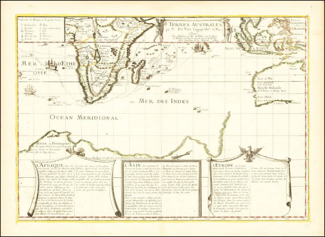
Antique Map of the Western Indian Ocean -- First State of the Second Printed Map to Show Gonneville's Land Fine early map of the Dutch Discoveries in the New Holland and the Indian Ocean, published in Paris by Pierre Du Val, the second printed map to...
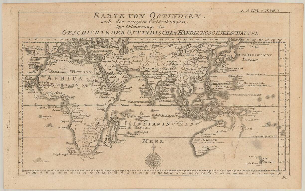
Rare map of Australia and the Indian Ocean, from Johann Justinus Gebauers' Algemeine Welthistorie . . . Zeit XXVI. Theil. Histoire Der Neuern Zeiten. VIII Theil. The map presents a fine depiction of Australia (Neu Holland) on the eve of the arrival of...

An 18th Century English Wall Map of Asia, Australia & The Indian Ocean Nice example of the 6 sheet Laurie and Whittle wall map of Asia, Australia and the Indian Ocean, first published in Asia in 1794. The map in its complete state covers an area...

Penelope Steel's Map of the Indian Ocean -- Used in an American Circumnavigation in the 1840s. Rare four-sheet blueback sea chart of the Indian and Pacific Oceans, focusing on the trading routes from the east coast of Africa to Canton and New Zealand,...
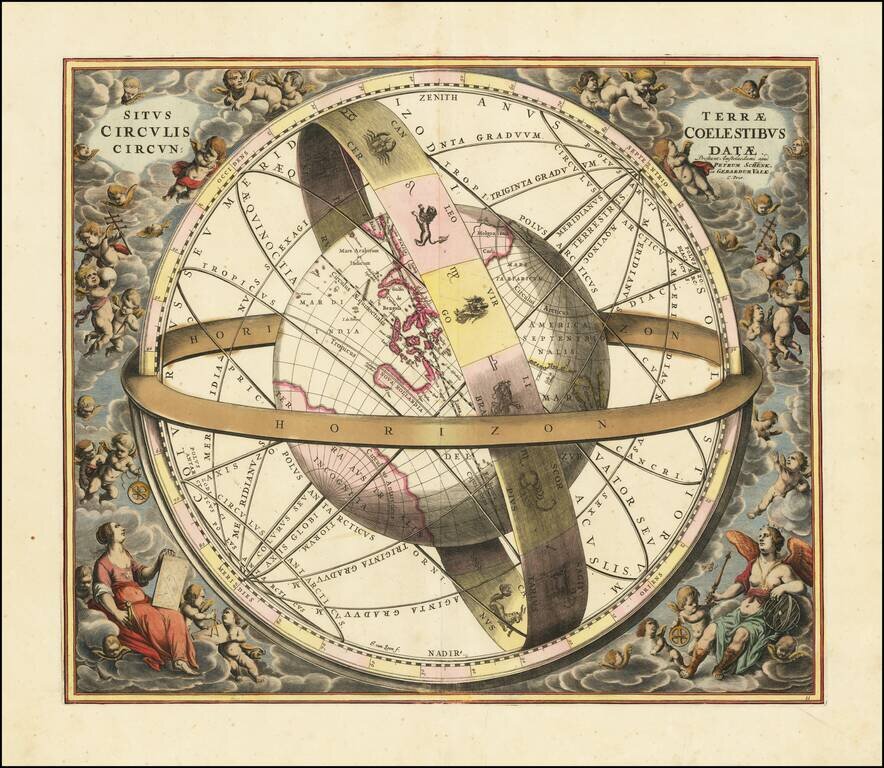
Striking original hand-color celestial chart, showing a Ptolemaic model of the Universe, with the earth in its relation to the plane of the ecliptic, from the 1708 Valk & Schenk edition of Andreas Cellarius' Harmonia Macrocosmica seu Atlas...

Fine example of Johannes Van Loons' sea chart of the Pacific Ocean, extending from Australia, New Zealand and Japan to California. Van Loon's chart is among the earliest regional maps to focus on the Dutch discoveries in New Zealand and Australia. Van...
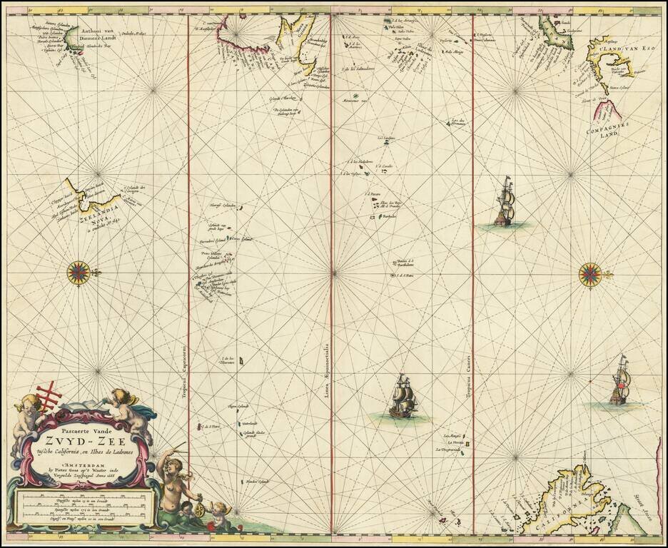
Rare Dutch Sea Chart of the Pacific Fine old color example of Pieter Goos' sea chart of the Pacific Ocean, extending from Australia, New Zealand and Japan to California. Oriented with west at the top, Goos's chart is among the earliest regional maps...

The Return of the First Fleet -- Fundamental Map for Australian Collectors A highly important map in the history of settling Australia, with the present example including annotations in pencil noting a ship wreck and other details. The track of the...
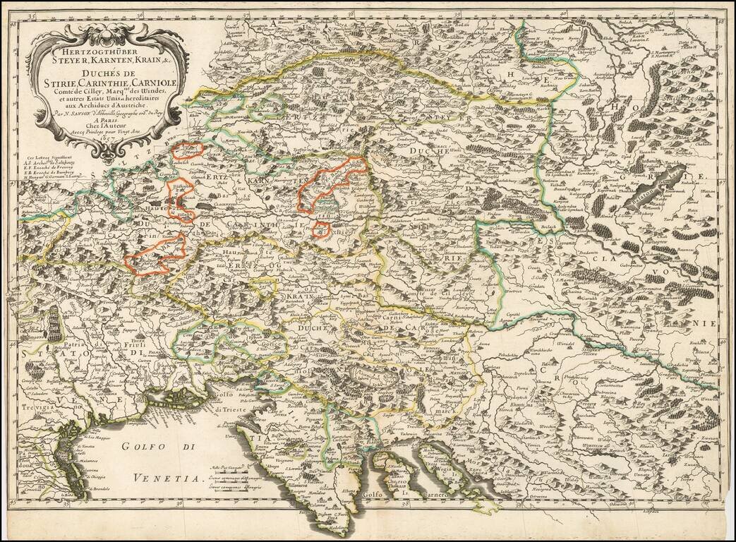
Nicolas Sanson's 1657 double-page engraved map of the Gulf of Venice in the southwest extending to southeastern Austria in the north, and to Croatia in the southeast. The map shows towns, rivers, lakes, mountains, islands and other details.
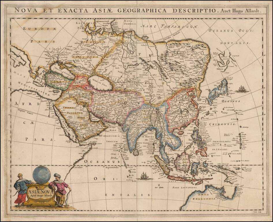
Rare Hugo Allard map of Asia and the north part of Australia. The map includes a nice representation of the Philippines. Korea is shown as a strangely shaped peninsula. China and the Great Wall are located. The depiction of Yedso, Comps. Landt and...
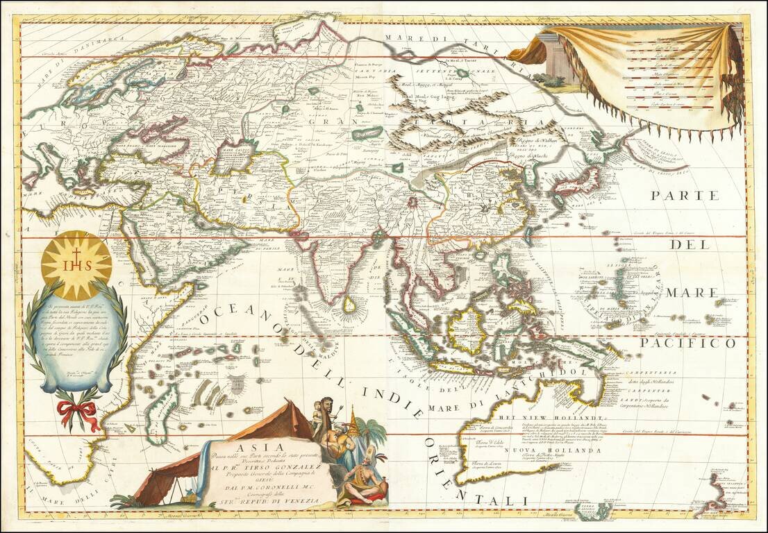
Striking Example of Coronelli's Striking Two-Sheet Map of Asia Fine example of Coronelli's detailed map of the Asian continent. The map shows the latest discoveries in Southeast Asia and the Pacific, and is dedicated to the Jesuit missionaries at...
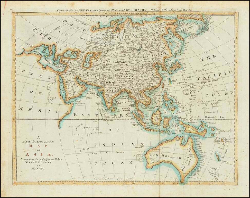
Detailed map of Asia and Australia, which appeared in Middleton's Geography. Shows a still largely speculative Southern Australian coastline. Among the most notable features is the reference of the Sea of Korea.
![Asia [with large inset of Australia]](/map/small/67619.jpg)
Detailed map of Asia, including part of Polynesia and a large inset of Australia. Includes color key noting the colonial possessions of Britain, France, Spain, Portugal, Holland and independent islands. Decorative border. An excellent map from the...
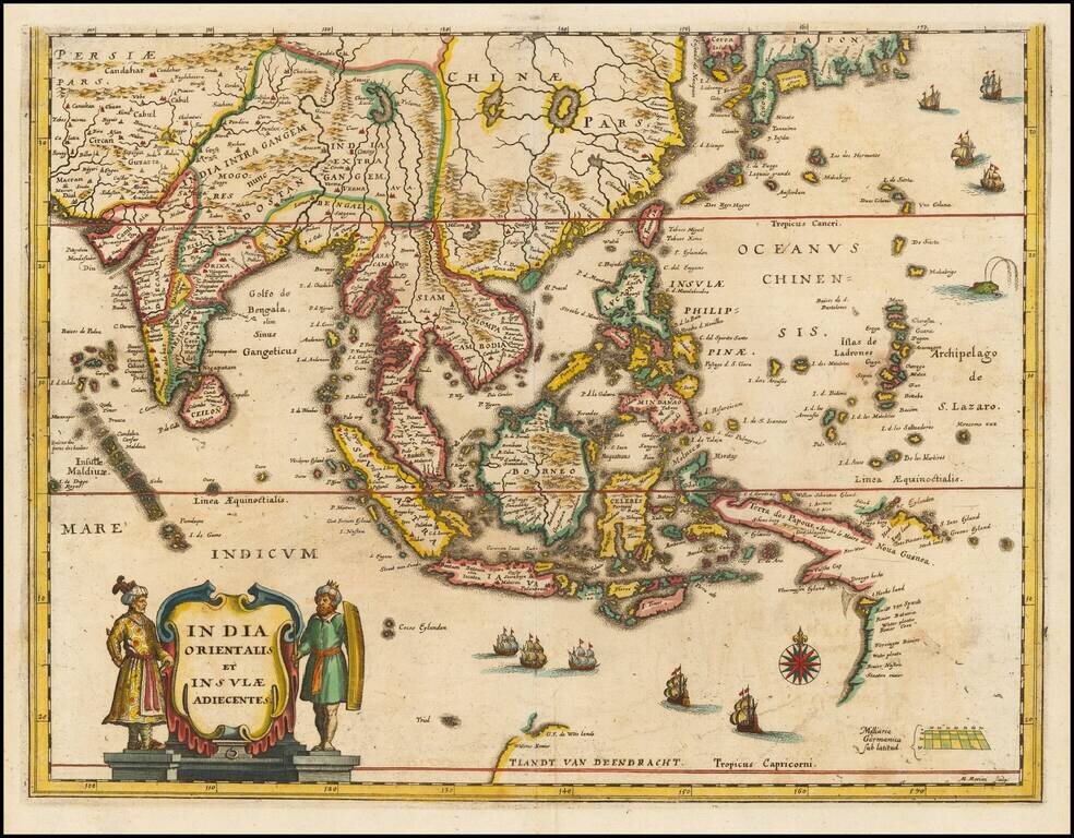
Southeast Asia with an Early Depiction of Northwestern Australia Based on Gerrit Frederikszoon de Witt's Discoveries in 1628 Scarce decorative map of Southeast Asia, China, India, the Philippines and western Oceana, along with the newly discovered...
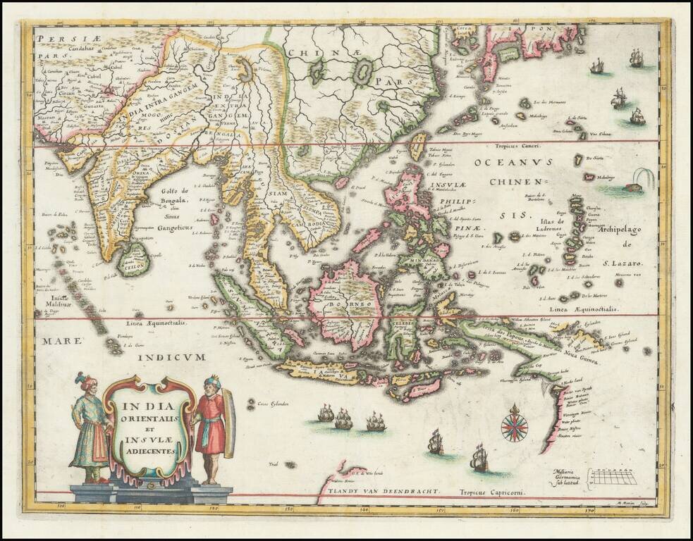
Southeast Asia with an Early Depiction of Northwestern Australia Based on Gerrit Frederikszoon de Witt's Discoveries in 1628 This is a scarce decorative map of Southeast Asia, China, India, the Philippines, and western Oceania. Perhaps the most...
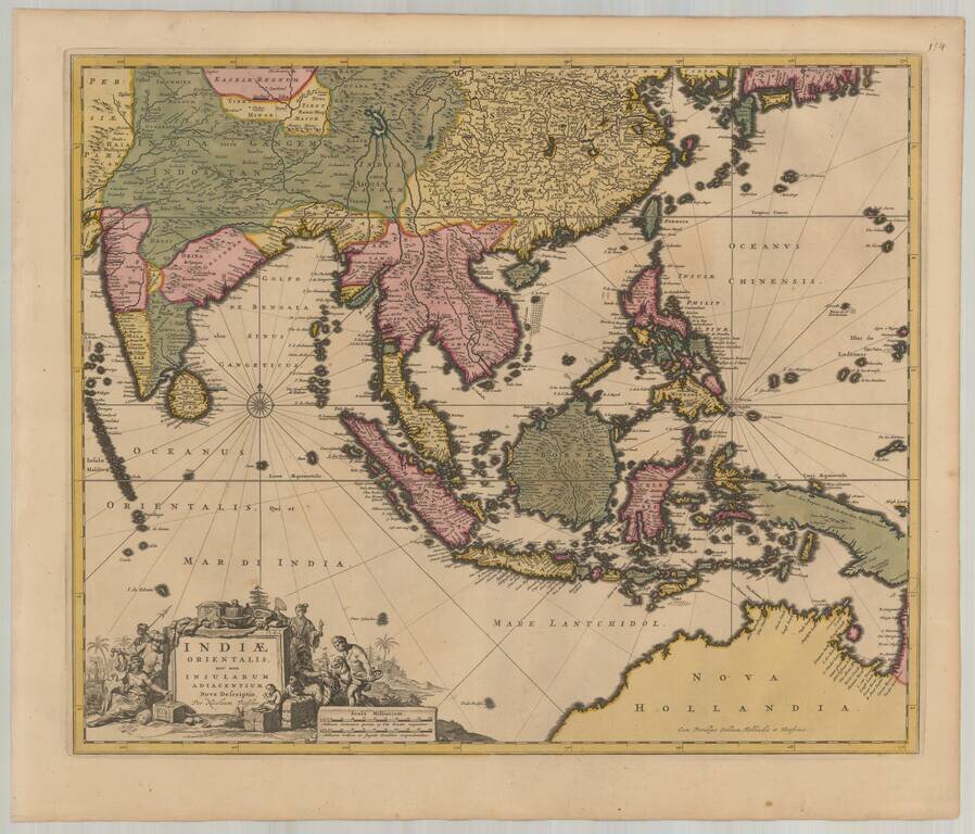
Detailed map of Southeast Asia and the North Coast of Australia, published in Amsterdam by Nicolas Visscher. The map extends from India and the Maldives in the west to New Guinea and the southern coast of Japan in the east, centered on the Stratis of...