Map size in jpg-format: 7.15987MiB
Click to open in high resolution (open in new tab).
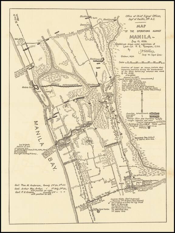
Detailed military map of the area between Malate and Pasai, to the south of Manila, published by American Army Signal Corps in October 1898.
The map notes the position of various American Troops during the the Naval bombardment of Manila, before the Army 1st Brigade advanced toward Manila.
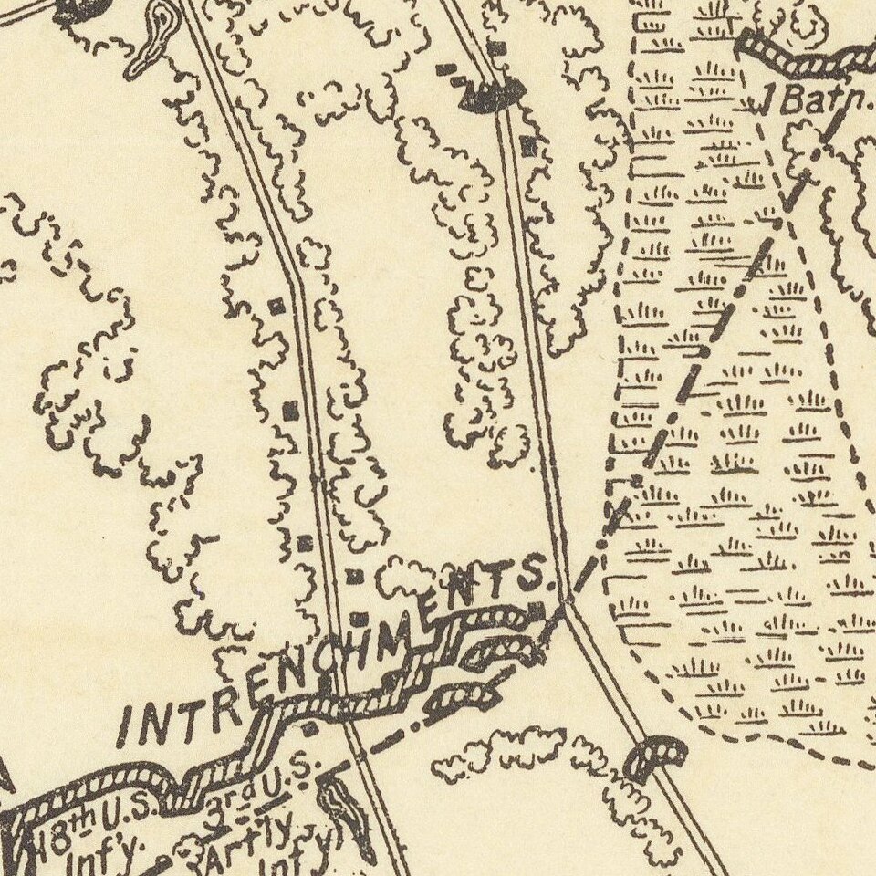
The key locates the entrenchments of the Americans, Insurgents and Spanish, along with telegraph lines, stations, buildings, churches and roads.
Among the American commanding officers was General Arthur MacArthur (father of Douglas MacArthur), who would go on to become the military Governor-General of the American-occupied Philippines in 1900.
If you are a student, write to us in telegram: @antiquemaps and indicate what material you need and for what work you need a map in high detail. We are ready to provide material on special terms. For students only!
![[Martin Behaim Globe / Book] Pars Globi terrestris Ao. 1492 a Martino Behaim Equite Lusitano Norimbergae confecti Delineavit Christoph. Theoph de Murr 1778 (bound with:) Diplomatische Geschichte des Portugesischen berühmten Ritters Martin Behaims](/map/small/68828.jpg)
![Il Disegno Della Terza Parte Dell' Asia [Gastaldi's Wall Map of SE Asia with extra panels!]](/map/small/30554hbp.jpg)
![Chinae, olim Sinarum regionis nova descriptio. auctore Ludouico Georgio. [English Edition!]](/map/small/71123.jpg)