
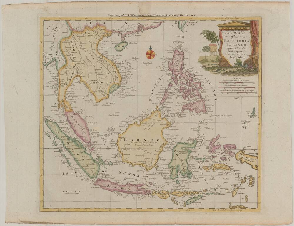
Scarce map of the Philippines and Southeast Asia, published for Millar's New Complete & Universal System of Geography. The map is centered on the Philippines and Brunei, and includes a decorative cartouche.
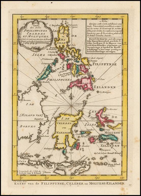
Detailed map of the Philippines and islands to the south, including the Moluques, part of the New Guinea, Gilolo, Timor and parts of Borneo and Java. From a Dutch edition of Bellin's Atlas.
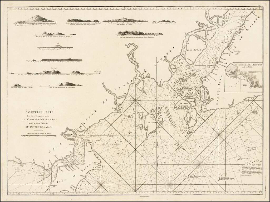
A rare sea chart, including a map of Singapore and the Straits of Malacca and Banca, which appeared only in the second and enlarged edition of Mannevillette's Le Neptune Oriental. Important early chart of the East Coast of Sumatra, the eastern portion...
![[Untitled Map of the Spice Islands--Celebes, Gilolo, etc.] [Published in Manila!]](/map/small/58611.jpg)
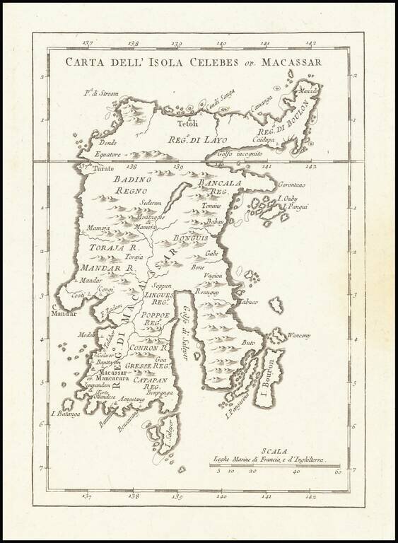
Extremely rare map of part of the Spice Islands (Sulawesi and Halmahera), published by Cipriano Bagay in Manila, one of the few maps published in the Philippines in the 18th Century. The map extends from an area called "Allias Buen-Fin" in the north...
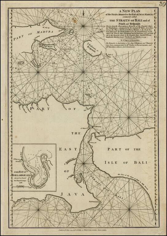
Scarce sea chart of the Straits of Bali and part of Madura, with a large inset of the Bay of Ballambouang, showing the narrow channel between the Isand of Bali and East Java. Includes extensive details and soundings. The northeastern part of Borneo is...
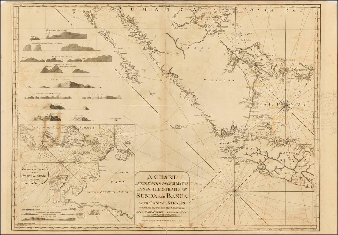
Detailed sea chart the southern part of Sumatra, western Java and neigbhoring islands, with a large inset of the Straits of Sunda. The present example includes some pencil notes showing sailing directions and mentioning Hendrick Rock. Includes numerous...
Highly detailed map of Southeast Asia, covering the region between Formosa and Hainan islands in the North and Australia in the South. Excellent detail in the Philippines and South East Asia. Robert Wilkinson was active in London as a cartographic...
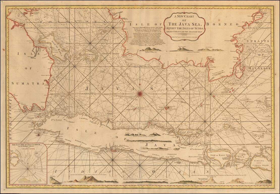
Detailed sea chart of the region from the southern part of Borneo, Sumatra and Pulau Bangka to Java, Bali and the islands to the east, published in London by Laurie & Whittle. The chart includes sailing direction, numeous profile views of the...
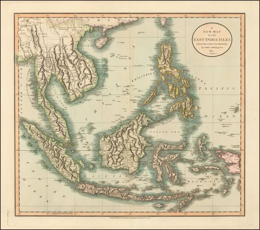
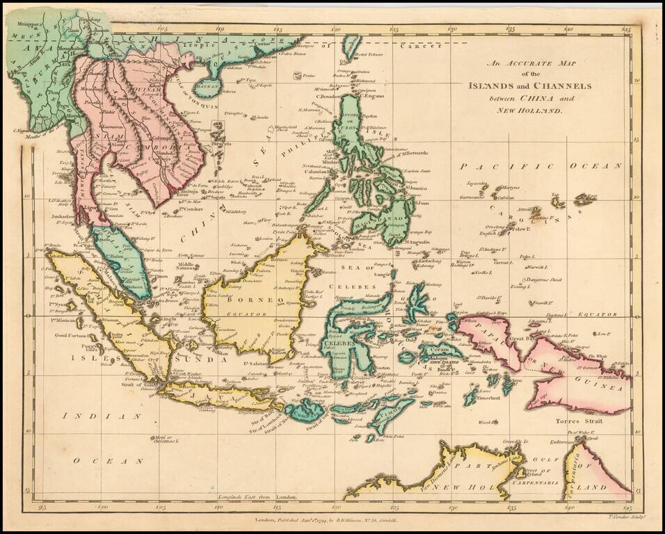
Large detailed map of Southeast Asia, from John Cary's atlas. Extends from Mergui Archipelago, Straits of Malacca and Sumatra to Papua New Guinea, Pelew Islands, and part of Formosa. Extremely detailed.
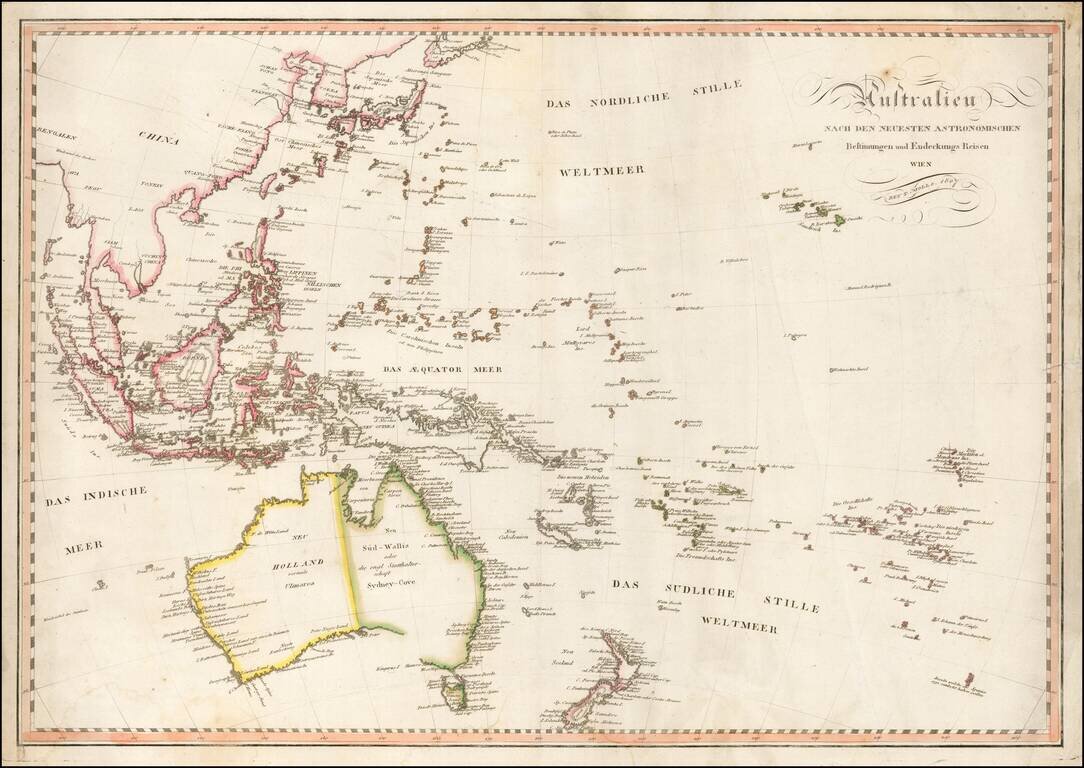
Fine early map of Oceana and Southeast Asia, published in Vienna by Tranquillo Mollo. Mollo's map includes a marvelous early depiction of Neu Holland vormals Ulimaroa. The coastline of Australia is still incomplete andther is no detail in the...
Detailed map of the Philippine Islands and Southeast Asia, published in London in 1805. The map is centered on the China Sea, with a fine detailed presentation of the Philippines. The Straits of Sincapore is noted, as is the Dutch Factory on the...
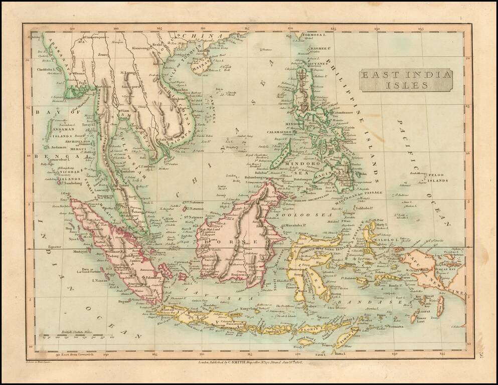
Detailed map of SE Asia, centered on Borneo. Extends from the Gulf of Tonquin and the southern tip of Formosa to Papua or New Guinea, Mimor, Java and Sumatra. Excellent detail. Shows towns, rivers, mountains, islands, etc. From Smith's General Atlas....
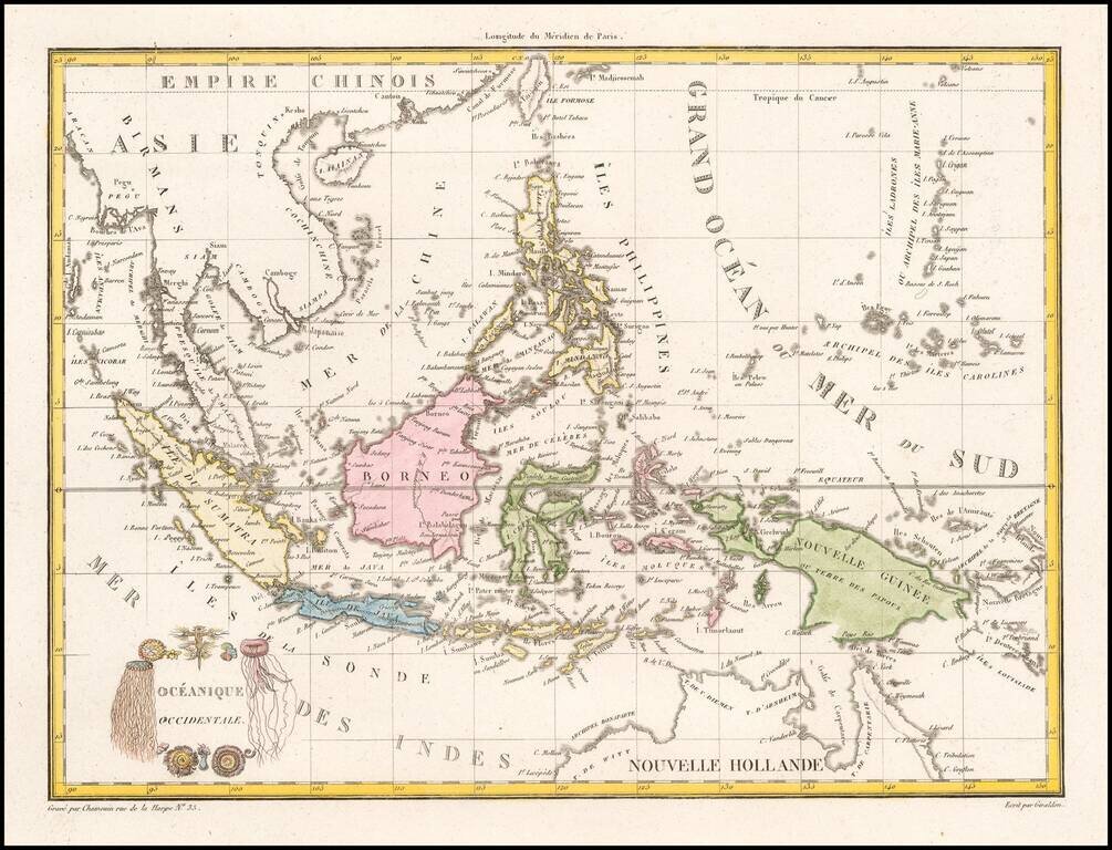
Decorative map of the region bounded by Taiwan, Pegu and Northern Australia, centered on the Philippines and Borneo. Malte Brun's maps were very up to date and well researched, meaning that this map includes the most recent discoveries in the Pacific.
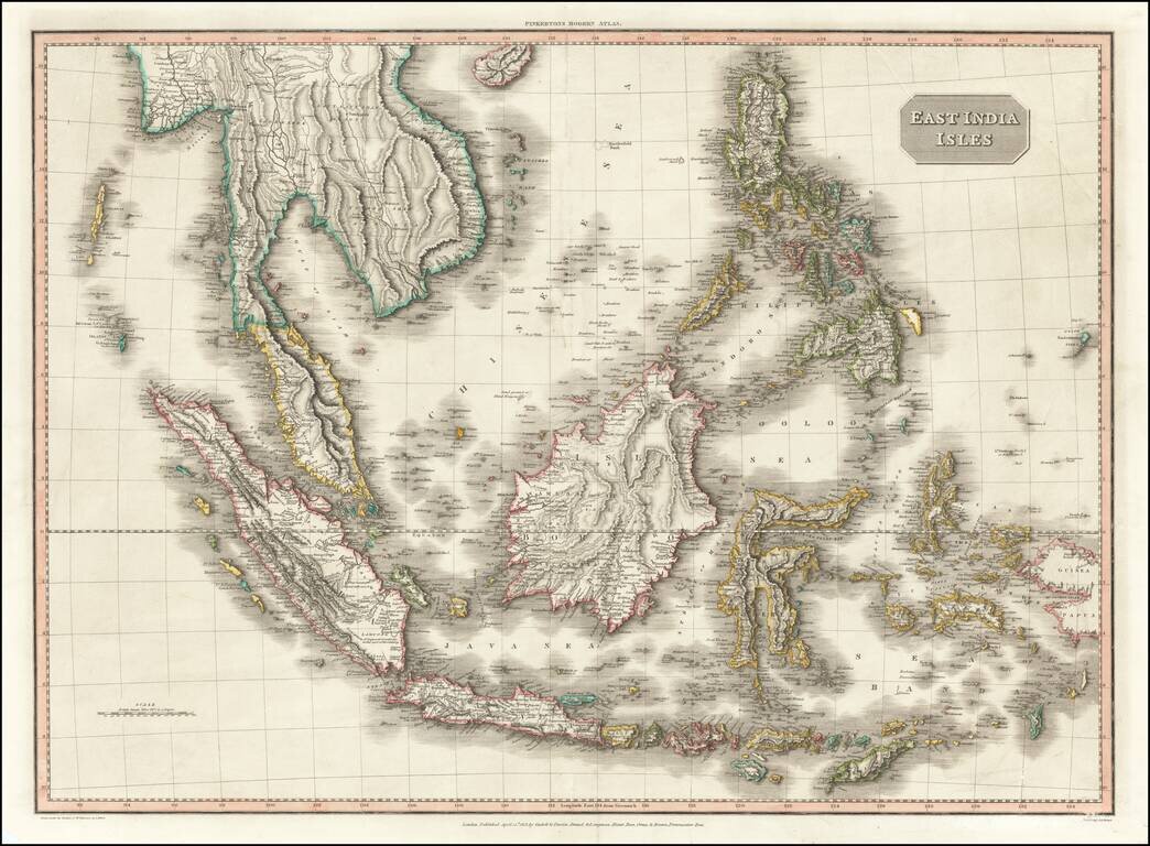
Gorgeous map of the Philippines and Southeast Asia, from John Pinkerton's scarce world atlas. The map extends from Burma, Java and Sumatra to Papua New Guinea, Pelew, the Philippines and Hainan. The map is an absolute masterpiece of fine copperplate...
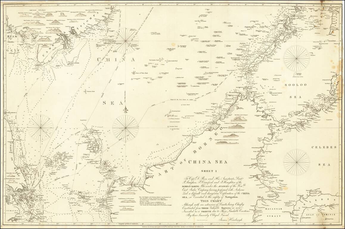
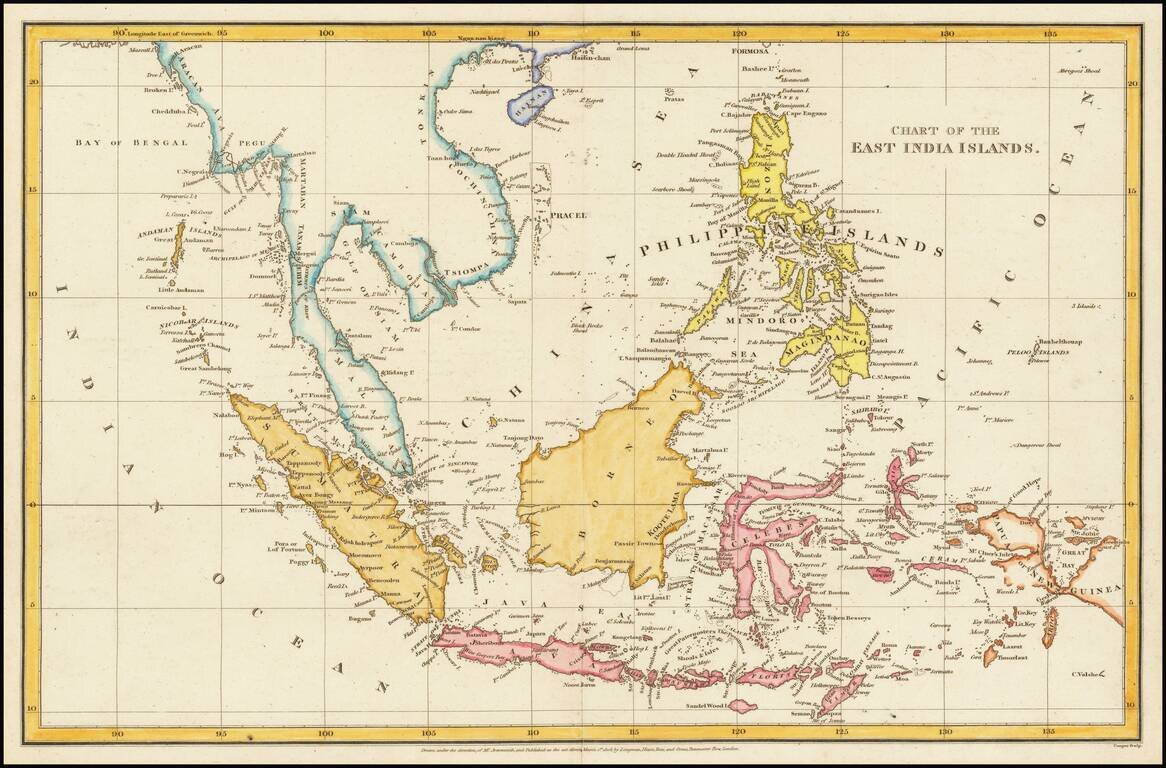
Detailed sea chart of the region extending from Singapore, Gulf of Siam, Cambodia, Vietnam, Mindanao and Borneo, first published by the East India Company in 1821. Extremely detailed chart of the region, with a number of coastal profiles. The present...