
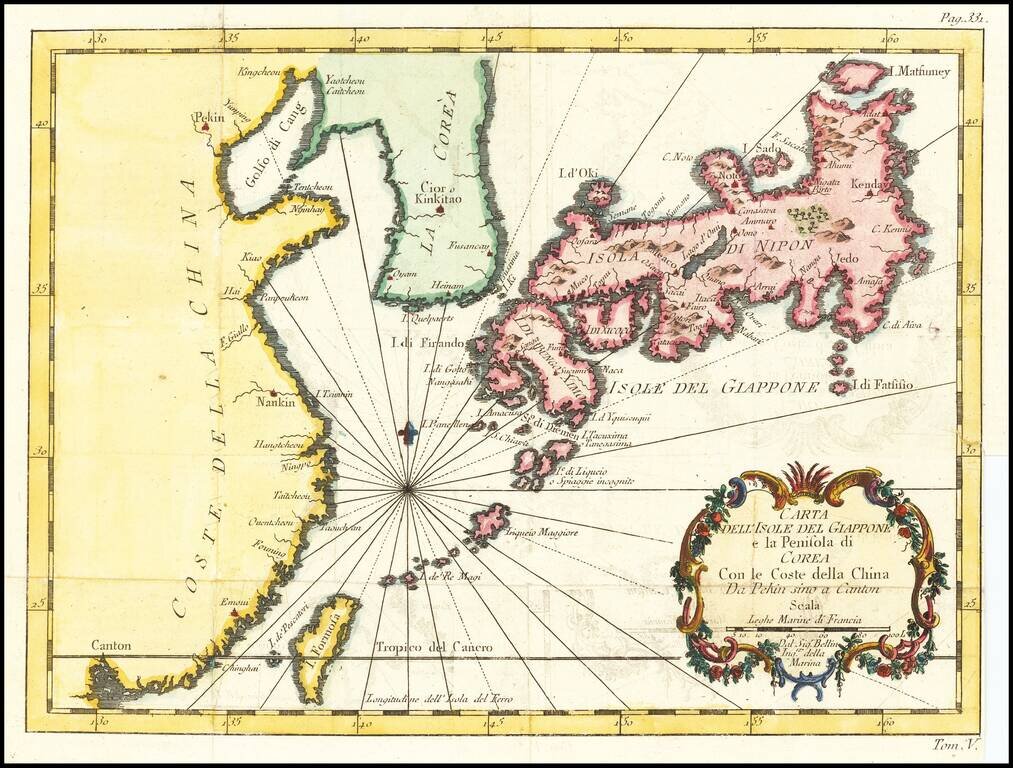
Italian edition of Bellin's regional map, showing Japan, the Korean Peninsula and China, including Canton and the Island of Formosa. Decorative cartouche and Rhumb lines.
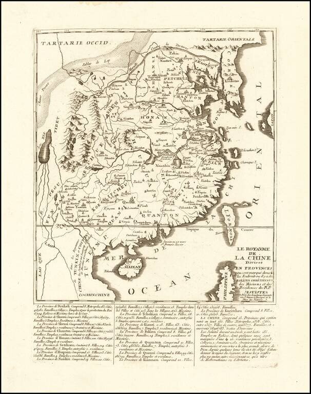
An Unrecorded Jesuit Map of China Rare Jesuit map of China, published in Paris by Longchamps. The map gives extensive details regarding China's provinces, major cities, families, colleges, temples, churches and Missions. The ending note discusses the...
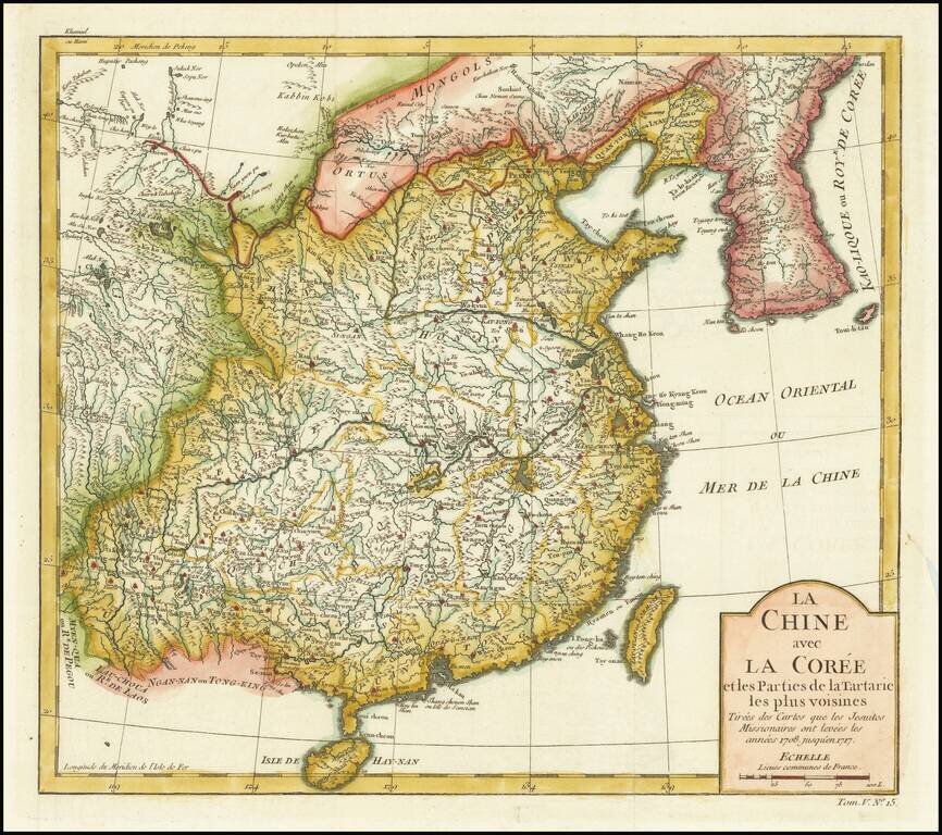
Detailed map of China and Korea, based upon the reports of Jesuit Missionaries between 1708 and 1717.
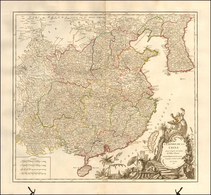
Striking large format map of China & Korea, from De Vaugondy's Atlas Universel. Includes a large and detailed Formosa. Beautifully colored by province, with a striking full-color cartouche. Includes the Island of Taiwan or Formosa.
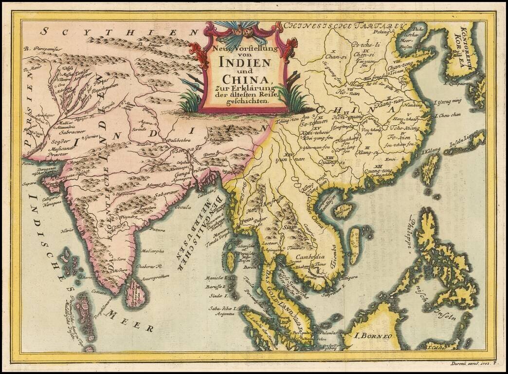
Rare regional map, extending from Korea and the Philippines to India and the Maldives. The map is apparently quite rare, as we can find no records for the map or its maker.
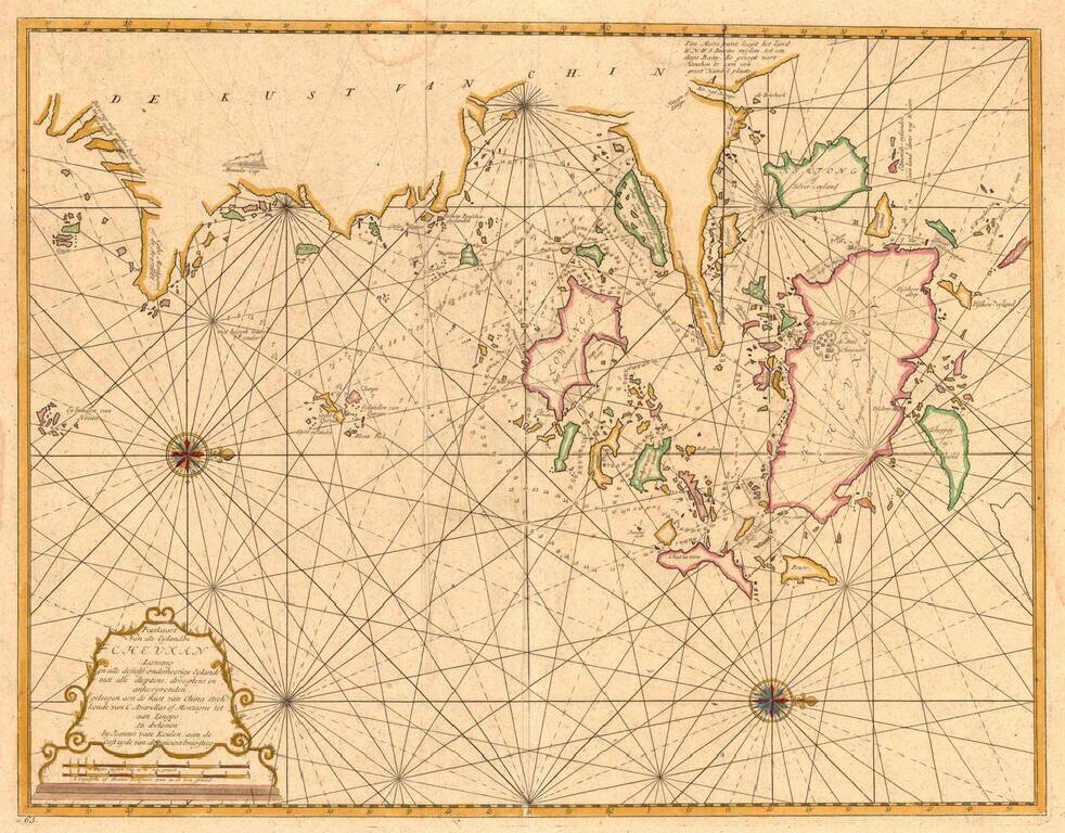
From the Secret Atlas! Nice example of this extremely rare sea chart of the area around Ningbo, Zhoushan and Mount Putuo (Powto) in the Zheijang Province of China, at the mouth of the Yangtze Delta, just south of Shanghai, from the Dutch East India'...
Canton, Macao & Hong Kong etc. -- The VOC Secret Atlas The chart was made for and used by the VOC (Dutch East India Company) for navigation and trading, with a compass rose with rhumb lines, depth indications and other relevant navigational...
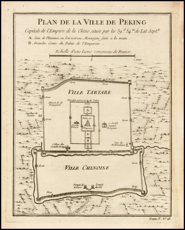
Finely engraved plan showing the walls, gates and inner details of the city of Peking (Beijing). The city is divided into the Ville Tartare and Ville Chinoise, with Emperor's Place and French Jesuit and Portuguese Jesuit missions shown in the Ville...
![[China Sea / Luzon / Hong Kong / Canton / Formosa] Bogt Toncqin](/map/small/64690.jpg)
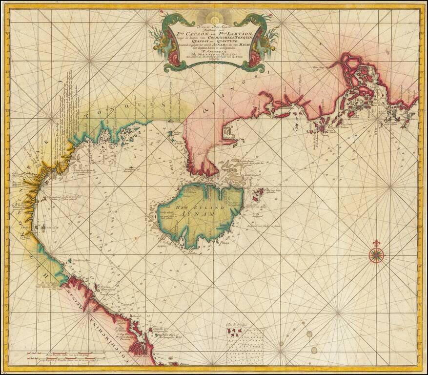
Manuscript Sea Chart of the Coasts of China, Luzon and Vietnam Drawn by the Chief Mapmaker of the Dutch East India Company in Batavia (Jakarta) Striking and unique survival in the hand of Gerrit de Haan, the chief mapmaker of the Dutch East India...
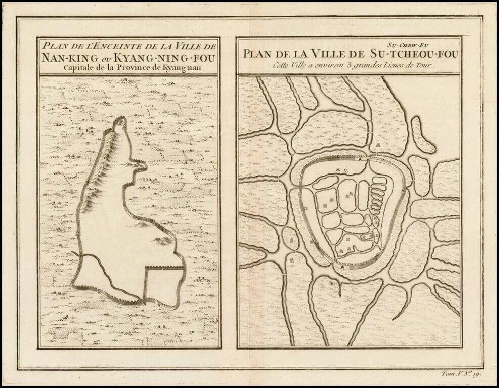
Two maps on a single sheet, depicting major Chinese cities. The plan on the left shows Nanking and its fortifications. The plan on the right shows Su-Tcheou-Fou or Su-Chew-Fu.
Detailed map of China, Korea and the Islands of Japan, showing the Provinces, towns, mountains, rivers, lakes, islands, published in Paris by Jean Lattre. The map is drawn from D'Anville's atlas of China, the first modern atlas of China and a work...
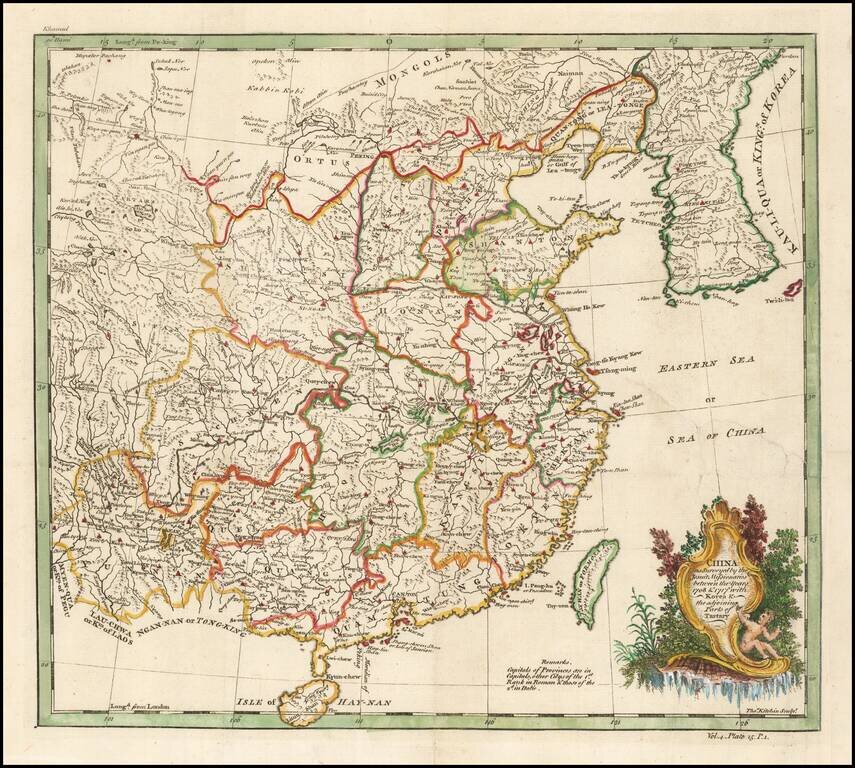
Based on a Jesuit Map of China Finely executed map of China and Korea, originally drawn from Jesuit Sources. The Qing Emperor Kangxi commissioned a ground of Jesuit surveyors to map China from 1708 to 1716. The resulting maps were published as the...
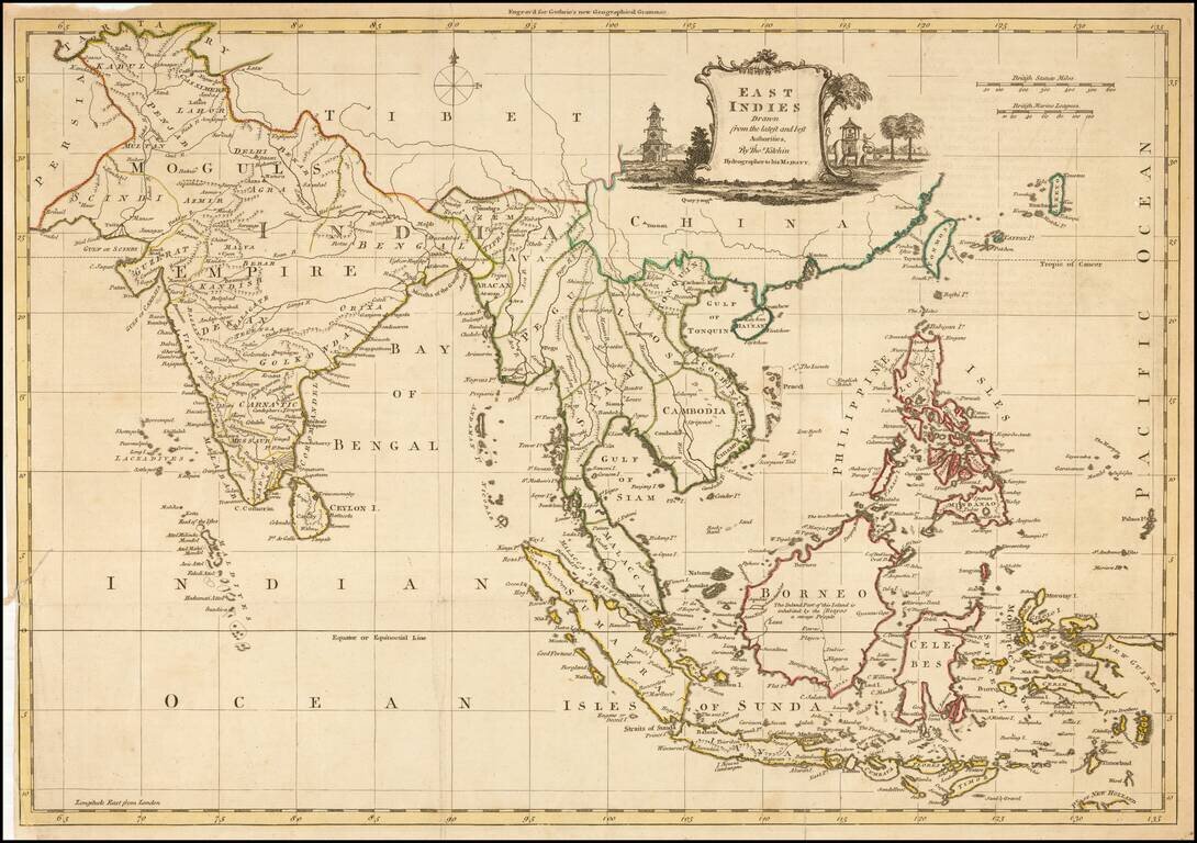
Decorative map of China, Korea, Southeast Asia, the Philippines, and India, published in Guthrie's New Geographical Grammar.
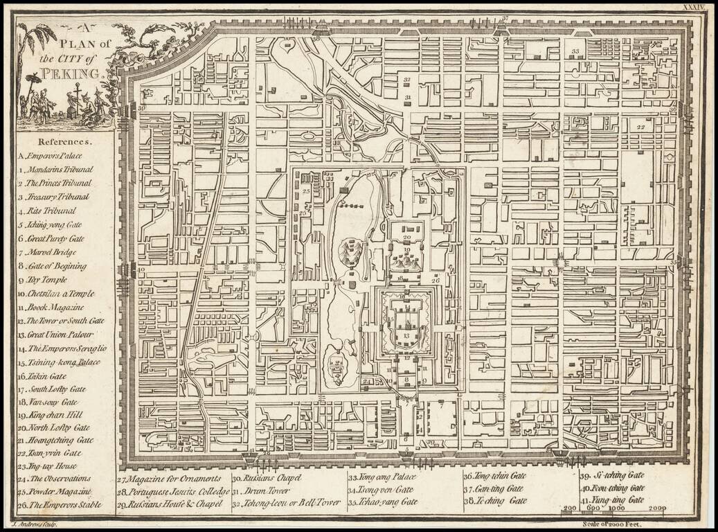
Scarce plan of the City of Beijing, published in London by John Andrews.
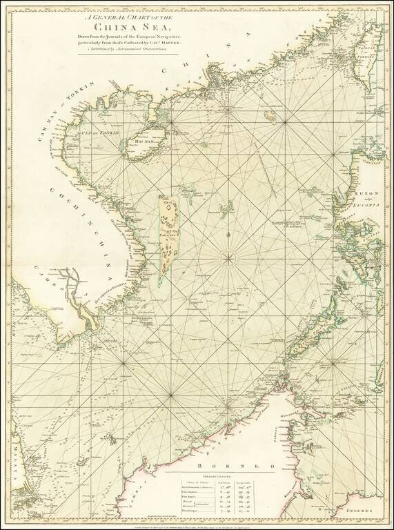
Stunning Original Hand-Color. Rare English sea chart of the South China Sea, published in London by Robert Sayer for an early edition of his The Oriental pilot, or, A select collection of charts and plans ... for the navigation of the country trade in...
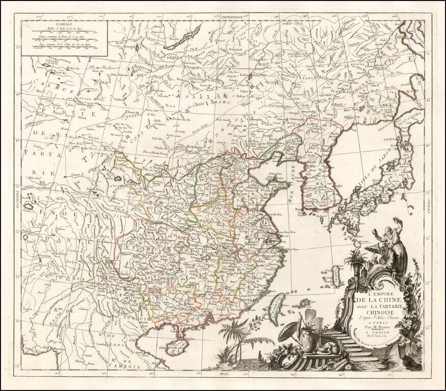
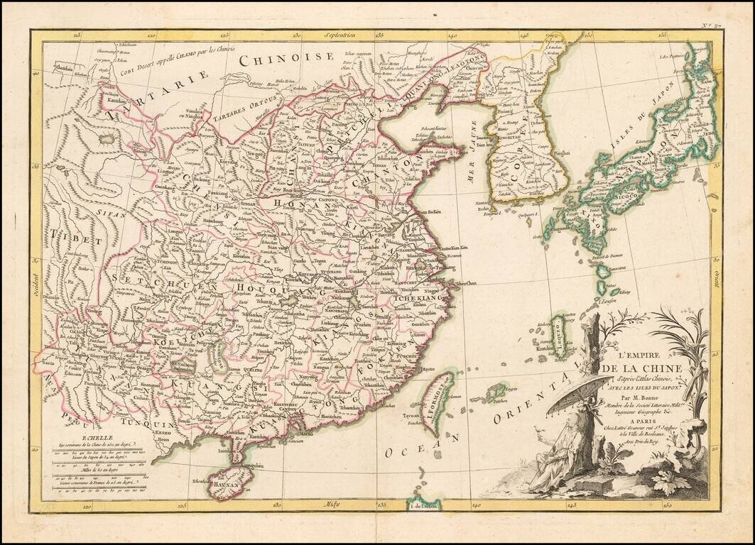
Fine large format map of China, based in part on information derived from Bonne's Atlas of China. The map shows all of China, with outline color for the provinces, and a decorative thematic cartouche.