Map size in jpg-format: 23.3835MiB
Click to open in high resolution (open in new tab).
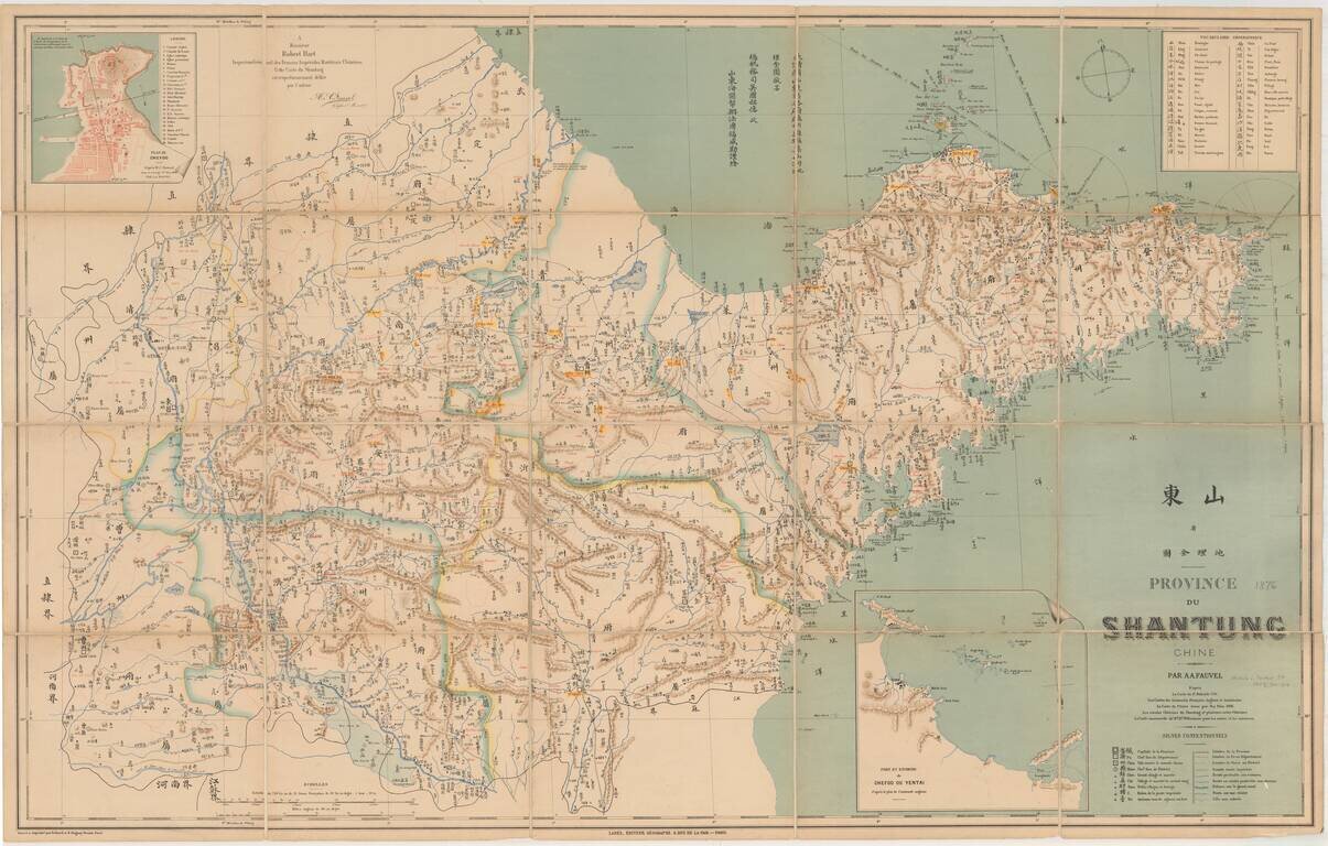
Detailed map of the Shandong Province, printed in Chinese and French.
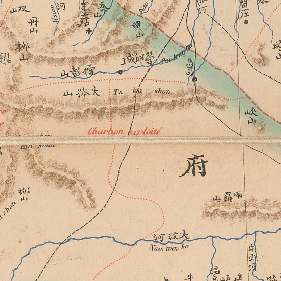
The map shows rivers and mountains and natural resources, and includes a Geographical Vocabulary table at the top left, showing Chinese symbols and translations and a table at the bottom with additional translations from Chinese to French.
Two inset details of Plan de Chefoo and Port and Environs de Chefoo ou Yentai.
Map of Shandong Province by Albert August Fauvel, a former French colonial officer and well versed in the Chinese language, who published several local and geographical studies, and also worked for the Chinese Customs Service 1872-84.
If you are a student, write to us in telegram: @antiquemaps and indicate what material you need and for what work you need a map in high detail. We are ready to provide material on special terms. For students only!
![[Martin Behaim Globe / Book] Pars Globi terrestris Ao. 1492 a Martino Behaim Equite Lusitano Norimbergae confecti Delineavit Christoph. Theoph de Murr 1778 (bound with:) Diplomatische Geschichte des Portugesischen berühmten Ritters Martin Behaims](/map/small/68828.jpg)
![Il Disegno Della Terza Parte Dell' Asia [Gastaldi's Wall Map of SE Asia with extra panels!]](/map/small/30554hbp.jpg)
![Chinae, olim Sinarum regionis nova descriptio. auctore Ludouico Georgio. [English Edition!]](/map/small/71123.jpg)