Alexis-Hubert Jaillot (ca. 1632-1712) was one of the most important French cartographers of the seventeenth century. Jaillot traveled to Paris with his brother, Simon, in 1657, hoping to take advantage of Louis XIV's call to the artists and scientists of France to settle and work in Paris. Originally a sculptor, he married the daughter of Nicholas Berey, Jeanne Berey, in 1664, and went into partnership with Nicholas Sanson's sons. Beginning in 1669, he re-engraved and often enlarged many of Sanson's maps, filling in the gap left by the destruction of the Blaeu's printing establishment in 1672.
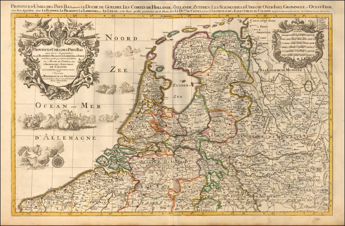
A finely detailed map of the Low Countries, published in Paris. The map illustrates the united provinces of the Low Countries including Flanders, Brabant, Limburg, Lyege, etc. It also notes archdiocese and bishop's palaces throughout the region....
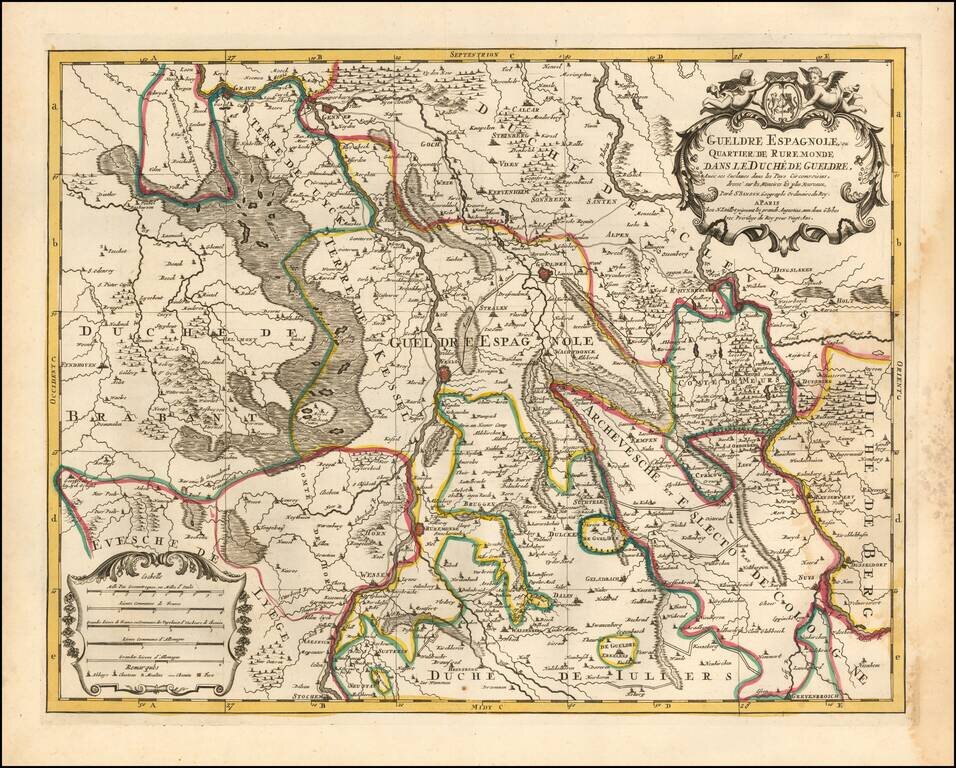
Attractive engraving of Gelderland with the towns of Roermond and Venlo at center. The map is filled with tiny villages, towns, lakes and rivers. Adorned by a decorative strapwork title cartouche and five distance scales. The county of Gelderland,...
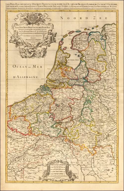
Map of the Seventeen Provinces of the Low Countries (Netherlands, Belgium, and Luxembourg), published in Paris, circa 1700. Includes two additional sheets with an alphabetical index of town names and villages and a Table of the Seventeen Provinces of...
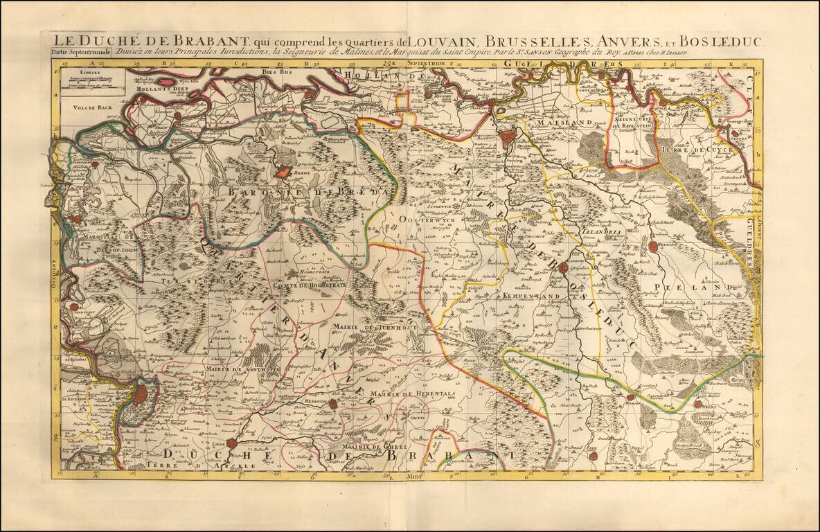
Map of the Duchy of Brabant which includes the districts of Leuven, Brussels, Antwerp, and Bosleduc. Includes 2 sheets with 4 city plans and/or views of the areas within northern and southern Brabant. Also includes an alphabetical table of towns and...
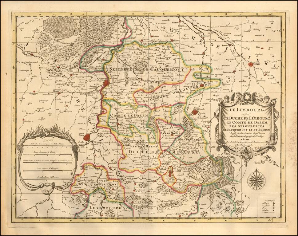
A fine and detailed map of Limburg and Dalem in the southern Netherlands. The map includes a separate sheet with an alphabetical table of towns and villages within Limburg. Based on the work of Nicholas Sanson, the map highlights the counties and...
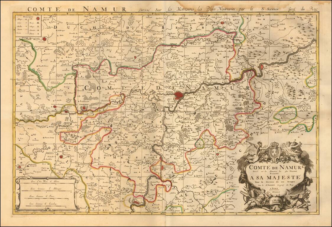
Map of the County of Namur, published in Paris, circa 1700. A fine and detailed map of the region around the city of Namur, from Jaillot’s “Nouvelle introduction a le geographie....” The map is embellished with a beautifully engraved title and...
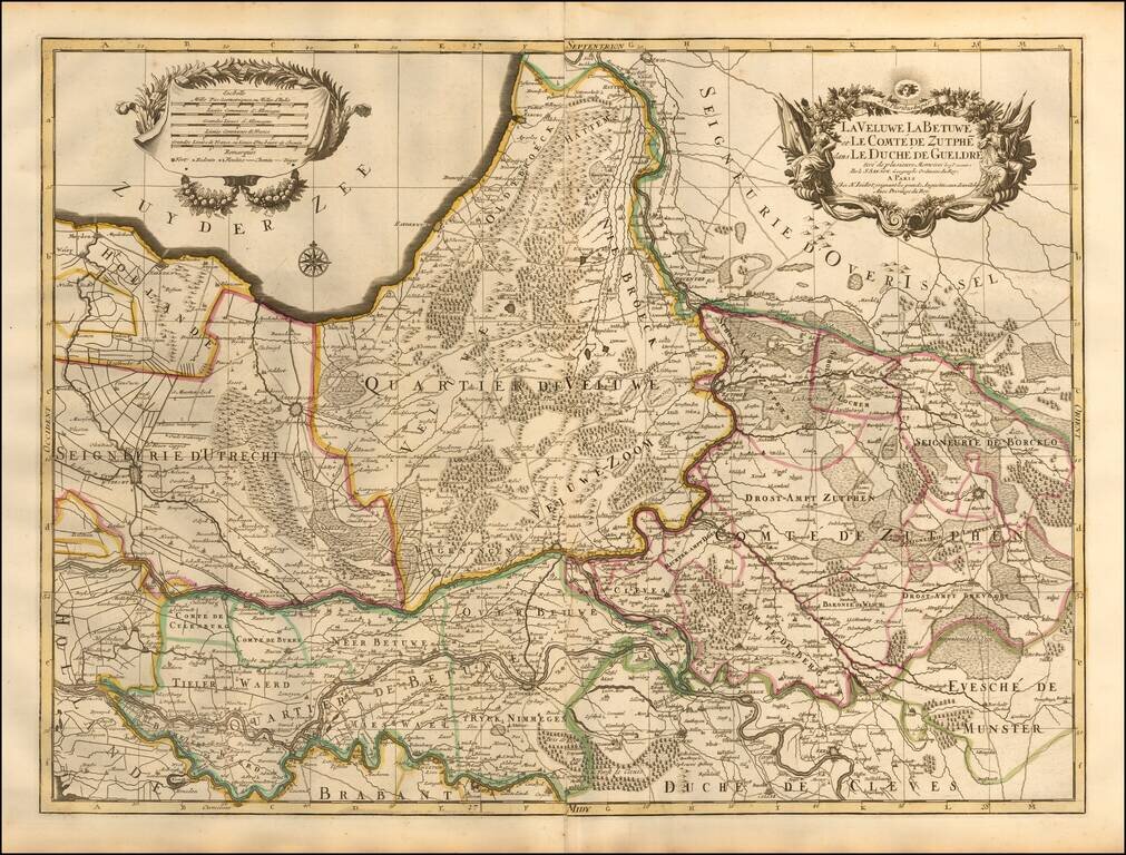
A beautifully detailed map of Utrecht, Veluwe, Zutphen, Holland, and Neder-Betuw published in Paris. The map outlines in color the towns and municipalities of Utrecht, Veluwe, Zutphen, Neder-Betuwe, etc., and shows relief pictorially. Features lakes,...

An exceptional old color example of this scarce map of the Savoye region, topped by Lake Geneva. The color in this example is truly extraordinary. The map is adorned with a title cartouche decorated with a globe crowned with fleurs de lys and two...
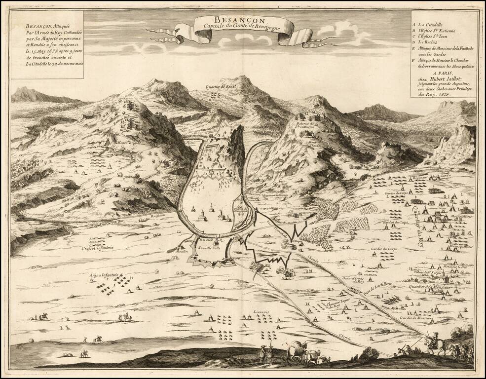
Rare separately published view of Bensancon, issued by Hubert Jaillot in Paris. The second title is: Besançon, Attaquée par l'Armée du Roy Com[m]andée par Sa Majesté en personne et Rendue à son obeissance le 15 May 1674 après 9 jours de...
![[Duke of York's Copy] Le Toulois ou sont Les Chatellenies et Les Prevotes du Temporel de l'Eveche de Toul et de son Chapitre; Partie du Balliage de l'Eveche de Verdun. Le Duche de Barrois ou Balliage de Bar le Duc . . .](/map/small/71292.jpg)
The Duke of York's Copy Nice example of Jaillot's map of the region centered on Bar le Duc, in eastern France, with the bookplate of the Duke of York on the verso. The Duke of York as a Prolific Map Collector Frederick Augustus, Duke of York and...
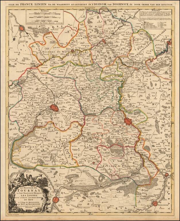
A fine example of Jaillot's map of the border area between France and Belgium with the towns of Tournai, Lille, Ipres, Douay, Condé and others. The map also locates smaller towns, churches, religious schools, residential areas, castles, cabarets,...
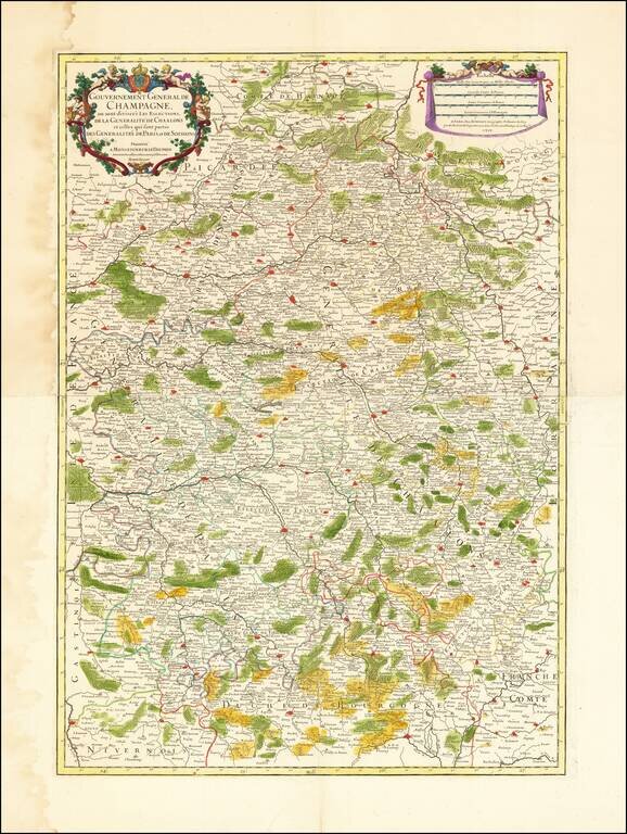
Striking old color example of this two sheet regional map of Champagne and neighboring regions. Extends south to Dijon, Semeur and Cosne, west to Melun, Lagny and Mondidier, north to Bavay and Chuyn and east to Arlon, Hatton Chastel, and Aigremont....
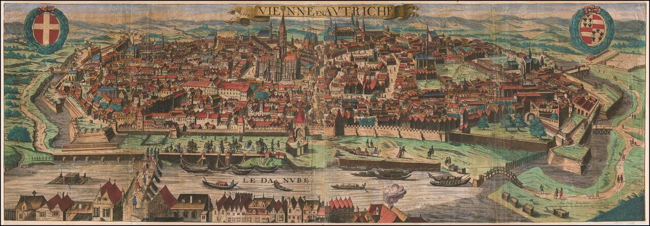
Rare separately publshed view of Vienna by Hubert Jaillot, published in Paris in 1669. This is a very early work for Jaillot. Rarity We located no other examples of the view in OCLC or any auction records or dealer catalogs.
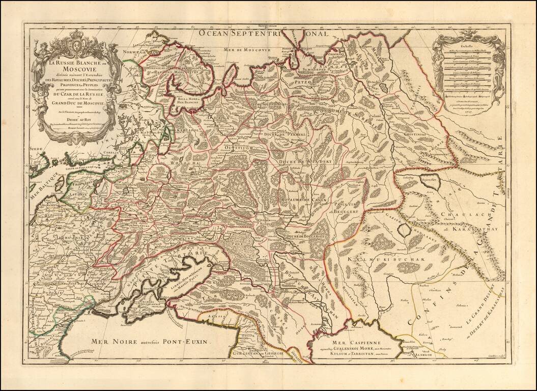
Striking large format map of Russia, extending from the Baltic and Black Seas to Grande Tartarie and the Grande Desert or Desert De Karkkathay, published by Hubert Jaillot. This map of Russia provides a highly detailed picture of European Russia and...

Finely detailed map of Transylvania, published in Paris by Hubert Jaillot in 1696. The map is centered on Aux Moldaves and covers the area between Russie Rouge ou Noir Montagnes Appellees (Red Russia or Black Mountains) to the north, Autrefois De La...
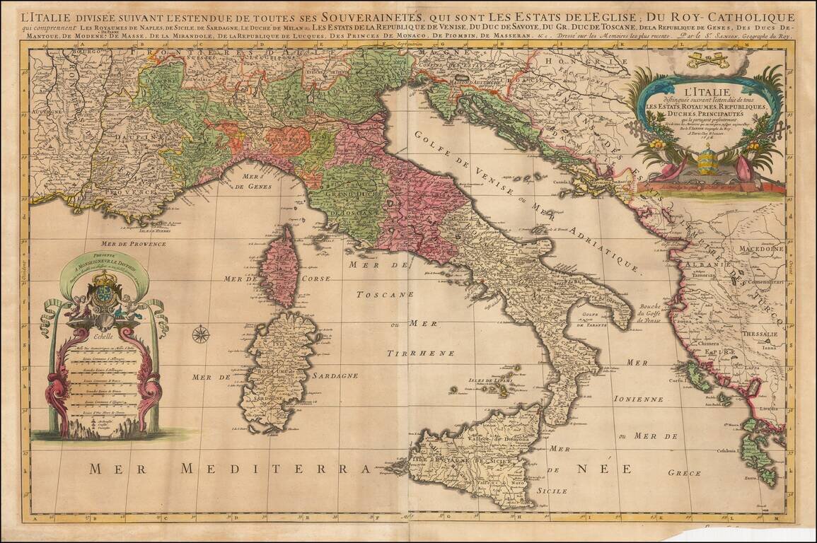
Striking large and highly detailed map of Italy, the Adriatic, Mediterranean and contiguous islands, including Corsica, Sardinia and Sicily. Two highly decorative large cartouches. One of the best large format maps of Italy to appear in a commercial...