Map size in jpg-format: 26.6892MiB
Click to open in high resolution (open in new tab).
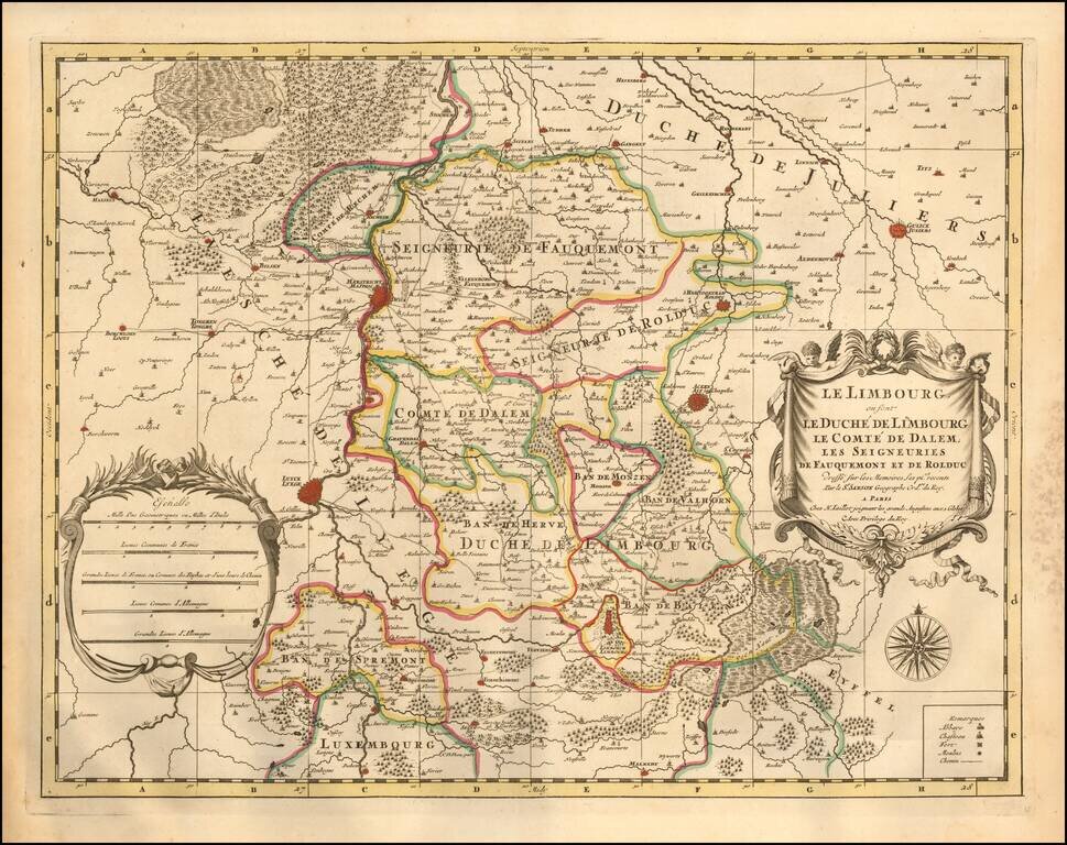
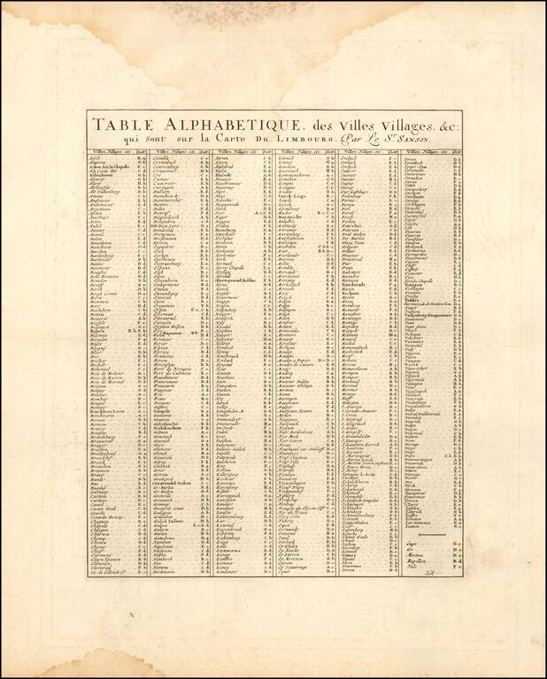
A fine and detailed map of Limburg and Dalem in the southern Netherlands. The map includes a separate sheet with an alphabetical table of towns and villages within Limburg.
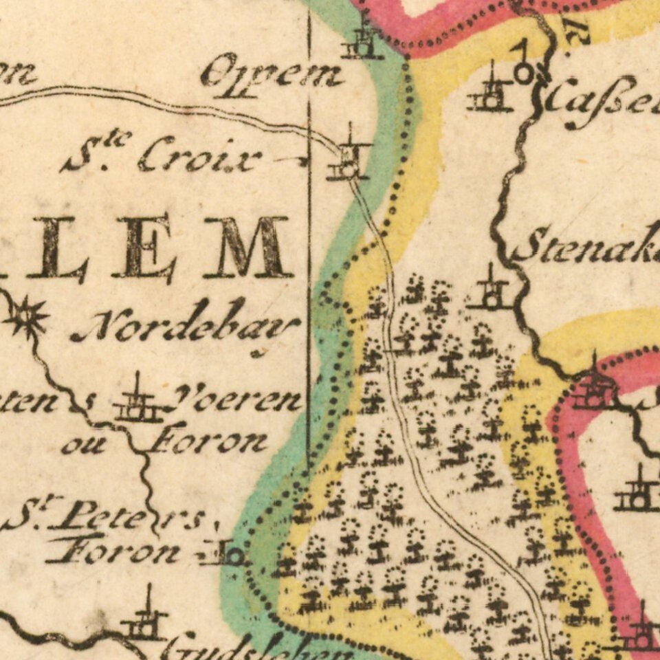
Based on the work of Nicholas Sanson, the map highlights the counties and lordships of Faquemont, Rolduc, Salem, Herve, Balen, Sprimont, Monzen, etc, Major cities are colored coded in red including Aachen, Maastricht, Liege, Limburg, etc. The map is embellished with a beautifully engraved title cartouche, scale of distance, a compass, and remarks. Abbeys, chateaus, forts, windmills, and paths are noted throughout the region.
Alexis-Hubert Jaillot (ca. 1632-1712) was one of the most important French cartographers of the seventeenth century. Jaillot traveled to Paris with his brother, Simon, in 1657, hoping to take advantage of Louis XIV's call to the artists and scientists of France to settle and work in Paris. Originally a sculptor, he married the daughter of Nicholas Berey, Jeanne Berey, in 1664, and went into partnership with Nicholas Sanson's sons. Beginning in 1669, he re-engraved and often enlarged many of Sanson's maps, filling in the gap left by the destruction of the Blaeu's printing establishment in 1672.
If you are a student, write to us in telegram: @antiquemaps and indicate what material you need and for what work you need a map in high detail. We are ready to provide material on special terms. For students only!


