Map size in jpg-format: 34.6964MiB
Click to open in high resolution (open in new tab).
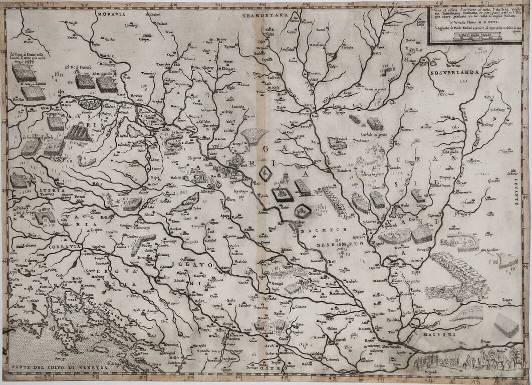
Finely detailed map of Transylvania, published in Paris by Hubert Jaillot in 1696.
The map is centered on Aux Moldaves and covers the area between Russie Rouge ou Noir Montagnes Appellees (Red Russia or Black Mountains) to the north, Autrefois De La Transilvanie Aux Hongrois (Hungary) to the west, Aux Valaques in the south and Cote D'Orbay, Aux Sicules to the east.
The notes at the bottom right of the map explain the region is called Transilvanie (Transylvania) because of its vast forested areas and mountain ranges. It also details the locations of neighboring regions such as Poland, Hungary, Red Russion, Moldavia, etc.
Remarks at the bottom of the map call out the letters and colors that define the German, Hungarian, and French encampments as well as the location of key rivers and mountains.
A scale of miles and hours is also included at the bottom of the map which outlines the road hours and distances to German and Hungarian locations.
Alexis-Hubert Jaillot (ca. 1632-1712) was one of the most important French cartographers of the seventeenth century. Jaillot traveled to Paris with his brother, Simon, in 1657, hoping to take advantage of Louis XIV's call to the artists and scientists of France to settle and work in Paris. Originally a sculptor, he married the daughter of Nicholas Berey, Jeanne Berey, in 1664, and went into partnership with Nicholas Sanson's sons. Beginning in 1669, he re-engraved and often enlarged many of Sanson's maps, filling in the gap left by the destruction of the Blaeu's printing establishment in 1672.
If you are a student, write to us in telegram: @antiquemaps and indicate what material you need and for what work you need a map in high detail. We are ready to provide material on special terms. For students only!
![Pomeraniae, Wandalicae Regionis Typ [with] Livoniae Nova Descriptio [with] Ducatus Oswieczensis, et Zatoriensis, Descriptio](/map/small/43172.jpg)