logo

1696. L'Italie Distinguee Suivant L'Estendue de tous Les Etats, Royaumes, Republiques, Duches, Principautes qui la partagent presentement . . . 1696

  • L'Italie Distinguee Suivant L'Estendue de tous Les Etats, Royaumes, Republiques, Duches, Principautes qui la partagent presentement . . . 1696

L'Italie Distinguee Suivant L'Estendue de tous Les Etats, Royaumes, Republiques, Duches, Principautes qui la partagent presentement . . . 1696 information:

Year of creation: 
Resolution size (pixels): 
 2878x1914 px
Disk Size: 
 1.72803MiB
Number of pages: 
 1
Place: 
 Amsterdam

Print information. Print size (Width x height in inches):
Printing at 72 dpi 
  39.97 х 26.58
Printing at 150 dpi 
 19.19 х 12.76
Printing at 300 dpi 
 9.59 х 6.38

An example of detailing the file of this map of in a printable high-resolution:

Click to open in high resolution (open in new tab).
Attention! this is just the central piece (central area 960x960 px) of the map file!
This is an example, so that you can see and study the level of detail of a given map. The entire Map will be fully available after payment!

L'Italie Distinguee Suivant L'Estendue de tous Les Etats, Royaumes, Republiques, Duches, Principautes qui la partagent presentement . . . 1696

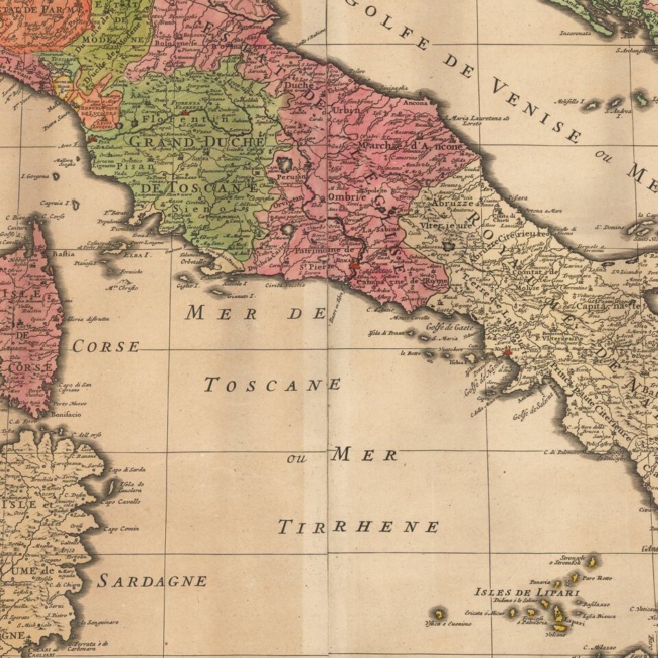
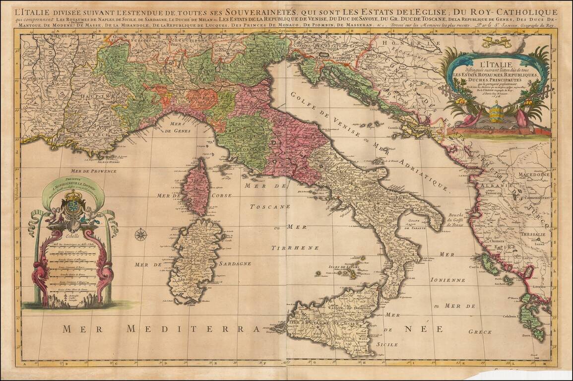
Striking large and highly detailed map of Italy, the Adriatic, Mediterranean and contiguous islands, including Corsica, Sardinia and Sicily.

Two highly decorative large cartouches.

One of the best large format maps of Italy to appear in a commercial atlas at the end of the 17th Century.

Alexis-Hubert Jaillot (ca. 1632-1712) was one of the most important French cartographers of the seventeenth century. Jaillot traveled to Paris with his brother, Simon, in 1657, hoping to take advantage of Louis XIV's call to the artists and scientists of France to settle and work in Paris. Originally a sculptor, he married the daughter of Nicholas Berey, Jeanne Berey, in 1664, and went into partnership with Nicholas Sanson's sons. Beginning in 1669, he re-engraved and often enlarged many of Sanson's maps, filling in the gap left by the destruction of the Blaeu's printing establishment in 1672.


Special conditions for students!

If you are a student, write to us in telegram: @antiquemaps and indicate what material you need and for what work you need a map in high detail. We are ready to provide material on special terms. For students only!

Item information:

Year of creation:
Size:
2878x1914 px
Disk:
1.72803MiB
Number of pages:
1
Place:
Amsterdam
Author:
Alexis-Hubert Jaillot.
$9.99

Related item