Alexis-Hubert Jaillot (ca. 1632-1712) was one of the most important French cartographers of the seventeenth century. Jaillot traveled to Paris with his brother, Simon, in 1657, hoping to take advantage of Louis XIV's call to the artists and scientists of France to settle and work in Paris. Originally a sculptor, he married the daughter of Nicholas Berey, Jeanne Berey, in 1664, and went into partnership with Nicholas Sanson's sons. Beginning in 1669, he re-engraved and often enlarged many of Sanson's maps, filling in the gap left by the destruction of the Blaeu's printing establishment in 1672.
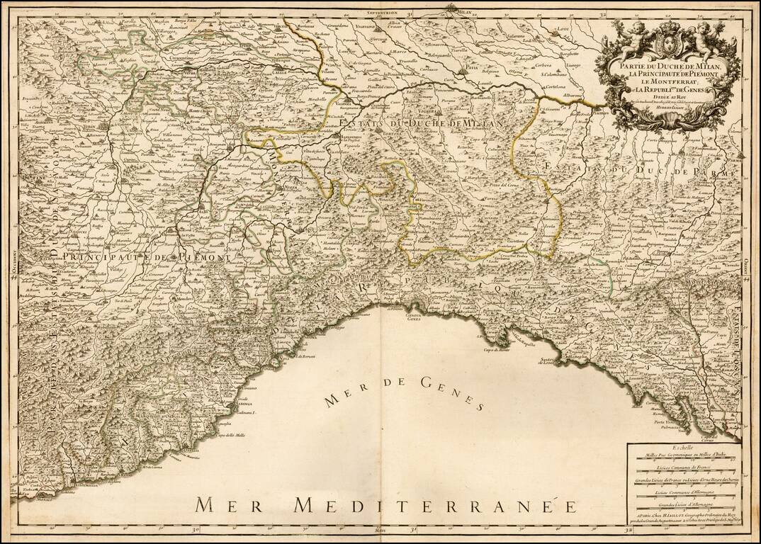
Striking large and highly detailed map of the Italian Mediterranean Coast and extending north to Milan. A fine decorative example with wide clean margins and large cartouche. From Jaillot's monumental atlas.
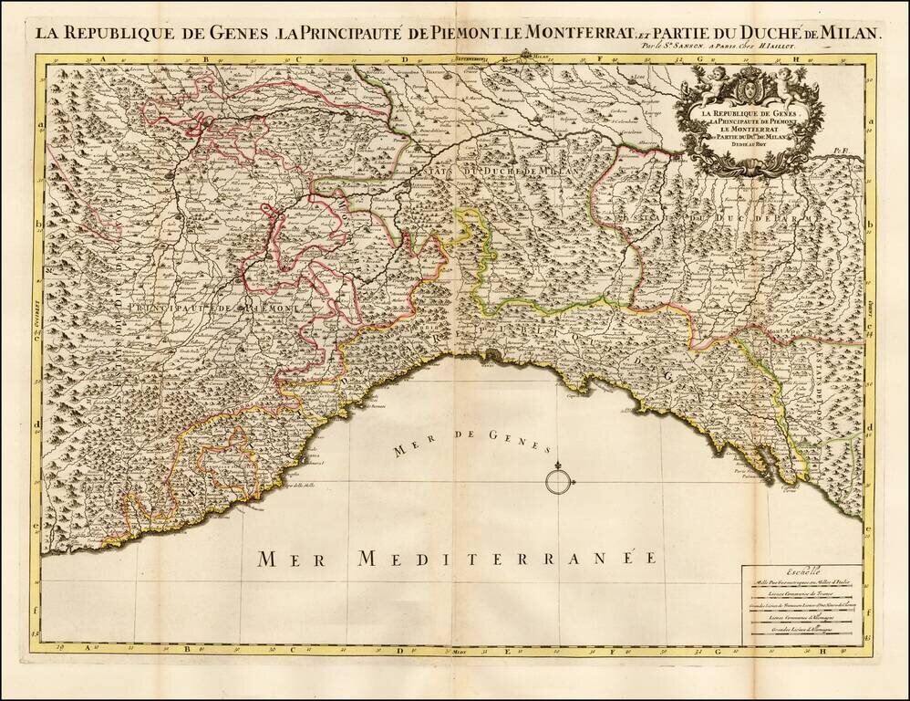
Striking large and highly detailed map of the Italian Mediterranean Coast and extending north to Milan. A fine decorative example with wide clean margins and large cartouche.
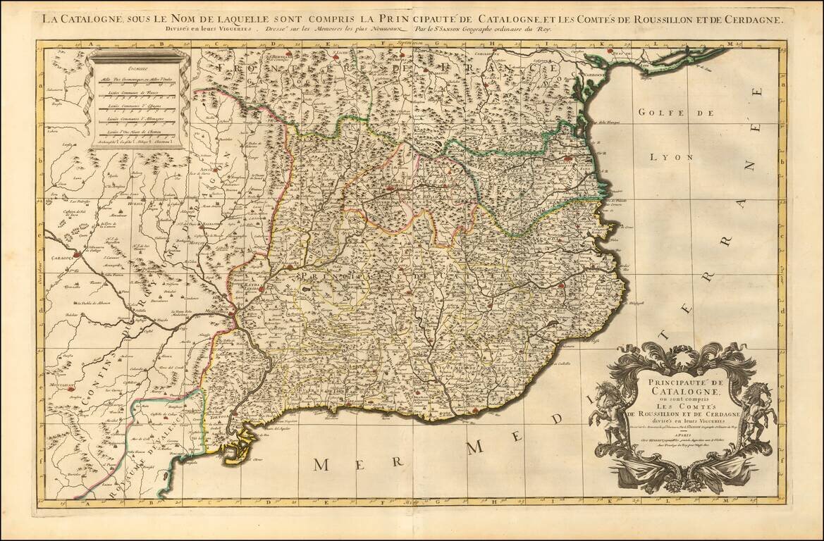
Striking large and highly detailed map of Catalonia, with a large decorative cartouche and a scale of distance. In addition, there are 4 separate sheets, each with an accompanying set 8 town plans and birdseye views, including Roussilon, Perpignan...
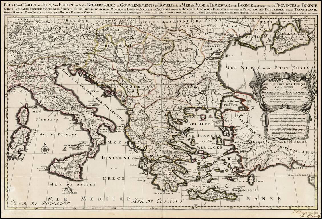
Scarce large format map of the Turkish Empire in Europe and the Eastern Mediterranean, published by Jaillot, based upon the earlier maps of Nicolas Sanson .
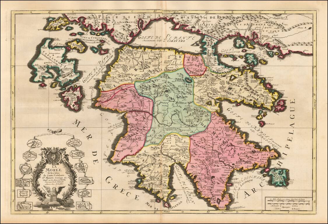
Striking large and highly detailed map of Morea and surrounding islands by Jaillot. Includes smaller plans of 12 other islands.
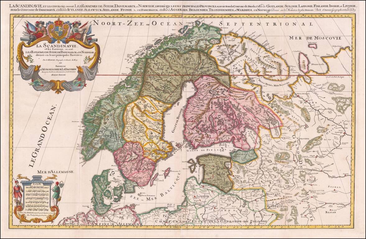
Striking large format map of Scandinavia, published by Hubert Jaillot. First issued in 1674, this two sheet map of the region, based upon the geographical compilations and work of Nicolas Sanson which remained unpublished at the time of his death....
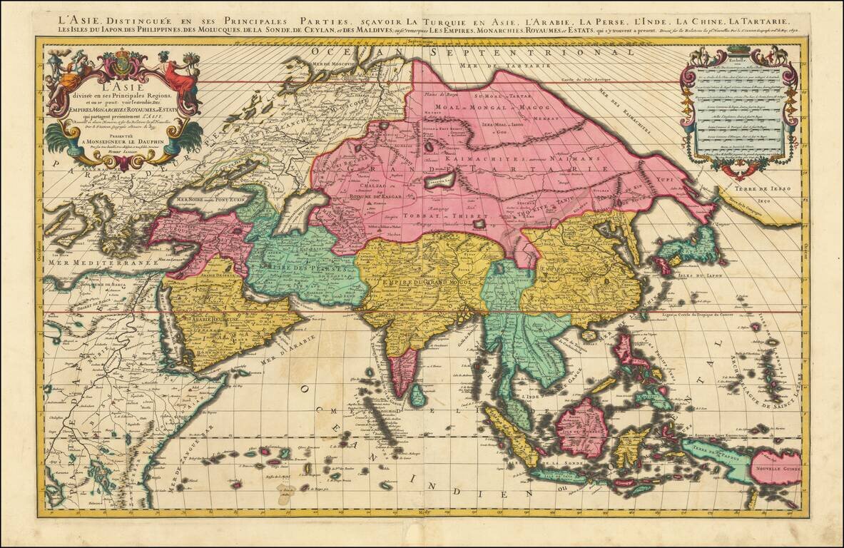
Superb Original Hand-Color Example. Striking large format map of Asia, by Jaillot. Although the imprint line has not been updated, this example was probably published by Mortier in Amsterdam around 1696. The map extends as far east as New Guinea and...
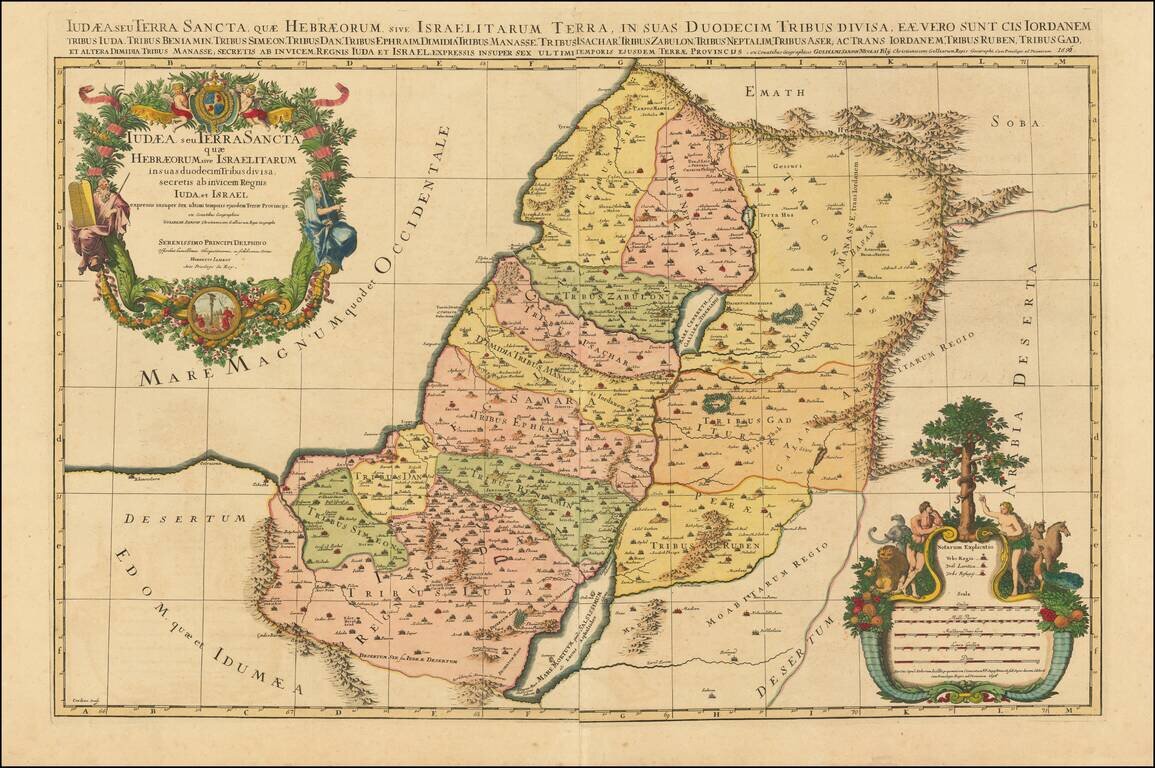
Striking large format map of the Holy Land, with tribal divisions and a wealth of place names and topographical detail, including the locations of royal and priestly cities, and sanctuaries. Decorated with two fine cartouches. The title cartouche...
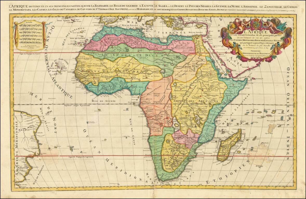
Fine Large-Format Map of Africa by Jaillot Striking map of the continent of Africa, by the French mapmaker Alexis-Hubert Jaillot. Although the imprint line has not been updated, this example was probably published by Mortier in Amsterdam around 1696....
![[Title Page] Atlas Nouveau Contenant Toutes les Parties du Monde, ou Sont exactement Remarques Les Empires, Monarchies, Royaumes, Estats . . .](/map/small/62570.jpg)
Striking example of the Title Page from Jaillot's Atlas Nouveau. The gods Mars and Pallas are shown, along with Louis the Great, King of France. Navarra and Monseigneur Le Dauphin are shown mounted on horseback, along with a picture of Atlas...
![[Title Page] Nouvelle Introduction a la Geographie pour l'usage de Monseigneur Le Dauphin. . . .M. DC. LXXXXIII.](/map/small/43114.jpg)
Title page from Jaillot's monumental work. Includes coat of arms and other embellishments.