Map size in jpg-format: 48.4487MiB
Click to open in high resolution (open in new tab).

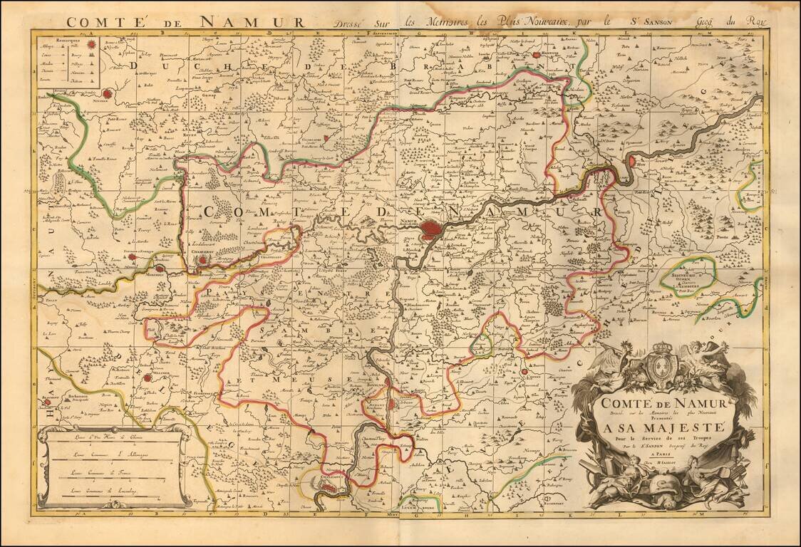
Map of the County of Namur, published in Paris, circa 1700.
A fine and detailed map of the region around the city of Namur, from Jaillot’s “Nouvelle introduction a le geographie....” The map is embellished with a beautifully engraved title and scale cartouche. Cartographically this map is based on the work of Nicholas Sanson.
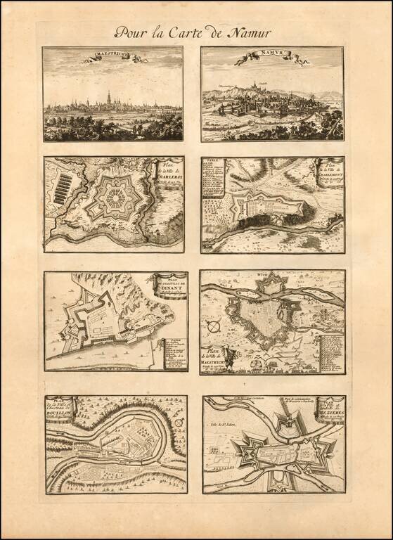
Includes a separete sheet with bird's-eye and town plan views of Maestricht, Namur, Charleroi, Charlemont, Dinant, Bouillon, and Mezieres.
Alexis-Hubert Jaillot (ca. 1632-1712) was one of the most important French cartographers of the seventeenth century. Jaillot traveled to Paris with his brother, Simon, in 1657, hoping to take advantage of Louis XIV's call to the artists and scientists of France to settle and work in Paris. Originally a sculptor, he married the daughter of Nicholas Berey, Jeanne Berey, in 1664, and went into partnership with Nicholas Sanson's sons. Beginning in 1669, he re-engraved and often enlarged many of Sanson's maps, filling in the gap left by the destruction of the Blaeu's printing establishment in 1672.
If you are a student, write to us in telegram: @antiquemaps and indicate what material you need and for what work you need a map in high detail. We are ready to provide material on special terms. For students only!


