Map size in jpg-format: 32.0127MiB
Click to open in high resolution (open in new tab).

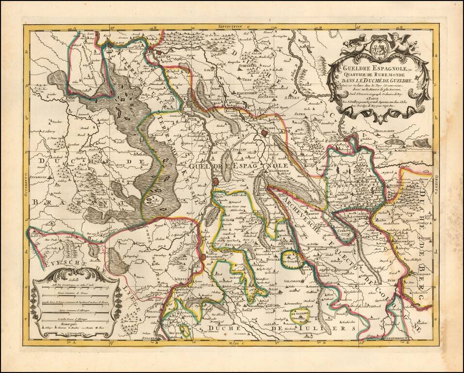
Attractive engraving of Gelderland with the towns of Roermond and Venlo at center. The map is filled with tiny villages, towns, lakes and rivers. Adorned by a decorative strapwork title cartouche and five distance scales.
The county of Gelderland, which became the Duchy of Gelderland at the end of the 12th century, is a former Duchy of the Holy Roman Empire. At the beginning of the 16th century, it was incorporated in the Cercle de Bourgogne and is currently in the Netherlands.
The main cities include Arnhem, Nijmegen, Zutphen, Venlo, Roermond, and Tiel (Thiel).
The Spanish Netherlands
At the death of Duke Charles, and despite the pretensions of his sister, wife of the Duke of Lorraine Rene II, Charles V attributed the duchy to William of Cleves, but took it back in 1543 and integrated it into the Spanish Netherlands. The Spanish Netherlands was the collective name of States of the Holy Roman Empire in the Low Countries, held in personal union by the Spanish Crown (also called Habsburg Spain) from 1556 to 1714.
Alexis-Hubert Jaillot (ca. 1632-1712) was one of the most important French cartographers of the seventeenth century. Jaillot traveled to Paris with his brother, Simon, in 1657, hoping to take advantage of Louis XIV's call to the artists and scientists of France to settle and work in Paris. Originally a sculptor, he married the daughter of Nicholas Berey, Jeanne Berey, in 1664, and went into partnership with Nicholas Sanson's sons. Beginning in 1669, he re-engraved and often enlarged many of Sanson's maps, filling in the gap left by the destruction of the Blaeu's printing establishment in 1672.
If you are a student, write to us in telegram: @antiquemaps and indicate what material you need and for what work you need a map in high detail. We are ready to provide material on special terms. For students only!


